Guther's Bar

Coastal Marsh, Saltings in Cornwall

England

Guther's Bar

Bar Point at a low spring tide Looking across Crow Sound to the western end of St Martin’s, Tean, and St Helen’s.
Bar Point at a low spring tide Credit: David Lally

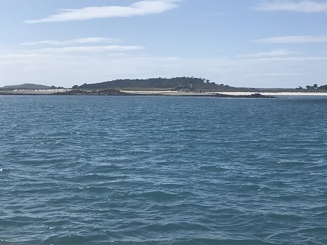
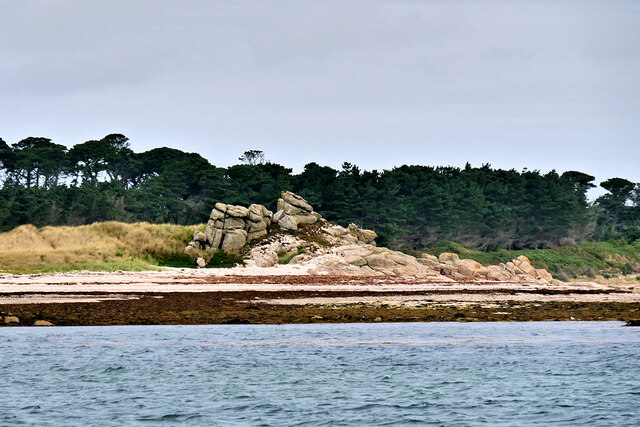
Guther's Bar is a popular coastal marsh located in Cornwall, England. Situated within the beautiful and picturesque landscape of the Saltings, it offers visitors a unique and tranquil experience.

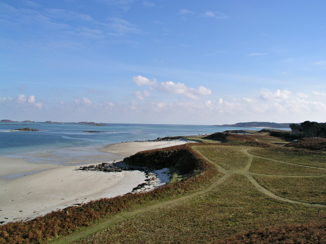
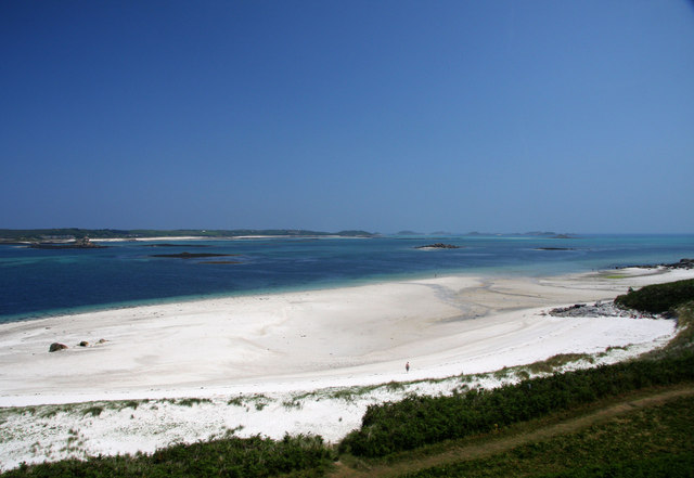
The bar is known for its stunning views of the surrounding marshes and the nearby coastline. The marshes themselves are a haven for wildlife, making it a popular spot for birdwatching enthusiasts. Visitors can expect to see a variety of bird species, including herons, egrets, and wading birds, as they explore the area.

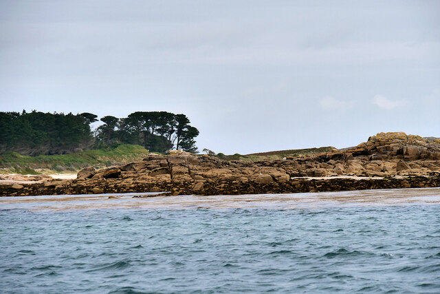
Guther's Bar is also home to a diverse range of plant life, with salt-tolerant vegetation thriving in the marshy environment. The unique ecosystem provides a rich habitat for many species of flora and fauna.

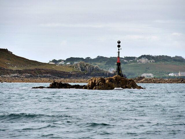
Visitors can access the bar via a well-maintained footpath, which winds its way through the marshes. The path offers beautiful views of the surrounding landscape and provides an opportunity for visitors to immerse themselves in the natural beauty of the area.

The bar itself is a small, rustic structure that serves as a resting point for visitors. It offers basic amenities such as seating and picnic tables, allowing visitors to relax and take in the breathtaking scenery. It is important to note that the bar does not serve food or drinks, so visitors are advised to bring their own refreshments.

Overall, Guther's Bar in Cornwall is a must-visit destination for nature lovers and those seeking a peaceful and scenic experience. Its unique location within the Coastal Marsh and Saltings makes it a truly special place to explore and appreciate the natural wonders of Cornwall.

If you have any feedback on the listing, please let us know in the comments section below.

Guther's Bar Images

Images are sourced within 2km of 49.953209/-6.2979831 or Grid Reference SV9114. Thanks to Geograph Open Source API. All images are credited.

Bar Point at a low spring tide Looking across Crow Sound to the western end of St Martin’s, Tean, and St Helen’s.
Bar Point at a low spring tide
Looking across Crow Sound to the western end of St Martin’s, Tean, and St Helen’s.
Looking east from Bar Point At a low spring tide.
Looking east from Bar Point
At a low spring tide.
Tobaccoman’s Point and Green Island With Tresco Abbey behind.

Taken on the way back from St Martin’s.
Tobaccoman’s Point and Green Island
With Tresco Abbey behind. Taken on the way back from St Martin’s.
Lower Town Quay The smaller of the two quays on St Martin’s. The larger quay at Higher Town is the one used for freight deliveries, but is inaccessible at a low tide.

The island behind is the uninhabited Tean (pronounced tea-an).
Lower Town Quay
The smaller of the two quays on St Martin’s. The larger quay at Higher Town is the one used for freight deliveries, but is inaccessible at a low tide. The island behind is the uninhabited Tean (pronounced tea-an).
Great Bay panorama On of the most beautiful spots on the islands.
Great Bay panorama
On of the most beautiful spots on the islands.
Isles of Scilly, Eastern Isles from Crow Sound The large island in the background is St Martin's.
Isles of Scilly, Eastern Isles from Crow Sound
The large island in the background is St Martin's.
Crow Rock and Beacon Crow Rock is an islet in the Isles of Scilly, situated near to Halangy Point on St Mary's. At high tide. only the central tip of the rock is visible above the water, hence the need for the beacon.
Crow Rock and Beacon
Crow Rock is an islet in the Isles of Scilly, situated near to Halangy Point on St Mary's. At high tide. only the central tip of the rock is visible above the water, hence the need for the beacon.
Isles of Scilly, Crow Rock and Halangy Down Transmitter Mast Crow Rock is an islet in the Isles of Scilly, situated near Halangy Point on St Mary's. At high tide. only the central tip of the rock is visible above the water, hence the need for the beacon. The Halangy Down transmitter on St Mary's is a 500-watt FM radio and television transmitter with a 250 feet high steel lattice tower, surmounted by a main TV antenna. It was built by the BBC in 1969.
Isles of Scilly, Crow Rock and Halangy Down Transmitter Mast
Crow Rock is an islet in the Isles of Scilly, situated near Halangy Point on St Mary's. At high tide. only the central tip of the rock is visible above the water, hence the need for the beacon. The Halangy Down transmitter on St Mary's is a 500-watt FM radio and television transmitter with a 250 feet high steel lattice tower, surmounted by a main TV antenna. It was built by the BBC in 1969.
Green Island, Tresco
Tresco, Skirt Island
Borough Farm Outbuildings Grade II listed. Listing number 1376771. House and outbuilding, now outbuilding. C18 with extension between 1880 and 1906.
Borough Farm Outbuildings
Grade II listed. Listing number 1376771. House and outbuilding, now outbuilding. C18 with extension between 1880 and 1906.
Rowesfield cottage On Tresco, Isles of Scily.
Rowesfield cottage
On Tresco, Isles of Scily.
Farmland on the eastern side of Tresco
Footpath to Rushy Point from near the Old Blockhouse Tresco
Borough; east Tresco The white sand of pentle Bay.
As seen from the outgoing helicopter flight to Tresco.
Borough; east Tresco
The white sand of pentle Bay. As seen from the outgoing helicopter flight to Tresco.
Beach on Tresco The northern end of the strip of glorious white sand beach on the east coast of Tresco, taken from near the blockhouse.  The Eastern Isles in the background.
Beach on Tresco
The northern end of the strip of glorious white sand beach on the east coast of Tresco, taken from near the blockhouse. The Eastern Isles in the background.
Higher Town Bay
Higher Town Bay
St Martins The beautiful St Martin's Bay
St Martins
The beautiful St Martin's Bay
Show me another place!

Guther's Bar is located at Grid Ref: SV9114 (Lat: 49.953209, Lng: -6.2979831)

Division: Isles of Scilly

Unitary Authority: Isles of Scilly

Police Authority: Devon and Cornwall

What 3 Words

///creamed.hours.kilt. Near St Martin's, Isles of Scilly

Related Wikis

St Martin's Methodist Church, Isles of Scilly

The Methodist Church, St Martin's, Isles of Scilly is a Grade II listed chapel in St Martin's, Isles of Scilly. == History == Bible Christians arrived...

Higher Town, Isles of Scilly

Higher Town (Cornish: Trewartha) is the easternmost and largest settlement on the island of St Martin's in the Isles of Scilly, England. It is situated...

St Martin's Church, St Martin's

St Martin's Church, St Martin's is a Grade II listed parish church in the Church of England located in St Martin's, Isles of Scilly, UK. == History... ==

St Martin's, Isles of Scilly

St Martin's (Cornish: Brechiek, lit. 'dappled island') is the northernmost populated island of the Isles of Scilly, England, United Kingdom. It has an...

Lower Town, Isles of Scilly

Lower Town (Cornish: Trewoles) is the westernmost settlement on the island of St Martin's in the Isles of Scilly, England. One of the island's two quays...

Middle Town, St Martin's

Middle Town (Cornish: Tregres) is a small settlement on the island of St Martin's in the Isles of Scilly, England. It is situated slightly inland, approximately...

Wheel Wreck

The Wheel Wreck is the remains of a shipwreck lying in Crow sound off Little Ganinick in the Isles of Scilly. The wreck site consists of a discrete mound...

Teän

Teän ( TEE-ən, sometimes written Tean without the diaeresis; Cornish: Enys Tian) is an uninhabited island to the north of the Isles of Scilly archipelago...

Have you been to Guther's Bar?

Leave your review of Guther's Bar below (or comments, questions and feedback).