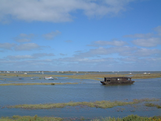
Agar Creek

Sea, Estuary, Creek in Norfolk North Norfolk

England

Agar Creek

Boats on Morston Creek Another seal-watching trip heads for Blakeney Point.
Boats on Morston Creek Credit: Gareth James

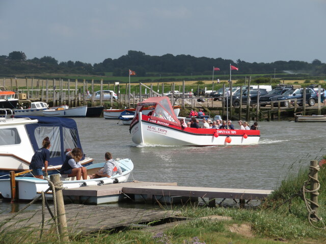
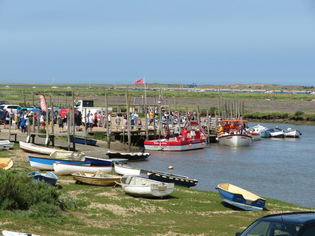
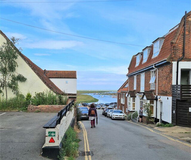
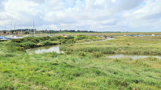
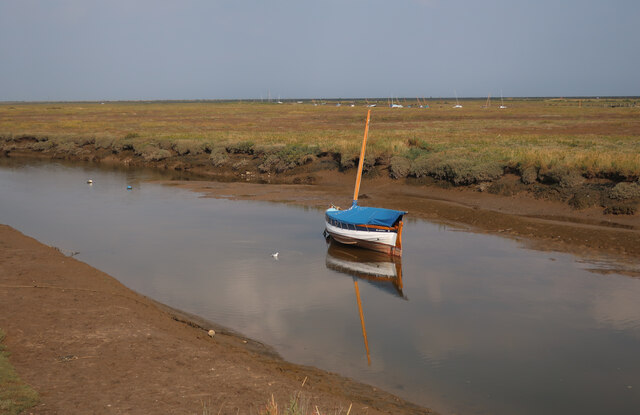
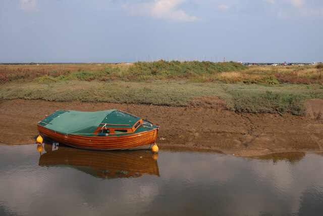
Agar Creek is a picturesque waterway located in Norfolk, England. It flows through the Norfolk Broads, a nationally protected wetland area that is renowned for its stunning natural beauty and diverse wildlife. The creek is situated near the village of Sea Palling and is part of the larger Hickling Broad and Horsey Mere network of water bodies.

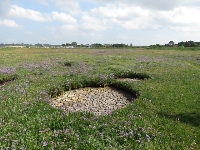
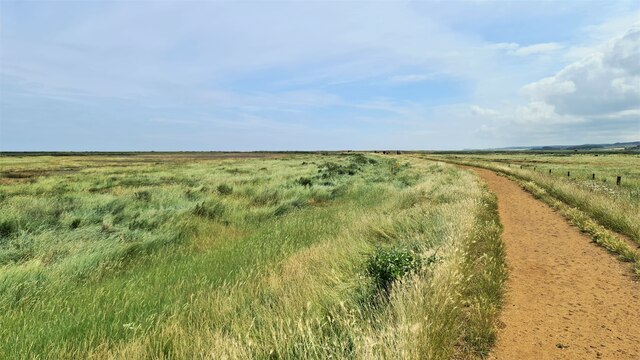
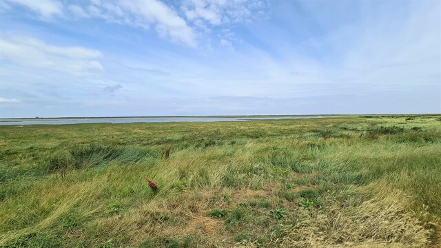
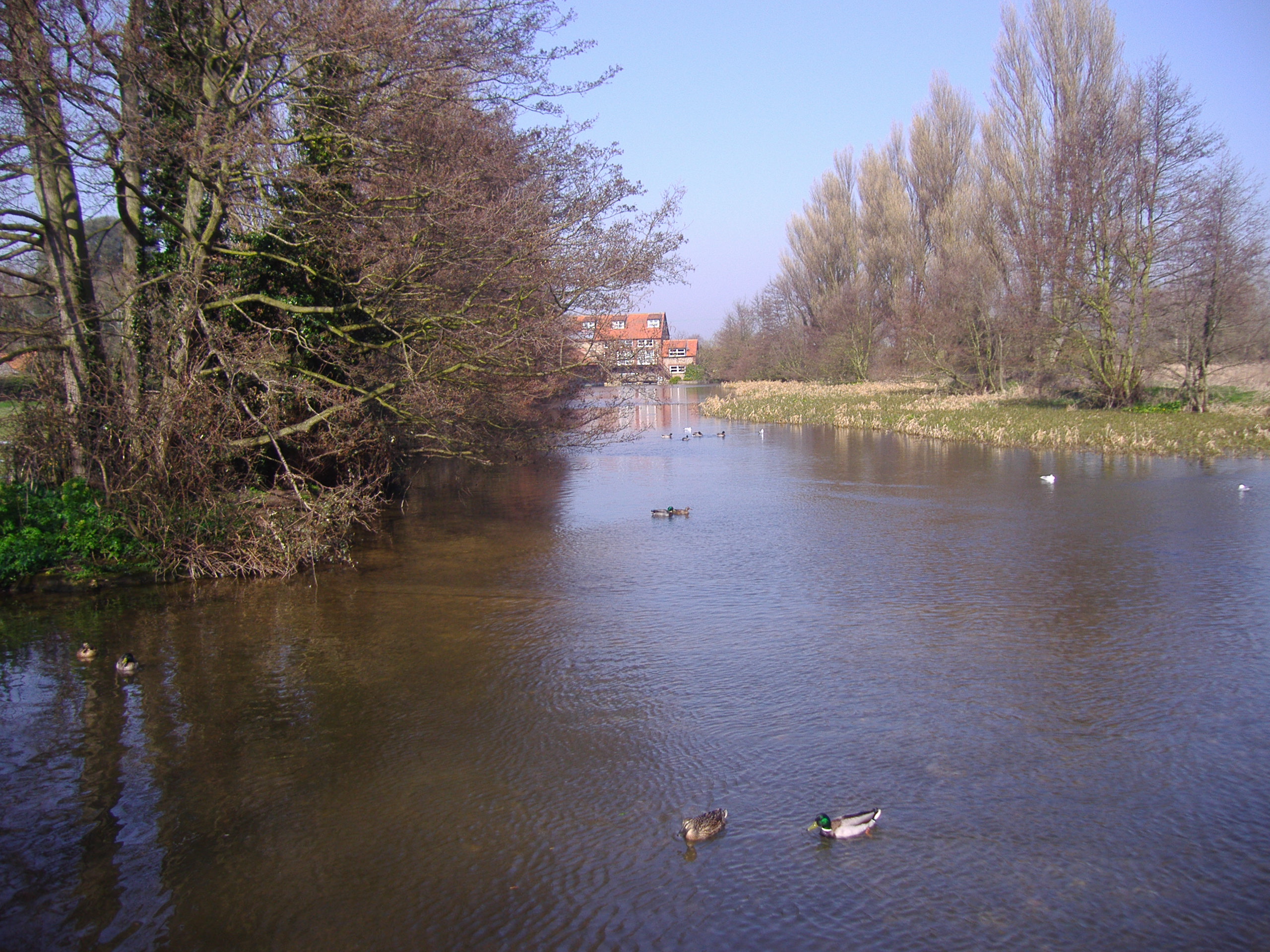
As an estuary, Agar Creek serves as an important habitat for various species of birds, fish, and mammals. Its calm, brackish waters provide an ideal environment for a wide range of flora and fauna to thrive. Visitors to the creek may have the opportunity to spot birds such as terns, ducks, and herons, as well as rare species like the bittern and marsh harrier.

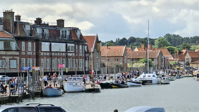
Agar Creek is also a popular destination for water sports enthusiasts and nature lovers. Its tranquil waters make it an excellent spot for canoeing, kayaking, and paddleboarding, allowing visitors to explore the creek at their own pace. Additionally, the creek offers several fishing opportunities, with anglers often reeling in bream, pike, and perch.

The surrounding landscape of Agar Creek is characterized by lush marshes, reed beds, and open water, creating a picturesque backdrop for nature walks and picnics. The area is well-maintained, with designated footpaths and viewpoints that allow visitors to fully immerse themselves in the natural beauty of the creek.

Overall, Agar Creek in Norfolk offers a peaceful and idyllic setting for those seeking to connect with nature and experience the unique ecosystem of the Norfolk Broads.

If you have any feedback on the listing, please let us know in the comments section below.
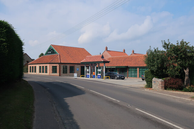
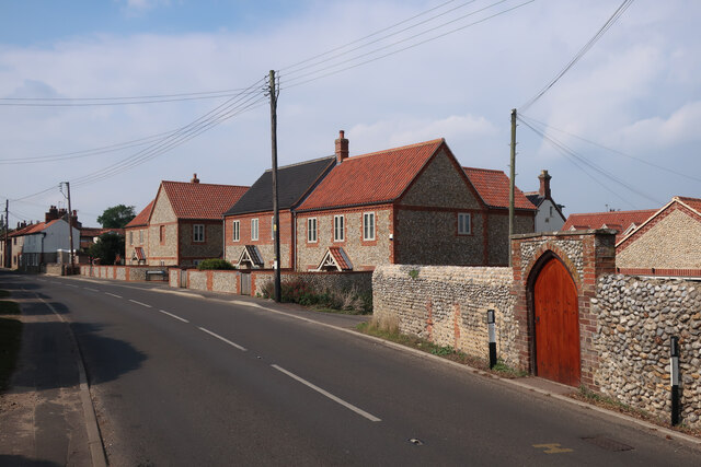
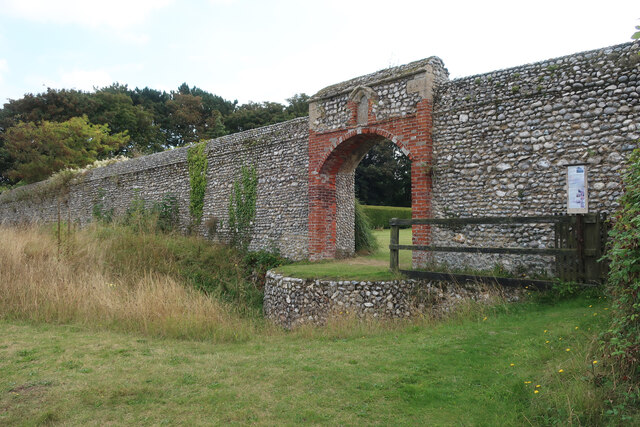
Agar Creek Images

Images are sourced within 2km of 52.957379/1.0101514 or Grid Reference TG0244. Thanks to Geograph Open Source API. All images are credited.

Boats on Morston Creek Another seal-watching trip heads for Blakeney Point.
Boats on Morston Creek
Another seal-watching trip heads for Blakeney Point.
Morston Quay
Morston Quay
Dried pool on Morston Greens
High Street, Blakeney
Blakeney Harbour from High Street
Blakeney Quay
Blakeney Quay
Peddars Way and Norfolk Coastal Path at Blakeney Looking east
Peddars Way and Norfolk Coastal Path at Blakeney
Looking east
Blakeney saltmarsh looking towards The Marrams At high tide. The small building on the left horizon is a former lifeboat station now used to house National Trust rangers.
Blakeney saltmarsh looking towards The Marrams
At high tide. The small building on the left horizon is a former lifeboat station now used to house National Trust rangers.
High tide at Blakeney
Galley Hill Farm campsite
Free parking by Blakeney Village Hall
Blakeney parish offices By the village hall.
Blakeney parish offices
By the village hall.
Queens Close, Blakeney
Recently built houses in Blakeney
Agar Creek Looking across the saltmarsh from Blakeney.
Agar Creek
Looking across the saltmarsh from Blakeney.
Boat in a creek, Blakeney
Medieval wall north of Friary Farm See <span class="nowrap"><a title="https://historicengland.org.uk/listing/the-list/list-entry/1039496" rel="nofollow ugc noopener" href="https://historicengland.org.uk/listing/the-list/list-entry/1039496">Link</a><img style="margin-left:2px;" alt="External link" title="External link - shift click to open in new window" src="https://s1.geograph.org.uk/img/external.png" width="10" height="10"/></span> for the listing details.
Medieval wall north of Friary Farm
See LinkExternal link for the listing details.
Show me another place!

Agar Creek is located at Grid Ref: TG0244 (Lat: 52.957379, Lng: 1.0101514)

Administrative County: Norfolk

District: North Norfolk

Police Authority: Norfolk

What 3 Words

///police.kickbacks.remains. Near Wells-next-the-Sea, Norfolk

Related Wikis

Blakeney Guildhall

Blakeney Guildhall is a building in the coastal village of Blakeney in the north of the county of Norfolk. The property is in the care of English Heritage...

Blakeney, Norfolk

Blakeney is a coastal village and civil parish in the English county of Norfolk. Blakeney lies within the Norfolk Coast AONB (Area of Outstanding Natural...

Blakeney Windmill

Blakeney Tower Windmill, built in 1769, is located on Friar Farm just to the east of the village of Blakeney in the English county of Norfolk. The mill...

North Norfolk Coast Site of Special Scientific Interest

The North Norfolk Coast Site of Special Scientific Interest (SSSI) is an area of European importance for wildlife in Norfolk, England. It comprises 7,700...

St Nicholas, Blakeney

St Nicholas is the Anglican parish church of Blakeney, Norfolk, in the deanery of Holt and the Diocese of Norwich. The church was founded in the 13th century...

River Glaven

The River Glaven in the eastern English county of Norfolk is 10.5 mi (16.9 km) long and flows through picturesque North Norfolk countryside to the North...

Wiveton Downs

Wiveton Downs is a 28.9-hectare (71-acre) biological and geological Site of Special Scientific Interest at Wiveton, west of Sheringham in the English county...

Morston

Morston is a village and civil parish in the English county of Norfolk. It covers an area of 8.68 km2 (3.35 sq mi) and had a population of 86 in 42 households...

Nearby Amenities

Located within 500m of 52.957379,1.0101514
Post Box
Collection Times: Mo-Fr 16:30; Sa 11:00; Su off
Drive Through: no
Operator: Royal Mail
Post Box Mounting: metal_post
Post Box Type: lamp
Ref: NR25 2550
Royal Cypher: EIIR
Royal Cypher Wikidata: Q33102113
Source: survey
Survey Date: 2019-09-17
Lat/Long: 52.954007/1.0145373
Restaurant
Blakeney Hotel
Addr Postcode: NR25 7NE
Addr Street: The Quay
Addr Village: Blakeney
Fhrs Id: 281045
Source Addr: FHRS Open Data
Lat/Long: 52.9557019/1.0167711
Pub
King's Arms
Addr Postcode: NR25 7NQ
Addr Street: Westgate Street
Addr Village: Blakeney
Fhrs Id: 281048
Freehouse: yes
Source: local_knowledge
Source Addr: FHRS Open Data
Wikidata: Q26464990
Lat/Long: 52.9547907/1.0144295
Barrier: bollard
Bollard: fixed
Lat/Long: 52.9561033/1.0171913
Bench
Backrest: yes
Colour: brown
Material: wood
Lat/Long: 52.9553312/1.0148681
Fuel
Brand: Pace
Lat/Long: 52.9538685/1.0135126
Westons
Addr Housenumber: 5A
Addr Postcode: NR25 7NQ
Addr Street: Westgate Street
Addr Village: Blakeney
Fhrs Id: 349004
Shop: seafood
Source Addr: FHRS Open Data
Lat/Long: 52.9543733/1.0145205
Post Office
Blakeney Post Office
Addr City: Holt
Addr Housenumber: 7-9
Addr Postcode: NR25 7NQ
Addr Street: Westgate Street
Addr Village: Blakeney
Brand: Post Office
Brand Wikidata: Q1783168
Contact Website: https://www.postoffice.co.uk/branch-finder/3471365/blakeney
Note: within Spar
Opening Hours: Mo-Su 07:00-22:00
Ref Pol Id: 13467
Source Addr: pol_branch_list_2018-01
Source Opening Hours: pol_branch_list_2018-01
Lat/Long: 52.9542272/1.0145455
Traffic Calming: bump
Lat/Long: 52.9555116/1.0165009
Leisure: slipway
Lat/Long: 52.9579701/1.017079
Blakeney
Man Made: village_sign
Material: wood
Lat/Long: 52.9552917/1.014854
Blakeney Slipway
Leisure: slipway
Lat/Long: 52.9554435/1.0154093
Atm
ATM inside the Spar
Description: Inside SPAR
Lat/Long: 52.9541311/1.0146259
Cafe
The Blakeney Buoy
Addr Housenumber: 5
Addr Postcode: NR25 7NQ
Addr Street: Westgate Street
Addr Village: Blakeney
Cuisine: coffee_shop
Fhrs Id: 1090491
Source: survey
Source Addr: FHRS Open Data
Survey Date: 2019-09-17
Lat/Long: 52.9544668/1.0145241
The data included in this document is from www.openstreetmap.org. The data is made available under ODbL.

Have you been to Agar Creek?

Leave your review of Agar Creek below (or comments, questions and feedback).