The Carnser

Coastal Marsh, Saltings in Norfolk North Norfolk

England

The Carnser

Cley Windmill
Cley Windmill Credit: Gareth James

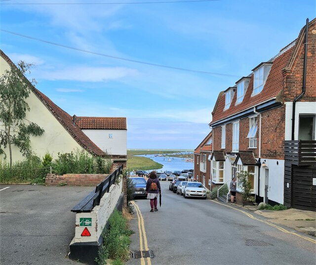
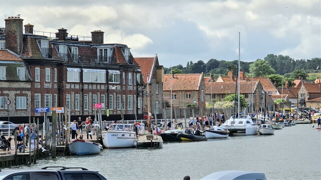
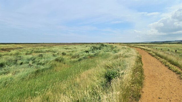
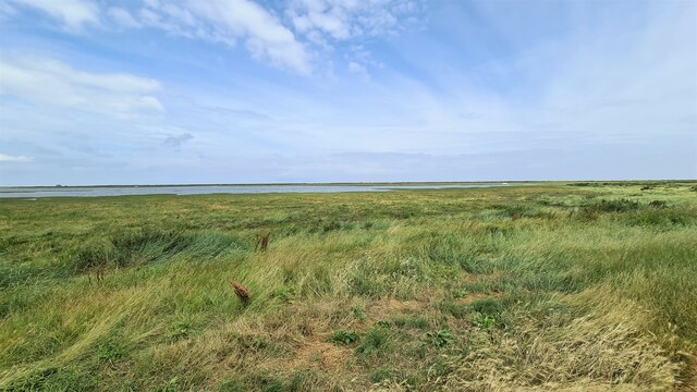
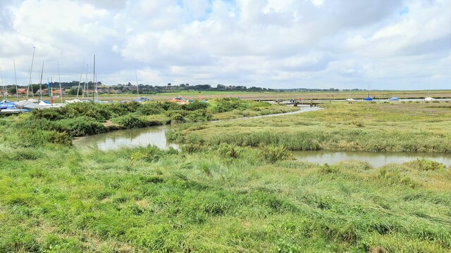
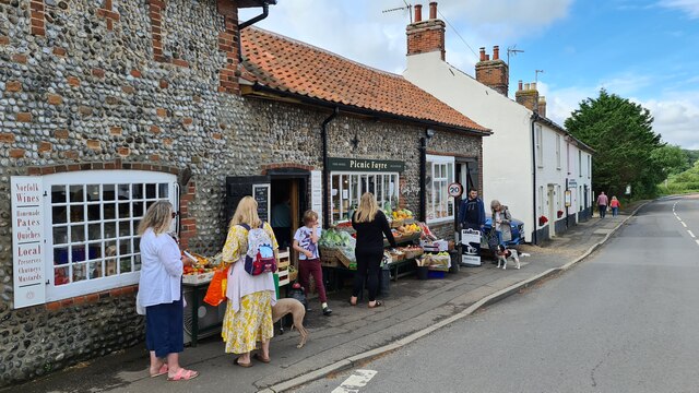
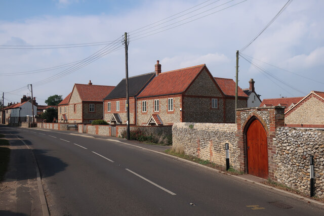
The Carnser, located in Norfolk, England, is a picturesque coastal marshland and saltings area. This natural landscape is characterized by its unique combination of saltwater marshes, mudflats, and reed beds, creating a diverse ecosystem that supports a variety of plant and animal life.

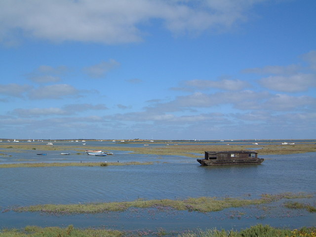
The marshes of The Carnser are flooded by the tides of the North Sea, resulting in a dynamic environment that changes with the ebb and flow of the water. This constant movement of saltwater and sediment shapes the landscape, creating channels and creeks that wind their way through the marshland.

The vegetation in The Carnser is predominantly made up of salt-tolerant plants such as glasswort, sea lavender, and cordgrass. These plants provide crucial habitats for a range of bird species, including wading birds like avocets, redshanks, and lapwings. During the breeding season, these birds can be observed nesting and foraging in the marshes.

The mudflats of The Carnser are an important feeding ground for many migratory birds, as well as a haven for various invertebrates. Crabs, mollusks, and worms thrive in the nutrient-rich mud, attracting numerous bird species, including dunlins, curlews, and oystercatchers.

The Carnser is not only a haven for wildlife but also a popular destination for nature enthusiasts and birdwatchers. Its unspoiled beauty, serene atmosphere, and abundance of wildlife make it an ideal place for nature walks and bird-spotting activities.

Overall, The Carnser in Norfolk offers a remarkable coastal marshland experience, showcasing the delicate balance of nature and providing a sanctuary for numerous bird species and other wildlife.

If you have any feedback on the listing, please let us know in the comments section below.
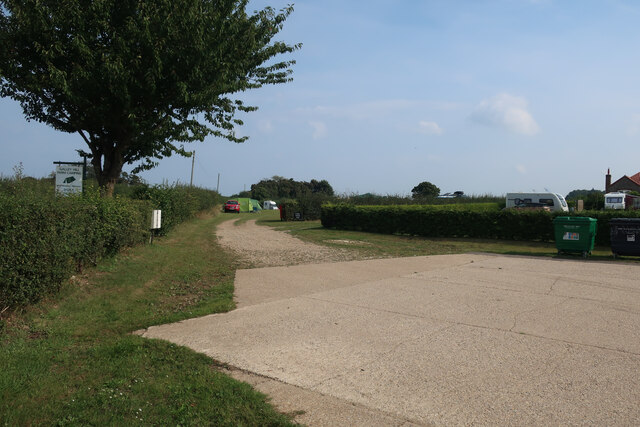
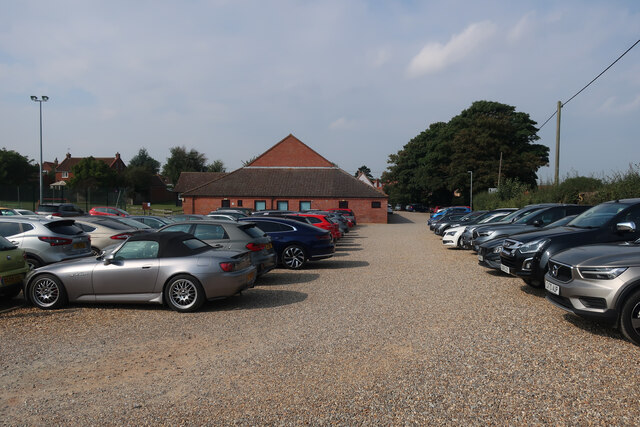
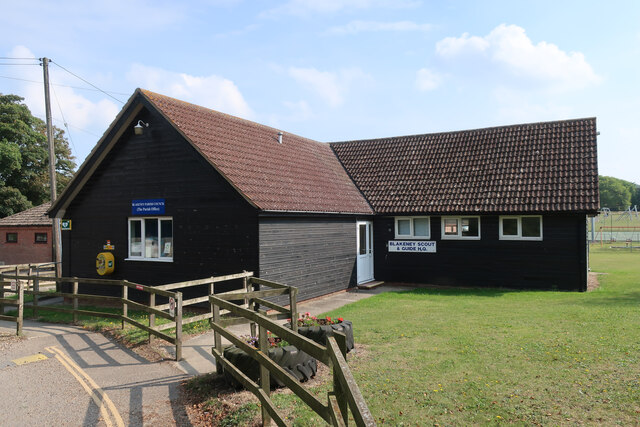
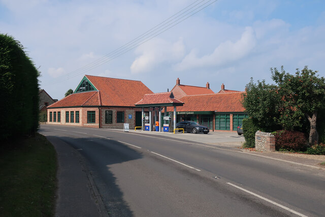
The Carnser Images

Images are sourced within 2km of 52.957346/1.0174756 or Grid Reference TG0244. Thanks to Geograph Open Source API. All images are credited.

Cley Windmill
Cley Windmill
The Coast Road through Cley next the Sea
High Street, Blakeney
Blakeney Harbour from High Street
Blakeney Quay
Blakeney Quay
Peddars Way and Norfolk Coastal Path at Blakeney Looking east
Peddars Way and Norfolk Coastal Path at Blakeney
Looking east
Blakeney saltmarsh looking towards The Marrams At high tide. The small building on the left horizon is a former lifeboat station now used to house National Trust rangers.
Blakeney saltmarsh looking towards The Marrams
At high tide. The small building on the left horizon is a former lifeboat station now used to house National Trust rangers.
High tide at Blakeney
Picnic Fayre, Cley next the Sea
High Street, Cley next the Sea
Windmill, Cley next the Sea
Galley Hill Farm campsite
Free parking by Blakeney Village Hall
Blakeney parish offices By the village hall.
Blakeney parish offices
By the village hall.
Queens Close, Blakeney
Recently built houses in Blakeney
Show me another place!

The Carnser is located at Grid Ref: TG0244 (Lat: 52.957346, Lng: 1.0174756)

Administrative County: Norfolk

District: North Norfolk

Police Authority: Norfolk

What 3 Words

///lungs.soonest.human. Near Wells-next-the-Sea, Norfolk

Related Wikis

Blakeney Guildhall

Blakeney Guildhall is a building in the coastal village of Blakeney in the north of the county of Norfolk. The property is in the care of English Heritage...
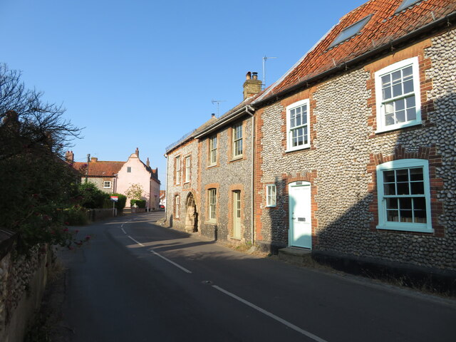
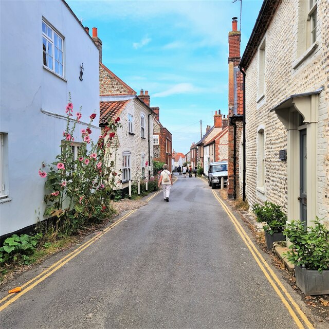
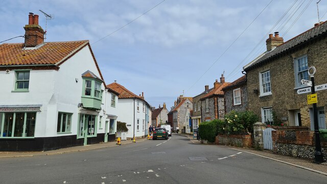
Blakeney, Norfolk

Blakeney is a coastal village and civil parish in the English county of Norfolk. Blakeney lies within the Norfolk Coast AONB (Area of Outstanding Natural...
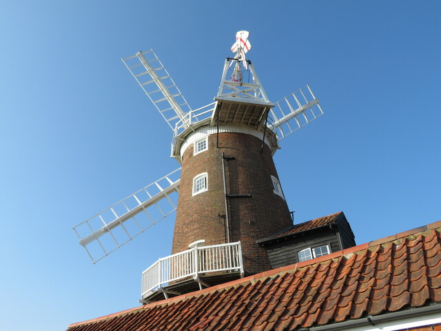
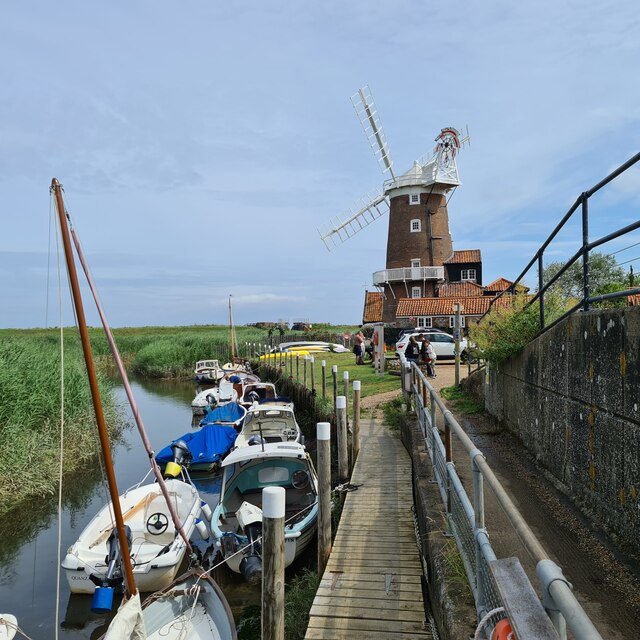
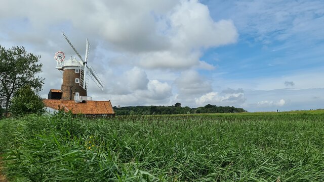
Blakeney Windmill

Blakeney Tower Windmill, built in 1769, is located on Friar Farm just to the east of the village of Blakeney in the English county of Norfolk. The mill...

St Nicholas, Blakeney

St Nicholas is the Anglican parish church of Blakeney, Norfolk, in the deanery of Holt and the Diocese of Norwich. The church was founded in the 13th century...

Wiveton Hall

Wiveton Hall is a country house in Wiveton, Norfolk, England. It is Grade II* listed. It was built in 1652 and extended in 1908. However there are remains...

North Norfolk Coast Site of Special Scientific Interest

The North Norfolk Coast Site of Special Scientific Interest (SSSI) is an area of European importance for wildlife in Norfolk, England. It comprises 7,700...

Wiveton Downs

Wiveton Downs is a 28.9-hectare (71-acre) biological and geological Site of Special Scientific Interest at Wiveton, west of Sheringham in the English county...
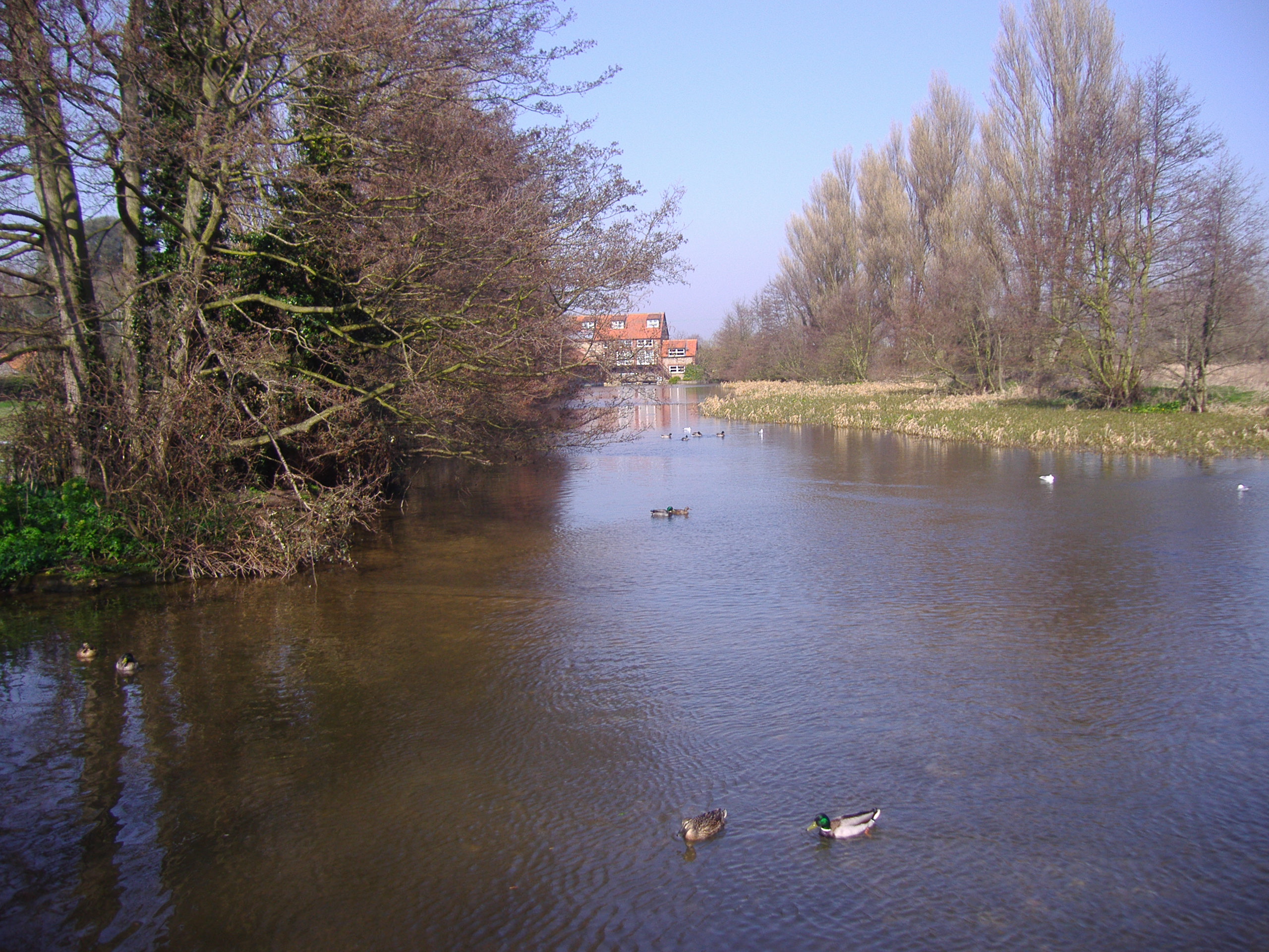
River Glaven

The River Glaven in the eastern English county of Norfolk is 10.5 mi (16.9 km) long and flows through picturesque North Norfolk countryside to the North...

Nearby Amenities

Located within 500m of 52.957346,1.0174756
Crossing
Crossing: island
Tactile Paving: yes
Lat/Long: 52.9534751/1.0146079
Post Box
Collection Times: Mo-Fr 16:30; Sa 11:00; Su off
Drive Through: no
Operator: Royal Mail
Post Box Mounting: metal_post
Post Box Type: lamp
Ref: NR25 2550
Royal Cypher: EIIR
Royal Cypher Wikidata: Q33102113
Source: survey
Survey Date: 2019-09-17
Lat/Long: 52.954007/1.0145373
Restaurant
Blakeney Hotel
Addr Postcode: NR25 7NE
Addr Street: The Quay
Addr Village: Blakeney
Fhrs Id: 281045
Source Addr: FHRS Open Data
Lat/Long: 52.9557019/1.0167711
Booth: KX100
Covered: booth
Disused Amenity: telephone
Man Made: telephone_box
Lat/Long: 52.9559998/1.0180715
Post Box
Collection Times: Mo-Fr 09:00; Sa 07:00; Su off
Drive Through: no
Operator: Royal Mail
Post Box Type: wall
Ref: NR25 2523D
Royal Cypher: EIIR
Royal Cypher Wikidata: Q33102113
Source: survey
Lat/Long: 52.9549516/1.0181572
Telephone
Booth: K6
Covered: booth
Listed Status: Grade II
Lat/Long: 52.9536738/1.0194449
Manor Hotel
Addr Postcode: NR25 7ND
Addr Street: The Quay
Addr Village: Blakeney
Fhrs Id: 281047
Note: moved back from bad edit
Source Addr: FHRS Open Data
Tourism: hotel
Wikidata: Q26291232
Lat/Long: 52.9561816/1.0193447
Pub
King's Arms
Addr Postcode: NR25 7NQ
Addr Street: Westgate Street
Addr Village: Blakeney
Fhrs Id: 281048
Freehouse: yes
Source: local_knowledge
Source Addr: FHRS Open Data
Wikidata: Q26464990
Lat/Long: 52.9547907/1.0144295
Bus Stop
bus shelter, W-bound
Bench: yes
Naptan AtcoCode: 2900B3210
Naptan Bearing: NW
Naptan CommonName: bus shelter
Naptan Indicator: W-bound
Naptan Landmark: Langham Road
Naptan Locality: Blakeney
Naptan NaptanCode: nfoadwtm
Naptan Street: New Road
Naptan Verified: no
Shelter: yes
Source: naptan_import
Lat/Long: 52.9533157/1.0147077
Bus Stop
bus shelter, E-bound
Bench: yes
Naptan AtcoCode: 2900B3211
Naptan Bearing: SE
Naptan CommonName: bus shelter
Naptan Indicator: E-bound
Naptan Landmark: opp Langham Road
Naptan Locality: Blakeney
Naptan NaptanCode: nfoadwtp
Naptan Street: New Road
Naptan Verified: no
Shelter: yes
Source: naptan_import
Lat/Long: 52.9534021/1.0148477
Traffic Calming: bump
Lat/Long: 52.9533282/1.0154098
Ice Cream
The Ice Cream Shop
Lat/Long: 52.9559677/1.0178898
Barrier: bollard
Bollard: fixed
Lat/Long: 52.9561033/1.0171913
Bench
Backrest: yes
Colour: brown
Material: wood
Lat/Long: 52.9553312/1.0148681
Fuel
Brand: Pace
Lat/Long: 52.9538685/1.0135126
Westons
Addr Housenumber: 5A
Addr Postcode: NR25 7NQ
Addr Street: Westgate Street
Addr Village: Blakeney
Fhrs Id: 349004
Shop: seafood
Source Addr: FHRS Open Data
Lat/Long: 52.9543733/1.0145205
Blakeney Delicatessen
Addr Housenumber: 30
Addr Postcode: NR25 7AL
Addr Street: High Street
Addr Village: Blakeney
Fhrs Id: 281042
Shop: deli
Source Addr: FHRS Open Data
Lat/Long: 52.9547291/1.0183809
Place Of Worship
Blakeney Methodist Church
Denomination: methodist
Religion: christian
Source: survey;Bing
Lat/Long: 52.9537625/1.0199906
Post Office
Blakeney Post Office
Addr City: Holt
Addr Housenumber: 7-9
Addr Postcode: NR25 7NQ
Addr Street: Westgate Street
Addr Village: Blakeney
Brand: Post Office
Brand Wikidata: Q1783168
Contact Website: https://www.postoffice.co.uk/branch-finder/3471365/blakeney
Note: within Spar
Opening Hours: Mo-Su 07:00-22:00
Operator: Royal Mail
Ref Pol Id: 13467
Source Addr: pol_branch_list_2018-01
Source Opening Hours: pol_branch_list_2018-01
Lat/Long: 52.9542272/1.0145455
Blakeney
Name Ru: Блейкни
Place: village
Lat/Long: 52.9539794/1.0180288
Quay Art
Shop: art
Lat/Long: 52.9558044/1.0174893
The Anchor Shop
Shop: gift
Lat/Long: 52.9552988/1.0179941
Restaurant
The Moorings
Addr Postcode: NR25 7NA
Addr Street: High Street
Addr Village: Blakeney
Fhrs Id: 281044
Source Addr: FHRS Open Data
Lat/Long: 52.9556554/1.0178354
Blakeney House Guest House
Addr Postcode: NR25 7NX
Addr Street: High Street
Addr Village: Blakeney
Email: admin@blakeneyhouse.com
Fhrs Id: 281693
Internet Access: wlan
Phone: +44 1263 740561
Smoking: no
Source: survey; Bing
Source Addr: FHRS Open Data
Stars: 5
Tourism: guest_house
Website: https://www.blakeneyhouse.com/
Lat/Long: 52.9529794/1.0190201
Traffic Calming: bump
Lat/Long: 52.9555116/1.0165009
Tourism: viewpoint
Lat/Long: 52.9557896/1.0183687
Hollyhock Cottage
Addr City: Blakeney
Addr Postcode: NR25 7AL
Addr Street: High Street
Building: house
Lat/Long: 52.9549162/1.0179716
Toilets
Free public toilet
Lat/Long: 52.9532097/1.0146376
Leisure: playground
Lat/Long: 52.9538983/1.0162043
Leisure: slipway
Lat/Long: 52.9579701/1.017079
Blakeney
Man Made: village_sign
Material: wood
Lat/Long: 52.9552917/1.014854
Blakeney Slipway
Leisure: slipway
Lat/Long: 52.9554435/1.0154093
Atm
ATM inside the Spar
Description: Inside SPAR
Lat/Long: 52.9541311/1.0146259
Cafe
The Blakeney Buoy
Addr Housenumber: 5
Addr Postcode: NR25 7NQ
Addr Street: Westgate Street
Addr Village: Blakeney
Cuisine: coffee_shop
Fhrs Id: 1090491
Source: survey
Source Addr: FHRS Open Data
Survey Date: 2019-09-17
Lat/Long: 52.9544668/1.0145241
Bench
Backrest: yes
Lat/Long: 52.9564705/1.0183007
Bench
Backrest: yes
Lat/Long: 52.9563751/1.0183476
Bench
Backrest: yes
Lat/Long: 52.9563275/1.0183302
Bench
Backrest: yes
Lat/Long: 52.9564042/1.0182698
Bench
Backrest: yes
Lat/Long: 52.9564632/1.0182363
Vending Machine
Vending: parking_tickets
Lat/Long: 52.9561336/1.017844
Entrance: yes
Wheelchair: yes
Lat/Long: 52.9560565/1.0182606
The Blakeney Cottage Company
Office: yes
Lat/Long: 52.9559441/1.0174014
The Handcrafted Company
Shop: gift
Lat/Long: 52.9558653/1.0174497
Waste Basket
Waste: dog_excrement
Lat/Long: 52.9560081/1.0181605
Waste Basket
Lat/Long: 52.9560138/1.0181732
Bench
Backrest: yes
Lat/Long: 52.9560187/1.0180539
Bench
Backrest: yes
Lat/Long: 52.9560069/1.0179982
Clock
Lat/Long: 52.9559898/1.0178773
Seaguls and Samphire
Shop: gift
Lat/Long: 52.955892/1.01795
Cafe
Two Magpies Bakery
Addr Housename: St Nicholas Church Hall
Addr Postcode: NR25 7ND
Addr Street: The Quay
Addr Village: Blakeney
Fhrs Id: 1363899
Opening Hours: Mo-Su 08:00-17:00
Shop: bakery
Source Addr: FHRS Open Data
Website: https://twomagpiesbakery.co.uk/blakeney/
Lat/Long: 52.9559474/1.0180579
Defibrillator
Access: yes
Check Date: 2023-03-10
Defibrillator Location: On exterior wall of public toilets, under the porch by the entrance to the ladies.
Emergency: defibrillator
Indoor: no
Not Ref GB The Circuit: 653D98AB-50DD-48DE-9090-B09A00DA6E6C
Ref: CHT-09-002
Lat/Long: 52.9560349/1.0182262
Entrance: yes
Male: yes
Lat/Long: 52.9560431/1.0183241
Entrance: yes
Female: yes
Lat/Long: 52.9560252/1.0182166
Recycling
Lat/Long: 52.953309/1.014289
Barrier: stile
Lat/Long: 52.9537188/1.0145877
The data included in this document is from www.openstreetmap.org. The data is made available under ODbL.

Have you been to The Carnser?

Leave your review of The Carnser below (or comments, questions and feedback).