Lòn Erista

Sea, Estuary, Creek in Ross-shire

Scotland

Lòn Erista

Baile-na-Cille, Lewis, 1989
Baile-na-Cille, Lewis, 1989 Credit: Nigel Thompson

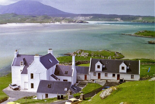
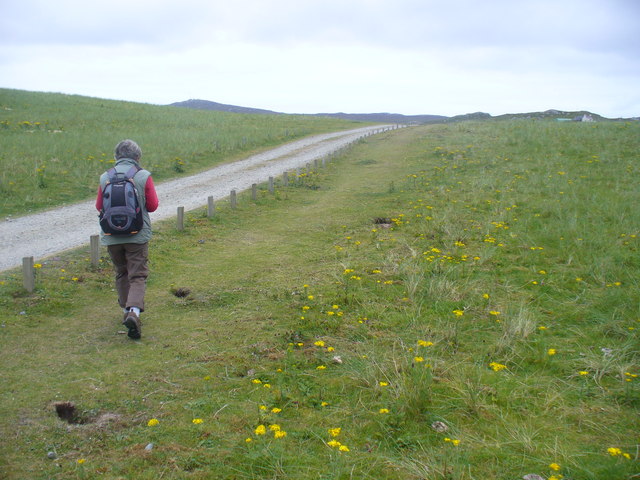
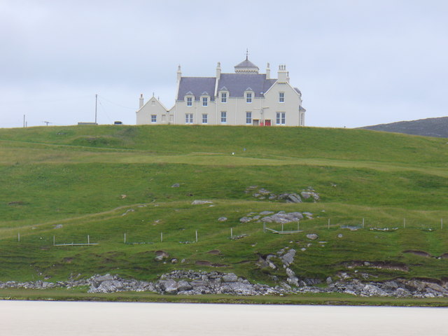
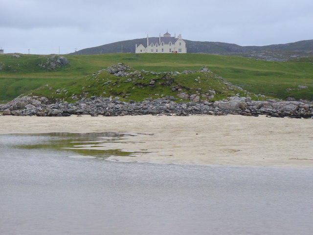
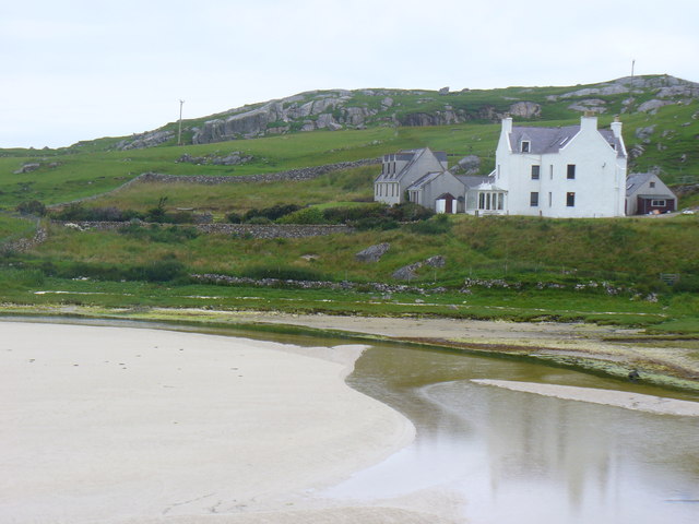
Lòn Erista, located in Ross-shire, Scotland, is a picturesque and ecologically diverse area encompassing a sea, estuary, and creek. Nestled on the west coast of Scotland, it is renowned for its stunning natural beauty and rich marine life.

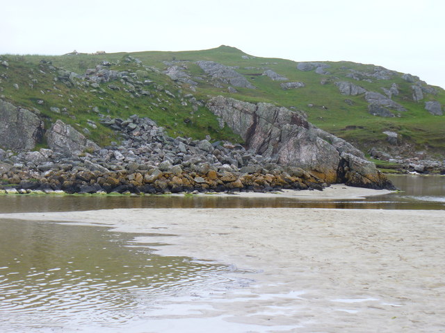
The sea surrounding Lòn Erista offers breathtaking views of the North Atlantic Ocean. Its crystal-clear waters attract a variety of marine species, making it a popular spot for fishing and water sports enthusiasts. The sea also provides a habitat for seals, dolphins, and various bird species, delighting wildlife enthusiasts and birdwatchers.

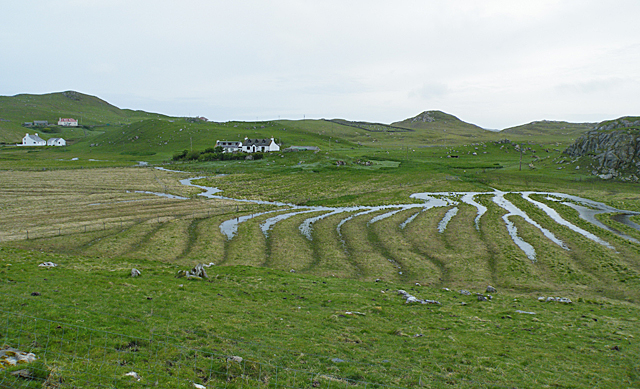
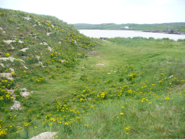
Adjacent to the sea, the estuary of Lòn Erista is a haven for migratory birds and wading species. The estuary's mudflats and salt marshes provide a vital feeding ground for these birds, including the iconic curlew and redshank. During high tide, the estuary transforms into a serene body of water, reflecting the surrounding mountains and creating a tranquil atmosphere.

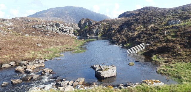
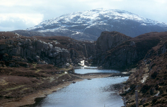
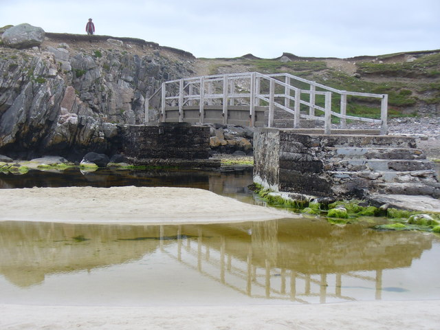
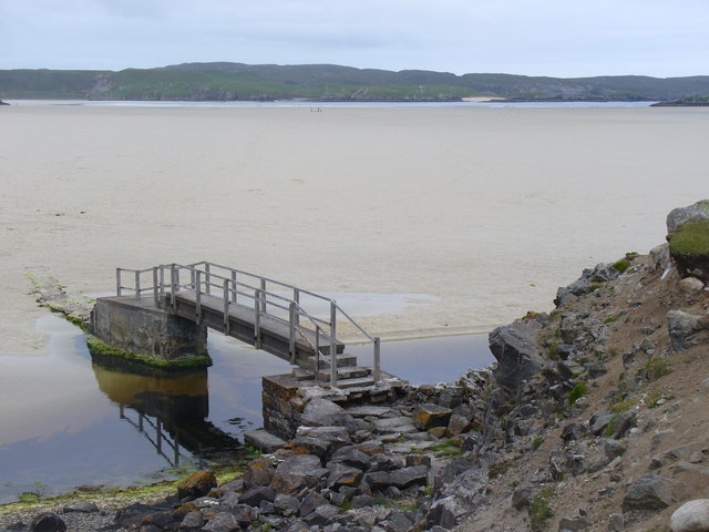
Further inland, the creek meanders through the lush countryside, offering a peaceful retreat for visitors. The creek is home to a diverse range of plant and animal species, including otters and water voles. Its banks provide an idyllic setting for leisurely walks and picnics, with the soothing sound of running water adding to the overall serenity.

Lòn Erista is a true gem of Ross-shire, offering a unique blend of coastal and inland environments. Its natural beauty and diverse ecosystem make it a must-visit destination for nature lovers and those seeking a respite from the hustle and bustle of everyday life.

If you have any feedback on the listing, please let us know in the comments section below.
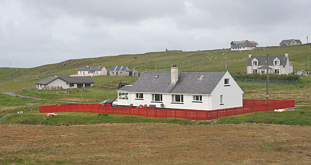
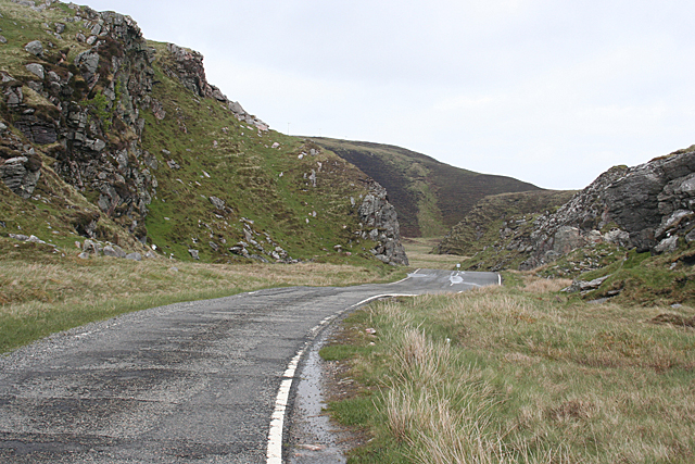
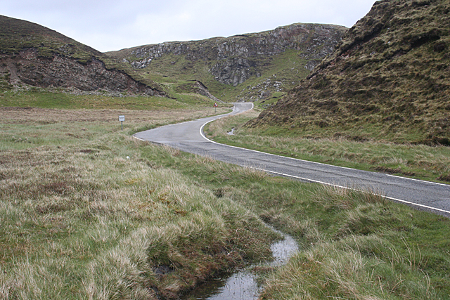
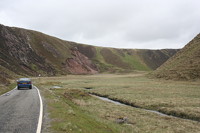
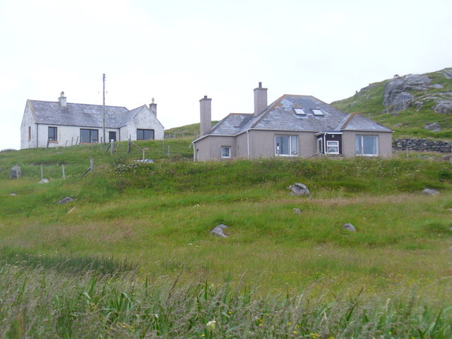
Lòn Erista Images

Images are sourced within 2km of 58.183916/-7.0084909 or Grid Reference NB0532. Thanks to Geograph Open Source API. All images are credited.

Baile-na-Cille, Lewis, 1989
River leading from Loch Stacsabhat
A river tumbles down to Uig Bay Late snow coats the west Lewis mountains.
A river tumbles down to Uig Bay
Late snow coats the west Lewis mountains.
Waterlogged Lazybeds After a day of torrential rain, the old lazybeds at Eadar Dha Fhadail (Ardroil) are almost submerged by flooding.
Waterlogged Lazybeds
After a day of torrential rain, the old lazybeds at Eadar Dha Fhadail (Ardroil) are almost submerged by flooding.
Timsgearraidh (Timsgarry) Most of the older cottages at Timsgearraidh have being replaced by modern houses. They may be less picturesque, but they're much more comfortable for the occupants.
Timsgearraidh (Timsgarry)
Most of the older cottages at Timsgearraidh have being replaced by modern houses. They may be less picturesque, but they're much more comfortable for the occupants.
Gleann Bhaltois (Glen Valtos) 1 Gleann Bhaltois is a spectacular example of a glacial meltwater channel. At the end of the last Ice Age, about 10,000 years ago, there is thought to have been a lake where Uig Bay now lies, dammed by ice to the west. The outlet from the lake was at the head of what is now Gleann Bhaltois, and carved a deep steep-sided glen, exploiting a fault line in the rocks. This is taken from the col at the top of the glen, looking down along the B8011 road which now occupies it.
Gleann Bhaltois (Glen Valtos) 1
Gleann Bhaltois is a spectacular example of a glacial meltwater channel. At the end of the last Ice Age, about 10,000 years ago, there is thought to have been a lake where Uig Bay now lies, dammed by ice to the west. The outlet from the lake was at the head of what is now Gleann Bhaltois, and carved a deep steep-sided glen, exploiting a fault line in the rocks. This is taken from the col at the top of the glen, looking down along the B8011 road which now occupies it.
Gleann Bhaltois (Glen Valtos) 2 Gleann Bhaltois is a spectacular example of a glacial meltwater channel. At the end of the last Ice Age, about 10,000 years ago, there is thought to have been a lake where Uig Bay now lies, dammed by ice to the west. The outlet from the lake was at the head of what is now Gleann Bhaltois, and carved a deep steep-sided glen, exploiting a fault line in the rocks. However the upper part of the glen follows a more sinuous course. The single-track B8011 road with passing places now winds through the glen.
Gleann Bhaltois (Glen Valtos) 2
Gleann Bhaltois is a spectacular example of a glacial meltwater channel. At the end of the last Ice Age, about 10,000 years ago, there is thought to have been a lake where Uig Bay now lies, dammed by ice to the west. The outlet from the lake was at the head of what is now Gleann Bhaltois, and carved a deep steep-sided glen, exploiting a fault line in the rocks. However the upper part of the glen follows a more sinuous course. The single-track B8011 road with passing places now winds through the glen.
Gleann Bhaltois (Glen Valtos) 4 Gleann Bhaltois is a spectacular example of a glacial meltwater channel. At the end of the last Ice Age, about 10,000 years ago, there is thought to have been a lake where Uig Bay now lies, dammed by ice to the west. The outlet from the lake was at the head of what is now Gleann Bhaltois, and carved a deep steep-sided glen, exploiting a fault line in the rocks.
Gleann Bhaltois (Glen Valtos) 4
Gleann Bhaltois is a spectacular example of a glacial meltwater channel. At the end of the last Ice Age, about 10,000 years ago, there is thought to have been a lake where Uig Bay now lies, dammed by ice to the west. The outlet from the lake was at the head of what is now Gleann Bhaltois, and carved a deep steep-sided glen, exploiting a fault line in the rocks.
Wooden King, Uig Sculpture based on one of the famous Lewis chessmen, sited close to the cemetery at Uig.
<span class="nowrap"><a title="http://www.uigandbernera.com/" rel="nofollow ugc noopener" href="http://www.uigandbernera.com/">Link</a><img style="margin-left:2px;" alt="External link" title="External link - shift click to open in new window" src="https://s1.geograph.org.uk/img/external.png" width="10" height="10"/></span>
Wooden King, Uig
Sculpture based on one of the famous Lewis chessmen, sited close to the cemetery at Uig. LinkExternal link
Track to Uig Sands Paralleled by a grassy footpath across the machair.
<span class="nowrap"><a title="http://www.uigandbernera.com/" rel="nofollow ugc noopener" href="http://www.uigandbernera.com/">Link</a><img style="margin-left:2px;" alt="External link" title="External link - shift click to open in new window" src="https://s1.geograph.org.uk/img/external.png" width="10" height="10"/></span>
Track to Uig Sands
Paralleled by a grassy footpath across the machair. LinkExternal link
Sand Dunes at Uig Flanking the wide expanses of sand flats at Uig Bay.
<span class="nowrap"><a title="http://www.uigandbernera.com/" rel="nofollow ugc noopener" href="http://www.uigandbernera.com/">Link</a><img style="margin-left:2px;" alt="External link" title="External link - shift click to open in new window" src="https://s1.geograph.org.uk/img/external.png" width="10" height="10"/></span>
Sand Dunes at Uig
Flanking the wide expanses of sand flats at Uig Bay. LinkExternal link
Outflow at Tràigh Ùige Rivermouth where the outflow is hemmed beneath rocky crags.
<span class="nowrap"><a title="http://www.uigandbernera.com/" rel="nofollow ugc noopener" href="http://www.uigandbernera.com/">Link</a><img style="margin-left:2px;" alt="External link" title="External link - shift click to open in new window" src="https://s1.geograph.org.uk/img/external.png" width="10" height="10"/></span>
Outflow at Tràigh Ùige
Rivermouth where the outflow is hemmed beneath rocky crags. LinkExternal link
Loidse Uig Uig Lodge, large hilltop mansion overlooking the expanses of Tràigh Ùige.
<span class="nowrap"><a title="http://www.uigandbernera.com/" rel="nofollow ugc noopener" href="http://www.uigandbernera.com/">Link</a><img style="margin-left:2px;" alt="External link" title="External link - shift click to open in new window" src="https://s1.geograph.org.uk/img/external.png" width="10" height="10"/></span>
Loidse Uig
Uig Lodge, large hilltop mansion overlooking the expanses of Tràigh Ùige. LinkExternal link
Dun Borrainais Remains of an Early Iron Age fort below a rocky promontory at Uig Sands.
<span class="nowrap"><a title="http://www.uigandbernera.com/" rel="nofollow ugc noopener" href="http://www.uigandbernera.com/">Link</a><img style="margin-left:2px;" alt="External link" title="External link - shift click to open in new window" src="https://s1.geograph.org.uk/img/external.png" width="10" height="10"/></span>
Dun Borrainais
Remains of an Early Iron Age fort below a rocky promontory at Uig Sands. LinkExternal link
Footbridge at Uig Sands 1980 wooden footbridge connecting Traigh Uige with the rocky promontory above Dun Borranais.
<span class="nowrap"><a title="http://www.uigandbernera.com/" rel="nofollow ugc noopener" href="http://www.uigandbernera.com/">Link</a><img style="margin-left:2px;" alt="External link" title="External link - shift click to open in new window" src="https://s1.geograph.org.uk/img/external.png" width="10" height="10"/></span>
Footbridge at Uig Sands
1980 wooden footbridge connecting Traigh Uige with the rocky promontory above Dun Borranais. LinkExternal link
Borranais a Muigh The northern end of Traigh Uige's expanses of sand flats with the 1980 footbridge across the river close to Dun Borranais.
<span class="nowrap"><a title="http://www.uigandbernera.com/" rel="nofollow ugc noopener" href="http://www.uigandbernera.com/">Link</a><img style="margin-left:2px;" alt="External link" title="External link - shift click to open in new window" src="https://s1.geograph.org.uk/img/external.png" width="10" height="10"/></span>
Borranais a Muigh
The northern end of Traigh Uige's expanses of sand flats with the 1980 footbridge across the river close to Dun Borranais. LinkExternal link
Old Manse at Baile na Cille Above Traigh na Cille, the northern end of Traigh Uige's expansive sand flats.
<span class="nowrap"><a title="http://www.uigandbernera.com/" rel="nofollow ugc noopener" href="http://www.uigandbernera.com/">Link</a><img style="margin-left:2px;" alt="External link" title="External link - shift click to open in new window" src="https://s1.geograph.org.uk/img/external.png" width="10" height="10"/></span>
Old Manse at Baile na Cille
Above Traigh na Cille, the northern end of Traigh Uige's expansive sand flats. LinkExternal link
Baile na Cille Crofts on the grassy hillside west of Timsgearraidh, Uig.
<span class="nowrap"><a title="http://www.uigandbernera.com/" rel="nofollow ugc noopener" href="http://www.uigandbernera.com/">Link</a><img style="margin-left:2px;" alt="External link" title="External link - shift click to open in new window" src="https://s1.geograph.org.uk/img/external.png" width="10" height="10"/></span>
Baile na Cille
Crofts on the grassy hillside west of Timsgearraidh, Uig. LinkExternal link
Show me another place!

Lòn Erista is located at Grid Ref: NB0532 (Lat: 58.183916, Lng: -7.0084909)

Unitary Authority: Na h-Eileanan an Iar

Police Authority: Highlands and Islands

What 3 Words

///school.shampoo.twinkling. Near Carloway, Na h-Eileanan Siar

Related Wikis

Uig, Lewis

Uig (Scottish Gaelic: Ùig [uːkʲ]), also known as Sgìr' Ùig, is a civil parish and community in the west of the Isle of Lewis in the Outer Hebrides, Scotland...

Ardroil

Ardroil (Scottish Gaelic: Eadar Dhà Fhadhail) is a village on the Isle of Lewis in the Outer Hebrides, Scotland. Ardroil is within the parish of Uig....

Timsgarry

Timsgarry (Scottish Gaelic: Tuimisgearraidh) is a village on the Isle of Lewis, in the Outer Hebrides, Scotland. Timsgarry is home to the Baile na Cille...
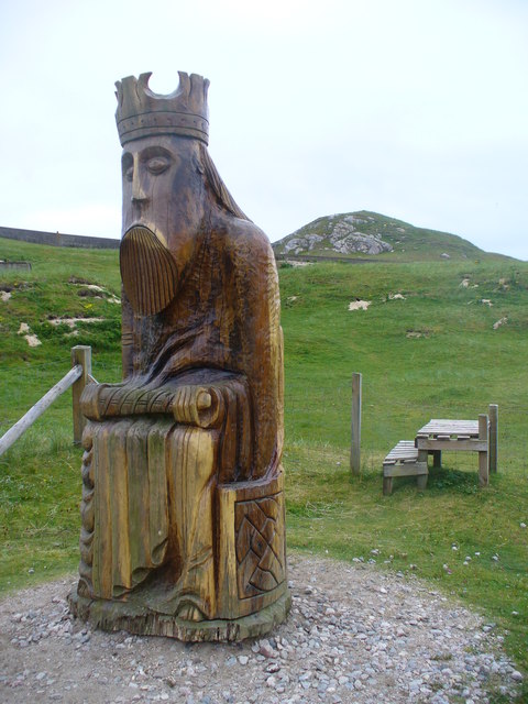
Camas Uig

Camas Uig (Uig Bay) is a bay on the west coast of the Isle of Lewis, in the Outer Hebrides of Scotland. The Lewis Chessmen were discovered in the dunes...

Nearby Amenities

Located within 500m of 58.183916,-7.0084909
Barrier: cattle_grid
Lat/Long: 58.1804924/-7.011282
Passing Place
Lat/Long: 58.1805853/-7.0102667
Passing Place
Lat/Long: 58.1879695/-7.0071115
Power: pole
Lat/Long: 58.1827564/-7.0165039
Power: pole
Lat/Long: 58.183963/-7.0159667
Power: pole
Lat/Long: 58.1844651/-7.0153438
Power: pole
Lat/Long: 58.1849934/-7.0146125
Power: pole
Lat/Long: 58.1854765/-7.0139534
Power: pole
Lat/Long: 58.1858834/-7.0133666
Power: pole
Lat/Long: 58.1863094/-7.0127572
Power: pole
Lat/Long: 58.1870602/-7.0123983
Power: pole
Lat/Long: 58.1877859/-7.0120394
Noexit: yes
Lat/Long: 58.1825923/-7.0073853
Golf: pin
Lat/Long: 58.1867098/-7.0145803
The data included in this document is from www.openstreetmap.org. The data is made available under ODbL.

Have you been to Lòn Erista?

Leave your review of Lòn Erista below (or comments, questions and feedback).