Caolas Shòdhaigh
Sea, Estuary, Creek in Inverness-shire
Scotland
Caolas Shòdhaigh

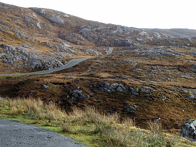
Caolas Shòdhaigh is a small coastal area located in Inverness-shire, Scotland. It is known for its picturesque sea views, estuary, and creek, making it a popular destination for nature enthusiasts and outdoor lovers.
Situated on the western coast of Scotland, Caolas Shòdhaigh offers stunning views of the sea, with its crystal-clear waters and rugged cliffs. The area is home to a diverse range of marine wildlife, including seals, dolphins, and various seabird species, making it a haven for birdwatchers and animal lovers.
The estuary in Caolas Shòdhaigh is a natural inlet where the sea meets a river, creating a unique ecosystem that supports a variety of plant and animal life. It is an important habitat for many bird species, providing a feeding ground and nesting site. The estuary is subject to tidal changes, which create ever-changing landscapes and opportunities for exploration.
The creek in Caolas Shòdhaigh is a small, narrow waterway that flows into the sea. It is surrounded by lush vegetation and offers a tranquil setting for visitors to enjoy. The creek is often used by kayakers and canoeists, who can navigate its calm waters while taking in the beautiful scenery.
In addition to its natural beauty, Caolas Shòdhaigh also has historical significance. There are ancient ruins and archaeological sites in the area that offer a glimpse into the region's past.
Overall, Caolas Shòdhaigh is a stunning coastal area with its sea, estuary, and creek, providing a haven for nature lovers and a place of tranquility amidst Scotland's rugged beauty.
If you have any feedback on the listing, please let us know in the comments section below.
Caolas Shòdhaigh Images
Images are sourced within 2km of 57.946606/-6.9572078 or Grid Reference NB0606. Thanks to Geograph Open Source API. All images are credited.


Caolas Shòdhaigh is located at Grid Ref: NB0606 (Lat: 57.946606, Lng: -6.9572078)
Unitary Authority: Na h-Eileanan an Iar
Police Authority: Highlands and Islands
What 3 Words
///viewer.grace.estuaries. Near Tarbert, Na h-Eileanan Siar
Nearby Locations
Related Wikis

Soay Sound
Soay Sound (Scottish Gaelic: Caolas Shòdhaigh) is a strait separating the islands of Soay Mòr and Soay Beag from the northern part of Harris. The sound...

Soay Mòr
Soay Mòr (Scottish Gaelic: Sòdhaigh Mòr) is an island in West Loch Tarbert, between the northern and southern parts of Harris. The uninhabited island is...

Soay Beag
Soay Beag (Scottish Gaelic: Sòdhaigh Beag) is a small, uninhabited tidal island in West Loch Tarbert, between the northern and southern parts of Harris...

West Loch Tarbert
West Loch Tarbert (Scottish Gaelic: Loch A Siar) is a sea loch that separates the northern and southern parts of Harris in the Outer Hebrides of Scotland...
Have you been to Caolas Shòdhaigh?
Leave your review of Caolas Shòdhaigh below (or comments, questions and feedback).