Rubha Linish

Coastal Feature, Headland, Point in Ross-shire

Scotland

Rubha Linish

Baile-na-Cille, Lewis, 1989
Baile-na-Cille, Lewis, 1989 Credit: Nigel Thompson

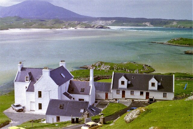
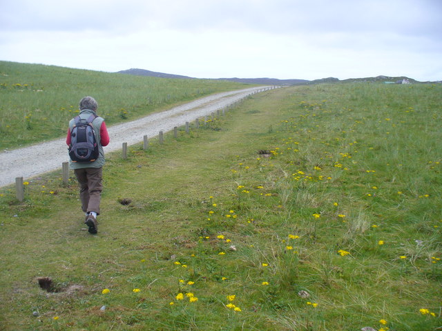
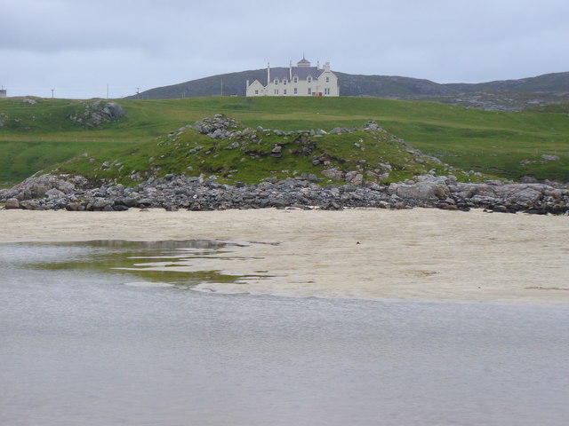
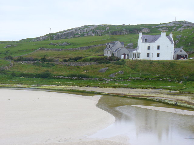
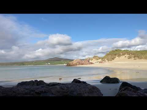
Rubha Linish, located in Ross-shire, Scotland, is a prominent coastal feature that extends into the vast expanse of the North Atlantic Ocean. It is classified as a headland or point, jutting out into the sea from the surrounding coastline. The headland is situated on the western coast of the Scottish Highlands, close to the village of Gairloch.

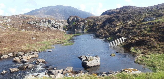
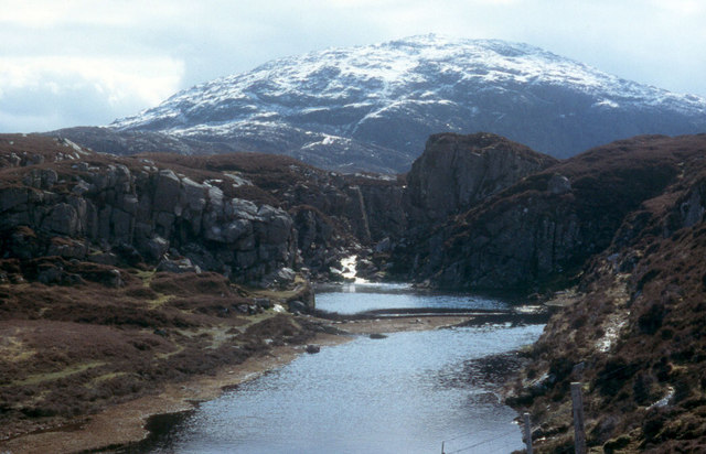
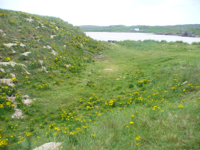
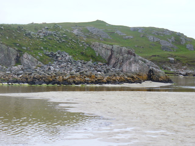
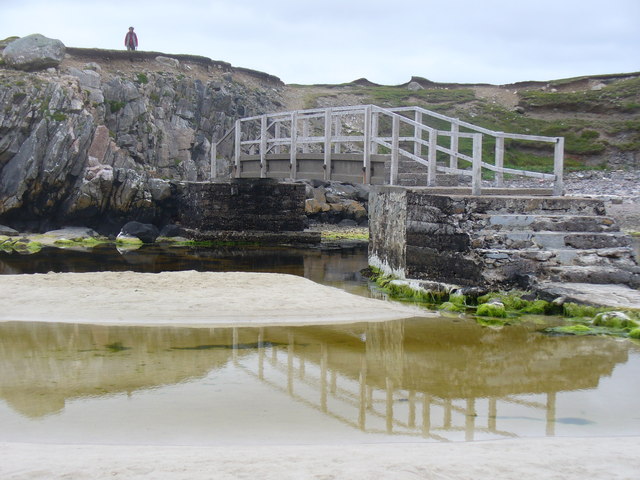
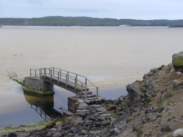
With its rugged cliffs and stunning views, Rubha Linish is a popular destination for outdoor enthusiasts and nature lovers alike. The headland showcases a diverse range of geological formations, including layers of ancient rock and evidence of glacial activity. Its elevation offers breathtaking vistas of the surrounding landscape, including the nearby Isle of Skye and the Inner Hebrides.

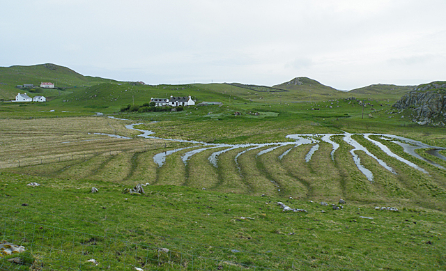
The headland is also home to a rich variety of flora and fauna, providing a habitat for numerous bird species, including puffins, fulmars, and guillemots. The surrounding waters are teeming with marine life, making it an excellent spot for fishing and wildlife spotting.

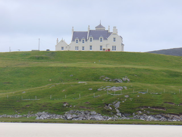
Rubha Linish is a site of historical significance as well. It is believed that the headland was once inhabited by ancient settlers, leaving behind traces of their existence in the form of standing stones and burial mounds. These remnants serve as a reminder of the area's rich cultural heritage.

In conclusion, Rubha Linish is a captivating headland situated in Ross-shire, Scotland. Its dramatic cliffs, panoramic views, diverse wildlife, and historical remnants make it a must-visit destination for those seeking to immerse themselves in the natural beauty and history of the Scottish Highlands.

If you have any feedback on the listing, please let us know in the comments section below.
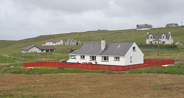
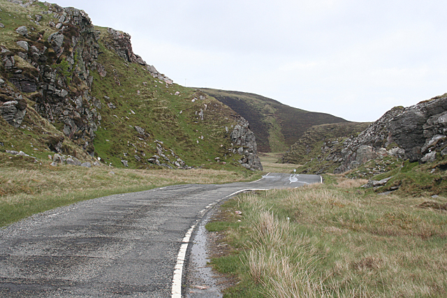
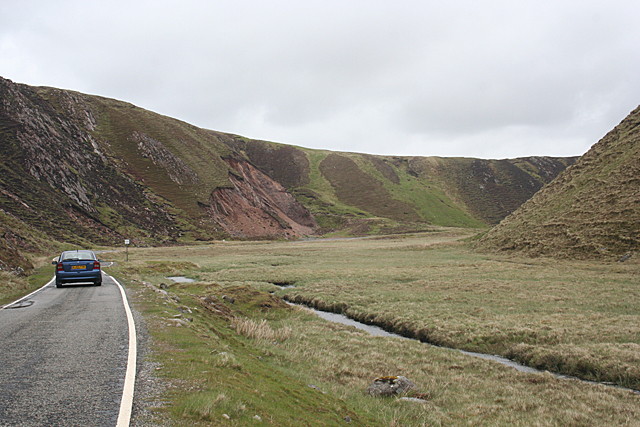
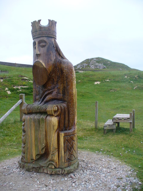
Rubha Linish Images

Images are sourced within 2km of 58.184512/-7.0157463 or Grid Reference NB0532. Thanks to Geograph Open Source API. All images are credited.

Baile-na-Cille, Lewis, 1989
Cappadale Sands
Cappadale Sands
River leading from Loch Stacsabhat
A river tumbles down to Uig Bay Late snow coats the west Lewis mountains.
A river tumbles down to Uig Bay
Late snow coats the west Lewis mountains.
Waterlogged Lazybeds After a day of torrential rain, the old lazybeds at Eadar Dha Fhadail (Ardroil) are almost submerged by flooding.
Waterlogged Lazybeds
After a day of torrential rain, the old lazybeds at Eadar Dha Fhadail (Ardroil) are almost submerged by flooding.
Cappadale Sands The map names this arm of Tràigh Uige as Cappadale Sands. As the tide is in, the sand is only visible through the water, giving it that characteristic Hebridean turquoise colour. It would have been even better in sunshine. The hill on the skyline is Forsnabhal (205 metres), and the houses at the far side of the bay are at Timsgearraidh.
Cappadale Sands
The map names this arm of Tràigh Uige as Cappadale Sands. As the tide is in, the sand is only visible through the water, giving it that characteristic Hebridean turquoise colour. It would have been even better in sunshine. The hill on the skyline is Forsnabhal (205 metres), and the houses at the far side of the bay are at Timsgearraidh.
Timsgearraidh (Timsgarry) Most of the older cottages at Timsgearraidh have being replaced by modern houses. They may be less picturesque, but they're much more comfortable for the occupants.
Timsgearraidh (Timsgarry)
Most of the older cottages at Timsgearraidh have being replaced by modern houses. They may be less picturesque, but they're much more comfortable for the occupants.
Gleann Bhaltois (Glen Valtos) 1 Gleann Bhaltois is a spectacular example of a glacial meltwater channel. At the end of the last Ice Age, about 10,000 years ago, there is thought to have been a lake where Uig Bay now lies, dammed by ice to the west. The outlet from the lake was at the head of what is now Gleann Bhaltois, and carved a deep steep-sided glen, exploiting a fault line in the rocks. This is taken from the col at the top of the glen, looking down along the B8011 road which now occupies it.
Gleann Bhaltois (Glen Valtos) 1
Gleann Bhaltois is a spectacular example of a glacial meltwater channel. At the end of the last Ice Age, about 10,000 years ago, there is thought to have been a lake where Uig Bay now lies, dammed by ice to the west. The outlet from the lake was at the head of what is now Gleann Bhaltois, and carved a deep steep-sided glen, exploiting a fault line in the rocks. This is taken from the col at the top of the glen, looking down along the B8011 road which now occupies it.
Gleann Bhaltois (Glen Valtos) 4 Gleann Bhaltois is a spectacular example of a glacial meltwater channel. At the end of the last Ice Age, about 10,000 years ago, there is thought to have been a lake where Uig Bay now lies, dammed by ice to the west. The outlet from the lake was at the head of what is now Gleann Bhaltois, and carved a deep steep-sided glen, exploiting a fault line in the rocks.
Gleann Bhaltois (Glen Valtos) 4
Gleann Bhaltois is a spectacular example of a glacial meltwater channel. At the end of the last Ice Age, about 10,000 years ago, there is thought to have been a lake where Uig Bay now lies, dammed by ice to the west. The outlet from the lake was at the head of what is now Gleann Bhaltois, and carved a deep steep-sided glen, exploiting a fault line in the rocks.
Wooden King, Uig Sculpture based on one of the famous Lewis chessmen, sited close to the cemetery at Uig.
<span class="nowrap"><a title="http://www.uigandbernera.com/" rel="nofollow ugc noopener" href="http://www.uigandbernera.com/">Link</a><img style="margin-left:2px;" alt="External link" title="External link - shift click to open in new window" src="https://s1.geograph.org.uk/img/external.png" width="10" height="10"/></span>
Wooden King, Uig
Sculpture based on one of the famous Lewis chessmen, sited close to the cemetery at Uig. LinkExternal link
Track to Uig Sands Paralleled by a grassy footpath across the machair.
<span class="nowrap"><a title="http://www.uigandbernera.com/" rel="nofollow ugc noopener" href="http://www.uigandbernera.com/">Link</a><img style="margin-left:2px;" alt="External link" title="External link - shift click to open in new window" src="https://s1.geograph.org.uk/img/external.png" width="10" height="10"/></span>
Track to Uig Sands
Paralleled by a grassy footpath across the machair. LinkExternal link
Sand Dunes at Uig Flanking the wide expanses of sand flats at Uig Bay.
<span class="nowrap"><a title="http://www.uigandbernera.com/" rel="nofollow ugc noopener" href="http://www.uigandbernera.com/">Link</a><img style="margin-left:2px;" alt="External link" title="External link - shift click to open in new window" src="https://s1.geograph.org.uk/img/external.png" width="10" height="10"/></span>
Sand Dunes at Uig
Flanking the wide expanses of sand flats at Uig Bay. LinkExternal link
Outflow at Tràigh Ùige Rivermouth where the outflow is hemmed beneath rocky crags.
<span class="nowrap"><a title="http://www.uigandbernera.com/" rel="nofollow ugc noopener" href="http://www.uigandbernera.com/">Link</a><img style="margin-left:2px;" alt="External link" title="External link - shift click to open in new window" src="https://s1.geograph.org.uk/img/external.png" width="10" height="10"/></span>
Outflow at Tràigh Ùige
Rivermouth where the outflow is hemmed beneath rocky crags. LinkExternal link
Loidse Uig Uig Lodge, large hilltop mansion overlooking the expanses of Tràigh Ùige.
<span class="nowrap"><a title="http://www.uigandbernera.com/" rel="nofollow ugc noopener" href="http://www.uigandbernera.com/">Link</a><img style="margin-left:2px;" alt="External link" title="External link - shift click to open in new window" src="https://s1.geograph.org.uk/img/external.png" width="10" height="10"/></span>
Loidse Uig
Uig Lodge, large hilltop mansion overlooking the expanses of Tràigh Ùige. LinkExternal link
Dun Borrainais Remains of an Early Iron Age fort below a rocky promontory at Uig Sands.
<span class="nowrap"><a title="http://www.uigandbernera.com/" rel="nofollow ugc noopener" href="http://www.uigandbernera.com/">Link</a><img style="margin-left:2px;" alt="External link" title="External link - shift click to open in new window" src="https://s1.geograph.org.uk/img/external.png" width="10" height="10"/></span>
Dun Borrainais
Remains of an Early Iron Age fort below a rocky promontory at Uig Sands. LinkExternal link
Footbridge at Uig Sands 1980 wooden footbridge connecting Traigh Uige with the rocky promontory above Dun Borranais.
<span class="nowrap"><a title="http://www.uigandbernera.com/" rel="nofollow ugc noopener" href="http://www.uigandbernera.com/">Link</a><img style="margin-left:2px;" alt="External link" title="External link - shift click to open in new window" src="https://s1.geograph.org.uk/img/external.png" width="10" height="10"/></span>
Footbridge at Uig Sands
1980 wooden footbridge connecting Traigh Uige with the rocky promontory above Dun Borranais. LinkExternal link
Borranais a Muigh The northern end of Traigh Uige's expanses of sand flats with the 1980 footbridge across the river close to Dun Borranais.
<span class="nowrap"><a title="http://www.uigandbernera.com/" rel="nofollow ugc noopener" href="http://www.uigandbernera.com/">Link</a><img style="margin-left:2px;" alt="External link" title="External link - shift click to open in new window" src="https://s1.geograph.org.uk/img/external.png" width="10" height="10"/></span>
Borranais a Muigh
The northern end of Traigh Uige's expanses of sand flats with the 1980 footbridge across the river close to Dun Borranais. LinkExternal link
Old Manse at Baile na Cille Above Traigh na Cille, the northern end of Traigh Uige's expansive sand flats.
<span class="nowrap"><a title="http://www.uigandbernera.com/" rel="nofollow ugc noopener" href="http://www.uigandbernera.com/">Link</a><img style="margin-left:2px;" alt="External link" title="External link - shift click to open in new window" src="https://s1.geograph.org.uk/img/external.png" width="10" height="10"/></span>
Old Manse at Baile na Cille
Above Traigh na Cille, the northern end of Traigh Uige's expansive sand flats. LinkExternal link
Show me another place!

Rubha Linish is located at Grid Ref: NB0532 (Lat: 58.184512, Lng: -7.0157463)

Unitary Authority: Na h-Eileanan an Iar

Police Authority: Highlands and Islands

What 3 Words

///stiletto.stub.tourist. Near Carloway, Na h-Eileanan Siar

Related Wikis

Uig, Lewis

Uig (Scottish Gaelic: Ùig [uːkʲ]), also known as Sgìr' Ùig, is a civil parish and community in the west of the Isle of Lewis in the Outer Hebrides, Scotland...

Ardroil

Ardroil (Scottish Gaelic: Eadar Dhà Fhadhail) is a village on the Isle of Lewis in the Outer Hebrides, Scotland. Ardroil is within the parish of Uig....

Timsgarry

Timsgarry (Scottish Gaelic: Tuimisgearraidh) is a village on the Isle of Lewis, in the Outer Hebrides, Scotland. Timsgarry is home to the Baile na Cille...

Camas Uig

Camas Uig (Uig Bay) is a bay on the west coast of the Isle of Lewis, in the Outer Hebrides of Scotland. The Lewis Chessmen were discovered in the dunes...

Abhainn Dearg distillery

Abhainn Dearg distillery ( AV-in JAIRG) or Red River distillery is a Scotch whisky distillery in Uig, on the west coast of the Isle of Lewis in the Outer...

Gasker

Gasker is a small uninhabited islet in the Outer Hebrides of Scotland, 8 kilometres (4+1⁄2 nautical miles) southwest of Scarp, off the west coast of Harris...

Cliff, Lewis

Cliff (Scottish Gaelic: Cliobh) is a small settlement on the Isle of Lewis, in the Outer Hebrides, Scotland. Cliff is within the parish of Uig. The settlement...

Stac Dhòmhnaill Chaim

Stac Dhòmnuill Chaim, or Stac Dhòmhnaill Chaim, or Stac Domhnuill Chaim, is a fortified promontory located near Mangursta (or Mangersta, Scottish Gaelic...

Related Videos

Wild camping at Uig beach with the Vango vango f10 helium ul 1 tent

Lyons Individual Foil Wrapped Coffee Bags @ https://amzn.to/2XFOWOg UK views Get cashback on your outdoor store purchases ...

Uig Sands (Tràigh Uige) / Ardroil Beach, Isle of Lewis, Outer Hebrides, Scotland

When the sun appeared late on a summer evening a beach paradise was revealed as the tide went out with unspoilt white sands ...

Uig Sands - Isle of Lewis - Scotland | 4K | DJI Mini 3 Pro

Uig Sands (also known as Ardroil Beach) is located at the western side of Isle of Lewis, the biggest island of Outer Hebrides in ...

Uig Sands - White noise, sea sounds, relaxation, meditation.

Video from Uig Sands on the Isle of Lewis and Harris on the Outer Hebrides, Western Isles. A pristine beach at one of the furthest ...

Nearby Amenities

Located within 500m of 58.184512,-7.0157463
Passing Place
Lat/Long: 58.1822151/-7.0211168
Ardroil Sands Campsite
Caravans: yes
Drinking Water: no
Phone: +44 1851 672 248
Tents: yes
Tourism: camp_site
Lat/Long: 58.1857771/-7.0226219
Power: pole
Lat/Long: 58.1818062/-7.0222106
Power: pole
Lat/Long: 58.1818042/-7.0213849
Power: pole
Lat/Long: 58.181791/-7.0207303
Power: pole
Lat/Long: 58.1820471/-7.0198524
Power: pole
Lat/Long: 58.1820186/-7.0193929
Power: pole
Lat/Long: 58.1817925/-7.0181346
Power: pole
Lat/Long: 58.1821984/-7.0190107
Power: pole
Lat/Long: 58.1827564/-7.0165039
Power: pole
Lat/Long: 58.183963/-7.0159667
Power: pole
Lat/Long: 58.1844651/-7.0153438
Power: pole
Lat/Long: 58.1849934/-7.0146125
Power: pole
Lat/Long: 58.1854765/-7.0139534
Power: pole
Lat/Long: 58.1858834/-7.0133666
Power: pole
Lat/Long: 58.1863094/-7.0127572
Power: pole
Lat/Long: 58.1870602/-7.0123983
Power: pole
Lat/Long: 58.1877859/-7.0120394
Passing Place
Lat/Long: 58.1801143/-7.0141725
Power: pole
Lat/Long: 58.1811604/-7.0176525
Power: pole
Lat/Long: 58.1808167/-7.017403
Power: pole
Lat/Long: 58.1801111/-7.0168854
Golf: pin
Lat/Long: 58.1877399/-7.0141451
Golf: pin
Lat/Long: 58.1877095/-7.0150262
Golf: pin
Lat/Long: 58.1872174/-7.0144429
Golf: pin
Lat/Long: 58.1867098/-7.0145803
The data included in this document is from www.openstreetmap.org. The data is made available under ODbL.

Have you been to Rubha Linish?

Leave your review of Rubha Linish below (or comments, questions and feedback).