Salcott Channel

Sea, Estuary, Creek in Essex Colchester

England

Salcott Channel

Feldy View Revisited My prediction made in 2005 see <a href="https://www.geograph.org.uk/photo/45732">TM0013 : Feldy View</a> is rapidly becoming true you can't see Feldy Marshes any more because of the trees!
Feldy View Revisited Credit: Glyn Baker

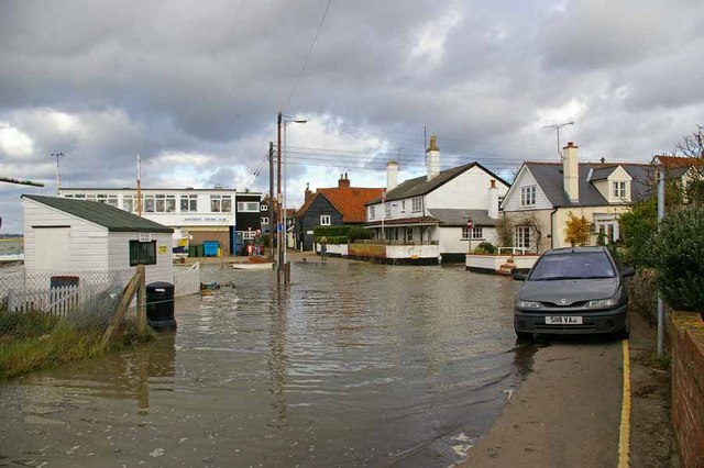
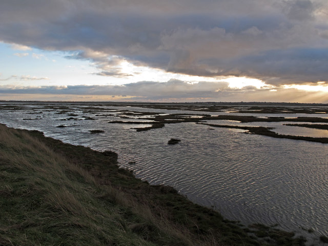
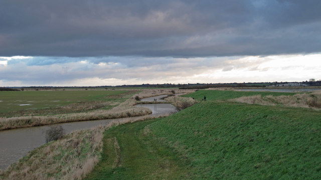
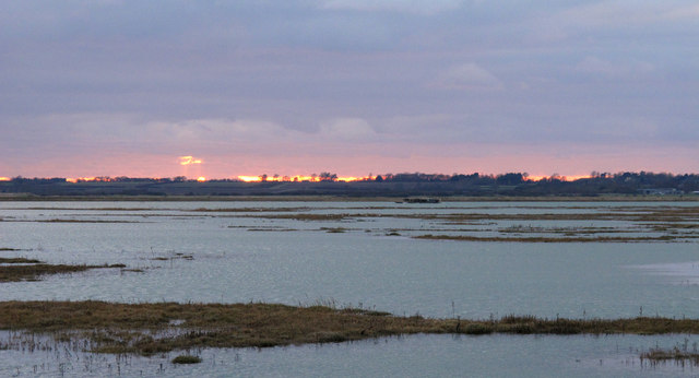
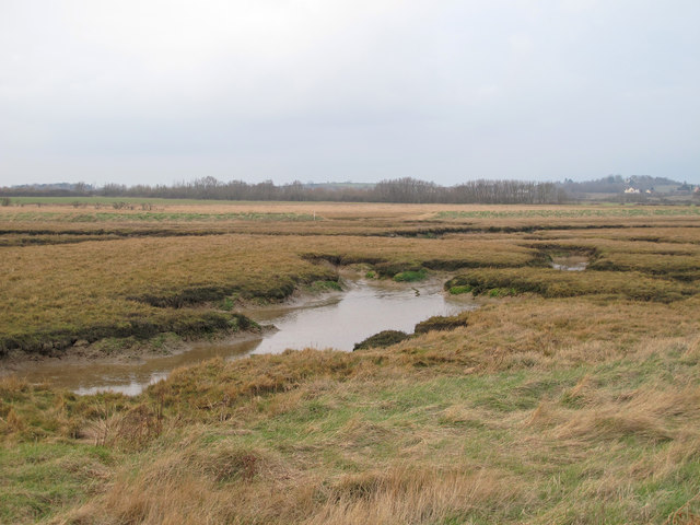
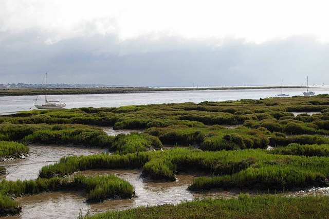
Salcott Channel is a picturesque waterway located in Essex, England. As its name suggests, it is a channel that connects the sea, estuary, and creek, making it a unique and diverse natural feature.

Situated near the village of Salcott, the channel is formed by the convergence of two smaller waterways - the Salcott Creek and the Blackwater Estuary. This confluence creates a dynamic ecosystem that is teeming with marine life and attracts a variety of bird species, making it a popular destination for nature enthusiasts.

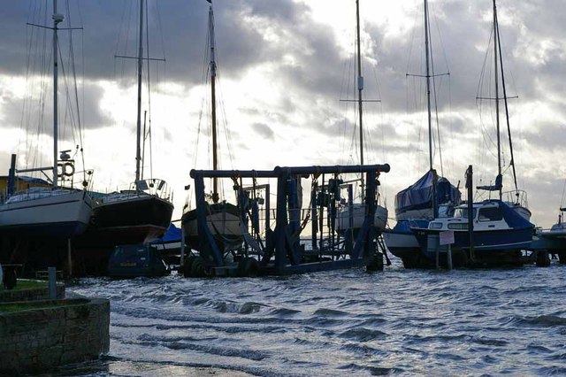
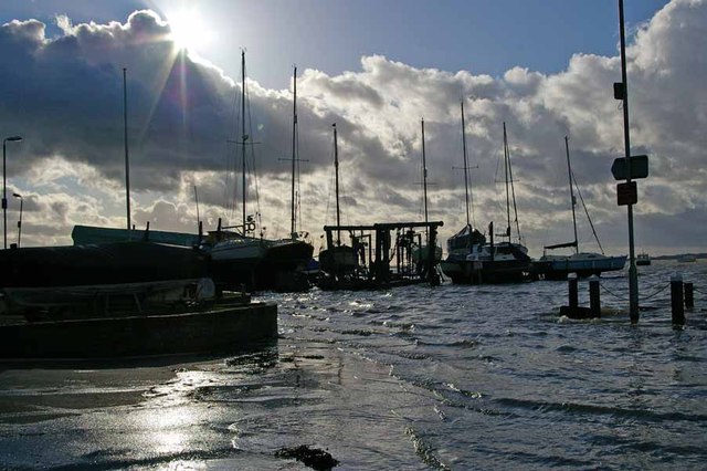
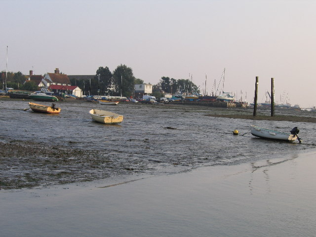
The channel itself is relatively narrow, with a width of approximately 100 meters (328 feet) at its widest point. It stretches for several kilometers, meandering through the surrounding marshlands and providing stunning views of the surrounding countryside. The water in the channel is influenced by the tides and can vary in depth, making it suitable for a range of water activities such as boating, kayaking, and fishing.

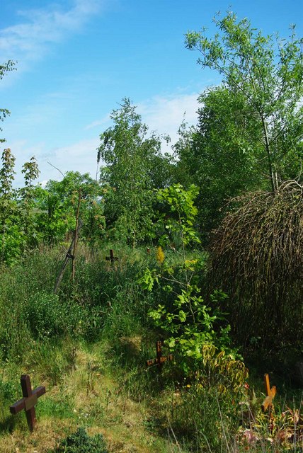
The marshlands flanking the channel are home to a diverse range of plant and animal species. Salt-tolerant vegetation, such as samphire and sea lavender, thrives in the brackish waters, while various wading birds, including herons and curlews, can often be spotted along the channel's banks.

Salcott Channel is not only a natural wonder but also an important part of the local economy. It supports a small fishing industry, with local fishermen casting nets to catch a variety of fish and shellfish, including cod, bass, and crab.

Overall, Salcott Channel offers visitors a unique opportunity to experience the beauty and biodiversity of the Essex coastline, making it a must-visit destination for nature lovers and outdoor enthusiasts.

If you have any feedback on the listing, please let us know in the comments section below.

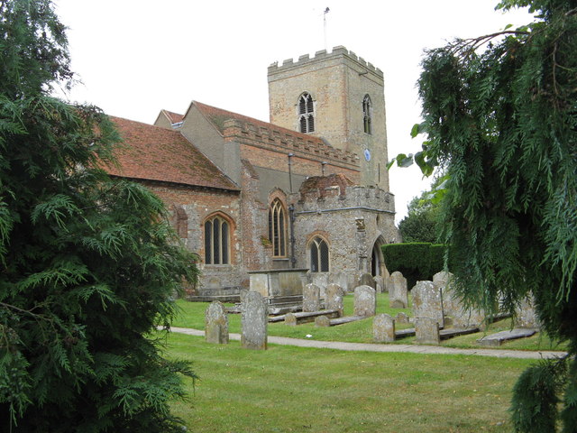
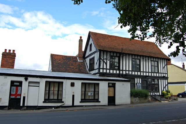
Salcott Channel Images

Images are sourced within 2km of 51.777081/0.8843762 or Grid Reference TL9912. Thanks to Geograph Open Source API. All images are credited.

Feldy View Revisited My prediction made in 2005 see <a href="https://www.geograph.org.uk/photo/45732">TM0013 : Feldy View</a> is rapidly becoming true you can't see Feldy Marshes any more because of the trees!
Feldy View Revisited
My prediction made in 2005 see TM0013 : Feldy View is rapidly becoming true you can't see Feldy Marshes any more because of the trees!
Dabchicks sailing club Dabchicks sailing club in West Mersea, Essex.
Dabchicks sailing club
Dabchicks sailing club in West Mersea, Essex.
Victory pub, Mersea Island Victory pub is located on  Mersea Island. Directly behind the photographer is the Blackwater estuary, the black banner in the centre of the building read   "A great place to sink a few"   very appropriate bearing in mind its location.
Victory pub, Mersea Island
Victory pub is located on Mersea Island. Directly behind the photographer is the Blackwater estuary, the black banner in the centre of the building read "A great place to sink a few" very appropriate bearing in mind its location.
The Captain's Table Inside the Company Shed is a fish restaurant. It only sells "Fruits of the Sea" you have to supply your own carbohydrate (however only bread is allowed!) the quality of the fayre is such that punters queue up for a table. Also with no licence you can bring your own wines, the shop just across the road does a fair trade in Mersea Wine from <a href="https://www.geograph.org.uk/photo/2121334">TM0313 : Mersea Island Vineyard</a>
The Captain's Table
Inside the Company Shed is a fish restaurant. It only sells "Fruits of the Sea" you have to supply your own carbohydrate (however only bread is allowed!) the quality of the fayre is such that punters queue up for a table. Also with no licence you can bring your own wines, the shop just across the road does a fair trade in Mersea Wine from TM0313 : Mersea Island Vineyard
High Tide Near Dabchicks Sailing Club Looking towards "The Lane" in West Mersea
High Tide Near Dabchicks Sailing Club
Looking towards "The Lane" in West Mersea
Not a Dry Dock! This part of Mersea Hard is only submerged at the highest of tides.
Not a Dry Dock!
This part of Mersea Hard is only submerged at the highest of tides.
Mersea Hard A very High Tide at Mersea Hard
Mersea Hard
A very High Tide at Mersea Hard
The Coast Inn, West Mersea A Public House and Restaurant on the Coast Road on the far west of the island.
The Coast Inn, West Mersea
A Public House and Restaurant on the Coast Road on the far west of the island.
The Old City Hall West Mersea This tiny chapel was built in about 1930 on the site of The Old Ship public house on the instructions of the Miss Plumers, Ann and Ruth of Seaview Avenue. In 1940 it was handed over to a group of local Christians with no conditions attached. (Information from westmersea.org)
The Old City Hall West Mersea
This tiny chapel was built in about 1930 on the site of The Old Ship public house on the instructions of the Miss Plumers, Ann and Ruth of Seaview Avenue. In 1940 it was handed over to a group of local Christians with no conditions attached. (Information from westmersea.org)
Abbot's Hall Saltings As seen from the sea wall near the National Trust's Copt Hall Farm. The water is Salcott Channel, part of the Blackwater Estuary.
Abbot's Hall Saltings
As seen from the sea wall near the National Trust's Copt Hall Farm. The water is Salcott Channel, part of the Blackwater Estuary.
Borrow Dyke near Copthall Saltings This borrow dyke is behind the seawall at Copthall Saltings. To the left is the National Trust Copt Hall Marshes.
Borrow Dyke near Copthall Saltings
This borrow dyke is behind the seawall at Copthall Saltings. To the left is the National Trust Copt Hall Marshes.
Sunset over Salcott Channel Taken from the seawall between Copthall Saltings and the National Trust's Copt Hall Marshes.
Sunset over Salcott Channel
Taken from the seawall between Copthall Saltings and the National Trust's Copt Hall Marshes.
Abbot's Hall Saltings Salt marsh seen from the sea wall on the boundary of the National Trust's Copt Hall Marshes.
Abbot's Hall Saltings
Salt marsh seen from the sea wall on the boundary of the National Trust's Copt Hall Marshes.
Lower Barn: from the south This barn at Copt Hall Farm is named on the map as "Lower Barn", this view from the south.
Lower Barn: from the south
This barn at Copt Hall Farm is named on the map as "Lower Barn", this view from the south.
The Lane, West Mersea The Grade II Listed Little Timbers of 18th century origin is the cottage with mansard roof on the right slightly forward of the weatherboarded cottage.
The Lane, West Mersea
The Grade II Listed Little Timbers of 18th century origin is the cottage with mansard roof on the right slightly forward of the weatherboarded cottage.
The Lane, West Mersea Right centre with the dormer is Grade II Listed Anchor Cottage dated around 1575. Left centre the white weatherboarded Bluebird Cottage is also Grade II listed and dates from late 18th or early 19th century.
The Lane, West Mersea
Right centre with the dormer is Grade II Listed Anchor Cottage dated around 1575. Left centre the white weatherboarded Bluebird Cottage is also Grade II listed and dates from late 18th or early 19th century.
St Peter & St Paul Church West Mersea
The White Hart Dead pub! A chalk board on the side of the building by the car park reads, rather poignantly, "Closed - Sorry"
The White Hart
Dead pub! A chalk board on the side of the building by the car park reads, rather poignantly, "Closed - Sorry"
Show me another place!

Salcott Channel is located at Grid Ref: TL9912 (Lat: 51.777081, Lng: 0.8843762)

Administrative County: Essex

District: Colchester

Police Authority: Essex

What 3 Words

///cross.jugs.footsteps. Near West Mersea, Essex

Related Wikis

West Mersea Yacht Club

West Mersea Yacht Club (WMYC) is a British yacht club that has its clubhouse in Coast Road, West Mersea, Mersea Island, Essex. It is on the estuary of...

Great Cob Island

Great Cob island is a small island in the estuary of the River Blackwater in Essex, England, the United Kingdom. The island is an area of low-lying salt...

West Mersea Priory

West Mersea Priory was a Benedictine priory in West Mersea, Essex, England. It was founded in 1046 and granted by Edward the Confessor to the Abbey of...

West Mersea

West Mersea is a town and electoral ward in Essex, England. It is the larger (in terms of population) of two settlements on Mersea Island, south of Colchester...

Little Wigborough

Little Wigborough is a village and former civil parish, now in the parish of Great and Little Wigborough, in the Colchester borough of Essex, England and...

Tollesbury Wick

Tollesbury Wick is a 242.8-hectare (600-acre) nature reserve east of Tollesbury in Essex. It is managed by the Essex Wildlife Trust.This is coastal freshwater...

Woodup Pool

Woodup Pool in Tollesbury, Essex (also known as Woodrolfe Pool) is a salt-water pond or lake used as an open-air swimming pool or amenity pool. == History... ==

Great and Little Wigborough

Great and Little Wigborough is a civil parish in the City of Colchester district of Essex, England, about 6 miles (10 km) from Colchester. The parish includes...

Nearby Amenities

Located within 500m of 51.777081,0.8843762
Feldy Marshes
Place: locality
Lat/Long: 51.7803641/0.8891666
The data included in this document is from www.openstreetmap.org. The data is made available under ODbL.

Have you been to Salcott Channel?

Leave your review of Salcott Channel below (or comments, questions and feedback).