Ness Hole

Sea, Estuary, Creek in Essex Rochford

England

Ness Hole

River Crouch sea wall path Looking west along the sea wall from the footpath junction (the sea wall path with the path coming south from Coney Hall and Holliwell Farm).
River Crouch sea wall path Credit: Trevor Harris

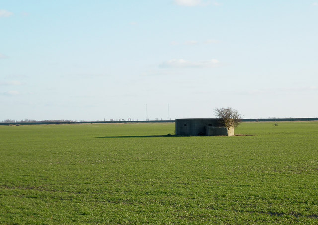
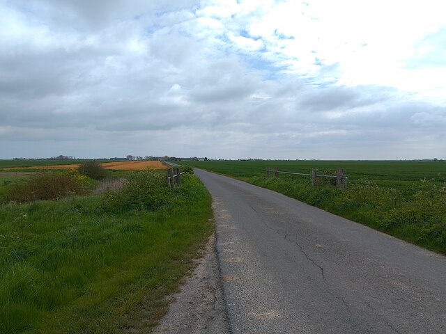
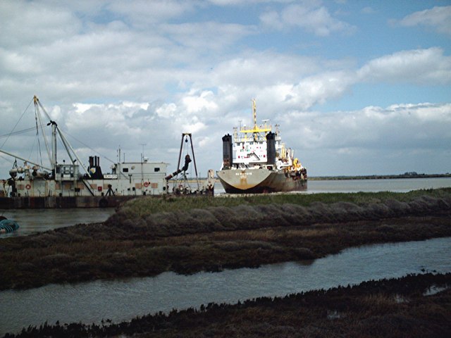
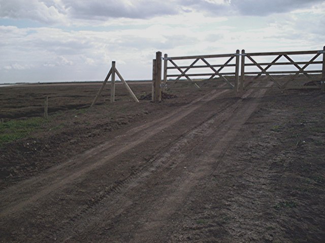
Ness Hole is a small coastal village located in the county of Essex, England. Situated on the eastern coast, it lies on the banks of the River Crouch, a tidal river that flows into the North Sea. The village is known for its picturesque views of the sea, estuary, and creek, making it a popular destination for tourists and nature enthusiasts.

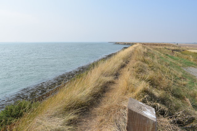
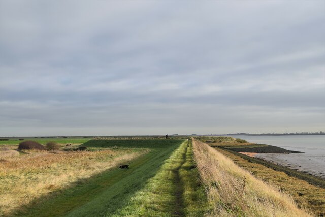
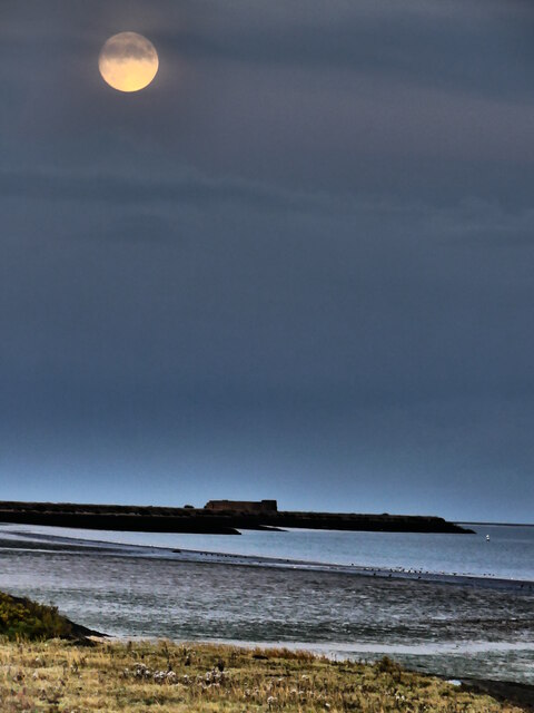
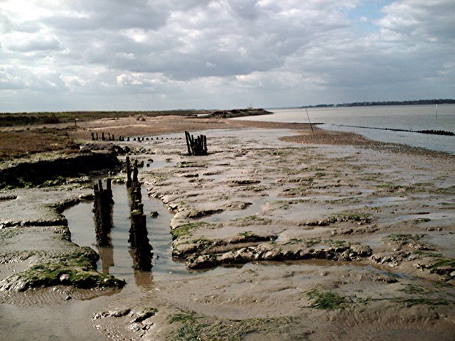
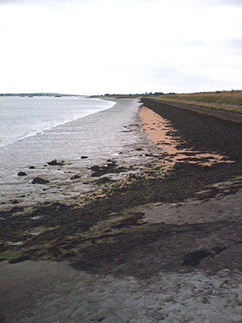
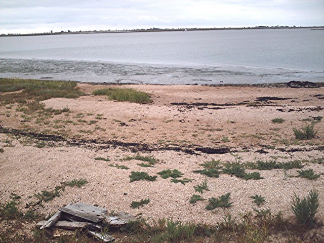
The sea at Ness Hole offers stunning vistas with its vast expanse of water meeting the horizon. The coastline is adorned with golden sandy beaches that attract visitors during the warmer months. It provides an ideal spot for relaxation, sunbathing, and leisurely walks along the shore.

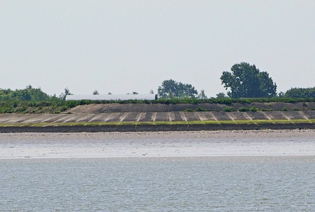
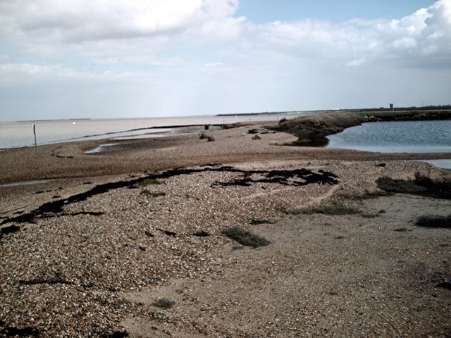
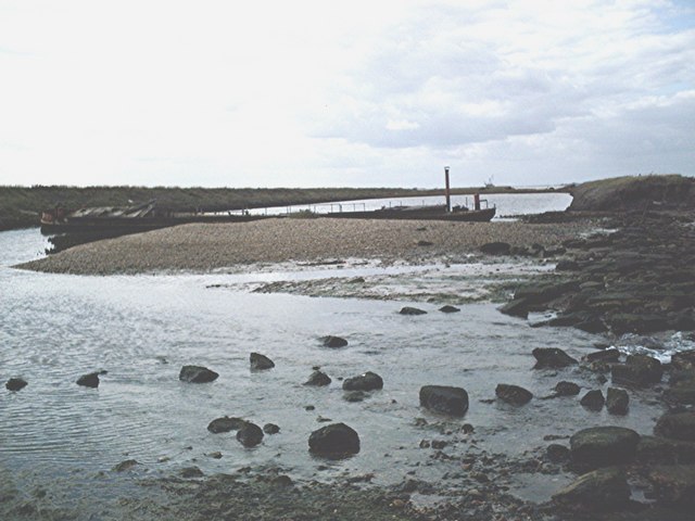
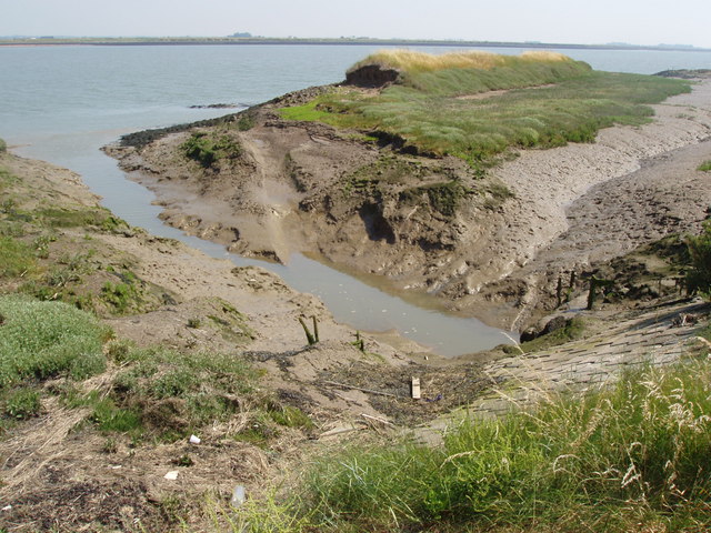
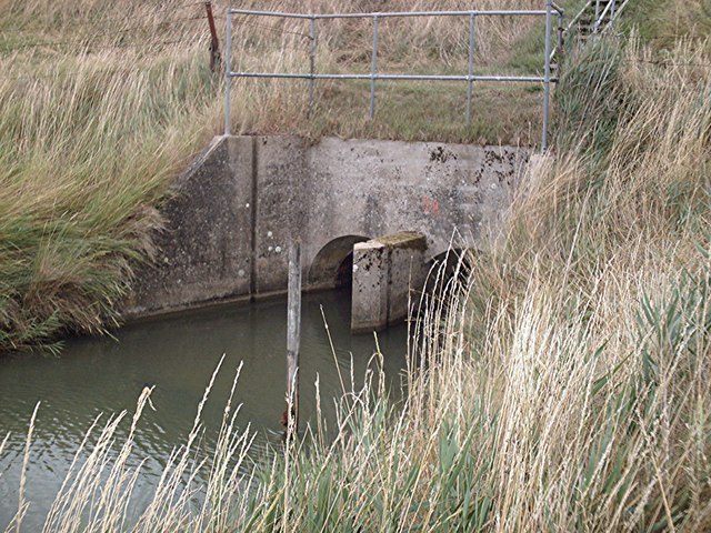
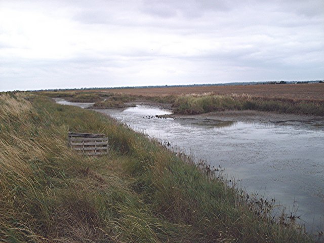
Ness Hole is also blessed with a beautiful estuary, formed by the convergence of the River Crouch and the North Sea. This estuary is home to a diverse range of marine life, including various species of fish, birds, and even seals. It provides an important habitat for these creatures and serves as a vital feeding ground.

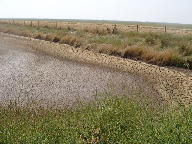
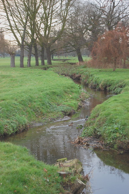
The village's creek is another prominent feature, winding through the landscape and providing a tranquil setting for boating and fishing. The creek is surrounded by lush greenery, including marshes and reed beds, which are home to numerous bird species, such as herons and swans.

Overall, Ness Hole in Essex offers a unique blend of natural beauty, including the sea, estuary, and creek. With its scenic views and diverse wildlife, it is a haven for outdoor enthusiasts and a serene escape for those seeking tranquility by the water's edge.

If you have any feedback on the listing, please let us know in the comments section below.

Ness Hole Images

Images are sourced within 2km of 51.616668/0.87150168 or Grid Reference TQ9894. Thanks to Geograph Open Source API. All images are credited.

River Crouch sea wall path Looking west along the sea wall from the footpath junction (the sea wall path with the path coming south from Coney Hall and Holliwell Farm).
River Crouch sea wall path
Looking west along the sea wall from the footpath junction (the sea wall path with the path coming south from Coney Hall and Holliwell Farm).
Dengie Pillbox Taken from Marsh Road.
Dengie Pillbox
Taken from Marsh Road.
High Corner Foulness Island This is the foreshore and sea wall of Foulness Island at High Corner and the River Crouch. The island is a sensitive military site where artillery is tested.
High Corner Foulness Island
This is the foreshore and sea wall of Foulness Island at High Corner and the River Crouch. The island is a sensitive military site where artillery is tested.
One man and his dog Crouch seawall east of Burnham Wick sluice
One man and his dog
Crouch seawall east of Burnham Wick sluice
Marsh Road, Southwick A cul-de-sac to farms east of Southwick.
Marsh Road, Southwick
A cul-de-sac to farms east of Southwick.
Moon Over The River Crouch The full moon rising over the river estuary on a cold autumnal evening.
Moon Over The River Crouch
The full moon rising over the river estuary on a cold autumnal evening.
Wallasea Ness - The Beach Confluence of the Roach and Crouch estuaries. About as far as you can get from any habitation in Essex - by land at least.
Wallasea Ness - The Beach
Confluence of the Roach and Crouch estuaries. About as far as you can get from any habitation in Essex - by land at least.
Ringwood Point Sign on sluice. Dredger in background
Ringwood Point
Sign on sluice. Dredger in background
Ringwood Point - Dredger I don't quite know what's happening here. The land behind the existing sea wall appears to be at least in part being removed and a new sea wall built to the south. The sucker ship and the big dumper obviously have some role in this.
Some 3 months after this picture was taken the sea wall was breached close to this point <a href="https://www.geograph.org.uk/photo/197354">TQ9794 : The Sea Returns</a>, <a href="https://www.geograph.org.uk/photo/196257">TQ9694 : Breaching the Sea Wall</a> and a large area of farmland was returned to the sea. The ships were in fact exchanging soil for "uncontaminated" mud dredged up offshore.
Ringwood Point - Dredger
I don't quite know what's happening here. The land behind the existing sea wall appears to be at least in part being removed and a new sea wall built to the south. The sucker ship and the big dumper obviously have some role in this. Some 3 months after this picture was taken the sea wall was breached close to this point TQ9794 : The Sea Returns, TQ9694 : Breaching the Sea Wall and a large area of farmland was returned to the sea. The ships were in fact exchanging soil for "uncontaminated" mud dredged up offshore.
Gates at end of new sea wall A new sea wall running roughly straight between this point and Grasslands Point is under construction and the area south of the old sea wall is being dug out to provide new salt marsh.
Gates at end of new sea wall
A new sea wall running roughly straight between this point and Grasslands Point is under construction and the area south of the old sea wall is being dug out to provide new salt marsh.
Barge aground - Wallasea Ness Wreck on the beach
Barge aground - Wallasea Ness
Wreck on the beach
Brankfleet Spit River Roach at confluence with Crouch
Brankfleet Spit
River Roach at confluence with Crouch
Old sea wall, Wallasea Island This remote corner of Essex has seen a change in policy by DEFRA in the battle against coastal flooding and erosion.  The old wall would be too costly to repair so the sea has been allowed to reclaim the area for the first time in 400 years.  Nearly 250 acres of Wallasea Island have been flood to create a wild life haven.
Old sea wall, Wallasea Island
This remote corner of Essex has seen a change in policy by DEFRA in the battle against coastal flooding and erosion. The old wall would be too costly to repair so the sea has been allowed to reclaim the area for the first time in 400 years. Nearly 250 acres of Wallasea Island have been flood to create a wild life haven.
The Sea Returns Wallasea Island, a remote corner of coastal Essex, is the site of a DEFRA project to re-flood land that for centuries has been protected by sea walls.  But global warming and higher tides mean that re-building the sea defences to protect agricultural land is too expensive.  Now the old earth banks along the estuary of the River Crouch have been deliberately breached and new wall built further inland.  The sea has returned and these mud flats will soon be a rich salt marsh and wild life haven again.
The Sea Returns
Wallasea Island, a remote corner of coastal Essex, is the site of a DEFRA project to re-flood land that for centuries has been protected by sea walls. But global warming and higher tides mean that re-building the sea defences to protect agricultural land is too expensive. Now the old earth banks along the estuary of the River Crouch have been deliberately breached and new wall built further inland. The sea has returned and these mud flats will soon be a rich salt marsh and wild life haven again.
Seawall and shore Unlike the south bank of the estuary on which most promontories, bays etc. are named, features on the north bank of the Crouch between Burnham and Holliwell Point at its mouth remain anonymous. This stretch is opposite Ringwood Point.
Seawall and shore
Unlike the south bank of the estuary on which most promontories, bays etc. are named, features on the north bank of the Crouch between Burnham and Holliwell Point at its mouth remain anonymous. This stretch is opposite Ringwood Point.
Small Beach Brankfleet Spit and mouth of Roach to the south across the estuary. Nice secluded spot for a barby.
Small Beach
Brankfleet Spit and mouth of Roach to the south across the estuary. Nice secluded spot for a barby.
Unnamed sluice Even the Environment Agency, whom I have thus far found meticulous in their naming and "Grid Referencing" of all of their facilities, have let me down here. No nice signs to prove where I've been! - or more importantly - where I am!
Unnamed sluice
Even the Environment Agency, whom I have thus far found meticulous in their naming and "Grid Referencing" of all of their facilities, have let me down here. No nice signs to prove where I've been! - or more importantly - where I am!
Islands in the borrow dyke Substantial, if somewhat shallow and muddy borrow dyke. I disturbed a pair of egrets from this dyke - global warming drawing them north?
Islands in the borrow dyke
Substantial, if somewhat shallow and muddy borrow dyke. I disturbed a pair of egrets from this dyke - global warming drawing them north?
Show me another place!

Ness Hole is located at Grid Ref: TQ9894 (Lat: 51.616668, Lng: 0.87150168)

Administrative County: Essex

District: Rochford

Police Authority: Essex

What 3 Words

///pacemaker.amending.answer. Near Burnham-on-Crouch, Essex

Related Wikis

River Roach

The River Roach is a river that flows entirely through the English county of Essex. It is one of four main streams that originate in the Rayleigh Hills...

Wallasea Wetlands

Wallasea Wetlands is a reclaimed wetlands area located in Essex, England. It has been created as part of a government-funded wetlands scheme to halt the...

Saint Mary the Virgin, Foulness Island

Saint Mary the Virgin is a parish of the Church of England on Foulness Island, in Essex, England. Before the 15th century, the island of Foulness was divided...

Foulness Island

Foulness Island () is a closed island on the east coast of Essex in England, which is separated from the mainland by narrow creeks. In the 2001 census...

Nearby Amenities

Located within 500m of 51.616668,0.87150168
Source: PGS
Lat/Long: 51.6148918/0.8650998
Source: PGS
Lat/Long: 51.6126394/0.8725914
Source: PGS
Lat/Long: 51.6136254/0.8734068
Source: PGS
Lat/Long: 51.614265/0.8746728
Created By: dmgroom_coastlines
Source: PGS
Lat/Long: 51.6147091/0.8756717
Created By: dmgroom_coastlines
Source: PGS
Lat/Long: 51.614942/0.876175
Created By: dmgroom_coastlines
Source: PGS
Lat/Long: 51.615213/0.876986
Created By: dmgroom_coastlines
Source: PGS
Lat/Long: 51.615484/0.877797
Branklet Spit
Seamark Buoy Lateral Category: preferred_channel_starboard
Seamark Buoy Lateral Colour: red;green;red
Seamark Buoy Lateral Colour Pattern: horizontal
Seamark Buoy Lateral Shape: pillar
Seamark Buoy Lateral System: iala-a
Seamark Light Character: Fl
Seamark Light Colour: red
Seamark Light Period: 10
Seamark Light Range: 1.0
Seamark Name: Branklet
Seamark Topmark Colour: red
Seamark Topmark Shape: cylinder
Seamark Type: buoy_lateral
Lat/Long: 51.6164833/0.8684
Wallasea Ness
Place: locality
Lat/Long: 51.6157138/0.8660137
Seamark Buoy Lateral Category: port
Seamark Buoy Lateral Colour: red
Seamark Buoy Lateral Shape: pillar
Seamark Buoy Lateral System: iala-a
Seamark Light Character: Fl
Seamark Light Colour: red
Seamark Light Period: 5
Seamark Light Range: 1.0
Seamark Name: Pinto
Seamark Topmark Colour: red
Seamark Topmark Shape: cylinder
Seamark Type: buoy_lateral
Lat/Long: 51.6180167/0.8768167
Seamark Buoy Special Purpose Category: yachting
Seamark Buoy Special Purpose Colour: yellow
Seamark Buoy Special Purpose Shape: spherical
Seamark Name: Greenward
Seamark Type: buoy_special_purpose
Lat/Long: 51.6199448/0.8702072
Seamark Buoy Special Purpose Category: yachting
Seamark Buoy Special Purpose Colour: yellow
Seamark Buoy Special Purpose Shape: spherical
Seamark Name: Redward
Seamark Type: buoy_special_purpose
Lat/Long: 51.6205914/0.8723298
The data included in this document is from www.openstreetmap.org. The data is made available under ODbL.

Have you been to Ness Hole?

Leave your review of Ness Hole below (or comments, questions and feedback).