Brankfleet

Sea, Estuary, Creek in Essex Rochford

England

Brankfleet

War Department Boundary Marker, Foulness Located adjacent to the Foulness Heritage Centre which is open the first Sunday of the month, April to October.

Milestone Society ID No. EX_WDFOUL02em
War Department Boundary Marker, Foulness Credit: Paul Jones

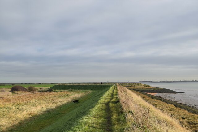
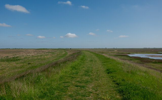
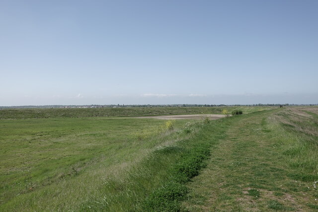
Brankfleet is a small coastal town located in the county of Essex, England. Situated along the North Sea, the town offers stunning views of the sea, estuary, and nearby creek.

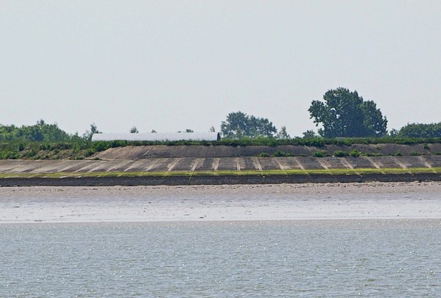
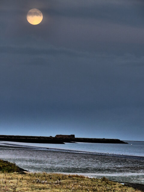
The sea, with its vast expanse of blue waters, plays a significant role in the daily life of Brankfleet. Its pristine sandy beaches attract locals and tourists alike, providing ample opportunities for relaxing walks, picnics, and sunbathing during the summer months. The sea also offers various recreational activities such as swimming, sailing, and fishing, making it a popular destination for water sports enthusiasts.

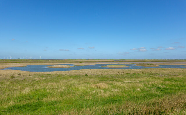
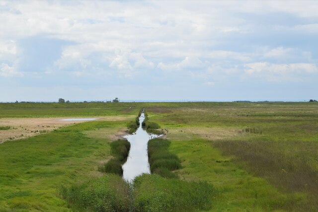
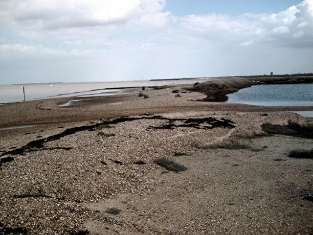
Adjacent to the sea is the estuary, where the river meets the sea. This unique ecosystem is a haven for wildlife, serving as a breeding ground for numerous bird species and a habitat for marine creatures. The estuary is a popular spot for birdwatching, as it attracts migratory birds throughout the year.

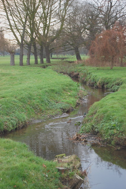
In addition to the sea and estuary, Brankfleet boasts a picturesque creek that winds through the town. The creek serves as a natural harbor for small boats and yachts, making it a vibrant hub for the local boating community. Its calm waters also provide a serene environment for kayaking and paddleboarding.

Brankfleet's coastal location offers residents and visitors a perfect blend of natural beauty and recreational activities. Whether it's strolling along the beach, exploring the estuary's diverse wildlife, or sailing down the creek, this small town has something to offer everyone seeking a coastal escape.

If you have any feedback on the listing, please let us know in the comments section below.
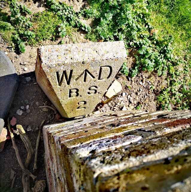
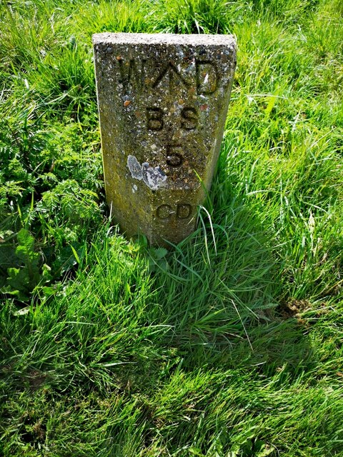
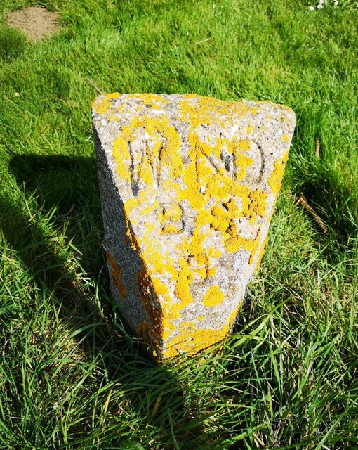
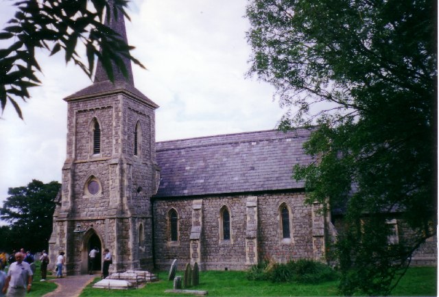
Brankfleet Images

Images are sourced within 2km of 51.613576/0.86960175 or Grid Reference TQ9894. Thanks to Geograph Open Source API. All images are credited.

War Department Boundary Marker, Foulness Located adjacent to the Foulness Heritage Centre which is open the first Sunday of the month, April to October.

Milestone Society ID No. EX_WDFOUL02em
War Department Boundary Marker, Foulness
Located adjacent to the Foulness Heritage Centre which is open the first Sunday of the month, April to October. Milestone Society ID No. EX_WDFOUL02em
War Department Boundary Marker, Foulness War Department boundary marker located close to the Heritage Centre. Foulness is open to the public on the first Sunday of the month, April to October.

Milestone Society ID No. EX_WDFOUL05em
War Department Boundary Marker, Foulness
War Department boundary marker located close to the Heritage Centre. Foulness is open to the public on the first Sunday of the month, April to October. Milestone Society ID No. EX_WDFOUL05em
War Department Boundary Marker, Foulness War Department boundary marker located close to the Heritage Centre. Foulness is open to the public on the first Sunday of the month, April to October.

Milestone Society ID No. EX_WDFOUL09em
War Department Boundary Marker, Foulness
War Department boundary marker located close to the Heritage Centre. Foulness is open to the public on the first Sunday of the month, April to October. Milestone Society ID No. EX_WDFOUL09em
Foulness Island: St Mary the Virgin Church Access to this island is severely restricted, and has been since, I believe, the Second World War. This photo was taken when there was a Flower Show on the Island, but even then you felt that you were being watched.
Foulness Island: St Mary the Virgin Church
Access to this island is severely restricted, and has been since, I believe, the Second World War. This photo was taken when there was a Flower Show on the Island, but even then you felt that you were being watched.
High Corner Foulness Island This is the foreshore and sea wall of Foulness Island at High Corner and the River Crouch. The island is a sensitive military site where artillery is tested.
High Corner Foulness Island
This is the foreshore and sea wall of Foulness Island at High Corner and the River Crouch. The island is a sensitive military site where artillery is tested.
Foulness Island: St Mary the Virgin gravestone One of many ancient gravestones in the mysterious churchyard at St Mary's, Churchend, on Foulness Island.  This is the final resting place of Ionas Allin 'who departed this life in 1769'.
Foulness Island: St Mary the Virgin gravestone
One of many ancient gravestones in the mysterious churchyard at St Mary's, Churchend, on Foulness Island. This is the final resting place of Ionas Allin 'who departed this life in 1769'.
Foulness Island: St Mary the Virgin Taken on the MOD controlled island of Foulness in Essex. Access for the general public is restricted. This is the East Wing of the church. The building depicted here was re-built in 1848 after the original church began to crumble.
Foulness Island: St Mary the Virgin
Taken on the MOD controlled island of Foulness in Essex. Access for the general public is restricted. This is the East Wing of the church. The building depicted here was re-built in 1848 after the original church began to crumble.
Foulness Island: St Mary the Virgin Another interesting shot of some old graves outside the church. Many of the graves pre-date the existing building, going back hundreds of years to when habitation on the island was much smaller.
Foulness Island: St Mary the Virgin
Another interesting shot of some old graves outside the church. Many of the graves pre-date the existing building, going back hundreds of years to when habitation on the island was much smaller.
Foulness Island: St Mary the Virgin, Churchend Stunning shot of this beautiful and seldom-visited church on the restricted MOD controlled island of Foulness. This shot looks east towards the side of the church showing the Victorian stonework. At time of taking the photograph my friend and I were being attacked by horseflies which were most prevalent on the island that day.
Foulness Island: St Mary the Virgin, Churchend
Stunning shot of this beautiful and seldom-visited church on the restricted MOD controlled island of Foulness. This shot looks east towards the side of the church showing the Victorian stonework. At time of taking the photograph my friend and I were being attacked by horseflies which were most prevalent on the island that day.
Foulness Island: Heritage Centre, Churchend This pretty cottage which was once the island's primary school, has now become the Heritage Centre. Some fascinating displays, photographs and architectural finds can be seen inside the old school house which can be viewed by appointment. In high summer a tractor ride departs from this area to take visitors to the village fete on an island tour.
Foulness Island: Heritage Centre, Churchend
This pretty cottage which was once the island's primary school, has now become the Heritage Centre. Some fascinating displays, photographs and architectural finds can be seen inside the old school house which can be viewed by appointment. In high summer a tractor ride departs from this area to take visitors to the village fete on an island tour.
Foulness Heritage Centre Housed in the old school house, near Churchend.
Foulness Heritage Centre
Housed in the old school house, near Churchend.
One man and his dog Crouch seawall east of Burnham Wick sluice
One man and his dog
Crouch seawall east of Burnham Wick sluice
Pool with small islands - RSPB Wallasea Island The following adapted from the RSPB website <span class="nowrap"><a title="https://www.rspb.org.uk/reserves-and-events/reserves-a-z/wallasea-island/" rel="nofollow ugc noopener" href="https://www.rspb.org.uk/reserves-and-events/reserves-a-z/wallasea-island/">Link</a><img style="margin-left:2px;" alt="External link" title="External link - shift click to open in new window" src="https://s1.geograph.org.uk/img/external.png" width="10" height="10"/></span>

"The reserve covers more than 740ha, with all of the arable farmland now transformed to saltmarsh, mudflats, lagoons and grazing marsh.

There are six walking trails – Jubilee Marsh, Allfleets Marsh, Marsh Flats, South Trail, New Pool Trail and Beagle Trail, making over 15km of trail on the reserve. At the ends of Allfleets Marsh trail and Jubilee Marsh trail are two shelters providing a comfortable place to sit overlooking the river.

To create this magical landscape of marshland, lagoons, ditches and sea, more than three million tonnes of earth was brought by boat from the tunnels and shafts created by the Crossrail scheme in London. This allowed us to raise the land above sea level and place the soil in a way that created a new 115-hectare intertidal area of saltmarsh, islands and mudflats (known as Jubilee Marsh).

In addition, Crossrail helped us create saline lagoons, a creek network and grazing marsh. All of which means Wallasea Island is now a wildlife-rich habitat and a great place to visit.

Wallasea Island sits within a Special Protection Area which covers the Crouch and Roach estuaries, and which is special for overwintering waders and wildfowl including Brent Geese. Our work here increases the habitat for these birds both whilst roosting and feeding, as well as creating new grassland areas (wet and dry). The intertidal areas have been designed with climate change in mind, with long shallow slopes from the new seawall providing space for the saltmarsh to creep up as sea levels rise."
Pool with small islands - RSPB Wallasea Island
The following adapted from the RSPB website LinkExternal link "The reserve covers more than 740ha, with all of the arable farmland now transformed to saltmarsh, mudflats, lagoons and grazing marsh. There are six walking trails – Jubilee Marsh, Allfleets Marsh, Marsh Flats, South Trail, New Pool Trail and Beagle Trail, making over 15km of trail on the reserve. At the ends of Allfleets Marsh trail and Jubilee Marsh trail are two shelters providing a comfortable place to sit overlooking the river. To create this magical landscape of marshland, lagoons, ditches and sea, more than three million tonnes of earth was brought by boat from the tunnels and shafts created by the Crossrail scheme in London. This allowed us to raise the land above sea level and place the soil in a way that created a new 115-hectare intertidal area of saltmarsh, islands and mudflats (known as Jubilee Marsh). In addition, Crossrail helped us create saline lagoons, a creek network and grazing marsh. All of which means Wallasea Island is now a wildlife-rich habitat and a great place to visit. Wallasea Island sits within a Special Protection Area which covers the Crouch and Roach estuaries, and which is special for overwintering waders and wildfowl including Brent Geese. Our work here increases the habitat for these birds both whilst roosting and feeding, as well as creating new grassland areas (wet and dry). The intertidal areas have been designed with climate change in mind, with long shallow slopes from the new seawall providing space for the saltmarsh to creep up as sea levels rise."
Jubilee Marsh Trail - RSPB Wallasea Island Looking south, see also:
<a href="https://www.geograph.org.uk/photo/7168017">TQ9693 : Jubilee Marsh Trail - RSPB Wallasea Island</a>
Jubilee Marsh Trail - RSPB Wallasea Island
Jubilee Marsh Trail - RSPB Wallasea Island Looking north, see also:
<a href="https://www.geograph.org.uk/photo/7168015">TQ9793 : Jubilee Marsh Trail - RSPB Wallasea Island</a>
Jubilee Marsh Trail - RSPB Wallasea Island
Land drain on Tillets Marsh A section of one of the dead-straight, north-south land drains which divided up the island prior to the RSPB's "Wild Coast Project. This is one of only a few remaining and the most easterly. Assorted ducks and geese are taking advantage of this less visited part of the island
Land drain on Tillets Marsh
A section of one of the dead-straight, north-south land drains which divided up the island prior to the RSPB's "Wild Coast Project. This is one of only a few remaining and the most easterly. Assorted ducks and geese are taking advantage of this less visited part of the island
Moon Over The River Crouch The full moon rising over the river estuary on a cold autumnal evening.
Moon Over The River Crouch
The full moon rising over the river estuary on a cold autumnal evening.
Wallasea Ness - The Beach Confluence of the Roach and Crouch estuaries. About as far as you can get from any habitation in Essex - by land at least.
Wallasea Ness - The Beach
Confluence of the Roach and Crouch estuaries. About as far as you can get from any habitation in Essex - by land at least.
Show me another place!

Brankfleet is located at Grid Ref: TQ9894 (Lat: 51.613576, Lng: 0.86960175)

Administrative County: Essex

District: Rochford

Police Authority: Essex

What 3 Words

///shoving.cemented.prowl. Near Burnham-on-Crouch, Essex

Related Wikis

River Roach

The River Roach is a river that flows entirely through the English county of Essex. It is one of four main streams that originate in the Rayleigh Hills...

Wallasea Wetlands

Wallasea Wetlands is a reclaimed wetlands area located in Essex, England. It has been created as part of a government-funded wetlands scheme to halt the...

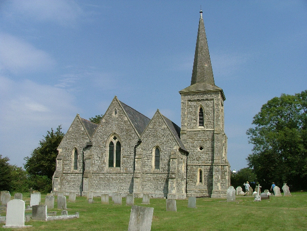
Saint Mary the Virgin, Foulness Island

Saint Mary the Virgin is a parish of the Church of England on Foulness Island, in Essex, England. Before the 15th century, the island of Foulness was divided...

Foulness Island

Foulness Island () is a closed island on the east coast of Essex in England, which is separated from the mainland by narrow creeks. In the 2001 census...

Wallasea Island

Wallasea Island lies in Essex, England. It is bounded to the north by the River Crouch, to the south east by the River Roach, and to the west by Paglesham...

Royal Corinthian Yacht Club

The Royal Corinthian Yacht Club is a watersports organisation based at Burnham-on-Crouch, Essex. == History == === Early history === The club was founded...

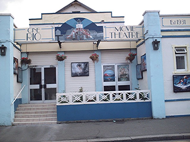
Rio Cinema (Burnham on Crouch)

The Rio Cinema is a purpose-built, two-screen, 280-seat cinema in Burnham on Crouch, Essex in the United Kingdom. The building dates from 1931. The Burnham...

Burnham-on-Crouch & District Museum

The Burnham-on-Crouch and District Museum, located in Burnham-on-Crouch, Essex, is a registered charity run by members of the Burnham History Society,...

Nearby Amenities

Located within 500m of 51.613576,0.86960175
Source: PGS
Lat/Long: 51.6134128/0.8647994
Source: PGS
Lat/Long: 51.6148408/0.8647584
Source: PGS
Lat/Long: 51.6150406/0.8641791
Source: PGS
Lat/Long: 51.6151472/0.864222
Source: PGS
Lat/Long: 51.6148918/0.8650998
Source: PGS
Lat/Long: 51.6136793/0.8650998
Source: PGS
Lat/Long: 51.6092948/0.8714327
Source: PGS
Lat/Long: 51.6101077/0.8717546
Created By: dmgroom_coastlines
Source: PGS
Lat/Long: 51.610639/0.872053
Source: PGS
Lat/Long: 51.6108672/0.8716473
Source: PGS
Lat/Long: 51.6114535/0.8716258
Source: PGS
Lat/Long: 51.6119732/0.8718833
Source: PGS
Lat/Long: 51.6126394/0.8725914
Source: PGS
Lat/Long: 51.6136254/0.8734068
Source: PGS
Lat/Long: 51.614265/0.8746728
Created By: dmgroom_coastlines
Source: PGS
Lat/Long: 51.6147091/0.8756717
Created By: dmgroom_coastlines
Source: PGS
Lat/Long: 51.614942/0.876175
Branklet Spit
Seamark Buoy Lateral Category: preferred_channel_starboard
Seamark Buoy Lateral Colour: red;green;red
Seamark Buoy Lateral Colour Pattern: horizontal
Seamark Buoy Lateral Shape: pillar
Seamark Buoy Lateral System: iala-a
Seamark Light Character: Fl
Seamark Light Colour: red
Seamark Light Period: 10
Seamark Light Range: 1.0
Seamark Name: Branklet
Seamark Topmark Colour: red
Seamark Topmark Shape: cylinder
Seamark Type: buoy_lateral
Lat/Long: 51.6164833/0.8684
Crow
Seamark Buoy Lateral Category: port
Seamark Buoy Lateral Colour: red
Seamark Buoy Lateral Shape: pillar
Seamark Buoy Lateral System: iala-a
Seamark Light Character: Fl
Seamark Light Colour: red
Seamark Light Period: 10
Seamark Light Range: 1.0
Seamark Name: Crow
Seamark Topmark Colour: red
Seamark Topmark Shape: cylinder
Seamark Type: buoy_lateral
Lat/Long: 51.6114333/0.8681
Wallasea Ness
Place: locality
Lat/Long: 51.6157138/0.8660137
The data included in this document is from www.openstreetmap.org. The data is made available under ODbL.

Have you been to Brankfleet?

Leave your review of Brankfleet below (or comments, questions and feedback).