Long Slough

Sea, Estuary, Creek in Kincardineshire

Scotland

Long Slough

Depot of oil drilling pipes
Depot of oil drilling pipes Credit: Alex McGregor

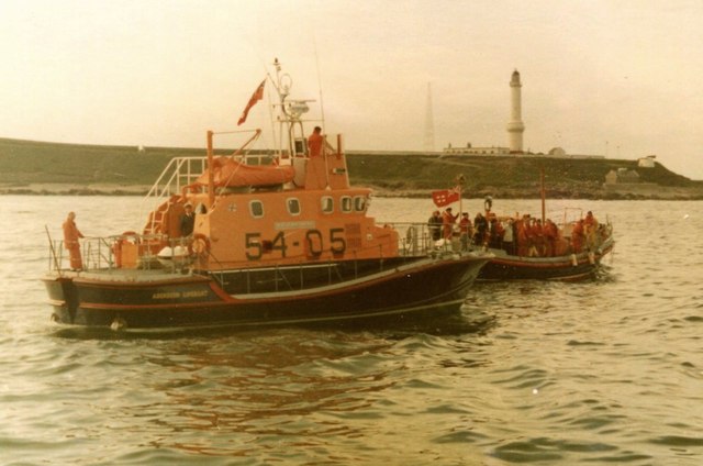
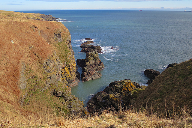
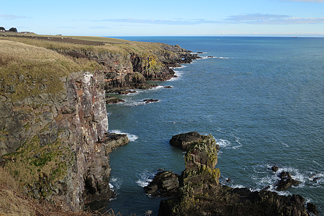
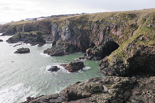
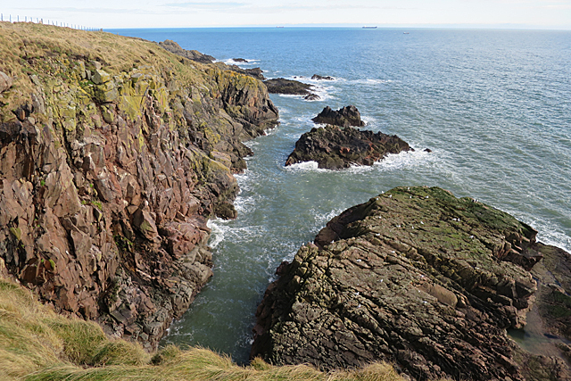
Long Slough is a picturesque water feature located in Kincardineshire, Scotland. It is a unique combination of a sea, estuary, and creek, making it a diverse and dynamic ecosystem. The slough stretches for approximately 5 kilometers and is formed by the confluence of the North Sea and the River Dee.

As a sea, Long Slough offers breathtaking views of the open waters. It is known for its moderate tidal movements, which create a mesmerizing ebb and flow effect. The constant influx of seawater brings a variety of marine species, making it an ideal spot for fishing enthusiasts and wildlife enthusiasts alike.

The estuary aspect of Long Slough is particularly fascinating. The merging of the river and the sea creates a transitional zone where fresh and saltwater mix. This unique blend of waters nurtures a diverse range of plant and animal life, including various species of fish, crustaceans, and birds. The estuary also serves as a vital breeding ground for many migratory birds, making it a popular destination for birdwatchers.

Furthermore, Long Slough features a meandering creek that winds its way through the surrounding landscape. The creek is lined with lush vegetation and provides a tranquil and idyllic setting for leisurely walks or kayaking adventures. The creek's gentle flow is also home to various species of freshwater fish and invertebrates.

Overall, Long Slough in Kincardineshire is a captivating blend of sea, estuary, and creek. Its diverse ecosystem, stunning views, and abundant wildlife make it a must-visit destination for nature lovers and those seeking a peaceful retreat.

If you have any feedback on the listing, please let us know in the comments section below.

Long Slough Images

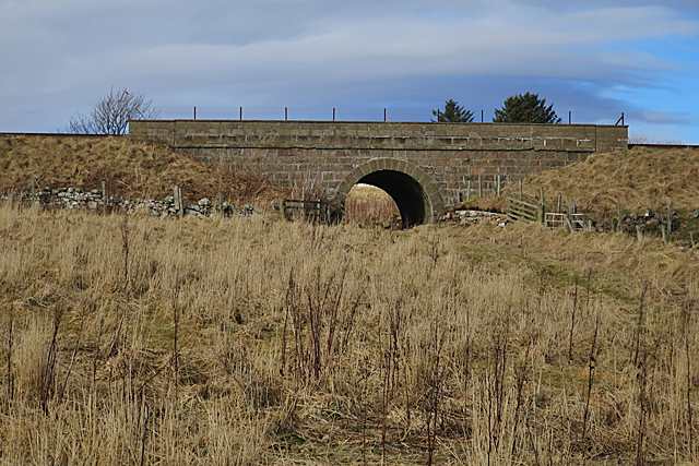
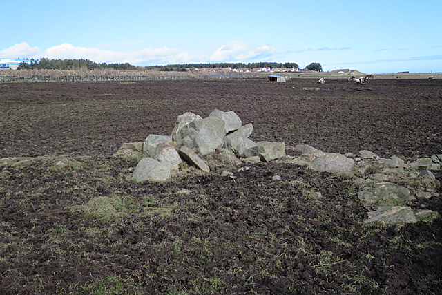
Images are sourced within 2km of 57.116698/-2.0588175 or Grid Reference NJ9602. Thanks to Geograph Open Source API. All images are credited.

Depot of oil drilling pipes
Tullos Primary School The classroom blinds add a nice bit of colour to this iconic 1930s art deco building, but the rusting metal and crumbling mortar are concerning...   B-listed: <span class="nowrap"><a title="http://www.britishlistedbuildings.co.uk/sc-49995-tullos-primary-school-girdleness-road-#.VxNisaT2amQ" rel="nofollow ugc noopener" href="http://www.britishlistedbuildings.co.uk/sc-49995-tullos-primary-school-girdleness-road-#.VxNisaT2amQ">Link</a><img style="margin-left:2px;" alt="External link" title="External link - shift click to open in new window" src="https://s1.geograph.org.uk/img/external.png" width="10" height="10"/></span> .
Tullos Primary School
The classroom blinds add a nice bit of colour to this iconic 1930s art deco building, but the rusting metal and crumbling mortar are concerning... B-listed: LinkExternal link .
Path... ...through Greenbank industrial estate.  The fly tipping and rotting rubbish absolutely everywhere make it look like a third-world slum.  In the background rather 'boxy' 1960s houses on the steep hillside of Balnagask and behind them, Victorian villas in Torry.
Path...
...through Greenbank industrial estate. The fly tipping and rotting rubbish absolutely everywhere make it look like a third-world slum. In the background rather 'boxy' 1960s houses on the steep hillside of Balnagask and behind them, Victorian villas in Torry.
Beech grove... ...on the hillside above Greenbank industrial estate.
Beech grove...
...on the hillside above Greenbank industrial estate.
Baron's Cairn... ...at the top of Tullos Hill: <span class="nowrap"><a title="https://canmore.org.uk/site/20242/barons-cairn-tullos-hill" rel="nofollow ugc noopener" href="https://canmore.org.uk/site/20242/barons-cairn-tullos-hill">Link</a><img style="margin-left:2px;" alt="External link" title="External link - shift click to open in new window" src="https://s1.geograph.org.uk/img/external.png" width="10" height="10"/></span> .  Girdleness Lighthouse is just visible in the distance.
Baron's Cairn...
...at the top of Tullos Hill: LinkExternal link . Girdleness Lighthouse is just visible in the distance.
Nigg Kirk Nigg Kirk was built in 1829 to the design of John Smith to replace the (now ruined) St Fittick's Kirk in Torry.  Compare St Clement's Church: <a title="https://www.geograph.org.uk/photo/3378773" href="https://www.geograph.org.uk/photo/3378773">Link</a> .  As already pointed out by Peter Robinson (<a title="https://www.geograph.org.uk/photo/3065186" href="https://www.geograph.org.uk/photo/3065186">Link</a> ), the windows are fakes, presumably on top of the boarded-up originals.
Nigg Kirk
Nigg Kirk was built in 1829 to the design of John Smith to replace the (now ruined) St Fittick's Kirk in Torry. Compare St Clement's Church: Link . As already pointed out by Peter Robinson (Link ), the windows are fakes, presumably on top of the boarded-up originals.
Amec Foster Wheeler office block An energy consultancy: <span class="nowrap"><a title="http://www.amecfw.com/aboutus/at-a-glance" rel="nofollow ugc noopener" href="http://www.amecfw.com/aboutus/at-a-glance">Link</a><img style="margin-left:2px;" alt="External link" title="External link - shift click to open in new window" src="https://s1.geograph.org.uk/img/external.png" width="10" height="10"/></span> .
Amec Foster Wheeler office block
An energy consultancy: LinkExternal link .
Oil company office, Altens industrial estate
Wood Group offices, Altens industrial estate
Road Bridge at Rare Breeds Farm The bridge carries a minor road across the railway between Aberdeen and Stonehaven railway stations. Someone seems to believe this is a peace bridge!
Road Bridge at Rare Breeds Farm
The bridge carries a minor road across the railway between Aberdeen and Stonehaven railway stations. Someone seems to believe this is a peace bridge!
Aberdeen lifeboats The RNLB 'BP Forties' 54-05, a 54ft Arun Class lifeboat, with the previous lifeboat, RNLB 'Ramsey – Dyce', a 52ft Barnett Class lifeboat behind. This was the day of the inauguration of the new boat in 1976.

The Category A listed Girdleness Lighthouse, dating from 1833 is in the distance.
Aberdeen lifeboats
The RNLB 'BP Forties' 54-05, a 54ft Arun Class lifeboat, with the previous lifeboat, RNLB 'Ramsey – Dyce', a 52ft Barnett Class lifeboat behind. This was the day of the inauguration of the new boat in 1976. The Category A listed Girdleness Lighthouse, dating from 1833 is in the distance.
The Poor Man I think the Poor Man is the long offshore rock beyond the sea stack.
The Poor Man
I think the Poor Man is the long offshore rock beyond the sea stack.
Drystane Dyke Looking a bit the worse for wear, and clearly no longer performing any useful function.
Drystane Dyke
Looking a bit the worse for wear, and clearly no longer performing any useful function.
Cliffs North of Cove From the look of the cliffs, the whole coast is probably riddled with caves, but there are few places where it is possible to get down to sea level to investigate.
Cliffs North of Cove
From the look of the cliffs, the whole coast is probably riddled with caves, but there are few places where it is possible to get down to sea level to investigate.
Railway Bridge The main railway line south from Aberdeen runs between the cliffs and the expanding suburbs south of Aberdeen. I was a little concerned that if the weather deteriorated, or I became tired or injured, I would have difficulty getting across the railway. In the event there are numerous bridges like this one all the way up the coast, and most of them are signposted as part of the path network.
Railway Bridge
The main railway line south from Aberdeen runs between the cliffs and the expanding suburbs south of Aberdeen. I was a little concerned that if the weather deteriorated, or I became tired or injured, I would have difficulty getting across the railway. In the event there are numerous bridges like this one all the way up the coast, and most of them are signposted as part of the path network.
Stones and Mud Presumably the stones have been cleared from the field and dumped here. The mud can be accounted for by a combination of cattle trampling and bad weather. In the distance are Burnbanks Village, a fairly new housing development, and the adjacent railway bridge.
Stones and Mud
Presumably the stones have been cleared from the field and dumped here. The mud can be accounted for by a combination of cattle trampling and bad weather. In the distance are Burnbanks Village, a fairly new housing development, and the adjacent railway bridge.
Black Cove The map says 'Caves' here, and at least one is visible from the clifftop path. In the background is part of the village of Cove Bay.
Black Cove
The map says 'Caves' here, and at least one is visible from the clifftop path. In the background is part of the village of Cove Bay.
Bun Stane The old map suggests that the Bun Stane is the one to the right of the inlet. The inlet is named Bunstane Cove and, not surprisingly, is the collapsed outer part of a cave that extends some distance back from the head of the inlet.
Bun Stane
The old map suggests that the Bun Stane is the one to the right of the inlet. The inlet is named Bunstane Cove and, not surprisingly, is the collapsed outer part of a cave that extends some distance back from the head of the inlet.
Show me another place!

Long Slough is located at Grid Ref: NJ9602 (Lat: 57.116698, Lng: -2.0588175)

Unitary Authority: City of Aberdeen

Police Authority: North East

What 3 Words

///makes.straw.zeal. Near Cove, Aberdeen

Related Wikis

Doonies Farm

Doonies Rare Breeds Farm was a farm in Aberdeen, Scotland. Doonies Farm had one of Scotland's largest collections of rare and endangered farm animal breeds...

Altens

Altens is a district in Aberdeen, on the north-east coast of Scotland.Altens is home to a large industrial estate, alongside a similar estate in neighbouring...

NESS Energy Project

The NESS Energy Project is an incinerator currently under construction in Aberdeen, UK. It is situated in East Tullos Industrial Estate on a site formerly...

Tullos

Tullos is an area of Aberdeen, Scotland. The area takes its name from the Vale of Tullos, which lies between Tullos Hill and Torry Hill. Tullos derived...

Nearby Amenities

Located within 500m of 57.116698,-2.0588175
Give Way
Direction: backward
Lat/Long: 57.1160901/-2.0634824
Mini Roundabout
Direction: clockwise
Lat/Long: 57.118399/-2.0624477
Bus Stop
Turning Circle
Bus: yes
Naptan AtcoCode: 639009063
Naptan CommonName: Turning Circle
Naptan Indicator: at
Naptan NaptanCode: 23237589
Naptan Verified: no
Public Transport: platform
Lat/Long: 57.1183502/-2.0626842
Man Made: survey_point
Lat/Long: 57.1128078/-2.0619609
Maxspeed: implicit
Traffic Sign: maxspeed
Lat/Long: 57.1162122/-2.0636171
Maxspeed: 30 mph
Traffic Sign: maxspeed
Lat/Long: 57.1160804/-2.0637654
Give Way
Direction: backward
Lat/Long: 57.1163439/-2.06441
Barrier: swing_gate
Lat/Long: 57.1171526/-2.0622319
Barrier: cycle_barrier
Lat/Long: 57.1171348/-2.0622446
Crossing
Crossing: unmarked
Crossing Island: no
Crossing Markings: no
Kerb: flush
Tactile Paving: yes
Lat/Long: 57.1163645/-2.0644039
Crossing
Crossing: unmarked
Crossing Island: no
Crossing Markings: no
Kerb: flush
Tactile Paving: no
Lat/Long: 57.1171304/-2.0623853
Give Way
Barrier: kerb
Direction: backward
Kerb: flush
Lat/Long: 57.1170926/-2.0624772
The data included in this document is from www.openstreetmap.org. The data is made available under ODbL.

Have you been to Long Slough?

Leave your review of Long Slough below (or comments, questions and feedback).