Altens Haven

Sea, Estuary, Creek in Kincardineshire

Scotland

Altens Haven

Depot of oil drilling pipes
Depot of oil drilling pipes Credit: Alex McGregor

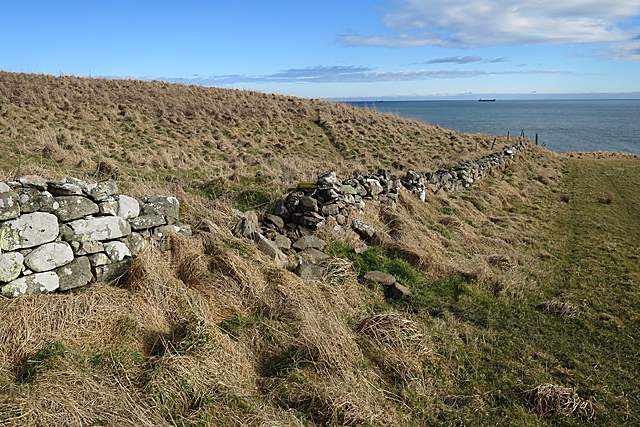
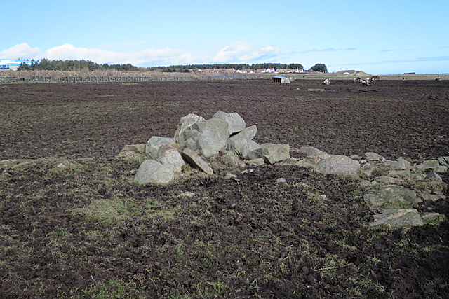
Altens Haven is a picturesque coastal region located in Kincardineshire, Scotland. Nestled on the eastern coast of the country, it is characterized by its stunning sea views, serene estuary, and meandering creek.

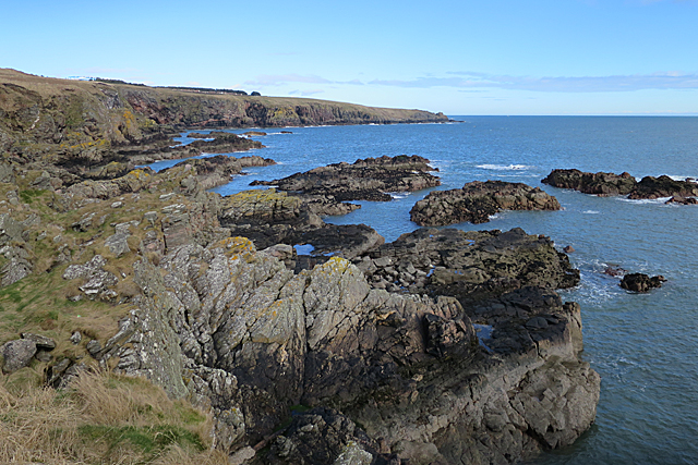
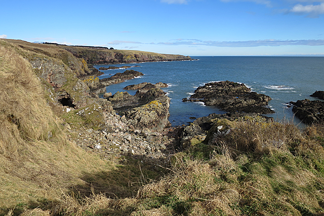
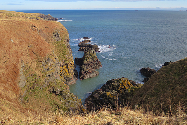
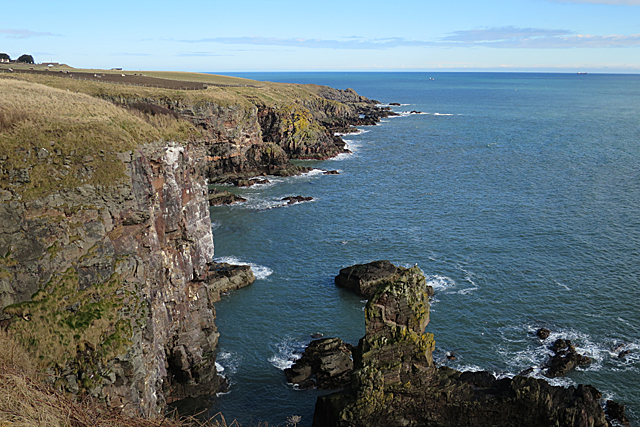
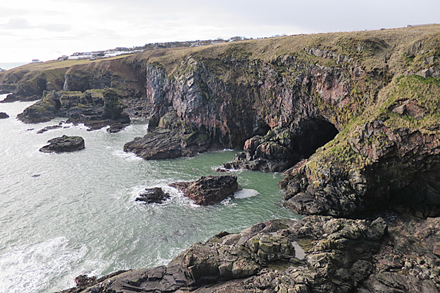
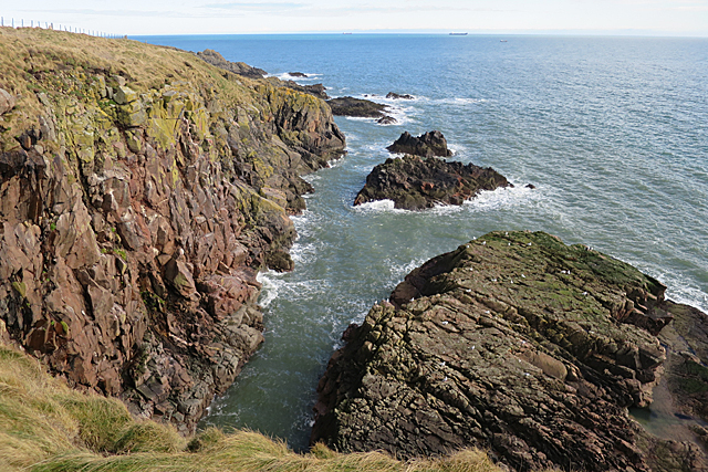
The main highlight of Altens Haven is its pristine sea, which stretches out as far as the eye can see. The crystal-clear waters provide a haven for a variety of marine life, making it a popular destination for snorkeling and diving enthusiasts. The rocky shores that surround the sea are home to a diverse range of flora and fauna, creating a vibrant and thriving ecosystem.

Adjacent to the sea is an estuary, where a river meets the sea. This estuary is a haven for a wide range of bird species, making it a birdwatcher's paradise. From wading birds to ducks and geese, visitors can observe these majestic creatures in their natural habitat.

Further inland, a peaceful creek winds its way through the landscape. The creek, with its gentle flow and lush vegetation, provides a tranquil setting for nature enthusiasts to explore. Visitors can enjoy leisurely walks along its banks, taking in the sights and sounds of the surrounding wilderness.

Altens Haven offers a unique blend of coastal beauty, abundant wildlife, and serene waterways. Whether it's exploring the sea, observing birds in the estuary, or immersing oneself in the tranquility of the creek, this region is a must-visit for nature lovers seeking a peaceful and picturesque escape.

If you have any feedback on the listing, please let us know in the comments section below.
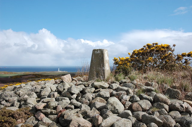
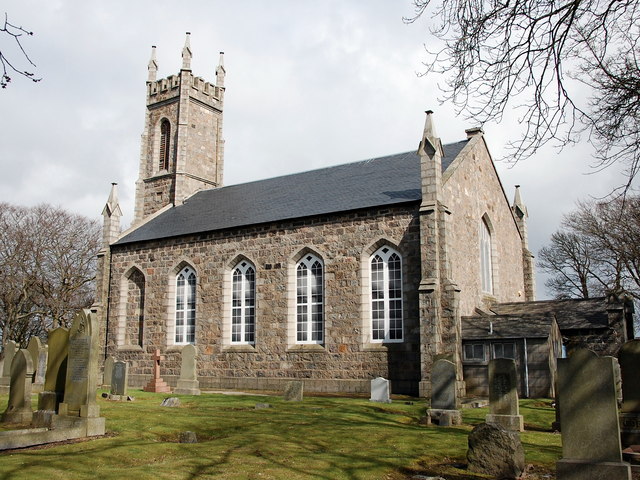
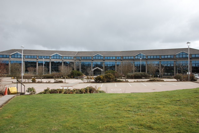
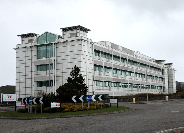
Altens Haven Images

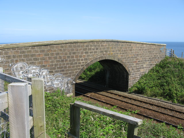
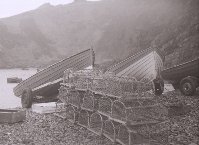
Images are sourced within 2km of 57.112097/-2.0608575 or Grid Reference NJ9602. Thanks to Geograph Open Source API. All images are credited.

Depot of oil drilling pipes
Beech grove... ...on the hillside above Greenbank industrial estate.
Beech grove...
...on the hillside above Greenbank industrial estate.
Baron's Cairn... ...at the top of Tullos Hill: <span class="nowrap"><a title="https://canmore.org.uk/site/20242/barons-cairn-tullos-hill" rel="nofollow ugc noopener" href="https://canmore.org.uk/site/20242/barons-cairn-tullos-hill">Link</a><img style="margin-left:2px;" alt="External link" title="External link - shift click to open in new window" src="https://s1.geograph.org.uk/img/external.png" width="10" height="10"/></span> .  Girdleness Lighthouse is just visible in the distance.
Baron's Cairn...
...at the top of Tullos Hill: LinkExternal link . Girdleness Lighthouse is just visible in the distance.
Nigg Kirk Nigg Kirk was built in 1829 to the design of John Smith to replace the (now ruined) St Fittick's Kirk in Torry.  Compare St Clement's Church: <a title="https://www.geograph.org.uk/photo/3378773" href="https://www.geograph.org.uk/photo/3378773">Link</a> .  As already pointed out by Peter Robinson (<a title="https://www.geograph.org.uk/photo/3065186" href="https://www.geograph.org.uk/photo/3065186">Link</a> ), the windows are fakes, presumably on top of the boarded-up originals.
Nigg Kirk
Nigg Kirk was built in 1829 to the design of John Smith to replace the (now ruined) St Fittick's Kirk in Torry. Compare St Clement's Church: Link . As already pointed out by Peter Robinson (Link ), the windows are fakes, presumably on top of the boarded-up originals.
Amec Foster Wheeler office block An energy consultancy: <span class="nowrap"><a title="http://www.amecfw.com/aboutus/at-a-glance" rel="nofollow ugc noopener" href="http://www.amecfw.com/aboutus/at-a-glance">Link</a><img style="margin-left:2px;" alt="External link" title="External link - shift click to open in new window" src="https://s1.geograph.org.uk/img/external.png" width="10" height="10"/></span> .
Amec Foster Wheeler office block
An energy consultancy: LinkExternal link .
Oil company office, Altens industrial estate
Wood Group offices, Altens industrial estate
Road Bridge at Rare Breeds Farm The bridge carries a minor road across the railway between Aberdeen and Stonehaven railway stations. Someone seems to believe this is a peace bridge!
Road Bridge at Rare Breeds Farm
The bridge carries a minor road across the railway between Aberdeen and Stonehaven railway stations. Someone seems to believe this is a peace bridge!
Cove Bay Fishing boats and lobster creels.
Cove Bay
Fishing boats and lobster creels.
Crawpeel Shore Looking northwards from just above the harbour at Cove. See also <a href="https://www.geograph.org.uk/photo/5702201">NJ9500 : Crawpeel Shore</a>
Crawpeel Shore
Looking northwards from just above the harbour at Cove. See also NJ9500 : Crawpeel Shore
Crawpeel Shore I suspect that this view, rather than <a href="https://www.geograph.org.uk/photo/5702199">NJ9500 : Crawpeel Shore</a>, is actually of Crawpeel Shore, because it is possible to get down to shore level here. The rocky ridges to the left are named on the maps as The Graves.
Crawpeel Shore
I suspect that this view, rather than NJ9500 : Crawpeel Shore, is actually of Crawpeel Shore, because it is possible to get down to shore level here. The rocky ridges to the left are named on the maps as The Graves.
The Poor Man I think the Poor Man is the long offshore rock beyond the sea stack.
The Poor Man
I think the Poor Man is the long offshore rock beyond the sea stack.
Drystane Dyke Looking a bit the worse for wear, and clearly no longer performing any useful function.
Drystane Dyke
Looking a bit the worse for wear, and clearly no longer performing any useful function.
Cliffs North of Cove From the look of the cliffs, the whole coast is probably riddled with caves, but there are few places where it is possible to get down to sea level to investigate.
Cliffs North of Cove
From the look of the cliffs, the whole coast is probably riddled with caves, but there are few places where it is possible to get down to sea level to investigate.
Railway Bridge The main railway line south from Aberdeen runs between the cliffs and the expanding suburbs south of Aberdeen. I was a little concerned that if the weather deteriorated, or I became tired or injured, I would have difficulty getting across the railway. In the event there are numerous bridges like this one all the way up the coast, and most of them are signposted as part of the path network.
Railway Bridge
The main railway line south from Aberdeen runs between the cliffs and the expanding suburbs south of Aberdeen. I was a little concerned that if the weather deteriorated, or I became tired or injured, I would have difficulty getting across the railway. In the event there are numerous bridges like this one all the way up the coast, and most of them are signposted as part of the path network.
Stones and Mud Presumably the stones have been cleared from the field and dumped here. The mud can be accounted for by a combination of cattle trampling and bad weather. In the distance are Burnbanks Village, a fairly new housing development, and the adjacent railway bridge.
Stones and Mud
Presumably the stones have been cleared from the field and dumped here. The mud can be accounted for by a combination of cattle trampling and bad weather. In the distance are Burnbanks Village, a fairly new housing development, and the adjacent railway bridge.
Black Cove The map says 'Caves' here, and at least one is visible from the clifftop path. In the background is part of the village of Cove Bay.
Black Cove
The map says 'Caves' here, and at least one is visible from the clifftop path. In the background is part of the village of Cove Bay.
Bun Stane The old map suggests that the Bun Stane is the one to the right of the inlet. The inlet is named Bunstane Cove and, not surprisingly, is the collapsed outer part of a cave that extends some distance back from the head of the inlet.
Bun Stane
The old map suggests that the Bun Stane is the one to the right of the inlet. The inlet is named Bunstane Cove and, not surprisingly, is the collapsed outer part of a cave that extends some distance back from the head of the inlet.
Show me another place!

Altens Haven is located at Grid Ref: NJ9602 (Lat: 57.112097, Lng: -2.0608575)

Unitary Authority: City of Aberdeen

Police Authority: North East

What 3 Words

///mime.start.table. Near Cove, Aberdeen

Related Wikis

Doonies Farm

Doonies Rare Breeds Farm was a farm in Aberdeen, Scotland. Doonies Farm had one of Scotland's largest collections of rare and endangered farm animal breeds...

Altens

Altens is a district in Aberdeen, on the north-east coast of Scotland.Altens is home to a large industrial estate, alongside a similar estate in neighbouring...

St Mary's Church, Cove Bay

St Mary the Virgin (Cove Bay) is an Episcopal Church in Cove Bay, Aberdeen, Scotland. It is part of the Diocese of Aberdeen and Orkney in the Scottish...

Cove Bay railway station

Cove Bay railway station served the suburb of Cove Bay, Aberdeen, Scotland from 1850 to 1956 on the Aberdeen Railway. == History == The station opened...

Nearby Amenities

Located within 500m of 57.112097,-2.0608575
Give Way
Direction: backward
Lat/Long: 57.1160901/-2.0634824
Crossing
Crossing: unmarked
Crossing Island: no
Crossing Markings: no
Kerb: flush
Tactile Paving: yes
Lat/Long: 57.1133603/-2.0678234
Bus Stop
Irvin House
Bus: yes
Naptan AtcoCode: 639009065
Naptan CommonName: Irvin House
Naptan Indicator: opp
Naptan NaptanCode: 23237632
Naptan Verified: no
Public Transport: platform
Lat/Long: 57.1133709/-2.0677447
Bus Stop
Irvin House
Bus: yes
Naptan AtcoCode: 639009064
Naptan CommonName: Irvin House
Naptan Indicator: at
Naptan NaptanCode: 23237629
Naptan Verified: no
Public Transport: platform
Lat/Long: 57.1143864/-2.0669871
Man Made: survey_point
Lat/Long: 57.1128078/-2.0619609
Burnbanks Haven
Natural: bay
Lat/Long: 57.1096114/-2.0640677
Maxspeed: implicit
Traffic Sign: maxspeed
Lat/Long: 57.1162122/-2.0636171
Maxspeed: 30 mph
Traffic Sign: maxspeed
Lat/Long: 57.1160804/-2.0637654
The data included in this document is from www.openstreetmap.org. The data is made available under ODbL.

Have you been to Altens Haven?

Leave your review of Altens Haven below (or comments, questions and feedback).