Lynch Cove

Sea, Estuary, Creek in Dorset

England

Lynch Cove

On the coast path by The Fleet, west of Wyke Regis
On the coast path by The Fleet, west of Wyke Regis Credit: Colin Park

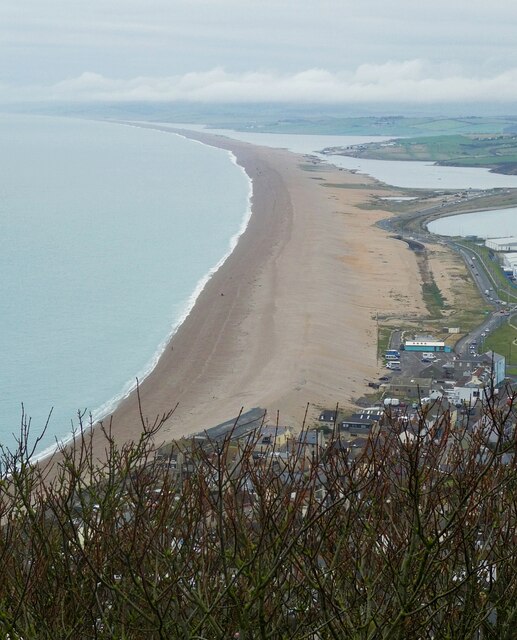
Lynch Cove is a picturesque coastal area located in Dorset, England. Situated along the stunning Jurassic Coastline, it is renowned for its natural beauty and diverse ecosystem. The cove is nestled between towering cliffs, providing a sense of tranquility and seclusion for visitors.

The main feature of Lynch Cove is its crystal-clear sea, which offers a mesmerizing turquoise hue. The calm waters are perfect for swimming, snorkeling, and other water activities. The area is home to a variety of marine life, including colorful fish, crabs, and even the occasional seal or dolphin sighting.

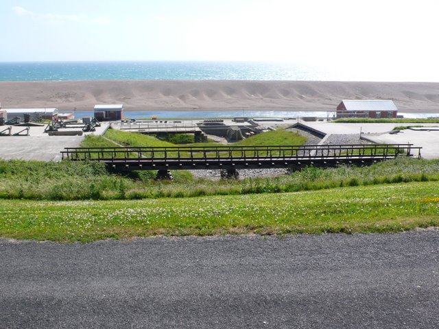
Adjacent to the sea is an estuary, where the water meets the mouth of a creek. This estuary is a haven for birdwatchers, as it attracts a wide range of avian species. Visitors can observe graceful herons, elegant egrets, and many other waterfowl in their natural habitat.

The creek that flows through Lynch Cove is a meandering body of water that winds its way through lush marshes and grasslands. This ecosystem provides a sanctuary for numerous species of flora and fauna, including rare plants and insects. It also offers a peaceful setting for nature walks and picnics.

Lynch Cove is a popular destination for outdoor enthusiasts, nature lovers, and those seeking a serene coastal retreat. The area boasts several walking trails, picnic areas, and viewpoints that offer breathtaking vistas of the surrounding cliffs and sea. Whether for a day trip or a longer stay, Lynch Cove promises a memorable experience for all who visit.

If you have any feedback on the listing, please let us know in the comments section below.
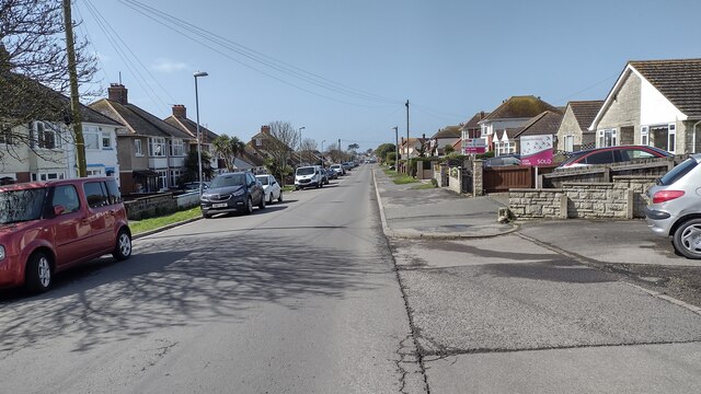
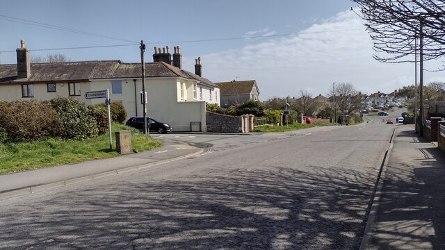
Lynch Cove Images

Images are sourced within 2km of 50.601762/-2.4979235 or Grid Reference SY6478. Thanks to Geograph Open Source API. All images are credited.

On the coast path by The Fleet, west of Wyke Regis
Chesil Beach from Portland viewpoint Looking along the natural wonder of Chesil Beach which is 18 miles long from Portland to West Bay. This photo was taken from a viewpoint towards the northern end of Portland. The water trapped between the beach and the inland coast is called The Fleet.
See also
<a href="https://www.geograph.org.uk/photo/7153236">SY6675 : Chesil Beach - View northwestwards</a>
<a href="https://www.geograph.org.uk/photo/7153263">SY6675 : Chesil Beach - View southeastwards</a>
<a href="https://www.geograph.org.uk/photo/7153270">SY6675 : Chesil Beach - Pebbles</a>
Chesil Beach from Portland viewpoint
Looking along the natural wonder of Chesil Beach which is 18 miles long from Portland to West Bay. This photo was taken from a viewpoint towards the northern end of Portland. The water trapped between the beach and the inland coast is called The Fleet. See also SY6675 : Chesil Beach - View northwestwards SY6675 : Chesil Beach - View southeastwards SY6675 : Chesil Beach - Pebbles
Crookhill Depot and Waste Transfer Station, Chickerell
Lynch Road Lynch Road one way towards the camera
Lynch Road
Lynch Road one way towards the camera
Chickerell Road Chickerell Road passing Quibo Lane
Chickerell Road
Chickerell Road passing Quibo Lane
Chickerell: postbox № DT3 110, Putton Lane This small postbox serves eastern Chickerell and is emptied at 4:30pm on weekdays and at 7am on Saturdays.
Chickerell: postbox № DT3 110, Putton Lane
This small postbox serves eastern Chickerell and is emptied at 4:30pm on weekdays and at 7am on Saturdays.
The Fleet and Chesil Beach at Wyke Regis This photo shows the mysterious holes or "caverns" that sometimes form in this area of the beach.
The Fleet and Chesil Beach at Wyke Regis
This photo shows the mysterious holes or "caverns" that sometimes form in this area of the beach.
Early morning on the Fleet Taken on the shore of the Fleet at Wyke Regis just south of the army Bridging Camp
Early morning on the Fleet
Taken on the shore of the Fleet at Wyke Regis just south of the army Bridging Camp
Curtis Fields, Weymouth A haven of green fields (but under threat of development) within Weymouth's suburbs. From this point at the southern edge of the square, there is a dramatic view over the town and Weymouth Bay to the East Dorset coast beyond. View looking north-east.
Curtis Fields, Weymouth
A haven of green fields (but under threat of development) within Weymouth's suburbs. From this point at the southern edge of the square, there is a dramatic view over the town and Weymouth Bay to the East Dorset coast beyond. View looking north-east.
Butterstreet Cove on The Fleet
Tidmoor Cove on The Fleet
Littlesea Holiday Park on The Fleet near Weymouth
East Fleet Campsite A view from the overflow field on East Fleet Farm Campsite, NE of the lane.
East Fleet Campsite
A view from the overflow field on East Fleet Farm Campsite, NE of the lane.
Military Base, Wyke Regis The Royal Engineers bridging unit is here, and ‘Dry’ (i.e. without explosives) bridge demolition training takes place. The Fleet, a tidal lagoon, is an ideal safety location for basic watermanship, improvised raft construction, and training on assault boats.
Military Base, Wyke Regis
The Royal Engineers bridging unit is here, and ‘Dry’ (i.e. without explosives) bridge demolition training takes place. The Fleet, a tidal lagoon, is an ideal safety location for basic watermanship, improvised raft construction, and training on assault boats.
The Fleet at Wyke Regis
Chesil Bank and Fleet, Wyke Regis
All Saints Church, Wyke Regis C15 Church with tall W tower, all of Portland ashlar.
All Saints Church, Wyke Regis
C15 Church with tall W tower, all of Portland ashlar.
Jetty on East Fleet, Dorset
Show me another place!

Lynch Cove is located at Grid Ref: SY6478 (Lat: 50.601762, Lng: -2.4979235)

Unitary Authority: Dorset

Police Authority: Dorset

What 3 Words

///hiking.major.types. Near Chickerell, Dorset

Related Wikis

Wyke Regis Training Area

Wyke Regis Training Area is an army training area primarily located in the parish and town of Chickerell, but near to the parish of Wyke Regis in neighbouring...

Budmouth Academy

Budmouth Academy (formerly Budmouth College) is a coeducational secondary school and sixth form situated in Weymouth, Dorset, overlooking the Jurassic...

Charlestown, Dorset

Charlestown is a suburb of Weymouth in Dorset, England, situated in the west of the town beside The Fleet, although it is in Chickerell parish (population...
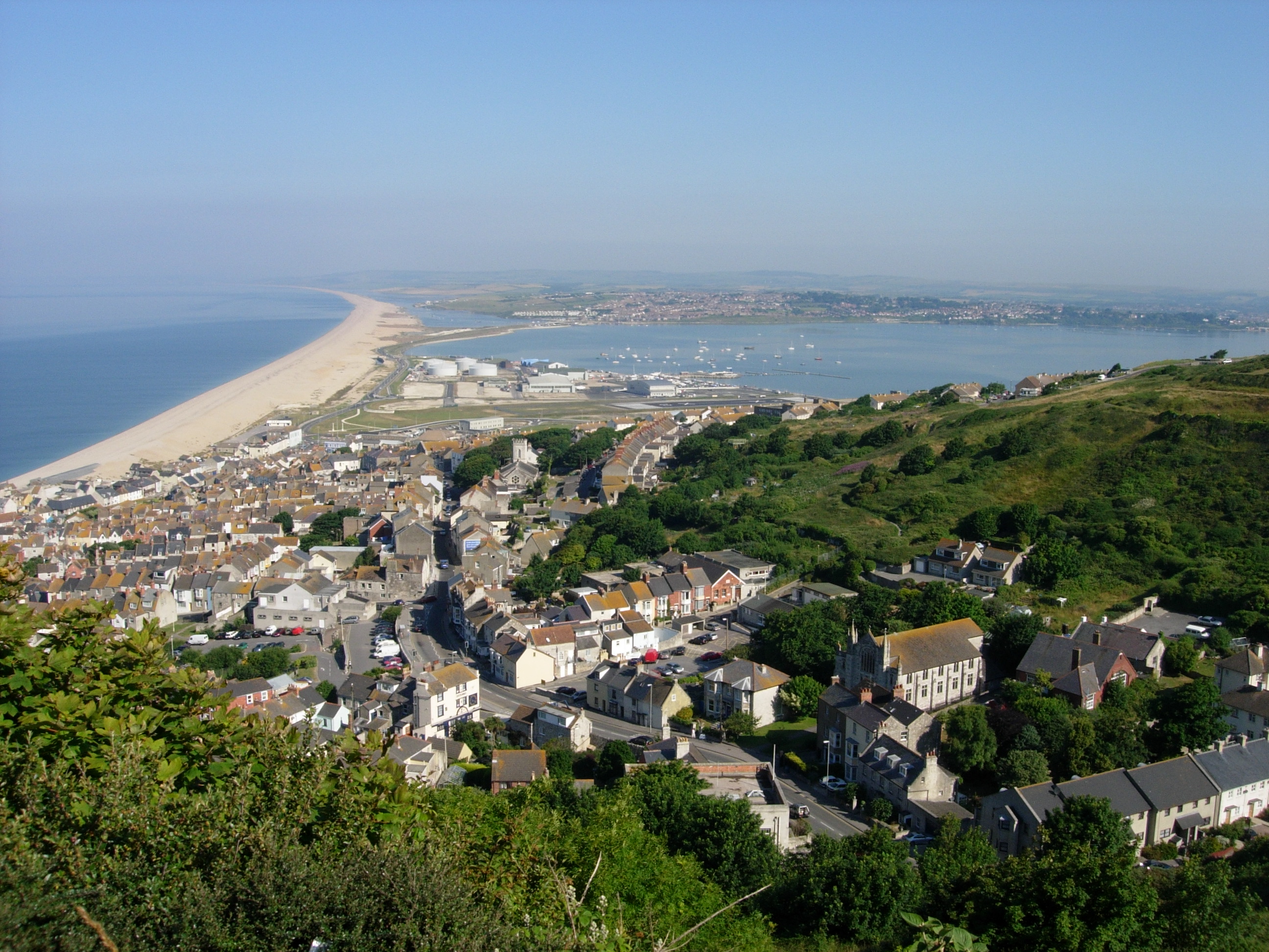
Chesil Beach

Chesil Beach (also known as Chesil Bank) in Dorset, England is one of three major shingle beach structures in Britain. Its name is derived from the Old...

Nearby Amenities

Located within 500m of 50.601762,-2.4979235
Source: PGS
Lat/Long: 50.6052641/-2.5013734
Source: PGS
Lat/Long: 50.6048419/-2.5011803
Source: PGS
Lat/Long: 50.6044061/-2.5009657
Source: PGS
Lat/Long: 50.6040112/-2.5006439
Source: PGS
Lat/Long: 50.603875/-2.5003864
Source: PGS
Lat/Long: 50.6033303/-2.4986268
Source: PGS
Lat/Long: 50.6033439/-2.4973394
Source: PGS
Lat/Long: 50.603303/-2.49676
Source: PGS
Lat/Long: 50.603126/-2.4962021
Source: PGS
Lat/Long: 50.6028536/-2.4956442
Source: PGS
Lat/Long: 50.6027174/-2.4955369
Source: PGS
Lat/Long: 50.6021999/-2.4954296
Source: PGS
Lat/Long: 50.6015189/-2.4960305
Source: PGS
Lat/Long: 50.6011512/-2.4972106
Source: PGS
Lat/Long: 50.6010014/-2.4973394
Source: PGS
Lat/Long: 50.60062/-2.4982406
Source: PGS
Lat/Long: 50.6001433/-2.4988414
Source: PGS
Lat/Long: 50.5998573/-2.499056
Source: PGS
Lat/Long: 50.599476/-2.4991418
Source: PGS
Lat/Long: 50.5989175/-2.4993993
Source: PGS
Lat/Long: 50.598577/-2.4994422
Source: PGS
Lat/Long: 50.5980186/-2.4992491
Source: PGS
Lat/Long: 50.5975283/-2.4989702
Littlesea Holiday Park Pool (Indoor)
Covered: yes
Leisure: swimming_pool
Sport: swimming
Lat/Long: 50.6033066/-2.4925878
Littlesea Holiday Park Laundrette
Shop: laundry
Lat/Long: 50.6032987/-2.4916759
Cafe
Starbucks
Brand: Starbucks
Brand Wikidata: Q37158
Cuisine: coffee_shop
Official Name: Starbucks Coffee
Takeaway: yes
Lat/Long: 50.6038815/-2.492504
Littlesea Holiday Park Mini-Market
Check Date: 2023-06-06
Shop: convenience
Lat/Long: 50.6038707/-2.4923321
Toilets
Lat/Long: 50.6036794/-2.4922275
Fast Food
Papa John's
Addr Place: Littlesea Holiday Park
Brand: Papa John's
Brand Wikidata: Q2759586
Brand Wikipedia: en:Papa John's Pizza
Cuisine: pizza
Takeaway: yes
Website: https://www.papajohns.co.uk/stores/other
Lat/Long: 50.6035866/-2.4921712
Woodlands
Place: locality
Lat/Long: 50.6015821/-2.4925429
Bay View
Place: locality
Lat/Long: 50.6015273/-2.4943465
Ocean View
Place: locality
Lat/Long: 50.6022689/-2.494487
Wessex Bank
Place: locality
Lat/Long: 50.6027592/-2.4927345
West Acres
Place: locality
Lat/Long: 50.6043594/-2.4948089
Chickerell View
Place: locality
Lat/Long: 50.6024732/-2.4921122
Swan View
Place: locality
Lat/Long: 50.6039212/-2.493979
Lagoon Close
Place: locality
Lat/Long: 50.6054649/-2.495481
Material: wood
Poles: bipole
Power: pole
Source: bing
Lat/Long: 50.5992599/-2.4938965
Material: wood
Poles: bipole
Power: pole
Source: bing
Lat/Long: 50.600324/-2.4943203
Material: wood
Poles: bipole
Power: pole
Source: bing
Lat/Long: 50.6018987/-2.4950069
Material: wood
Poles: bipole
Power: pole
Source: bing
Lat/Long: 50.6032947/-2.4959886
Poles: bipole
Power: pole
Source: bing
Lat/Long: 50.6046651/-2.496981
The data included in this document is from www.openstreetmap.org. The data is made available under ODbL.

Have you been to Lynch Cove?

Leave your review of Lynch Cove below (or comments, questions and feedback).