East Loch Tarbert

Sea, Estuary, Creek in Argyllshire

Scotland

East Loch Tarbert

East Loch Tarbert Looking towards the marina from a slipway near the ferry terminal.
East Loch Tarbert Credit: Anne Burgess

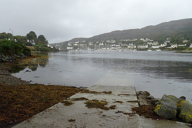
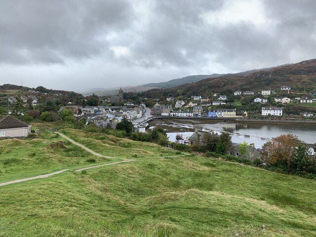
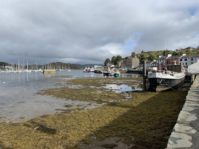
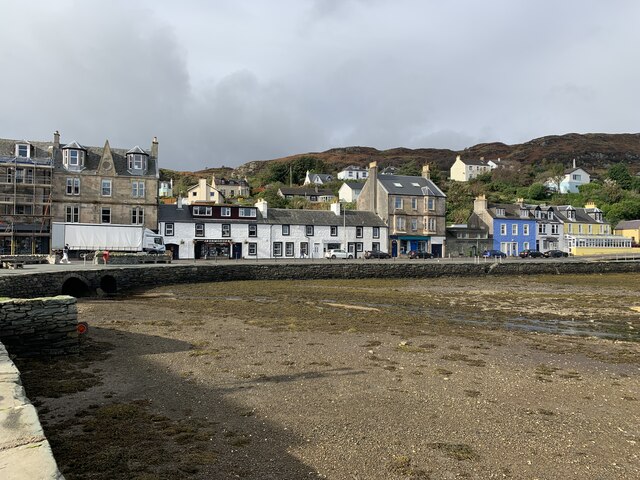
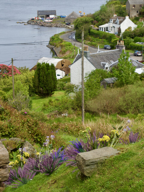
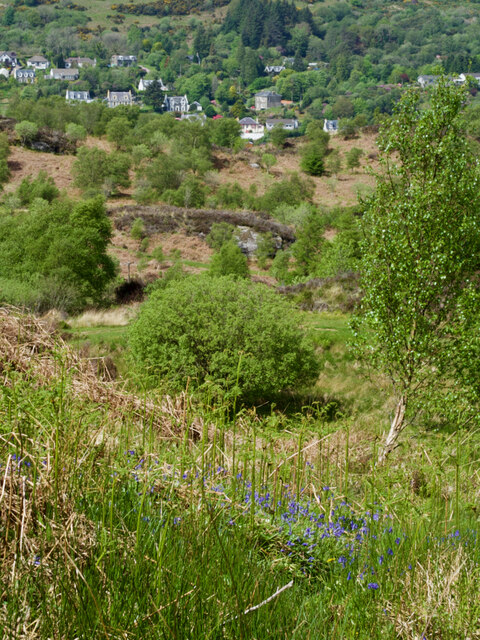
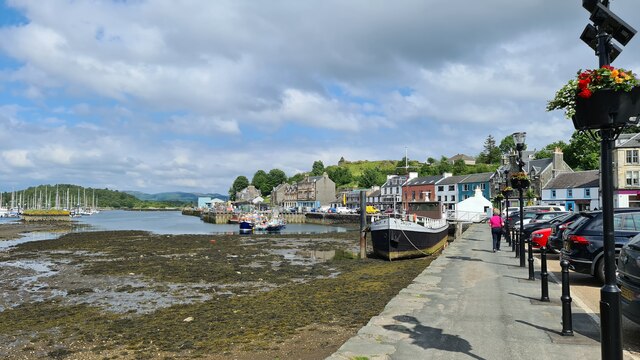
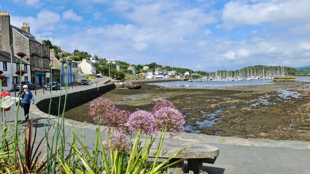
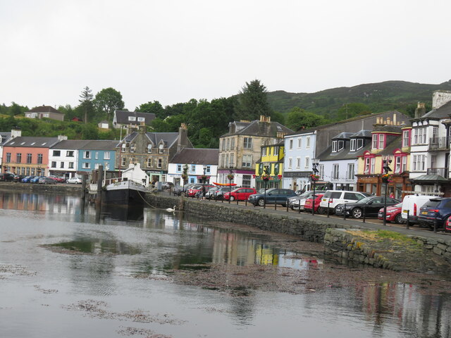
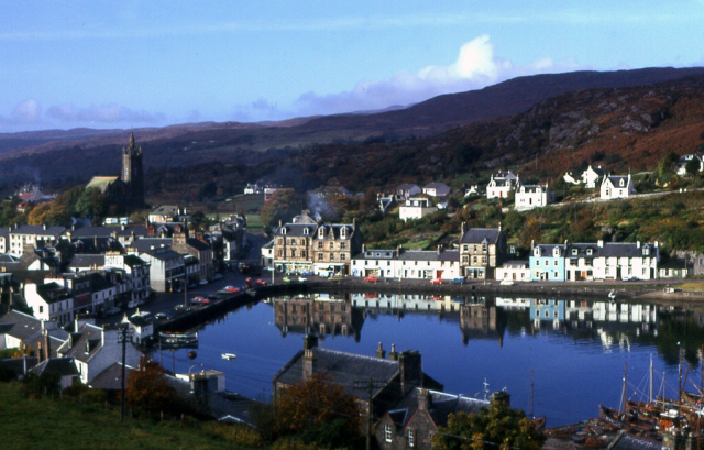
East Loch Tarbert is a picturesque body of water located in Argyllshire, Scotland. Situated on the western coast of the Kintyre Peninsula, it is an estuary characterized by its stunning natural beauty and tranquil atmosphere. The loch extends from the village of Tarbert and opens up to the North Atlantic Ocean, making it a significant maritime feature in the region.

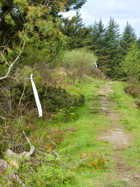
The loch is surrounded by rolling hills and lush green landscapes, providing a picturesque backdrop for visitors and locals alike. With its calm waters and sheltered position, East Loch Tarbert serves as a safe haven for various marine life, including seals, otters, and a diverse array of bird species. This makes it an ideal spot for wildlife enthusiasts and birdwatchers.

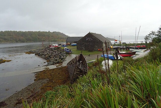
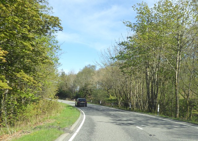
The loch also serves as a hub for recreational activities such as sailing, fishing, and kayaking. Its calm waters and gentle currents make it an excellent destination for beginners and experienced enthusiasts alike. Visitors can explore the loch's hidden coves and secluded beaches, offering a unique opportunity to connect with nature and soak in the peaceful surroundings.

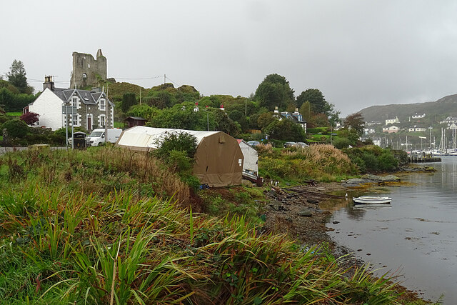
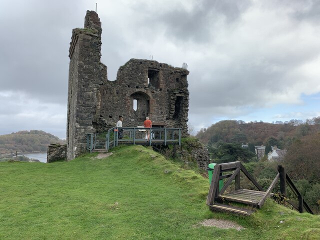
One of the notable features of East Loch Tarbert is the historic Tarbert Castle, which overlooks the water. This ancient castle, dating back to the 13th century, adds a touch of history and intrigue to the area.

Overall, East Loch Tarbert is a serene and idyllic location that offers a perfect blend of natural beauty, wildlife, and outdoor activities. Whether one is seeking relaxation or adventure, this loch is sure to captivate the hearts of all who visit.

If you have any feedback on the listing, please let us know in the comments section below.

East Loch Tarbert Images

Images are sourced within 2km of 55.866884/-5.3986006 or Grid Reference NR8768. Thanks to Geograph Open Source API. All images are credited.

East Loch Tarbert Looking towards the marina from a slipway near the ferry terminal.
East Loch Tarbert
Looking towards the marina from a slipway near the ferry terminal.
Pier Road The view isn't exactly enhanced by the tented buildings on the shore. In the background is Tarbert Castle, and the loch continues on the right past the marina to the town.
Pier Road
The view isn't exactly enhanced by the tented buildings on the shore. In the background is Tarbert Castle, and the loch continues on the right past the marina to the town.
Tarbert Loch Fyne Yacht Club A few small boats lie scattered around the yacht club's boatyard. What looks like a French flag beyond it is the information board at the Portavadie ferry terminal. Also beyond the yacht club building, on the left, is a small fish processing business.
Tarbert Loch Fyne Yacht Club
A few small boats lie scattered around the yacht club's boatyard. What looks like a French flag beyond it is the information board at the Portavadie ferry terminal. Also beyond the yacht club building, on the left, is a small fish processing business.
Tarbet from the castle A gloomy day.
Tarbet from the castle
A gloomy day.
Tarbet harbour With the dutch barge Dolfijn on the right.
Tarbet harbour
With the dutch barge Dolfijn on the right.
Harbour front in Tarbet The A83 is a busy road through the heart of this harbour town.
Harbour front in Tarbet
The A83 is a busy road through the heart of this harbour town.
Remains of Tarbert Castle Historic Environment Scotland Scheduled Monument reference SM276.
Remains of Tarbert Castle
Historic Environment Scotland Scheduled Monument reference SM276.
Footpath up Bàrr Reamhar
View down on Pier Road from the castle Excellent display of purple (heather?) and yellow flowers on the castle embankment. Trouble is they're plastic. A film crew had descorated the castle during filming.
View down on Pier Road from the castle
Excellent display of purple (heather?) and yellow flowers on the castle embankment. Trouble is they're plastic. A film crew had descorated the castle during filming.
Tape left over from some race or other
Tarbert from Cruach Buidhe
Tarbert Church Spire
Tarbert Quayside
Tarbert Quayside
Tarbert harbour towards Marina
Tarbert's waterfront A significant town on the isthmus between Kintyre and Knapdale.
Tarbert's waterfront
A significant town on the isthmus between Kintyre and Knapdale.
MV Isle of Cumbrae bound for Portavadie The MV Isle of Cumbrae leaving East Loch Tarbert bound for Portavadie as captured from Fasgadh, Pier Road, Tarbert.
MV Isle of Cumbrae bound for Portavadie
The MV Isle of Cumbrae leaving East Loch Tarbert bound for Portavadie as captured from Fasgadh, Pier Road, Tarbert.
A83 south of Barr Hill
Advertising board, Port a' Ghuail, Argyll Looking towards Barmore Island.

An advertising board isn't something that I was expecting to photograph in this grid square!  I assume that it's intended to be seen by people on passing yachts.
Advertising board, Port a' Ghuail, Argyll
Looking towards Barmore Island. An advertising board isn't something that I was expecting to photograph in this grid square! I assume that it's intended to be seen by people on passing yachts.
Show me another place!

East Loch Tarbert is located at Grid Ref: NR8768 (Lat: 55.866884, Lng: -5.3986006)

Unitary Authority: Argyll and Bute

Police Authority: Argyll and West Dunbartonshire

What 3 Words

///policy.dislodge.twee. Near Tarbert, Argyll & Bute

Related Wikis

East Loch Tarbert, Argyll

East Loch Tarbert, Argyll is a small sea loch on the eastern side of the Kintyre peninsula in Scotland. It is a part of the much larger Loch Fyne. The...

Tarbert Castle

Tarbert Castle is located on the southern shore of East Loch Tarbert, at Tarbert, Argyll, Scotland, at the north end of Kintyre. Tarbert Castle was a strategic...

Tarbert, Kintyre

Tarbert (Scottish Gaelic: An Tairbeart, pronounced [ən̪ˠ ˈt̪ʰaɾʲapərˠʃt̪], or Tairbeart Loch Fìne to distinguish it from other places of the same name...

Barmore Island

Barmore Island is a peninsula in Scotland located on the east of Knapdale, in the council area of Argyll and Bute. It is 1 and a half miles north from...

Nearby Amenities

Located within 500m of 55.866884,-5.3986006
Source: PGS
Lat/Long: 55.8666906/-5.4062389
Source: PGS
Lat/Long: 55.8671782/-5.4062174
Source: PGS
Lat/Long: 55.8672143/-5.4059921
Source: PGS
Lat/Long: 55.8673107/-5.4056917
Source: PGS
Lat/Long: 55.8672023/-5.4055307
Source: PGS
Lat/Long: 55.8670939/-5.4054878
Source: PGS
Lat/Long: 55.8670277/-5.4054771
Source: PGS
Lat/Long: 55.8670097/-5.4055522
Source: PGS
Lat/Long: 55.8667628/-5.4058955
Source: PGS
Lat/Long: 55.8666605/-5.406153
Source: PGS
Lat/Long: 55.8636623/-5.3932462
Source: PGS
Lat/Long: 55.86415/-5.3938792
Source: PGS
Lat/Long: 55.8647099/-5.3944264
Source: PGS
Lat/Long: 55.864734/-5.3947054
Source: PGS
Lat/Long: 55.8649688/-5.3950594
Source: PGS
Lat/Long: 55.8655768/-5.397806
Source: PGS
Lat/Long: 55.8656732/-5.3997586
Source: PGS
Lat/Long: 55.8658478/-5.4014001
Source: PGS
Lat/Long: 55.8658959/-5.4027198
Source: PGS
Lat/Long: 55.8664919/-5.4037068
Source: PGS
Lat/Long: 55.8663129/-5.4043851
Source: PGS
Lat/Long: 55.8657153/-5.4054986
Source: PGS
Lat/Long: 55.865631/-5.4056058
Source: PGS
Lat/Long: 55.865563/-5.405778
Source: PGS
Lat/Long: 55.8654022/-5.4061316
Source: PGS
Lat/Long: 55.8682799/-5.4060565
Source: PGS
Lat/Long: 55.8681715/-5.4060779
Source: PGS
Lat/Long: 55.8681775/-5.4059277
Source: PGS
Lat/Long: 55.8680692/-5.405284
Source: PGS
Lat/Long: 55.8681234/-5.4049514
Source: PGS
Lat/Long: 55.8682498/-5.4048763
Source: PGS
Lat/Long: 55.8683581/-5.404651
Source: PGS
Lat/Long: 55.8679969/-5.402237
Source: PGS
Lat/Long: 55.8679006/-5.4021834
Source: PGS
Lat/Long: 55.8678886/-5.401958
Source: PGS
Lat/Long: 55.8678645/-5.4017542
Source: PGS
Lat/Long: 55.868015/-5.4016684
Source: PGS
Lat/Long: 55.8680752/-5.4014323
Source: PGS
Lat/Long: 55.8681655/-5.4012929
Source: PGS
Lat/Long: 55.8687735/-5.4009173
Source: PGS
Lat/Long: 55.8688698/-5.4010032
Source: PGS
Lat/Long: 55.868918/-5.4008852
Source: PGS
Lat/Long: 55.8689661/-5.4005848
Source: PGS
Lat/Long: 55.8702905/-5.4004024
Source: PGS
Lat/Long: 55.8702664/-5.3985034
Source: PGS
Lat/Long: 55.8700918/-5.3984819
Source: PGS
Lat/Long: 55.8700858/-5.398321
Source: PGS
Lat/Long: 55.8700196/-5.3982137
Source: PGS
Lat/Long: 55.8700918/-5.3981279
Source: PGS
Lat/Long: 55.8697066/-5.3973446
Source: PGS
Lat/Long: 55.8693875/-5.3955637
Source: PGS
Lat/Long: 55.8693935/-5.3953705
Source: PGS
Lat/Long: 55.869481/-5.395315
Source: PGS
Lat/Long: 55.869993/-5.395347
Source: PGS
Lat/Long: 55.870509/-5.39515
Source: PGS
Lat/Long: 55.870492/-5.39606
Source: PGS
Lat/Long: 55.870752/-5.395849
Source: PGS
Lat/Long: 55.871012/-5.395637
Source: PGS
Lat/Long: 55.870986/-5.397002
Pier
Pier
Lat/Long: 55.8655408/-5.3973879
Tourism: viewpoint
Lat/Long: 55.8630817/-5.3986734
Leisure: bird_hide
Lat/Long: 55.8680951/-5.4057819
Seamark Beacon Lateral Category: starboard
Seamark Beacon Lateral Colour: green
Seamark Beacon Lateral Shape: pile
Seamark Beacon Lateral System: iala-a
Seamark Light Character: Q
Seamark Light Colour: green
Seamark Light Height: 3
Seamark Light Range: 2
Seamark Light Reference: A 4299
Seamark Type: beacon_lateral
Source: US NGA Pub. 114. 2011-05-26.
Lat/Long: 55.8666333/-5.4060667
Seamark Beacon Lateral Category: port
Seamark Beacon Lateral Colour: red
Seamark Beacon Lateral Shape: pile
Seamark Beacon Lateral System: iala-a
Seamark Light Character: Fl
Seamark Light Colour: red
Seamark Light Height: 4
Seamark Light Period: 2.5
Seamark Light Range: 3
Seamark Light Reference: A 4298
Seamark Light Sequence: 0.5+(2)
Seamark Type: beacon_lateral
Source: US NGA Pub. 114. 2011-05-26.
Lat/Long: 55.8668754/-5.4040222
Source: PGS
Lat/Long: 55.8664816/-5.4036634
Ferry: yes
Public Transport: stop_position
Lat/Long: 55.8662227/-5.403389
Post Box
Post Box Type: lamp
Ref: PA29 2
Royal Cypher: scottish_crown
Lat/Long: 55.8655481/-5.3977081
The data included in this document is from www.openstreetmap.org. The data is made available under ODbL.

Have you been to East Loch Tarbert?

Leave your review of East Loch Tarbert below (or comments, questions and feedback).