Port Muinntir Eiginn
Sea, Estuary, Creek in Argyllshire
Scotland
Port Muinntir Eiginn

Port Muinntir Eiginn is a picturesque coastal region located in Argyllshire, Scotland. Situated on the western coast of Scotland, it encompasses a sea, estuary, and creek, offering a diverse and captivating landscape.
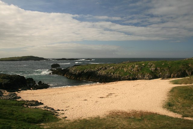
The sea at Port Muinntir Eiginn is characterized by its crystal-clear waters and stretches of sandy beaches. It is a haven for water sports enthusiasts, with activities such as swimming, surfing, and sailing being popular among locals and visitors alike. The sea is also home to a rich variety of marine life, making it a prime spot for snorkeling and scuba diving.
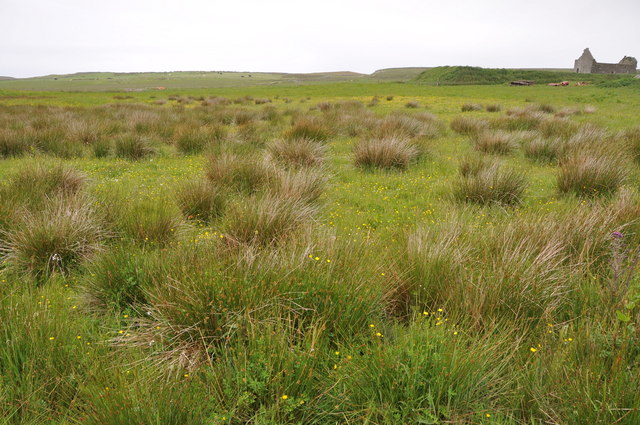
Adjacent to the sea is the estuary, where the river meets the sea. This area is known for its abundant wildlife and is a favored spot for birdwatchers. The estuary is a vital habitat for various bird species, including herons, ducks, and wading birds. Visitors can observe these birds in their natural habitat while taking a leisurely stroll along the estuary's banks.
Further inland, Port Muinntir Eiginn features a tranquil creek that winds its way through lush greenery. This creek is a popular spot for fishing enthusiasts, as it is home to an array of freshwater fish species. Anglers can be seen casting their lines from the creek's banks, hoping to catch salmon, trout, and other prized catches.
In summary, Port Muinntir Eiginn offers a captivating coastal experience, boasting a stunning sea, a wildlife-rich estuary, and a serene creek. Whether indulging in water sports, birdwatching, or fishing, visitors to this area are sure to be enthralled by its natural beauty and abundant wildlife.
If you have any feedback on the listing, please let us know in the comments section below.
Port Muinntir Eiginn Images
Images are sourced within 2km of 55.694275/-6.5200578 or Grid Reference NR1653. Thanks to Geograph Open Source API. All images are credited.


Port Muinntir Eiginn is located at Grid Ref: NR1653 (Lat: 55.694275, Lng: -6.5200578)
Unitary Authority: Argyll and Bute
Police Authority: Argyll and West Dunbartonshire
What 3 Words
///checked.sidelined.lectures. Near Portnahaven, Argyll & Bute
Related Wikis

Islay LIMPET
Islay LIMPET was the world's first commercial wave power device and was connected to the United Kingdom's National Grid. == History == Islay LIMPET (Land...

Eilean Mhic Coinnich
Eilean Mhic Coinnich, also known as Mackenzie Island (although recorded on the Land Register as McKenseys Island), is an uninhabited island of 17.3 hectares...

Portnahaven
Portnahaven (Scottish Gaelic: Port na h-Abhainne, meaning river port) is a village on Islay in the Inner Hebrides, Scotland. The village is within the...

Orsay, Inner Hebrides
Orsay (Scottish Gaelic: Orasaigh) is a small island in the Inner Hebrides of Scotland. It lies a short distance off the west coast of the island of Islay...
Nearby Amenities
Located within 500m of 55.694275,-6.5200578Have you been to Port Muinntir Eiginn?
Leave your review of Port Muinntir Eiginn below (or comments, questions and feedback).