Geodha Bun na Beirn
Coastal Feature, Headland, Point in Argyllshire
Scotland
Geodha Bun na Beirn

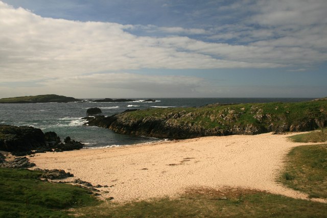
Geodha Bun na Beirn is a prominent coastal feature located in Argyllshire, Scotland. It is classified as a headland or a point, jutting out into the sea and offering stunning views of the surrounding landscape. Situated on the western coast of Scotland, it is part of the beautiful and rugged coastline that characterizes the region.
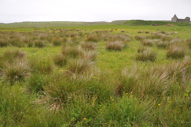
Geodha Bun na Beirn is known for its dramatic cliffs that rise sharply from the sea, creating a striking visual contrast against the deep blue waters. These cliffs are composed of ancient rock formations, showcasing the geological history of the area. The headland is also home to a diverse range of flora and fauna, with seabirds nesting on its ledges and wildflowers dotting the grassy slopes.
The coastal feature is a popular spot for nature enthusiasts and hikers, who are drawn to its natural beauty and tranquility. The headland offers several walking trails, allowing visitors to explore its rugged terrain and appreciate the stunning panoramic views it offers. On a clear day, one can see the distant islands and the vast expanse of the Atlantic Ocean.
Geodha Bun na Beirn is also steeped in history, with evidence of human habitation dating back thousands of years. Archaeological remains, such as ancient settlements and burial sites, have been discovered in the vicinity, highlighting the area's importance throughout the ages.
Overall, Geodha Bun na Beirn is a captivating coastal feature, combining stunning natural beauty, rich history, and a sense of tranquility that makes it a must-visit destination for anyone exploring the Argyllshire region of Scotland.
If you have any feedback on the listing, please let us know in the comments section below.
Geodha Bun na Beirn Images
Images are sourced within 2km of 55.694711/-6.5170343 or Grid Reference NR1653. Thanks to Geograph Open Source API. All images are credited.


Geodha Bun na Beirn is located at Grid Ref: NR1653 (Lat: 55.694711, Lng: -6.5170343)
Unitary Authority: Argyll and Bute
Police Authority: Argyll and West Dunbartonshire
What 3 Words
///awestruck.treat.gloves. Near Portnahaven, Argyll & Bute
Nearby Locations
Related Wikis

Islay LIMPET
Islay LIMPET was the world's first commercial wave power device and was connected to the United Kingdom's National Grid. == History == Islay LIMPET (Land...

Eilean Mhic Coinnich
Eilean Mhic Coinnich, also known as Mackenzie Island (although recorded on the Land Register as McKenseys Island), is an uninhabited island of 17.3 hectares...

Portnahaven
Portnahaven (Scottish Gaelic: Port na h-Abhainne, meaning river port) is a village on Islay in the Inner Hebrides, Scotland. The village is within the...

Orsay, Inner Hebrides
Orsay (Scottish Gaelic: Orasaigh) is a small island in the Inner Hebrides of Scotland. It lies a short distance off the west coast of the island of Islay...
Nearby Amenities
Located within 500m of 55.694711,-6.5170343Have you been to Geodha Bun na Beirn?
Leave your review of Geodha Bun na Beirn below (or comments, questions and feedback).