Geodh' an Tairbh

Coastal Feature, Headland, Point in Inverness-shire

Scotland

Geodh' an Tairbh

Biod an Athair High basalt crags by Dunvegan Head. View from the Ramasaig road south of Glendale.
Biod an Athair Credit: Richard Webb

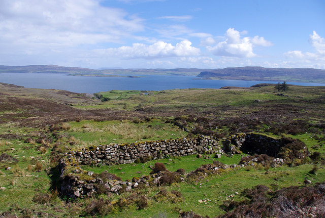
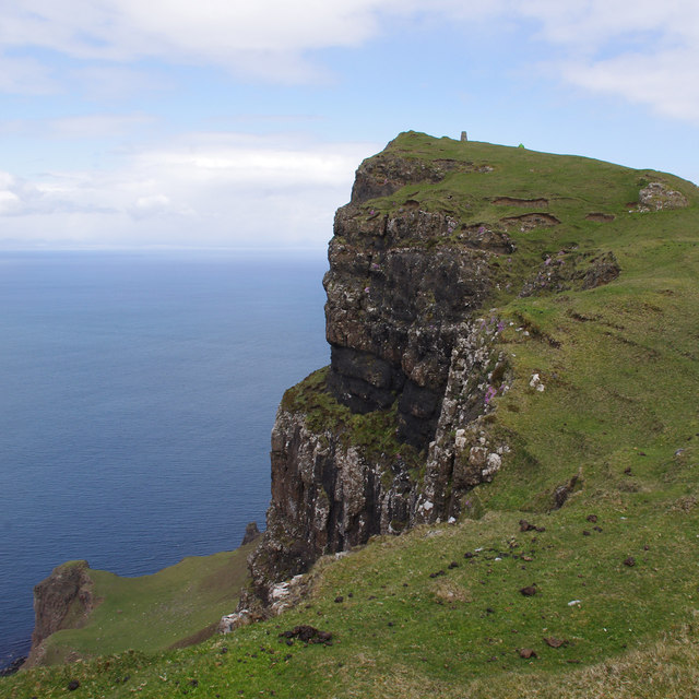
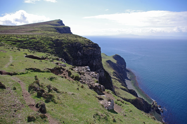
Geodh' an Tairbh, located in Inverness-shire, Scotland, is a prominent coastal feature known for its stunning headland and point. This picturesque site is situated on the western coast of Scotland, overlooking the North Atlantic Ocean.

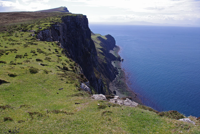
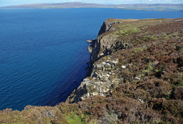
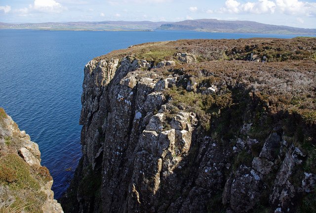
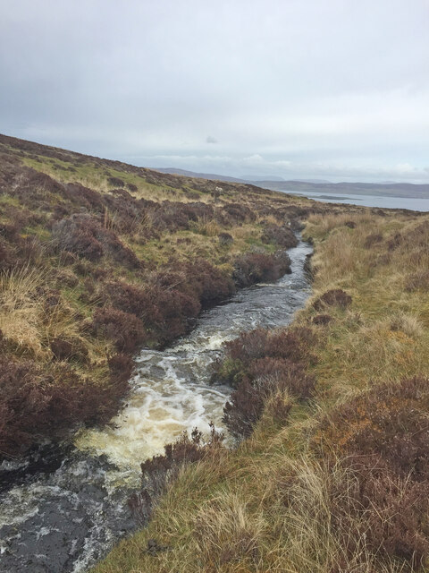
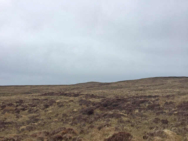
Geodh' an Tairbh stands out due to its rugged terrain and dramatic cliffs that jut out into the sea. The headland offers breathtaking panoramic views of the surrounding landscapes, with its towering rocks and crashing waves creating a mesmerizing spectacle. The point serves as a natural boundary, separating the vast ocean from the adjacent land.

The area is rich in biodiversity, attracting a variety of marine and bird species. Visitors may spot seals, dolphins, and various seabirds, adding to the allure of Geodh' an Tairbh. The coastal feature also offers opportunities for outdoor activities such as hiking, birdwatching, and photography.

The geological composition of Geodh' an Tairbh is of great interest to researchers and geologists. The headland exhibits layers of sedimentary rock, showcasing the history of the region's geological evolution over millions of years.

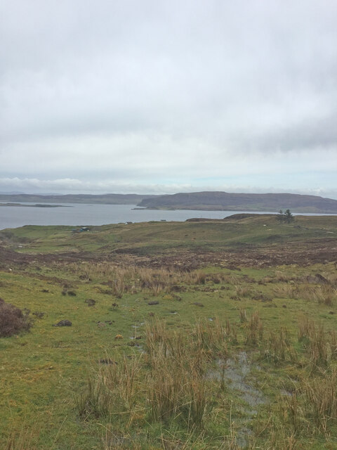
Access to Geodh' an Tairbh is convenient, with a well-maintained path leading to the headland. Visitors can explore the area safely while taking in the breathtaking scenery and immersing themselves in the tranquility of the surroundings.

Overall, Geodh' an Tairbh stands as a remarkable coastal feature, captivating visitors with its rugged beauty, diverse wildlife, and geological significance. It is a must-visit destination for nature enthusiasts and those seeking a peaceful escape along the Scottish coastline.

If you have any feedback on the listing, please let us know in the comments section below.

Geodh' an Tairbh Images

Images are sourced within 2km of 57.503934/-6.7389657 or Grid Reference NG1655. Thanks to Geograph Open Source API. All images are credited.

Biod an Athair High basalt crags by Dunvegan Head. View from the Ramasaig road south of Glendale.
Biod an Athair
High basalt crags by Dunvegan Head. View from the Ramasaig road south of Glendale.
Geodha na Gliongraich Pinnacle at the southern bound of Geodha na Gliongraich, a geo or gully 400m south of the summit of Biod an Athair.
Geodha na Gliongraich
Pinnacle at the southern bound of Geodha na Gliongraich, a geo or gully 400m south of the summit of Biod an Athair.
Ruin above Galtrigill This is clearly the same ruined croft or blackhouse as shown in <a href="https://www.geograph.org.uk/photo/3955062">NG1754 : Ruined croft above Galtrigill</a>.
Ruin above Galtrigill
This is clearly the same ruined croft or blackhouse as shown in NG1754 : Ruined croft above Galtrigill.
Ruin below Biod an Athair I presume these are remains of an old settlement, which are in an area of lazy beds.
Ruin below Biod an Athair
I presume these are remains of an old settlement, which are in an area of lazy beds.
Biod an Athair It was too windy to dwell near the edge, or try to work out how the sheep get to and from that shelf below (Scorgruim).
Biod an Athair
It was too windy to dwell near the edge, or try to work out how the sheep get to and from that shelf below (Scorgruim).
Flush bracket S9357 On the trig point on Biod an Athair (313m). See <a href="https://www.geograph.org.uk/photo/1048165">NG1554 : Biod an Athair trig point</a>.
Flush bracket S9357
On the trig point on Biod an Athair (313m). See NG1554 : Biod an Athair trig point.
Scorgruim Looking down from the cliff top (Biod an Athair) to the shelf below. It can be difficult to distinguish the sheep from the fallen rocks.
Scorgruim
Looking down from the cliff top (Biod an Athair) to the shelf below. It can be difficult to distinguish the sheep from the fallen rocks.
Cliffs north of Biod an Athair The grassy shelf below is Scorgruim.
The Outer Hebrides are on the horizon.
Cliffs north of Biod an Athair
The grassy shelf below is Scorgruim. The Outer Hebrides are on the horizon.
Cliffs north of Biod an Athair The grassy shelf below is Scorgruim.
The Outer Hebrides are on the horizon.
Cliffs north of Biod an Athair
The grassy shelf below is Scorgruim. The Outer Hebrides are on the horizon.
Dunvegan Head Looking across Loch Dunvegan to Waternish.
Dunvegan Head
Looking across Loch Dunvegan to Waternish.
Ravine south of Dunvegan Head Looking across Loch Dunvegan to Waternish.
Ravine south of Dunvegan Head
Looking across Loch Dunvegan to Waternish.
Geodha na Gliongraich A deep geodha in the high cliff-line south of Biod an Athair, with a big open view across the Minch to North Uist.

Forbes' Place Names of Skye (1923) gives a translation of "creek of the jingling or tinkling noise or sound".
Geodha na Gliongraich
A deep geodha in the high cliff-line south of Biod an Athair, with a big open view across the Minch to North Uist. Forbes' Place Names of Skye (1923) gives a translation of "creek of the jingling or tinkling noise or sound".
Biod an Athair from the south Looking towards the trig on the 313m summit of Biod an Athair -  the highest point on any of Skye's many sea cliffs.
Biod an Athair from the south
Looking towards the trig on the 313m summit of Biod an Athair - the highest point on any of Skye's many sea cliffs.
View to Loch Dunvegan on the way to Dunvegan Head Trig Point
Galtrigill Burn on the way to Dunvegan Head Trig Point
View towards Dunvegan Head Trig Point Still some distance to go across pathless rough, tough moorland
View towards Dunvegan Head Trig Point
Still some distance to go across pathless rough, tough moorland
View to Loch Dunvegan on the way to Dunvegan Head Trig Point
Dunvegan Head Trig Point Flush Bracket S9357
Show me another place!

Geodh' an Tairbh is located at Grid Ref: NG1655 (Lat: 57.503934, Lng: -6.7389657)

Unitary Authority: Highland

Police Authority: Highlands and Islands

What 3 Words

///custodian.reheat.handbag. Near Glendale, Highland

Nearby Locations

Geodh' an Tairbh

Related Wikis

Galtrigill

Galtrigill (Scottish Gaelic: Galtraigil) is a largely abandoned crofting township on the far north end of the east side of the Duirinish peninsula on the...

Borreraig

Borreraig (Scottish Gaelic: Boraraig) is a crofting settlement in Duirinish, north-west of Dunvegan on the Isle of Skye. The ancient and famous MacCrimmon...

Loch Dunvegan

Loch Dunvegan (Scottish Gaelic: Loch Dhùn Bheagain), is a sea loch on the west coast of the island of Skye in the Inner Hebrides of Scotland. Dunvegan...

Uig, Duirinish

Uig is a hamlet 14 miles (23 km) south west of Uig in Snizort, on the eastern shore of Loch Dunvegan, in the civil parish of Duirinish, on the Isle of...

Have you been to Geodh' an Tairbh?

Leave your review of Geodh' an Tairbh below (or comments, questions and feedback).