Loch Chollaim

Sea, Estuary, Creek in Inverness-shire

Scotland

Loch Chollaim

Loch Chliuthair This inlet opens in to Loch Cluer, another of the eastern Harris sea-lochs.
Loch Chliuthair Credit: Anne Burgess

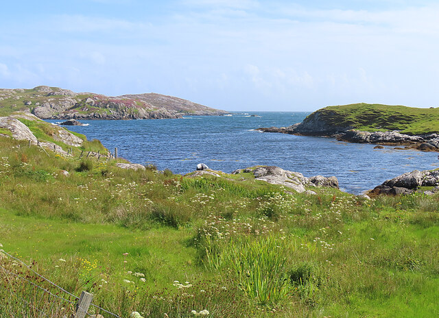
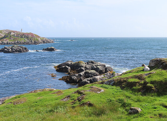
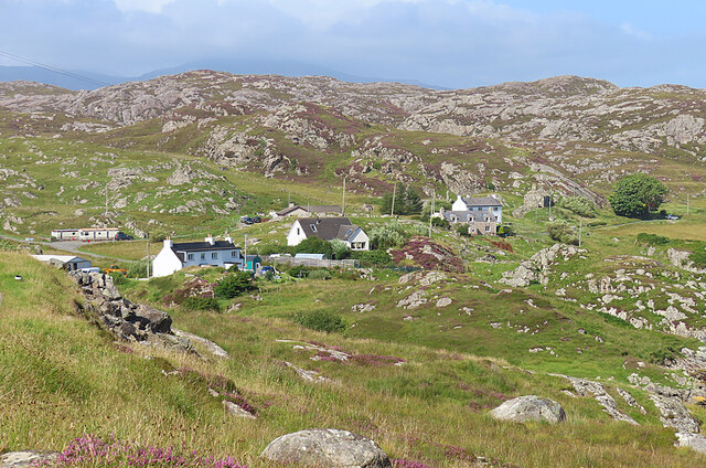
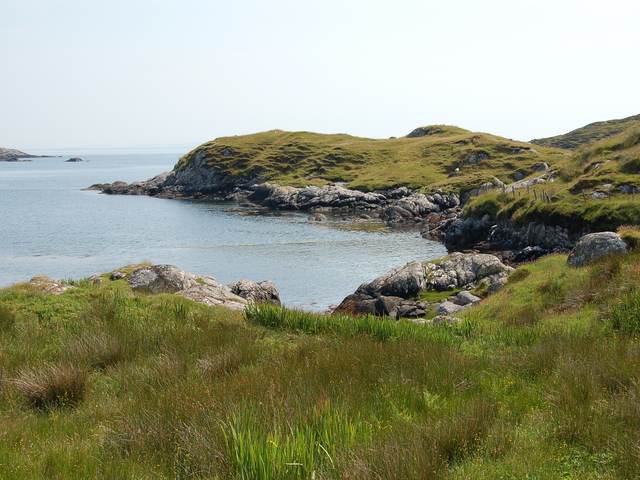
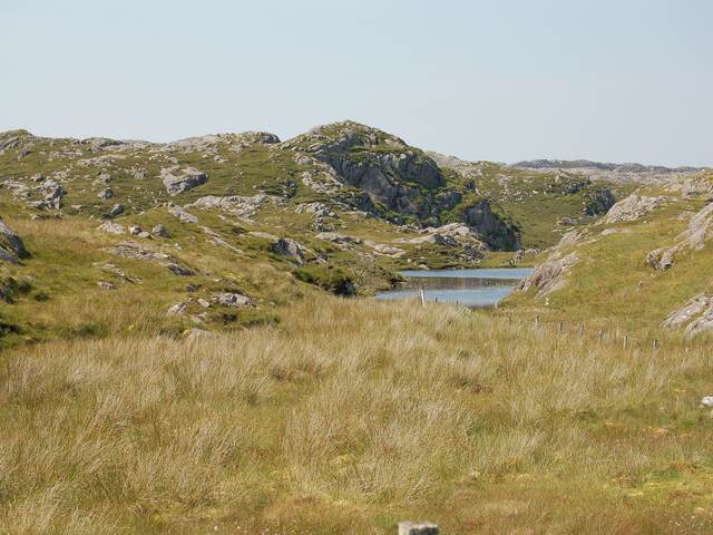
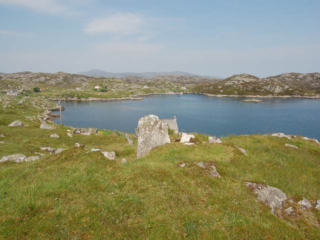
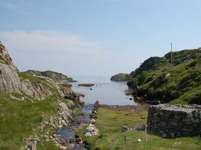
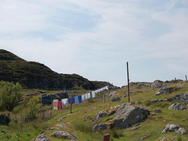
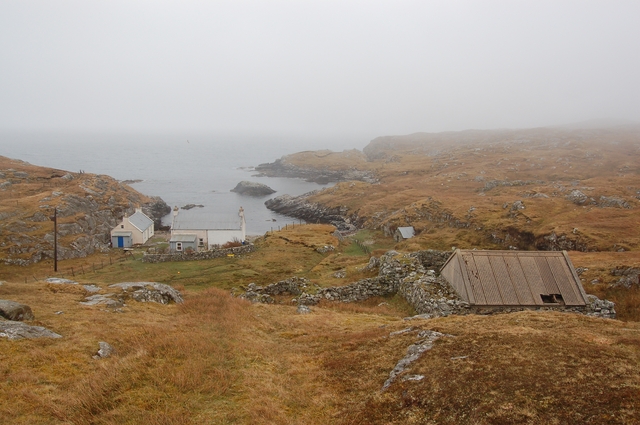
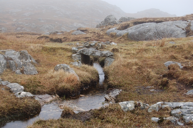
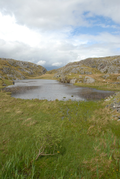
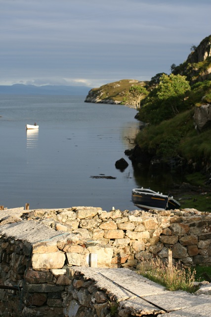
Loch Chollaim is a sea loch located in Inverness-shire, Scotland. It is a narrow body of water that extends inland from the North Sea, creating a picturesque and tranquil landscape. The loch is surrounded by rolling hills and lush greenery, making it a popular destination for nature enthusiasts and outdoor enthusiasts.

The waters of Loch Chollaim are brackish, meaning they are a mix of saltwater from the sea and freshwater from nearby rivers and streams. This unique blend of water creates a diverse ecosystem that supports a variety of marine life, including fish, crustaceans, and seabirds.

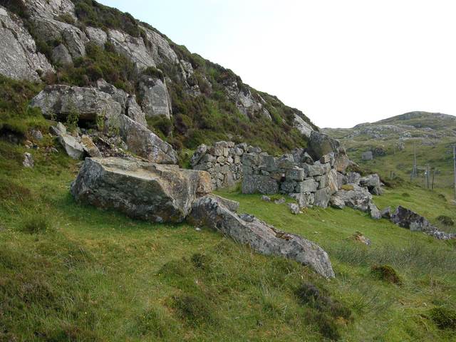
In addition to its natural beauty, Loch Chollaim also has historical significance, with several ancient ruins and archaeological sites located along its shores. Visitors can explore these remnants of the past while taking in the stunning views of the loch and surrounding countryside.

Overall, Loch Chollaim is a peaceful and idyllic destination for those looking to escape the hustle and bustle of city life and immerse themselves in the beauty of the Scottish Highlands.

If you have any feedback on the listing, please let us know in the comments section below.

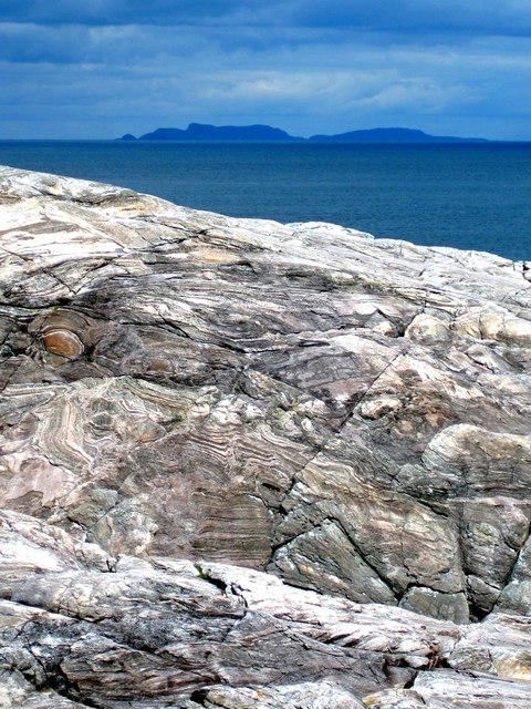
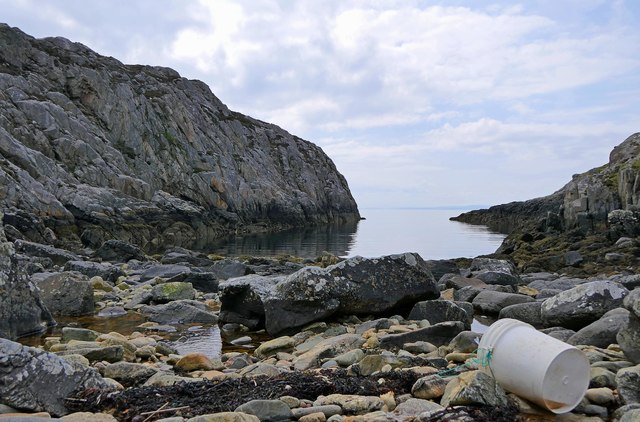
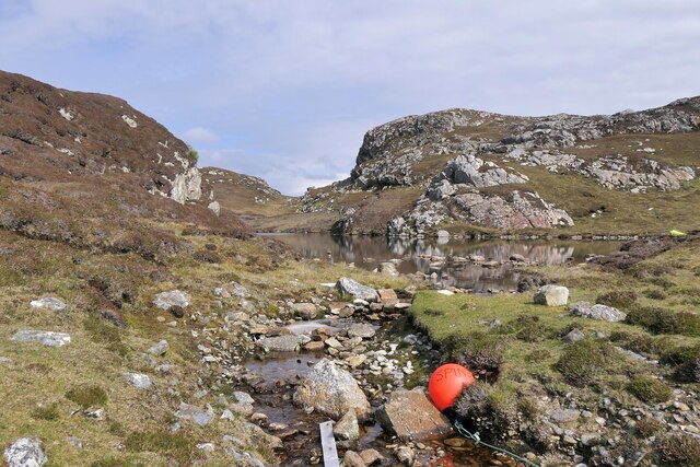
Loch Chollaim Images

Images are sourced within 2km of 57.816222/-6.783411 or Grid Reference NG1690. Thanks to Geograph Open Source API. All images are credited.

Loch Chliuthair This inlet opens in to Loch Cluer, another of the eastern Harris sea-lochs.
Loch Chliuthair
This inlet opens in to Loch Cluer, another of the eastern Harris sea-lochs.
Loch Cluer Loch Chliuthair in Gaelic takes its name from the village of Cliuthar, anglicised as Cluer.
Loch Cluer
Loch Chliuthair in Gaelic takes its name from the village of Cliuthar, anglicised as Cluer.
Collam A handful of houses beside Loch Ghreosabhaigh.
Collam
A handful of houses beside Loch Ghreosabhaigh.
Fish Farm In the outer part of Loch Ghreosabhagh. I take it that the poles and nets are to discourage birds form taking the fish.
Fish Farm
In the outer part of Loch Ghreosabhagh. I take it that the poles and nets are to discourage birds form taking the fish.
Lewisian Gneiss with the Shiant Isles behind Magnificent swirls of Lewisian Gneiss just south of Mol Ban in South Harris.
Lewisian Gneiss with the Shiant Isles behind
Magnificent swirls of Lewisian Gneiss just south of Mol Ban in South Harris.
Mol Bhi, Harris Mol Bhi (or Mol Vee) is an inlet on Loch Ghreosabhagh.
Mol Bhi, Harris
Mol Bhi (or Mol Vee) is an inlet on Loch Ghreosabhagh.
Outflow from Loch Chumain, Harris The buoy is from a boat called Spindrift, possibly SY128, a Stornoway registered potter (boat used to catch shellfish).
Outflow from Loch Chumain, Harris
The buoy is from a boat called Spindrift, possibly SY128, a Stornoway registered potter (boat used to catch shellfish).
The head of Loch Cliuthair
Loch na Buaile A small loch in a marshy hollow near Cliuthar.
Loch na Buaile
A small loch in a marshy hollow near Cliuthar.
Ghreosabhagh A view of the settlement of Ghreosabhagh looking across the top of Loch Ghreosabhagh.
Ghreosabhagh
A view of the settlement of Ghreosabhagh looking across the top of Loch Ghreosabhagh.
The head of Loch Chollaim The burn entering the sea here has been canalised to the left side of the head of the loch to provide some flat dry ground for sheep fanks, the edge of which can be seen on the right.
The head of Loch Chollaim
The burn entering the sea here has been canalised to the left side of the head of the loch to provide some flat dry ground for sheep fanks, the edge of which can be seen on the right.
Washing at Scadabhagh Taking advantage of a good drying day.
Washing at Scadabhagh
Taking advantage of a good drying day.
Old building at Scadabhagh A drystone construction of partly dressed gneiss using a small cliff for support. I would think agricultural rather than residential, and probably relatively recent.
Old building at Scadabhagh
A drystone construction of partly dressed gneiss using a small cliff for support. I would think agricultural rather than residential, and probably relatively recent.
Mol Ban Amazingly, in my opinion, the only access to this house is along a kilometre of ancient cart track. It is possible to use a wheelbarrow of the type with a ball for a wheel, but that apart no vehicles can get here - not even quads.
The photograph is taken from, and looking along, the end of the grassy track.
Mol Ban
Amazingly, in my opinion, the only access to this house is along a kilometre of ancient cart track. It is possible to use a wheelbarrow of the type with a ball for a wheel, but that apart no vehicles can get here - not even quads. The photograph is taken from, and looking along, the end of the grassy track.
Bridge on the track to Mol Ban The ancient cart track to Mol Ban <a href="https://www.geograph.org.uk/photo/396118">NG1590 : Mol Ban</a> crosses several burns by way of beautifully constructed stone bridges such as this.
Bridge on the track to Mol Ban
The ancient cart track to Mol Ban NG1590 : Mol Ban crosses several burns by way of beautifully constructed stone bridges such as this.
Loch Mich Neacail, from Collam bridge Excellent views of local raven over the Loch.
Loch Mich Neacail, from Collam bridge
Excellent views of local raven over the Loch.
Loch Chollaim, Isle of Harris
Loch view from Collom, Isle of Harris
Show me another place!

Loch Chollaim is located at Grid Ref: NG1690 (Lat: 57.816222, Lng: -6.783411)

Unitary Authority: Na h-Eileanan an Iar

Police Authority: Highlands and Islands

What 3 Words

///tracking.digesting.sometimes. Near Tarbert, Na h-Eileanan Siar

Related Wikis

Stockinish Island

Stockinish Island (Scottish Gaelic: Eilean Stocainis) is an uninhabited island off Harris, in the Outer Hebrides. == Geography and geology == Stockinish...

East Loch Tarbert

East Loch Tarbert (Scottish Gaelic: Loch an Tairbeairt) is a sea loch that lies to the east of Harris in the Outer Hebrides of Scotland. The loch contains...

Sgeotasaigh

Scotasay (Scottish Gaelic: Sgeotasaigh) is small island in the Outer Hebrides of Scotland. It lies 1 kilometre (0.6 miles) off the east coast of Harris...

Scalpay, Outer Hebrides

Scalpay (; Scottish Gaelic: Sgalpaigh or Sgalpaigh na Hearadh; i.e. "Scalpay of Harris" to distinguish it from Scalpay off Skye) is an island in the Outer...

Nearby Amenities

Located within 500m of 57.816222,-6.783411
Power: pole
Lat/Long: 57.8149133/-6.790785
Power: pole
Lat/Long: 57.8152891/-6.7895096
The data included in this document is from www.openstreetmap.org. The data is made available under ODbL.

Have you been to Loch Chollaim?

Leave your review of Loch Chollaim below (or comments, questions and feedback).