An Oitir

Beach in Sutherland

Scotland

An Oitir

Tongue Bay and the Rabbit Islands This is the most westerly of the Rabbit Islands (Eilean nan Gaill), and seems to be just the highest. The link, walkable at low tide, to the middle island is seen on the right.
Tongue Bay and the Rabbit Islands Credit: David Purchase

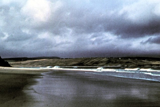
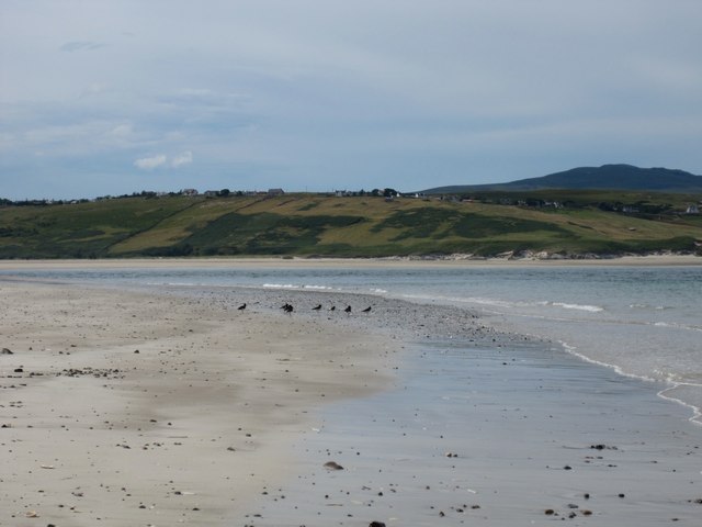
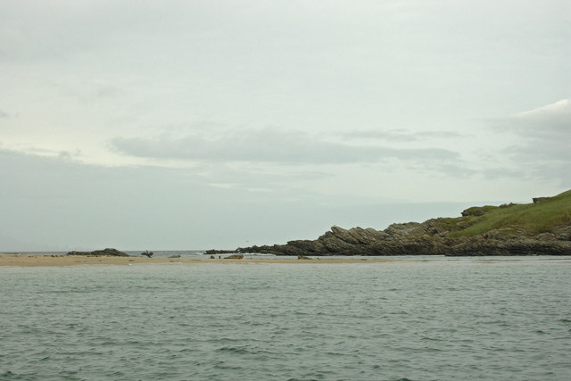
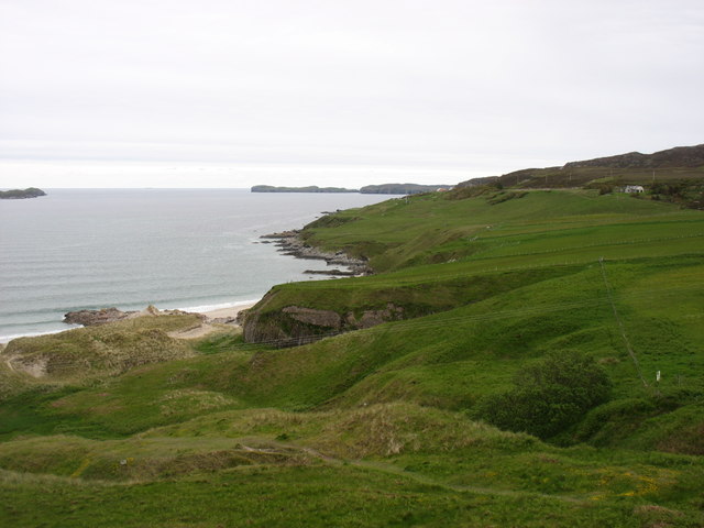
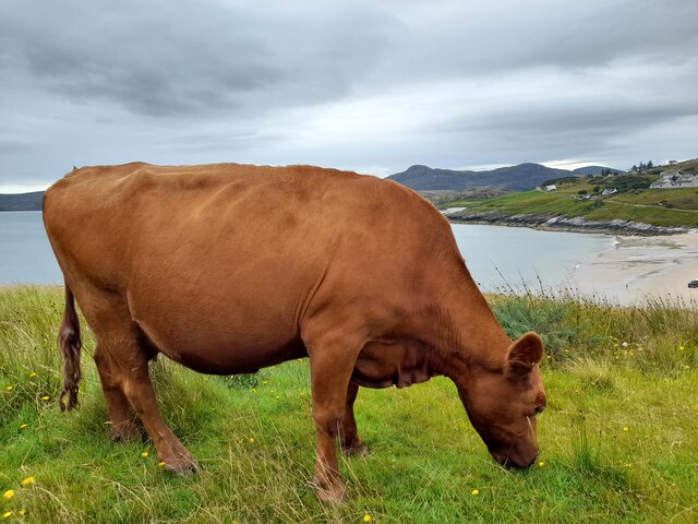
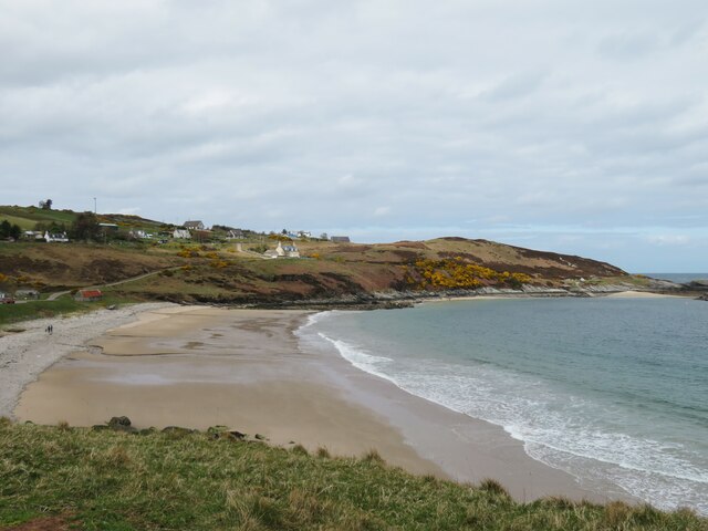
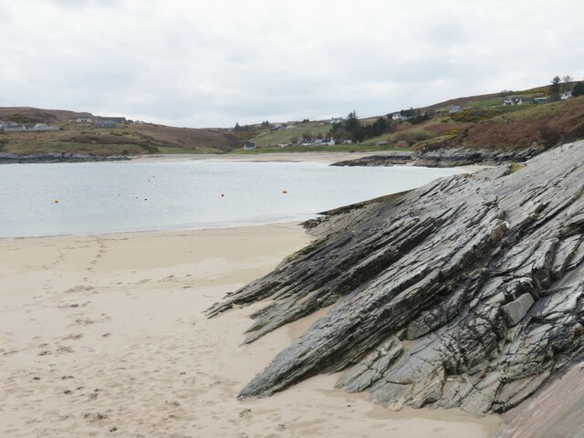
An Oitir, located in Sutherland, Scotland, is a picturesque and secluded beach that boasts natural beauty and tranquility. With its unspoiled coastline, golden sands, and crystal-clear turquoise waters, it offers a stunning setting for beach lovers and nature enthusiasts alike.

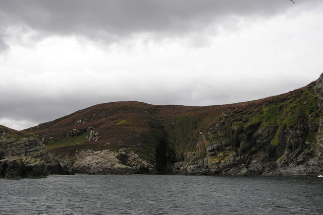
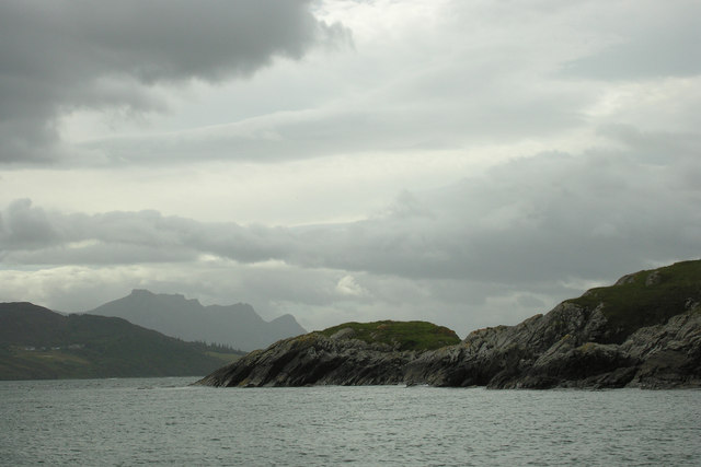
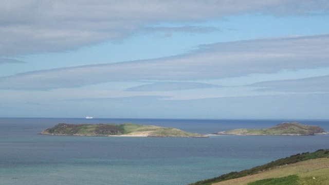
Situated on the northwestern coast of Scotland, An Oitir is surrounded by rugged cliffs and rolling hills, providing a dramatic backdrop to the beach. Its remote location ensures that it remains relatively uncrowded, allowing visitors to enjoy a sense of solitude and peacefulness.

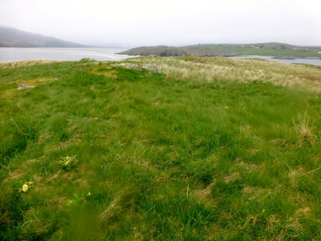
The beach at An Oitir is known for its pristine condition and clean waters, making it ideal for swimming, sunbathing, and picnicking. The beach is also a popular spot for birdwatching, as it attracts various seabirds, including puffins, guillemots, and razorbills.

Surrounding the beach are several walking trails that offer stunning views of the coastline and the nearby mountains. These paths provide an opportunity to explore the surrounding nature and spot wildlife, such as seals and dolphins, which are occasionally seen in the waters.

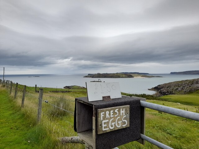
While An Oitir lacks facilities such as cafes or restrooms, its untouched and natural state is part of its charm. Visitors are advised to bring their own food, water, and any other amenities they may need.

Overall, An Oitir in Sutherland is a hidden gem that offers a serene and beautiful beach experience amidst stunning Scottish landscapes. Its remote location and unspoiled nature make it a must-visit destination for those seeking tranquility and natural beauty.

If you have any feedback on the listing, please let us know in the comments section below.

An Oitir Images

Images are sourced within 2km of 58.525697/-4.4059942 or Grid Reference NC5962. Thanks to Geograph Open Source API. All images are credited.
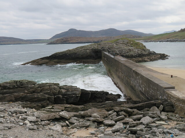
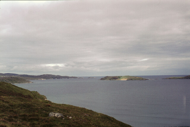
Tongue Bay and the Rabbit Islands This is the most westerly of the Rabbit Islands (Eilean nan Gaill), and seems to be just the highest. The link, walkable at low tide, to the middle island is seen on the right.
Tongue Bay and the Rabbit Islands
This is the most westerly of the Rabbit Islands (Eilean nan Gaill), and seems to be just the highest. The link, walkable at low tide, to the middle island is seen on the right.
Coldbackie beach - 1978 Coldbackie beach, Kyle of Tongue.
Coldbackie beach - 1978
Coldbackie beach, Kyle of Tongue.
Coldbackie beach - Kyle of Tongue A parcel of oystercatchers spotted on the beach at the mouth of the kyle. The most westerly bay is only accessible at low tide. The township of Melness is seen across the kyle. The houses are those featured in the photograph taken in 1978 <a href="https://www.geograph.org.uk/photo/2965631">NC6060 : Coldbackie beach - 1978</a>.
Coldbackie beach - Kyle of Tongue
A parcel of oystercatchers spotted on the beach at the mouth of the kyle. The most westerly bay is only accessible at low tide. The township of Melness is seen across the kyle. The houses are those featured in the photograph taken in 1978 NC6060 : Coldbackie beach - 1978.
Grey Atlantic seals on the Rabbit Islands Seals hauled out on the sandy spit that connects two of the three islands that make up the Rabbit Islands.
Grey Atlantic seals on the Rabbit Islands
Seals hauled out on the sandy spit that connects two of the three islands that make up the Rabbit Islands.
Sheltered bay in the sandstone cliffs of the Rabbit Islands A sheltered bay suitable for small craft only. The bay terminates in a narrow geo.
Sheltered bay in the sandstone cliffs of the Rabbit Islands
A sheltered bay suitable for small craft only. The bay terminates in a narrow geo.
South headland of the Rabbit Islands The south end of the Rabbit Islands. The backdrop is the 765 metre high Ben Loyal. An Caisteal and its many outliers.
South headland of the Rabbit Islands
The south end of the Rabbit Islands. The backdrop is the 765 metre high Ben Loyal. An Caisteal and its many outliers.
Rabbit Island South Bagged on a boat trip with 8 other island TUMP baggers on a grey afternoon. We were able to walk across the sand to Rabbit Island South for our 6th island TUMP.
Name: Rabbit Island South
Hill number:10099
Height:45m / 148ft
Parent (Ma/M):none
Area:16B: Durness to Loch Shin
Class:0
Grid ref:NC602630 (est)
Drop:45m
Col:Sea
Rabbit Island South
Bagged on a boat trip with 8 other island TUMP baggers on a grey afternoon. We were able to walk across the sand to Rabbit Island South for our 6th island TUMP. Name: Rabbit Island South Hill number:10099 Height:45m / 148ft Parent (Ma/M):none Area:16B: Durness to Loch Shin Class:0 Grid ref:NC602630 (est) Drop:45m Col:Sea
Rabbit Island North Bagged on a boat trip with 8 other island TUMP baggers on a grey afternoon. This was our 5th island TUMP and we were able to walk across the sand to Rabbit Island South for our 6th island TUMP.
Name: Rabbit Island North
Hill number:10103
Height:44m / 144ft
Parent (Ma/M):none
Area:16B: Durness to Loch Shin
Class:0
Grid ref:NC609636 (est)
Drop:44m
Col:Sea
Rabbit Island North
Bagged on a boat trip with 8 other island TUMP baggers on a grey afternoon. This was our 5th island TUMP and we were able to walk across the sand to Rabbit Island South for our 6th island TUMP. Name: Rabbit Island North Hill number:10103 Height:44m / 144ft Parent (Ma/M):none Area:16B: Durness to Loch Shin Class:0 Grid ref:NC609636 (est) Drop:44m Col:Sea
Tongue Bay at Coldbackie Eilean nan Ron in the distance, centre. Rabbit Islands on the left.
Tongue Bay at Coldbackie
Eilean nan Ron in the distance, centre. Rabbit Islands on the left.
Rabbit Islands Islands in the Kyle of Tongue. View from the A836 at Woodend.
Rabbit Islands
Islands in the Kyle of Tongue. View from the A836 at Woodend.
Ard Skinid lochan
Ard Skinid lochan
Roses at Talmine A fine perfume from these roses.
Roses at Talmine
A fine perfume from these roses.
Cow and Talmine Bay
Cow and Talmine Bay
The Good Eggs of Skinnet A half-dozen purchased.
The Good Eggs of Skinnet
A half-dozen purchased.
Talmine Bay and beach Not exactly crowded with sun worshippers or bathers, but with the temperature around 8C it wouldn't be too tempting.
Talmine Bay and beach
Not exactly crowded with sun worshippers or bathers, but with the temperature around 8C it wouldn't be too tempting.
Sands at Talmine Sandy beach backed by angled Moinian rocks.
Sands at Talmine
Sandy beach backed by angled Moinian rocks.
Pier to Eilean Creagach The concrete pier helps to shield a tiny harbour from the ravages of the North Atlantic and links the tiny island to the mainland. The translation is 'Rocky Island', which seems appropriate.
Pier to Eilean Creagach
The concrete pier helps to shield a tiny harbour from the ravages of the North Atlantic and links the tiny island to the mainland. The translation is 'Rocky Island', which seems appropriate.
Talmine Pier and two islands The pier connects the mainland to the tiny Eilean Creagach [Rocky Island], whilst further out is one of the two Rabbit Islands, so named as they were populated with rabbits by the chief of the Mackay clan in the 18th century as a supply of meat for the table.
Talmine Pier and two islands
The pier connects the mainland to the tiny Eilean Creagach [Rocky Island], whilst further out is one of the two Rabbit Islands, so named as they were populated with rabbits by the chief of the Mackay clan in the 18th century as a supply of meat for the table.
Show me another place!

An Oitir is located at Grid Ref: NC5962 (Lat: 58.525697, Lng: -4.4059942)

Unitary Authority: Highland

Police Authority: Highlands and Islands

What 3 Words

///vipers.learning.hurricane. Near Altnaharra, Highland

Related Wikis

Tongue Bay

Tongue Bay (Scottish Gaelic: Tunga from Old Norse: Tunga) is located in northwest Highland, Scotland, in the western part of the former county of Sutherland...

Talmine, Sutherland

Talmine is a crofting and fishing township, overlooking Talmine Bay, an inlet on the western shore of Tongue Bay in northern Sutherland, Scottish Highlands...

Melness

Melness (Gaelic: Taobh Mhealanais) is a locality comprising a group of small remote crofting townships, lying to the west of Tongue Bay opposite Coldbackie...

Skullomie

Scullomie is a small fishing and crofting township at the head of Tongue Bay in Sutherland in the Scottish Highlands. It is located around 3 miles (4...

Related Videos

Paddleboard Scotland's NC500 #paddleboard #adventure #travel

Along Scotland's NC500 there are lots of places to paddle board so make sure to take your SUP with you and subscribe to find the ...

Coldbackie beach Scotland

Coldbackie beach Scotland (yes Scotland has beautiful beaches to rival anywhere else)

Nearby Amenities

Located within 500m of 58.525697,-4.4059942
Created By: almien_coastlines
Source: PGS
Lat/Long: 58.521685/-4.409409
Created By: almien_coastlines
Source: PGS
Lat/Long: 58.521816/-4.409171
Created By: almien_coastlines
Source: PGS
Lat/Long: 58.523096/-4.409222
Created By: almien_coastlines
Source: PGS
Lat/Long: 58.523607/-4.409242
Source: PGS
Lat/Long: 58.5236336/-4.4094556
Source: PGS
Lat/Long: 58.5238941/-4.4101422
Source: PGS
Lat/Long: 58.5245753/-4.4110124
Source: PGS
Lat/Long: 58.5248448/-4.4115783
Source: PGS
Lat/Long: 58.5253044/-4.4127665
Source: PGS
Lat/Long: 58.525121/-4.4128857
Source: PGS
Lat/Long: 58.5246084/-4.4135213
Source: PGS
Lat/Long: 58.5246658/-4.4138432
Created By: almien_coastlines
Source: PGS
Lat/Long: 58.524836/-4.41394
Created By: almien_coastlines
Source: PGS
Lat/Long: 58.525094/-4.413707
Source: PGS
Lat/Long: 58.5252848/-4.4137493
Source: PGS
Lat/Long: 58.5253428/-4.4139719
The data included in this document is from www.openstreetmap.org. The data is made available under ODbL.

Have you been to An Oitir?

Leave your review of An Oitir below (or comments, questions and feedback).