Newthorne Beach
Beach in Devon Torridge
England
Newthorne Beach
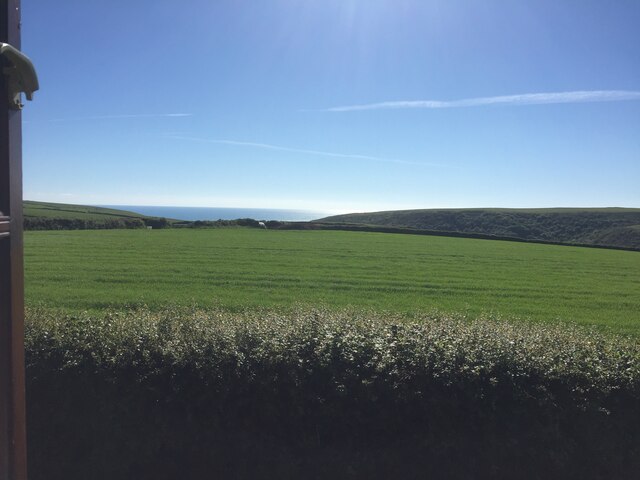
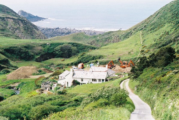
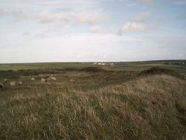
Newthorne Beach is a picturesque coastal retreat nestled along the rugged coastline of Devon, England. Located in the charming village of Newthorne, this beach offers a serene and tranquil escape for visitors seeking a peaceful seaside experience.
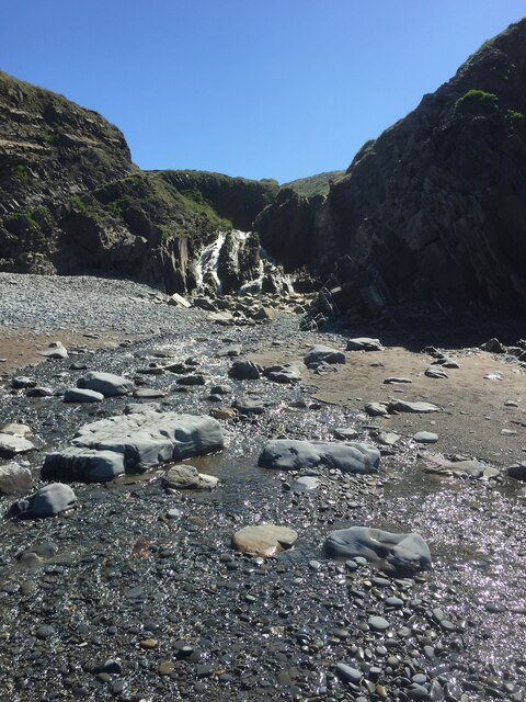
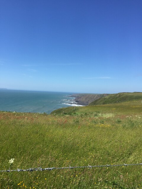
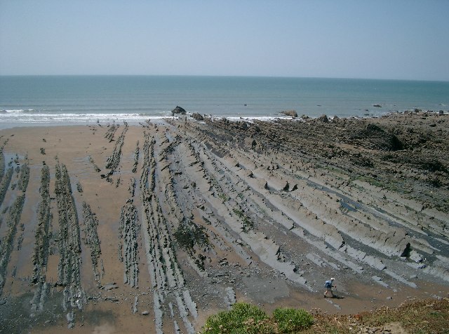
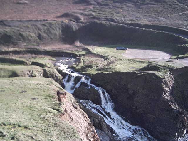
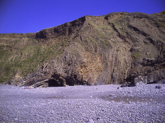
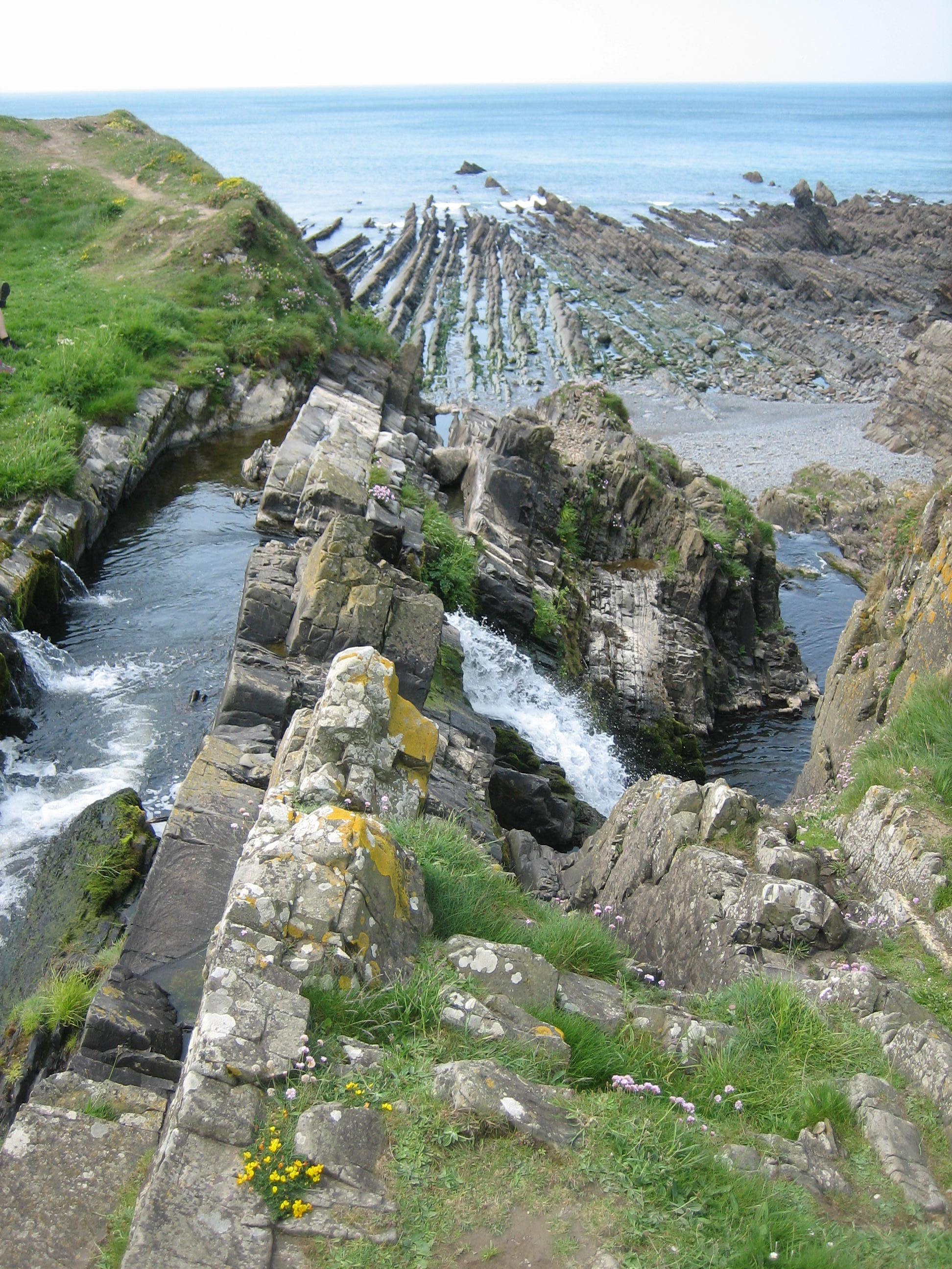
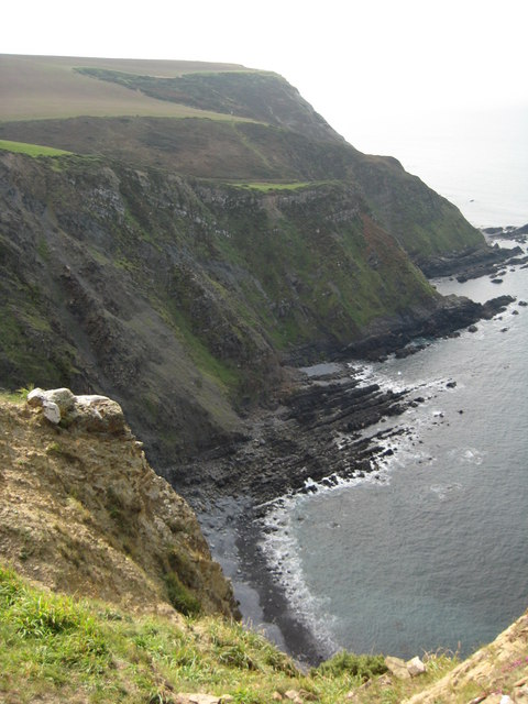
Stretching over a mile long, Newthorne Beach boasts soft golden sands that are perfect for long walks and sunbathing. The beach is framed by towering cliffs, creating a stunning backdrop that adds to its natural beauty. The crystal-clear waters of the English Channel gently lap against the shore, inviting swimmers and water enthusiasts to take a refreshing dip.
Due to its secluded location, Newthorne Beach is often less crowded than other popular beaches in the region, making it an ideal spot for those who prefer a quieter day by the sea. The beach is also known for its clean and well-maintained facilities, including public toilets and ample parking nearby.
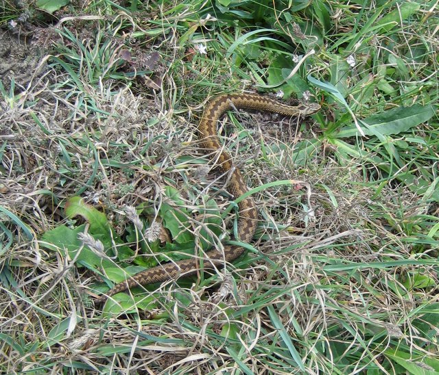
Nature lovers will be delighted by the abundance of wildlife that can be spotted at Newthorne Beach. Seagulls soar overhead, while curious rock pools reveal an array of fascinating marine creatures such as crabs, starfish, and small fish. The nearby cliffs provide a nesting ground for various seabirds, offering a wonderful opportunity for birdwatching enthusiasts.
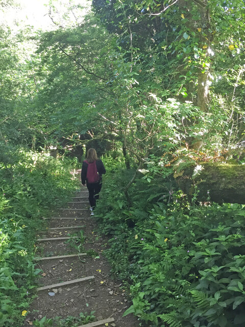
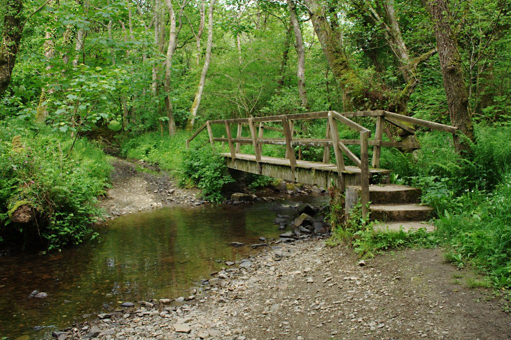
Visitors to Newthorne Beach can enjoy a leisurely stroll along the promenade, where charming beach huts and small cafes offer refreshments and snacks. The beach is also a popular spot for picnics, with plenty of grassy areas and benches available.
Overall, Newthorne Beach is a hidden gem on the Devon coastline, offering a peaceful and idyllic setting for a relaxing day by the sea.
If you have any feedback on the listing, please let us know in the comments section below.
Newthorne Beach Images
Images are sourced within 2km of 50.944938/-4.5431255 or Grid Reference SS2119. Thanks to Geograph Open Source API. All images are credited.

Newthorne Beach is located at Grid Ref: SS2119 (Lat: 50.944938, Lng: -4.5431255)
Administrative County: Devon
District: Torridge
Police Authority: Devon and Cornwall
What 3 Words
///paler.shrimps.jaws. Near Flexbury, Cornwall
Nearby Locations
Related Wikis

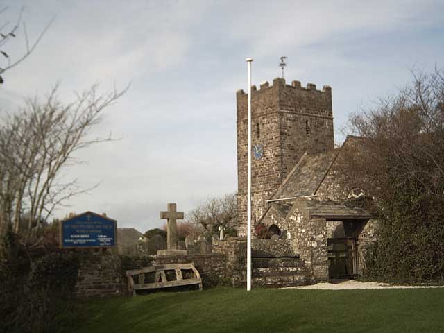
St Nectan's Church, Welcombe
St Nectan's Church is the parish church of Welcombe, on the border of Devon and Cornwall. W. G. Hoskins writes "St Nectan's Chapel was one of the many...
Welcombe
Welcombe is a village and civil parish on the coast of north Devon, England, just north of the border with Cornwall. It is part of the district of Torridge...

Gooseham Mill
Gooseham Mill is a hamlet in the parish of Morwenstow, Cornwall, England.The hamlet lies below Gooseham hamlet, in the Marsland valley. The county border...
Marsland Valley
Marsland Valley is a nature reserve situated in two large valleys which straddle the northern end of the Devon-Cornwall border. It is a designated nature...

RFA Green Ranger
RFA Green Ranger was a Ranger-class fleet support tanker of the Royal Fleet Auxiliary. On 24 September 1946, Green Ranger was struck by a torpedo in Portland...

Gooseham
Gooseham (Cornish: Pras an Woodh) is a hamlet in northeast Cornwall, England, United Kingdom. It is situated six miles (11 km) north of Bude and is approximately...
Steeple Point to Marsland Mouth
Steeple Point to Marsland Mouth is a coastal Site of Special Scientific Interest (SSSI) in Cornwall, England, UK, noted for its biological characteristics...
Church of St Morwenna and St John the Baptist, Morwenstow
The Church of St Morwenna and St John the Baptist is the parish church of Morwenstow, north Cornwall, England, United Kingdom, the most northerly parish...
Nearby Amenities
Located within 500m of 50.944938,-4.5431255Have you been to Newthorne Beach?
Leave your review of Newthorne Beach below (or comments, questions and feedback).