Coney Rock

Island in Devon Torridge

England

Coney Rock

Welcome Mouth Waterfall
Welcome Mouth Waterfall Credit: thejackrustles

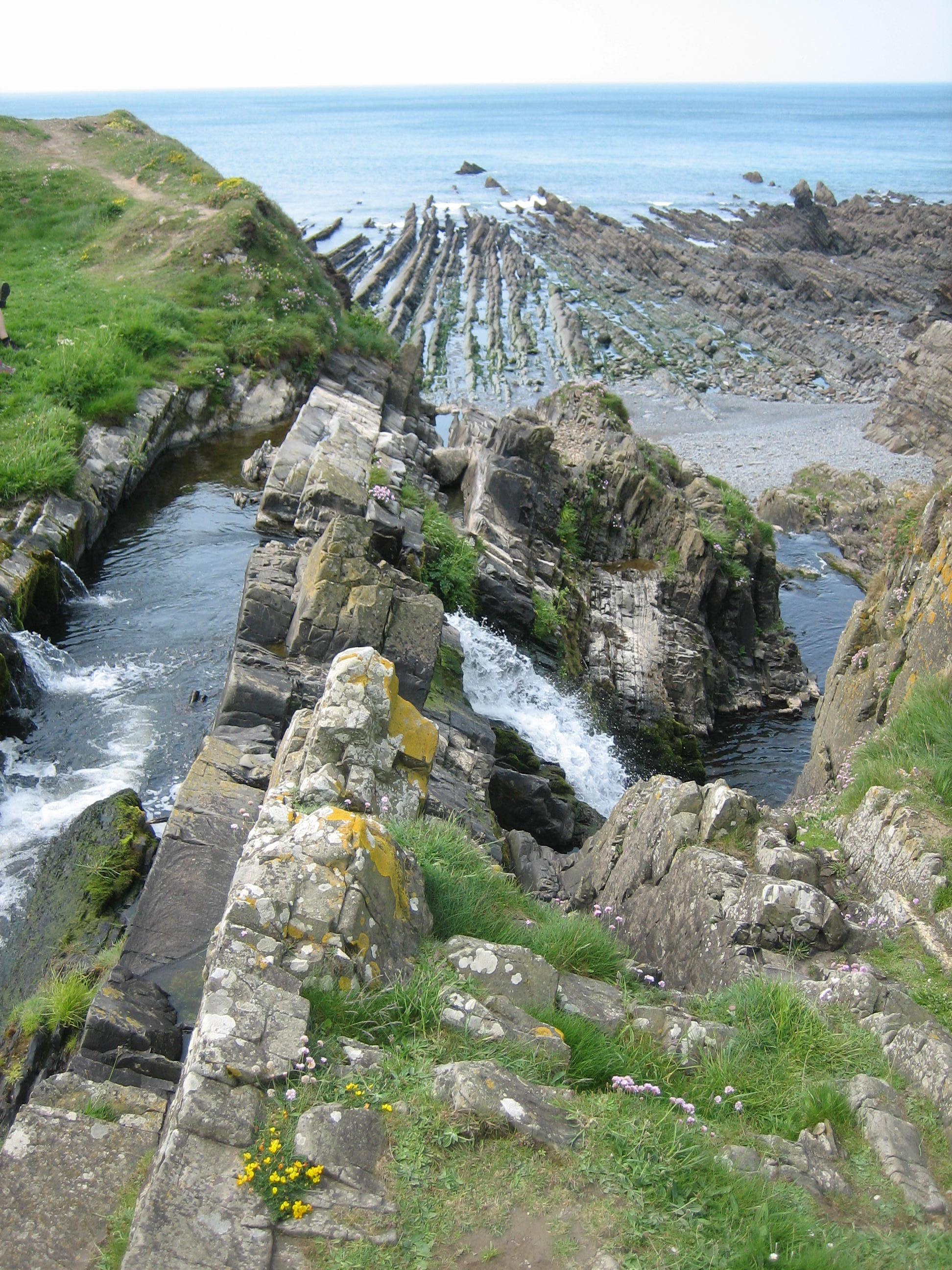
Coney Rock, also known as Coney Island, is a small island located off the coast of Devon, England. It is situated in the English Channel, approximately 2 miles south of the town of Ilfracombe. The island covers an area of about 8 acres and is accessible by boat or during low tide by foot.

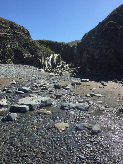
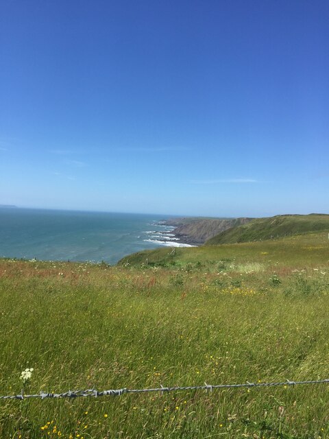
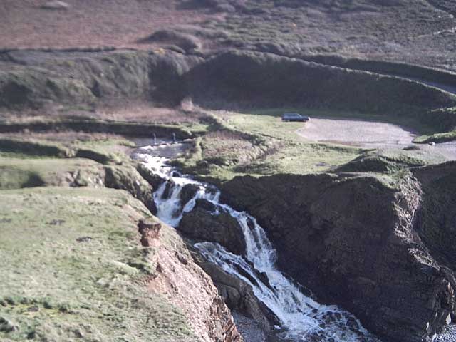
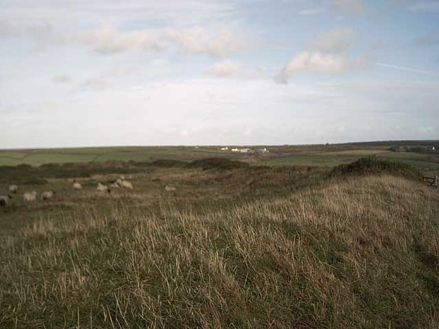
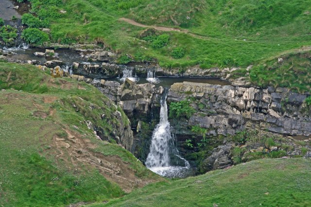
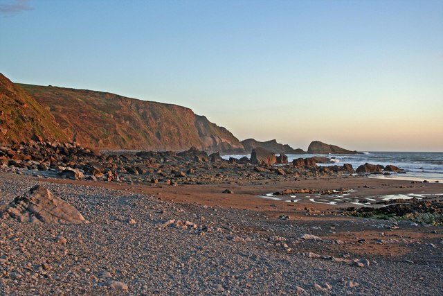
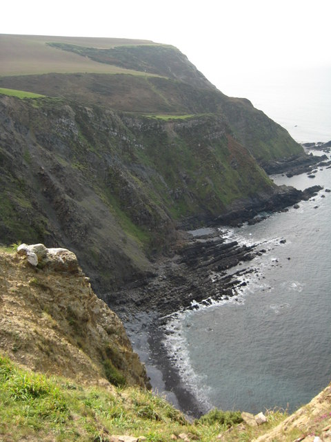
Coney Rock is characterized by its rugged and rocky terrain, with steep cliffs and rocky shores. The island is uninhabited and lacks any permanent structures or facilities. It is mainly visited by tourists and locals for its natural beauty and wildlife.

The island is a popular spot for birdwatching, as it serves as a nesting site for various seabirds, including guillemots, razorbills, and cormorants. The surrounding waters are also rich in marine life, making it a popular destination for snorkeling and diving.

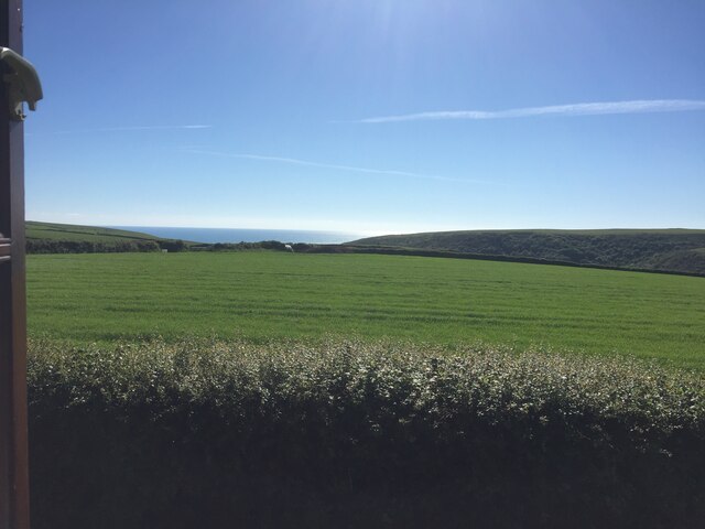
Coney Rock offers stunning panoramic views of the surrounding coastline and the Bristol Channel. On a clear day, visitors can even catch a glimpse of the distant Welsh coastline. The island's solitude and tranquility make it an ideal place for picnics and nature walks.

However, it is important to note that access to Coney Rock is subject to tidal conditions, as it is only accessible during low tide. Visitors must plan their visit accordingly and be aware of the changing tides to avoid being stranded on the island.

Overall, Coney Rock is a picturesque and serene island, offering visitors a chance to immerse themselves in nature and experience the beauty of the Devon coastline.

If you have any feedback on the listing, please let us know in the comments section below.

Coney Rock Images

Images are sourced within 2km of 50.951393/-4.5444747 or Grid Reference SS2119. Thanks to Geograph Open Source API. All images are credited.

Welcome Mouth Waterfall
Sea view from holiday cottage in Welcombe
Views out to sea near South Hole
Waterfalls at Welcombe Mouth Lots of rain recently, so lots of water for the waterfall. You can also see two people on the stepping stones.
Waterfalls at Welcombe Mouth
Lots of rain recently, so lots of water for the waterfall. You can also see two people on the stepping stones.
Embury Beacon An Iron-age promontory fort.
Embury Beacon
An Iron-age promontory fort.
West to Embury Beacon The hill in the distance ends abruptly with 500 ft. cliffs on the far side. From this point the sea is completely obscured.
West to Embury Beacon
The hill in the distance ends abruptly with 500 ft. cliffs on the far side. From this point the sea is completely obscured.
North of Putsole Farm View north over birchwood and gorse to the plantation around Golden Park.
North of Putsole Farm
View north over birchwood and gorse to the plantation around Golden Park.
An adder below Knap Head This adder (Vipera berus) was basking in the sun on the coast path as I was descending from Knap Head, my footsteps disturbed it, but I was able to photograph it quickly before it disappeared into the vegetation.  I think with its brown colouring this is a female.
An adder below Knap Head
This adder (Vipera berus) was basking in the sun on the coast path as I was descending from Knap Head, my footsteps disturbed it, but I was able to photograph it quickly before it disappeared into the vegetation. I think with its brown colouring this is a female.
Welcombe Mouth Waterfall
Evening at Welcombe Mouth View of beach and cliffs at Welcombe Mouth early evening
Evening at Welcombe Mouth
View of beach and cliffs at Welcombe Mouth early evening
Embury Beacon The defensive earthwork of Embury Beacon an Iron Age hill fort. The fort is situated above the cliffs on the coast and over time part of the hill fort has slipped into the sea as a result of coastal erosion.
Embury Beacon
The defensive earthwork of Embury Beacon an Iron Age hill fort. The fort is situated above the cliffs on the coast and over time part of the hill fort has slipped into the sea as a result of coastal erosion.
View north from Embury Beacon View north from the Iron Age hill fort on Embury Beacon. In the background the coastline stretches towards Hartland Point.
View north from Embury Beacon
View north from the Iron Age hill fort on Embury Beacon. In the background the coastline stretches towards Hartland Point.
Coast path at Embury Beacon The South West Coast Path passing the defensive earthwork protecting Embury Beacon hill fort.
Coast path at Embury Beacon
The South West Coast Path passing the defensive earthwork protecting Embury Beacon hill fort.
Bench on Knap Head Bench on Knap Head with the coast line stretching into the background.
Bench on Knap Head
Bench on Knap Head with the coast line stretching into the background.
Knap Head View north along the north Devon coast from Knap Head. The Hartland Quay hotel is just visible in the far distance.
Knap Head
View north along the north Devon coast from Knap Head. The Hartland Quay hotel is just visible in the far distance.
Grazing land near Knap Head Grazing land above the cliffs near Knap Head.
Grazing land near Knap Head
Grazing land above the cliffs near Knap Head.
Footpath to Welcombe Mouth Footpath sign on the coast path.
Footpath to Welcombe Mouth
Footpath sign on the coast path.
Welcombe Mouth Stream flowing into the sea at Welcombe Mouth.
Welcombe Mouth
Stream flowing into the sea at Welcombe Mouth.
Show me another place!

Coney Rock is located at Grid Ref: SS2119 (Lat: 50.951393, Lng: -4.5444747)

Administrative County: Devon

District: Torridge

Police Authority: Devon and Cornwall

What 3 Words

///pythons.shut.farmer. Near Flexbury, Cornwall

Related Wikis

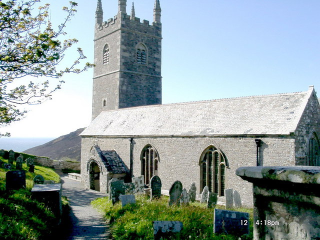
St Nectan's Church, Welcombe

St Nectan's Church is the parish church of Welcombe, on the border of Devon and Cornwall. W. G. Hoskins writes "St Nectan's Chapel was one of the many...

RFA Green Ranger

RFA Green Ranger was a Ranger-class fleet support tanker of the Royal Fleet Auxiliary. On 24 September 1946, Green Ranger was struck by a torpedo in Portland...

Welcombe

Welcombe is a village and civil parish on the coast of north Devon, England, just north of the border with Cornwall. It is part of the district of Torridge...

Gooseham Mill

Gooseham Mill is a hamlet in the parish of Morwenstow, Cornwall, England.The hamlet lies below Gooseham hamlet, in the Marsland valley. The county border...

Marsland Valley

Marsland Valley is a nature reserve situated in two large valleys which straddle the northern end of the Devon-Cornwall border. It is a designated nature...

Gooseham

Gooseham (Cornish: Pras an Woodh) is a hamlet in northeast Cornwall, England, United Kingdom. It is situated six miles (11 km) north of Bude and is approximately...

Steeple Point to Marsland Mouth

Steeple Point to Marsland Mouth is a coastal Site of Special Scientific Interest (SSSI) in Cornwall, England, UK, noted for its biological characteristics...

Church of St Morwenna and St John the Baptist, Morwenstow

The Church of St Morwenna and St John the Baptist is the parish church of Morwenstow, north Cornwall, England, United Kingdom, the most northerly parish...

Nearby Amenities

Located within 500m of 50.951393,-4.5444747
Source: PGS
Lat/Long: 50.9514653/-4.544604
Barrier: kissing_gate
Lat/Long: 50.9502901/-4.5383931
Covered: no
Leisure: picnic_table
Lat/Long: 50.9537757/-4.541635
The data included in this document is from www.openstreetmap.org. The data is made available under ODbL.

Have you been to Coney Rock?

Leave your review of Coney Rock below (or comments, questions and feedback).