Bagh an t-Seilisdeir

Beach in Inverness-shire

Scotland

Bagh an t-Seilisdeir

Flodda causeway
Flodda causeway Credit: Catherine Morgan

Bagh an t-Seilisdeir, also known as the Shiel Bridge Beach, is a stunning coastal area located in Inverness-shire, Scotland. Situated on the west coast of Scotland, this beautiful beach offers breathtaking views of the surrounding landscape and the crystal-clear waters of Loch Duich.

The beach is known for its pristine white sands, which stretch for approximately 1.5 kilometers along the coast. The contrast between the golden sands and the turquoise waters creates a picturesque scene that is perfect for a leisurely stroll or a relaxing sunbathing session.

The beach is surrounded by lush green hills and mountains, providing a dramatic backdrop to the coastal scenery. The area is rich in wildlife, and visitors may spot various bird species, seals, and even dolphins swimming in the distance. This makes Bagh an t-Seilisdeir a popular spot for nature enthusiasts and photographers.

Although the beach is not manned by lifeguards, it is generally considered safe for swimming and water activities. However, visitors are advised to be cautious of changing tides and to ensure they have the necessary equipment if participating in water sports.

Facilities at Bagh an t-Seilisdeir include a car park, picnic areas, and public toilets. There are also nearby accommodations and dining options in the surrounding area, making it a convenient destination for a day trip or a longer stay.

Overall, Bagh an t-Seilisdeir offers a tranquil and picturesque setting for those seeking a peaceful retreat or a chance to explore the stunning natural beauty of Inverness-shire's coastline.

If you have any feedback on the listing, please let us know in the comments section below.

Bagh an t-Seilisdeir Images

Images are sourced within 2km of 57.483871/-7.2540807 or Grid Reference NF8555. Thanks to Geograph Open Source API. All images are credited.
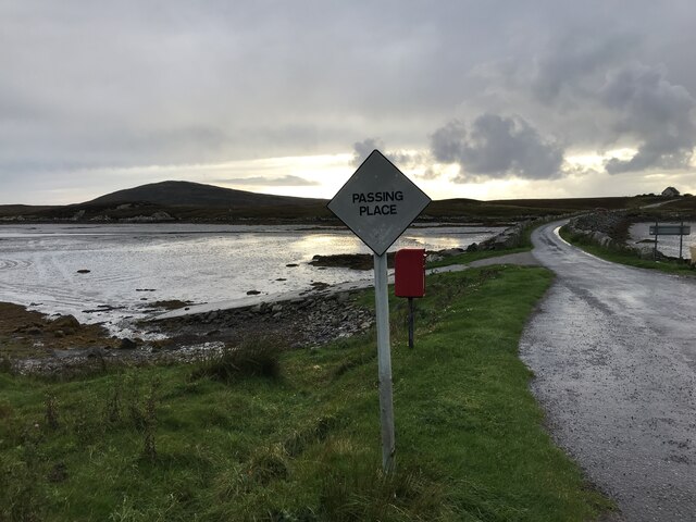
Flodda causeway
Flodda causeway
NCN780 on Grimsay Looking east, Loch an Fhaing on the left and Eaval, North Uist, in the distance.
NCN780 on Grimsay
Looking east, Loch an Fhaing on the left and Eaval, North Uist, in the distance.
Signpost on Grimsay The house beyond the end of Loch an Fhaing is marked as a Post Office on the map, but the may not be up to date information.
Signpost on Grimsay
The house beyond the end of Loch an Fhaing is marked as a Post Office on the map, but the may not be up to date information.
Bus stop and post box on Grimsay At the road-end of a loop that leaves the main road [A865].
Bus stop and post box on Grimsay
At the road-end of a loop that leaves the main road [A865].
House on Grimsay Looking across Bog Cotton from the A865.
House on Grimsay
Looking across Bog Cotton from the A865.
Gearraidh Dubh Looking over the shore near Gearraidh Dubh towards Eabhal.
Gearraidh Dubh
Looking over the shore near Gearraidh Dubh towards Eabhal.
Loch na Faoileag on Grimsay One of many small islets on Loch na Faoileag on the Isle of Grimsay
Loch na Faoileag on Grimsay
One of many small islets on Loch na Faoileag on the Isle of Grimsay
Loch na Faoileag Shoreline A view along the shoreline to north west finger on Loch na Faoileag (Isle of Grimsay) .Taken on the opposite bank from the roadside.
Loch na Faoileag Shoreline
A view along the shoreline to north west finger on Loch na Faoileag (Isle of Grimsay) .Taken on the opposite bank from the roadside.
Loch na Faoileag Cairn A small cairn situated at the south-eastern end of Loch na Faoileag.
Loch na Faoileag Cairn
A small cairn situated at the south-eastern end of Loch na Faoileag.
Near Gearraidh Dubh
Near Gearraidh Dubh
Bagh Sgotbheinn Not all Hebridean buildings fall into disrepair. I note that Dave Fergusson's 2007 photograph includes this small building, but now, twelve years later it has a new roof and is looking well cared for.
Bagh Sgotbheinn
Not all Hebridean buildings fall into disrepair. I note that Dave Fergusson's 2007 photograph includes this small building, but now, twelve years later it has a new roof and is looking well cared for.
Eilean an t-Seagail Seating located at a parking spot just off the A865 near Baile Glas on Benbecula.
Eilean an t-Seagail
Seating located at a parking spot just off the A865 near Baile Glas on Benbecula.
The summit region of Grimsay Grimsay is a low island between North Uist and Benbecula. It is difficult to be certain of its highest point, but this eminence, 25m or so above Mean Sea Level, is a good contender.
The summit region of Grimsay
Grimsay is a low island between North Uist and Benbecula. It is difficult to be certain of its highest point, but this eminence, 25m or so above Mean Sea Level, is a good contender.
Road on Eilean na h-Airigh Leaving the causeway from Benbecula and heading for Grimsay and North Uist. Eaval / Eabhal is the North Uist mountain in the distance.
<span class="nowrap"><a title="http://www.isle-of-benbecula.co.uk/" rel="nofollow ugc noopener" href="http://www.isle-of-benbecula.co.uk/">Link</a><img style="margin-left:2px;" alt="External link" title="External link - shift click to open in new window" src="https://s1.geograph.org.uk/img/external.png" width="10" height="10"/></span>
Road on Eilean na h-Airigh
Leaving the causeway from Benbecula and heading for Grimsay and North Uist. Eaval / Eabhal is the North Uist mountain in the distance. LinkExternal link
Baile Glas, Grimsay Hamlet on the causewayed road between Benbecula and North Uist.
<span class="nowrap"><a title="http://www.isle-of-benbecula.co.uk/" rel="nofollow ugc noopener" href="http://www.isle-of-benbecula.co.uk/">Link</a><img style="margin-left:2px;" alt="External link" title="External link - shift click to open in new window" src="https://s1.geograph.org.uk/img/external.png" width="10" height="10"/></span>
Baile Glas, Grimsay
Hamlet on the causewayed road between Benbecula and North Uist. LinkExternal link
Sandy inlet on the coast of Grimsay One of a maze of inlets and channels around Grimsay. This view is interesting as there are remains of old field walls [possibly iron age/centre picture] visible in the sand, indicating a lower sea level at some time. Cloud capped Eabhal rises in the distance.
Sandy inlet on the coast of Grimsay
One of a maze of inlets and channels around Grimsay. This view is interesting as there are remains of old field walls [possibly iron age/centre picture] visible in the sand, indicating a lower sea level at some time. Cloud capped Eabhal rises in the distance.
Grimsay: postbox № HS6 32 One of four postboxes on the island of Grimsay, this postbox stands at a road junction on the A865 close to the post office (<a href="https://www.geograph.org.uk/photo/3112850">NF8457 : Grimsay: the post office</a>) which is in the house in the background. It therefore might be considered the 'main' box on the island and that is reflected in its later collection times - 2pm on weekdays and at 9:45am on Saturdays.
Grimsay: postbox № HS6 32
One of four postboxes on the island of Grimsay, this postbox stands at a road junction on the A865 close to the post office (NF8457 : Grimsay: the post office) which is in the house in the background. It therefore might be considered the 'main' box on the island and that is reflected in its later collection times - 2pm on weekdays and at 9:45am on Saturdays.
Baymore: postbox № HS6 15 One of four postboxes on the island of Grimsay. Apart from the one on the main road close to the post office, they are emptied at 11:45am on weekdays and at 9:30am on Saturdays.
Baymore: postbox № HS6 15
One of four postboxes on the island of Grimsay. Apart from the one on the main road close to the post office, they are emptied at 11:45am on weekdays and at 9:30am on Saturdays.
Show me another place!

Bagh an t-Seilisdeir is located at Grid Ref: NF8555 (Lat: 57.483871, Lng: -7.2540807)

Unitary Authority: Na h-Eileanan an Iar

Police Authority: Highlands and Islands

What 3 Words

///subjects.hockey.rides. Near Balivanich, Na h-Eileanan Siar

Related Wikis

Flodaigh

Flodaigh is a tidal island lying to the north of Benbecula and south of Grimsay in the Outer Hebrides, Scotland. It is connected to Benbecula by a causeway...

Grimsay

Grimsay (Scottish Gaelic: Griomasaigh) is a tidal island in the Outer Hebrides of Scotland. == Geography == Grimsay is the largest of the low-lying stepping...

Baile Glas

Baile Glas or Ballaglasa (Scottish Gaelic: Am Baile Glas) is a settlement on Grimsay in the Outer Hebrides, Scotland. Ballaglasa is within the parish of...

Fraoch-Eilean

Fraoch-eilean is a small island with an uncertain population north of Benbecula in the Outer Hebrides of Scotland. It is about 55 hectares (140 acres...

Ronay

Ronay (Scottish Gaelic: Rònaigh) is an island in the Outer Hebrides of Scotland, which lies a short distance off the east coast of Grimsay. == Geography... ==

Bail' Iochdrach

Bail' Iochdrach or Baliochrach (Scottish Gaelic: Am Baile Ìochdrach) is a village on Benbecula in the Outer Hebrides, Scotland. Baliochrach is within the...

Uachdar

Uachdar (Scottish Gaelic: An t-Uachdar [ən̪ˠ ˈt̪ʰuəxkəɾ]) is a settlement on the Outer Hebridean Island of Benbecula. Uachdar is within the parish of South...

Carinish

Carinish (Scottish Gaelic: Càirinis), is a hamlet on North Uist, in the Outer Hebrides, Scotland. It is in the south of the island, about two miles (three...

Nearby Amenities

Located within 500m of 57.483871,-7.2540807
Created By: dmgroom_coastlines
Lat/Long: 57.48586/-7.25619
Passing Place
Lat/Long: 57.4864976/-7.2485503
Passing Place
Lat/Long: 57.4857048/-7.2480118
Passing Place
Lat/Long: 57.4857835/-7.2507655
Barrier: cattle_grid
Lat/Long: 57.486084/-7.2492162
Passing Place
Lat/Long: 57.486237/-7.252485
Barrier: cattle_grid
Lat/Long: 57.4865858/-7.2510367
Barrier: cattle_grid
Lat/Long: 57.4868405/-7.2557534
Passing Place
Lat/Long: 57.4868391/-7.2546683
Passing Place
Lat/Long: 57.4852977/-7.2477924
Bàgh an t-Seilisdeir
Natural: bay
Lat/Long: 57.4837715/-7.2529507
Power: pole
Lat/Long: 57.4877964/-7.255805
Power: pole
Lat/Long: 57.4878325/-7.2552275
Power: pole
Lat/Long: 57.4875698/-7.2548945
Power: pole
Lat/Long: 57.4873128/-7.2552705
Power: pole
Lat/Long: 57.4869808/-7.2541585
Power: pole
Lat/Long: 57.4865794/-7.2536321
Power: pole
Lat/Long: 57.4860077/-7.252931
Power: pole
Lat/Long: 57.4855082/-7.2522972
Power: pole
Lat/Long: 57.4855414/-7.251247
Power: pole
Lat/Long: 57.4855775/-7.2502827
Power: pole
Lat/Long: 57.4856381/-7.2489075
Power: pole
Lat/Long: 57.4856699/-7.2478439
Power: pole
Lat/Long: 57.485719/-7.2464526
Barrier: cattle_grid
Lat/Long: 57.4824892/-7.2509059
Power: pole
Lat/Long: 57.4868729/-7.2559362
Power: pole
Lat/Long: 57.4820329/-7.2495358
Power: pole
Lat/Long: 57.4820499/-7.2489487
Power: pole
Lat/Long: 57.4821056/-7.2477746
Power: pole
Lat/Long: 57.4821725/-7.2467568
Turning Circle
Lat/Long: 57.4865524/-7.2509839
Barrier: cattle_grid
Lat/Long: 57.4862587/-7.2511314
The data included in this document is from www.openstreetmap.org. The data is made available under ODbL.

Have you been to Bagh an t-Seilisdeir?

Leave your review of Bagh an t-Seilisdeir below (or comments, questions and feedback).