Scotvein

Settlement in Inverness-shire

Scotland

Scotvein

Flodda causeway
Flodda causeway Credit: Catherine Morgan

Scotvein is a small settlement located in the Inverness-shire region of Scotland. Situated in the Scottish Highlands, it is surrounded by breathtaking natural beauty, including lush green hills, picturesque valleys, and winding rivers. The village is nestled on the banks of the River Scotvein, which flows through the heart of the community.

Despite its small size, Scotvein is known for its warm and welcoming atmosphere. The residents are friendly and have a strong sense of community, making it an ideal place for those seeking a peaceful and close-knit environment. The village is primarily residential, with a small number of amenities available to its inhabitants.

The surrounding landscape provides ample opportunities for outdoor activities, attracting visitors from near and far. The nearby Munro mountains offer challenging hikes and stunning panoramic views at their summits. The river is also a popular spot for fishing enthusiasts, with salmon and trout being the most sought-after catches.

In terms of infrastructure, Scotvein has a well-maintained road network connecting it to the larger towns in the region. The nearest town, Inverness, is approximately 15 miles away and provides access to a wider range of amenities, including shopping centers, schools, and healthcare facilities.

Overall, Scotvein offers a tranquil and picturesque setting, making it an attractive destination for nature lovers and those seeking a slower pace of life in the Scottish Highlands.

If you have any feedback on the listing, please let us know in the comments section below.

Scotvein Images

Images are sourced within 2km of 57.484449/-7.2471299 or Grid Reference NF8555. Thanks to Geograph Open Source API. All images are credited.
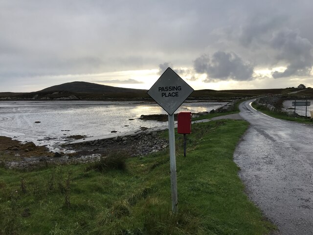
Flodda causeway
Flodda causeway
NCN780 on Grimsay Looking east, Loch an Fhaing on the left and Eaval, North Uist, in the distance.
NCN780 on Grimsay
Looking east, Loch an Fhaing on the left and Eaval, North Uist, in the distance.
Bus stop and post box on Grimsay At the road-end of a loop that leaves the main road [A865].
Bus stop and post box on Grimsay
At the road-end of a loop that leaves the main road [A865].
Gearraidh Dubh Looking over the shore near Gearraidh Dubh towards Eabhal.
Gearraidh Dubh
Looking over the shore near Gearraidh Dubh towards Eabhal.
Loch na Faoileag on Grimsay One of many small islets on Loch na Faoileag on the Isle of Grimsay
Loch na Faoileag on Grimsay
One of many small islets on Loch na Faoileag on the Isle of Grimsay
Loch na Faoileag Shoreline A view along the shoreline to north west finger on Loch na Faoileag (Isle of Grimsay) .Taken on the opposite bank from the roadside.
Loch na Faoileag Shoreline
A view along the shoreline to north west finger on Loch na Faoileag (Isle of Grimsay) .Taken on the opposite bank from the roadside.
Loch na Faoileag Cairn A small cairn situated at the south-eastern end of Loch na Faoileag.
Loch na Faoileag Cairn
A small cairn situated at the south-eastern end of Loch na Faoileag.
Near Gearraidh Dubh
Near Gearraidh Dubh
Bagh Sgotbheinn Not all Hebridean buildings fall into disrepair. I note that Dave Fergusson's 2007 photograph includes this small building, but now, twelve years later it has a new roof and is looking well cared for.
Bagh Sgotbheinn
Not all Hebridean buildings fall into disrepair. I note that Dave Fergusson's 2007 photograph includes this small building, but now, twelve years later it has a new roof and is looking well cared for.
Old harbour, Grimsay A crofthouse sitting on a reclaimed piece of land at Baymore (Bagh mor) which was the main harbour on the island before the Kallin (Ceallan) development.  The harbour is littered with lots of old creels and other flotsam and there are many old stone piers.
Old harbour, Grimsay
A crofthouse sitting on a reclaimed piece of land at Baymore (Bagh mor) which was the main harbour on the island before the Kallin (Ceallan) development. The harbour is littered with lots of old creels and other flotsam and there are many old stone piers.
The summit region of Grimsay Grimsay is a low island between North Uist and Benbecula. It is difficult to be certain of its highest point, but this eminence, 25m or so above Mean Sea Level, is a good contender.
The summit region of Grimsay
Grimsay is a low island between North Uist and Benbecula. It is difficult to be certain of its highest point, but this eminence, 25m or so above Mean Sea Level, is a good contender.
Baile Glas, Grimsay Hamlet on the causewayed road between Benbecula and North Uist.
<span class="nowrap"><a title="http://www.isle-of-benbecula.co.uk/" rel="nofollow ugc noopener" href="http://www.isle-of-benbecula.co.uk/">Link</a><img style="margin-left:2px;" alt="External link" title="External link - shift click to open in new window" src="https://s1.geograph.org.uk/img/external.png" width="10" height="10"/></span>
Baile Glas, Grimsay
Hamlet on the causewayed road between Benbecula and North Uist. LinkExternal link
Sandy inlet on the coast of Grimsay One of a maze of inlets and channels around Grimsay. This view is interesting as there are remains of old field walls [possibly iron age/centre picture] visible in the sand, indicating a lower sea level at some time. Cloud capped Eabhal rises in the distance.
Sandy inlet on the coast of Grimsay
One of a maze of inlets and channels around Grimsay. This view is interesting as there are remains of old field walls [possibly iron age/centre picture] visible in the sand, indicating a lower sea level at some time. Cloud capped Eabhal rises in the distance.
Grimsay: postbox № HS6 32 One of four postboxes on the island of Grimsay, this postbox stands at a road junction on the A865 close to the post office (<a href="https://www.geograph.org.uk/photo/3112850">NF8457 : Grimsay: the post office</a>) which is in the house in the background. It therefore might be considered the 'main' box on the island and that is reflected in its later collection times - 2pm on weekdays and at 9:45am on Saturdays.
Grimsay: postbox № HS6 32
One of four postboxes on the island of Grimsay, this postbox stands at a road junction on the A865 close to the post office (NF8457 : Grimsay: the post office) which is in the house in the background. It therefore might be considered the 'main' box on the island and that is reflected in its later collection times - 2pm on weekdays and at 9:45am on Saturdays.
Baymore: postbox № HS6 15 One of four postboxes on the island of Grimsay. Apart from the one on the main road close to the post office, they are emptied at 11:45am on weekdays and at 9:30am on Saturdays.
Baymore: postbox № HS6 15
One of four postboxes on the island of Grimsay. Apart from the one on the main road close to the post office, they are emptied at 11:45am on weekdays and at 9:30am on Saturdays.
Gearadu: postbox № HS6 34 One of four postboxes on the island of Grimsay. Apart from the one on the main road close to the post office, they are emptied at 11:45am on weekdays and at 9:30am on Saturdays.
Gearadu: postbox № HS6 34
One of four postboxes on the island of Grimsay. Apart from the one on the main road close to the post office, they are emptied at 11:45am on weekdays and at 9:30am on Saturdays.
Kallin: postbox № HS6 25 One of four postboxes on the island of Grimsay. Apart from the one on the main road close to the post office, they are emptied at 11:45am on weekdays and at 9:30am on Saturdays.
Kallin: postbox № HS6 25
One of four postboxes on the island of Grimsay. Apart from the one on the main road close to the post office, they are emptied at 11:45am on weekdays and at 9:30am on Saturdays.
Island Flodda: postbox № HS7 79 A small postbox serving this small island, just off the coast of Benbecula - we look across the Flodda Sound (Caolas Fhlodaigh) between the two. The box is emptied at 11am on weekdays and at 8:30am on Saturdays.
Island Flodda: postbox № HS7 79
A small postbox serving this small island, just off the coast of Benbecula - we look across the Flodda Sound (Caolas Fhlodaigh) between the two. The box is emptied at 11am on weekdays and at 8:30am on Saturdays.
Show me another place!

Scotvein is located at Grid Ref: NF8555 (Lat: 57.484449, Lng: -7.2471299)

Unitary Authority: Na h-Eileanan an Iar

Police Authority: Highlands and Islands

Also known as: Scotbheinn

What 3 Words

///trump.capillary.agrees. Near Balivanich, Na h-Eileanan Siar

Related Wikis

Grimsay

Grimsay (Scottish Gaelic: Griomasaigh) is a tidal island in the Outer Hebrides of Scotland. == Geography == Grimsay is the largest of the low-lying stepping...

Flodaigh

Flodaigh is a tidal island lying to the north of Benbecula and south of Grimsay in the Outer Hebrides, Scotland. It is connected to Benbecula by a causeway...

Baile Glas

Baile Glas or Ballaglasa (Scottish Gaelic: Am Baile Glas) is a settlement on Grimsay in the Outer Hebrides, Scotland. Ballaglasa is within the parish of...

Fraoch-Eilean

Fraoch-eilean is a small island with an uncertain population north of Benbecula in the Outer Hebrides of Scotland. It is about 55 hectares (140 acres...

Ronay

Ronay (Scottish Gaelic: Rònaigh) is an island in the Outer Hebrides of Scotland, which lies a short distance off the east coast of Grimsay. == Geography... ==

Bail' Iochdrach

Bail' Iochdrach or Baliochrach (Scottish Gaelic: Am Baile Ìochdrach) is a village on Benbecula in the Outer Hebrides, Scotland. Baliochrach is within the...

Uachdar

Uachdar (Scottish Gaelic: An t-Uachdar [ən̪ˠ ˈt̪ʰuəxkəɾ]) is a settlement on the Outer Hebridean Island of Benbecula. Uachdar is within the parish of South...

Carinish

Carinish (Scottish Gaelic: Càirinis), is a hamlet on North Uist, in the Outer Hebrides, Scotland. It is in the south of the island, about two miles (three...

Nearby Amenities

Located within 500m of 57.484449,-7.2471299
Barrier: cattle_grid
Lat/Long: 57.4863334/-7.2402444
Passing Place
Lat/Long: 57.4864976/-7.2485503
Passing Place
Lat/Long: 57.4868106/-7.2426861
Passing Place
Lat/Long: 57.4857048/-7.2480118
Passing Place
Lat/Long: 57.4857835/-7.2507655
Barrier: cattle_grid
Lat/Long: 57.486084/-7.2492162
Passing Place
Lat/Long: 57.486237/-7.252485
Barrier: cattle_grid
Lat/Long: 57.4865858/-7.2510367
Passing Place
Lat/Long: 57.4852977/-7.2477924
Passing Place
Lat/Long: 57.4868598/-7.2446774
Marketplace
Opening Hours: We 15:00-18:00
Operator: Ceann na h-Àirigh
Lat/Long: 57.4866788/-7.2403322
Cafe
Description: Tea/Coffee/Cake
Opening Hours: Tu,Th,Fr 11:00-13:30; We 11:00-18:00
Operator: Ceann na h-Airigh
Lat/Long: 57.4866874/-7.2402705
Post Office
Grimsay Post Office
Addr City: Uibhist a Tuath
Addr City En: Isle of North Uist
Addr Country: GB
Addr Postcode: HS6 5JA
Addr Suburb: Grimsay
Opening Hours: Mo-Fr 11:00-13:00
Ref Pol Id: 140232
Lat/Long: 57.4867213/-7.2403631
Bàgh an t-Seilisdeir
Natural: bay
Lat/Long: 57.4837715/-7.2529507
Power: pole
Lat/Long: 57.4865794/-7.2536321
Power: pole
Lat/Long: 57.4860077/-7.252931
Power: pole
Lat/Long: 57.4855082/-7.2522972
Power: pole
Lat/Long: 57.4855414/-7.251247
Power: pole
Lat/Long: 57.4855775/-7.2502827
Power: pole
Lat/Long: 57.4856381/-7.2489075
Power: pole
Lat/Long: 57.4856699/-7.2478439
Power: pole
Lat/Long: 57.485719/-7.2464526
Power: pole
Lat/Long: 57.4857695/-7.2450962
Power: pole
Lat/Long: 57.4858143/-7.2437425
Power: pole
Lat/Long: 57.4858619/-7.2424183
Power: pole
Lat/Long: 57.4821918/-7.2455555
Power: pole
Lat/Long: 57.4822366/-7.2446262
Power: pole
Lat/Long: 57.4823911/-7.2428427
Power: pole
Lat/Long: 57.4822784/-7.2438419
Power: pole
Lat/Long: 57.4825167/-7.2418355
Barrier: cattle_grid
Lat/Long: 57.4824892/-7.2509059
Power: pole
Lat/Long: 57.4820329/-7.2495358
Power: pole
Lat/Long: 57.4820499/-7.2489487
Power: pole
Lat/Long: 57.4821056/-7.2477746
Power: pole
Lat/Long: 57.4821725/-7.2467568
Power: pole
Lat/Long: 57.4859188/-7.241056
Power: pole
Lat/Long: 57.4859554/-7.2396931
Passing Place
Lat/Long: 57.4867836/-7.2468694
Turning Circle
Lat/Long: 57.4865524/-7.2509839
Barrier: cattle_grid
Lat/Long: 57.4862587/-7.2511314
The data included in this document is from www.openstreetmap.org. The data is made available under ODbL.

Have you been to Scotvein?

Leave your review of Scotvein below (or comments, questions and feedback).