Rubha Buidhe Scotvein
Coastal Feature, Headland, Point in Inverness-shire
Scotland
Rubha Buidhe Scotvein
Rubha Buidhe Scotvein is a prominent coastal feature located in Inverness-shire, Scotland. This headland, also referred to as a point, juts out into the vast Atlantic Ocean, offering breathtaking views and natural beauty to those who visit.
Situated on the western coast of Scotland, Rubha Buidhe Scotvein is characterized by its rugged cliffs, which soar up to impressive heights above the crashing waves below. The headland is predominantly composed of ancient rock formations, giving it a unique and captivating appearance.
The headland is surrounded by a diverse and rich marine ecosystem, making it a haven for wildlife enthusiasts. Visitors can spot a variety of seabirds, such as gannets and puffins, nesting on the cliffs. Additionally, seals and dolphins can often be seen frolicking in the waters surrounding Rubha Buidhe Scotvein, adding to the enchanting atmosphere of the area.
The headland is easily accessible by foot, with several walking trails leading to its summit. Hikers can enjoy the stunning coastal views and immerse themselves in the tranquility of the surrounding landscape. The cliffs provide a perfect vantage point for whale watching during the migration season, as these magnificent creatures pass by the coast on their journey.
Rubha Buidhe Scotvein is not only a natural wonder but also holds historical significance. It is believed that ancient settlements once existed in the area, and remnants of these can still be found, adding to the allure of the headland.
Overall, Rubha Buidhe Scotvein is a captivating coastal feature that offers a perfect blend of natural beauty, wildlife, and historical significance. It is a must-visit destination for nature lovers and those seeking a peaceful and awe-inspiring experience on the western coast of Scotland.
If you have any feedback on the listing, please let us know in the comments section below.
Rubha Buidhe Scotvein Images
Images are sourced within 2km of 57.482239/-7.2513564 or Grid Reference NF8555. Thanks to Geograph Open Source API. All images are credited.

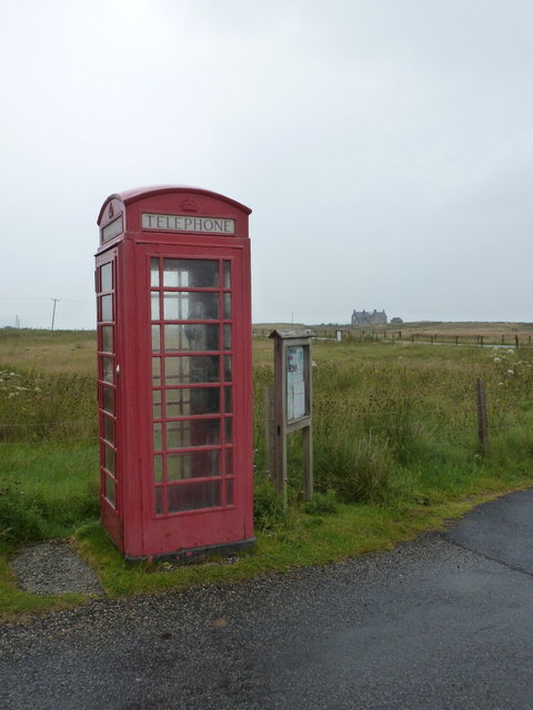
![Bus stop and post box on Grimsay At the road-end of a loop that leaves the main road [A865].](https://s0.geograph.org.uk/geophotos/05/02/60/5026016_5d555552.jpg)


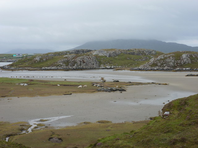
![Sandy inlet on the coast of Grimsay One of a maze of inlets and channels around Grimsay. This view is interesting as there are remains of old field walls [possibly iron age/centre picture] visible in the sand, indicating a lower sea level at some time. Cloud capped Eabhal rises in the distance.](https://s2.geograph.org.uk/geophotos/03/06/37/3063738_51fd0f96.jpg)


Rubha Buidhe Scotvein is located at Grid Ref: NF8555 (Lat: 57.482239, Lng: -7.2513564)
Unitary Authority: Na h-Eileanan an Iar
Police Authority: Highlands and Islands
What 3 Words
///surgical.shades.cherished. Near Balivanich, Na h-Eileanan Siar
Nearby Locations
Related Wikis

Flodaigh
Flodaigh is a tidal island lying to the north of Benbecula and south of Grimsay in the Outer Hebrides, Scotland. It is connected to Benbecula by a causeway...

Grimsay
Grimsay (Scottish Gaelic: Griomasaigh) is a tidal island in the Outer Hebrides of Scotland. == Geography == Grimsay is the largest of the low-lying stepping...

Baile Glas
Baile Glas or Ballaglasa (Scottish Gaelic: Am Baile Glas) is a settlement on Grimsay in the Outer Hebrides, Scotland. Ballaglasa is within the parish of...

Fraoch-Eilean
Fraoch-eilean is a small island with an uncertain population north of Benbecula in the Outer Hebrides of Scotland. It is about 55 hectares (140 acres...

Ronay
Ronay (Scottish Gaelic: Rònaigh) is an island in the Outer Hebrides of Scotland, which lies a short distance off the east coast of Grimsay. == Geography... ==

Uachdar
Uachdar (Scottish Gaelic: An t-Uachdar [ən̪ˠ ˈt̪ʰuəxkəɾ]) is a settlement on the Outer Hebridean Island of Benbecula. Uachdar is within the parish of South...

Bail' Iochdrach
Bail' Iochdrach or Baliochrach (Scottish Gaelic: Am Baile Ìochdrach) is a village on Benbecula in the Outer Hebrides, Scotland. Baliochrach is within the...

Carinish
Carinish (Scottish Gaelic: Càirinis), is a hamlet on North Uist, in the Outer Hebrides, Scotland. It is in the south of the island, about two miles (three...
Nearby Amenities
Located within 500m of 57.482239,-7.2513564Have you been to Rubha Buidhe Scotvein?
Leave your review of Rubha Buidhe Scotvein below (or comments, questions and feedback).