Tràigh Bhàlaig

Beach in Inverness-shire

Scotland

Tràigh Bhàlaig

A865 road by Traigh Athmor And another of those square "Passing Place" signs;  I much prefer the diamond shaped ones!
A865 road by Traigh Athmor Credit: Gordon Brown

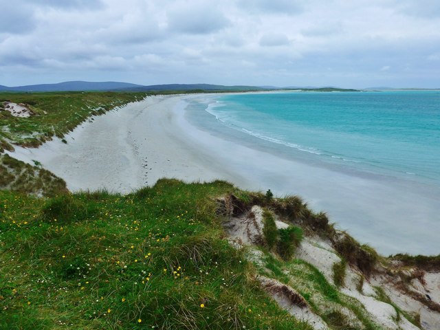
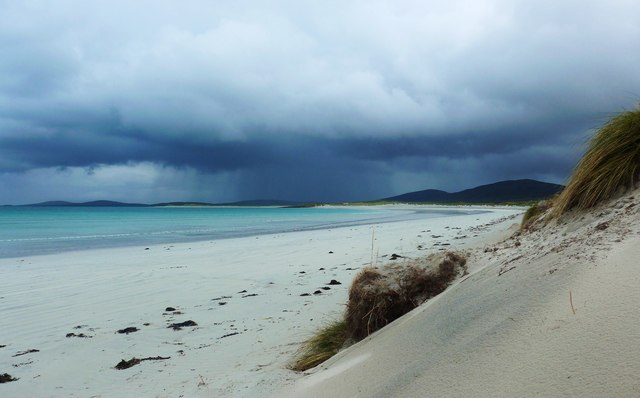
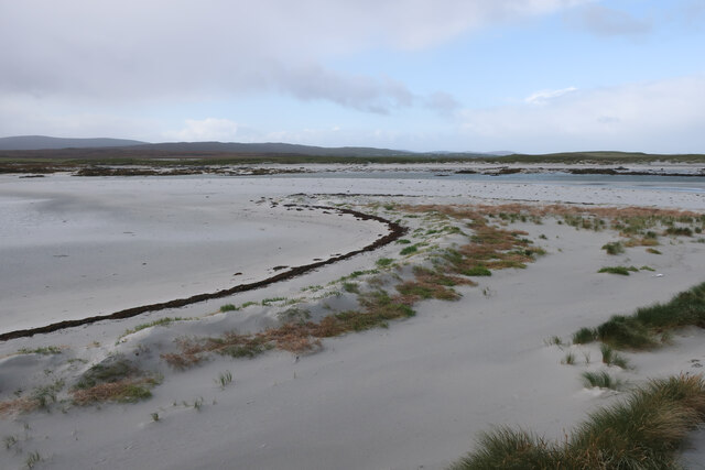
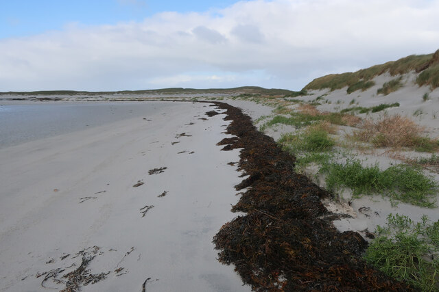
Tràigh Bhàlaig, located in Inverness-shire, Scotland, is a picturesque beach renowned for its stunning natural beauty and tranquil surroundings. Situated on the west coast of Scotland, this hidden gem stretches along the shores of the Sound of Sleat, offering visitors a breathtaking view of the surrounding rugged landscapes and crystal-clear waters.

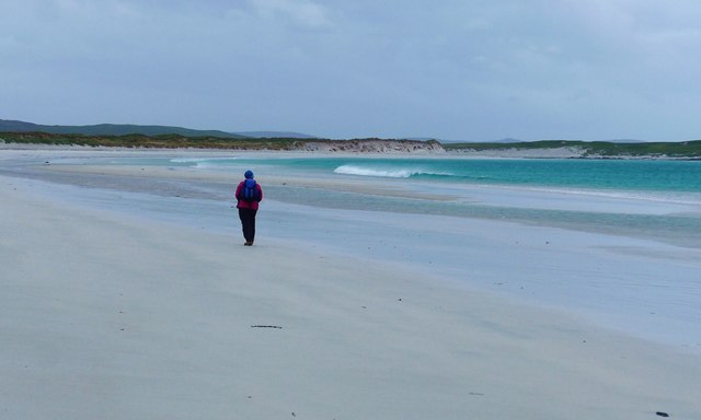
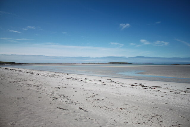
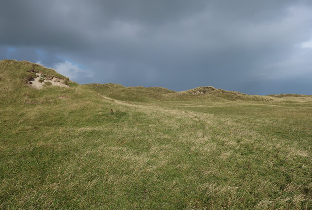
The beach boasts a long stretch of golden sand, perfect for leisurely walks and relaxation. Framed by rolling hills and majestic cliffs, Tràigh Bhàlaig provides a peaceful and idyllic setting, making it an ideal getaway for nature lovers and those seeking solace amidst nature's splendor.

The beach is relatively secluded, ensuring a serene and undisturbed experience for visitors. The absence of commercial development and crowds adds to the charm of Tràigh Bhàlaig, allowing visitors to fully immerse themselves in the tranquility of their surroundings.

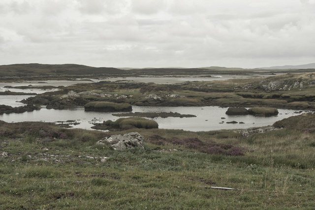
Nature enthusiasts will be delighted by the diverse wildlife that inhabits the area surrounding the beach. Seals, otters, and an array of bird species can often be spotted along the shoreline, adding a touch of wildlife exploration to the beach experience.

Tràigh Bhàlaig is also a popular spot for water activities such as swimming and kayaking. The clear waters provide an opportunity for visitors to enjoy a refreshing dip or explore the coastline from a different perspective.

Access to Tràigh Bhàlaig is relatively easy, with a car park available nearby. However, it is important to note that facilities are limited, so visitors are advised to bring their own supplies and be respectful of the environment by practicing responsible tourism.

Overall, Tràigh Bhàlaig is a hidden coastal treasure, offering a serene and picturesque escape from the hustle and bustle of everyday life.

If you have any feedback on the listing, please let us know in the comments section below.

Tràigh Bhàlaig Images

Images are sourced within 2km of 57.658227/-7.2741098 or Grid Reference NF8575. Thanks to Geograph Open Source API. All images are credited.
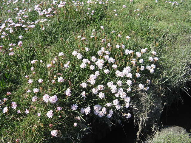
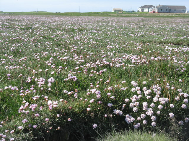
A865 road by Traigh Athmor And another of those square "Passing Place" signs;  I much prefer the diamond shaped ones!
A865 road by Traigh Athmor
And another of those square "Passing Place" signs; I much prefer the diamond shaped ones!
Traigh Athmor A typical scattering of Outer Hebrides houses above the shore.
Traigh Athmor
A typical scattering of Outer Hebrides houses above the shore.
Salt marsh at Trumaisgearraidh With a good flowering of Thrift [Armeria maritima].
Salt marsh at Trumaisgearraidh
With a good flowering of Thrift [Armeria maritima].
Thrift on North Uist Good flowering on a salt marsh at Trumaisgearraidh. Growing with Sea Plantain.
Thrift on North Uist
Good flowering on a salt marsh at Trumaisgearraidh. Growing with Sea Plantain.
Thrift and Sea Plantain Armeria maritima and Plantago maritima on the salt marsh at Trumaisgearraidh.
Thrift and Sea Plantain
Armeria maritima and Plantago maritima on the salt marsh at Trumaisgearraidh.
Sea pinks, North Uist If you're lucky enough to be there at the right time, it's an amazing display.
Sea pinks, North Uist
If you're lucky enough to be there at the right time, it's an amazing display.
Traigh Hornais Miles of sand and not a soul to be seen - that's Hebridean beaches for you.
Traigh Hornais
Miles of sand and not a soul to be seen - that's Hebridean beaches for you.
Gentle breakers on Traigh Hornais And the whole beach to ourselves - that's Hebridean beaches for you.
Gentle breakers on Traigh Hornais
And the whole beach to ourselves - that's Hebridean beaches for you.
Traigh Hornais dunes approaching Corran Bhalaig It was refreshing to see absolutely no trace of plastic waste on this and other Hebridean beaches.
Traigh Hornais dunes approaching Corran Bhalaig
It was refreshing to see absolutely no trace of plastic waste on this and other Hebridean beaches.
Near miss by a rainstorm On Traigh Hornais we were lucky to avoid a soaking from this near miss;  someone 'over there' was getting wet!
Near miss by a rainstorm
On Traigh Hornais we were lucky to avoid a soaking from this near miss; someone 'over there' was getting wet!
Loch nan Geireann
Loch nan Geireann
Low tide, Traigh Athmor The tide runs out a long way here, exposing many hectares of sand.
Low tide, Traigh Athmor
The tide runs out a long way here, exposing many hectares of sand.
Dun Aonghuis The dun covers the whole of a small island in Loch Aonghais. <span class="nowrap"><a title="https://canmore.org.uk/site/10366/north-uist-loch-aonghais-dun-aonais" rel="nofollow ugc noopener" href="https://canmore.org.uk/site/10366/north-uist-loch-aonghais-dun-aonais">Link</a><img style="margin-left:2px;" alt="External link" title="External link - shift click to open in new window" src="https://s1.geograph.org.uk/img/external.png" width="10" height="10"/></span>
Dun Aonghuis
The dun covers the whole of a small island in Loch Aonghais. LinkExternal link
House near Trumaisgearraidh - view to the W from the B893
Western expanse of Traigh Hornais Western expanse of Traigh Hornais photographed at low tide from below the dunes at Corran Bhàlaig.
Western expanse of Traigh Hornais
Western expanse of Traigh Hornais photographed at low tide from below the dunes at Corran Bhàlaig.
Small spit at Tràigh Bhàlaig
Tideline at Tràigh Bhàlaig
Dunes by Tràigh Bhàlaig
Show me another place!

Tràigh Bhàlaig is located at Grid Ref: NF8575 (Lat: 57.658227, Lng: -7.2741098)

Unitary Authority: Na h-Eileanan an Iar

Police Authority: Highlands and Islands

What 3 Words

///however.country.ounce. Near Lochmaddy, Na h-Eileanan Siar

Nearby Locations

Tràigh Bhàlaig Greineam

Related Wikis

Oronsay, Outer Hebrides

Oronsay (Gaelic Orasaigh) is a tidal island off North Uist in the Outer Hebrides. Lying to the north of Vallaquie Strand, the island has been uninhabited...

Lingeigh, North Uist

Lingeigh is an uninhabited island off North Uist, south east of Boreray. It is separated from North Uist by Traigh Lingeigh. == Footnotes ==

North Uist Machair and Islands

The North Uist Machair and Islands is a protected wetland area in the Outer Hebrides of Scotland. A total of 4,705 hectares comprises seven separate areas...

Sollas

Sollas (Scottish Gaelic: Solas) is a small crofting township on the northern coast of the island of North Uist, Scotland. == History == === The Battle... ===

Nearby Amenities

Located within 500m of 57.658227,-7.2741098
The data included in this document is from www.openstreetmap.org. The data is made available under ODbL.

Have you been to Tràigh Bhàlaig?

Leave your review of Tràigh Bhàlaig below (or comments, questions and feedback).