Bay of Hookin
Bay in Orkney
Scotland
Bay of Hookin

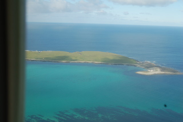
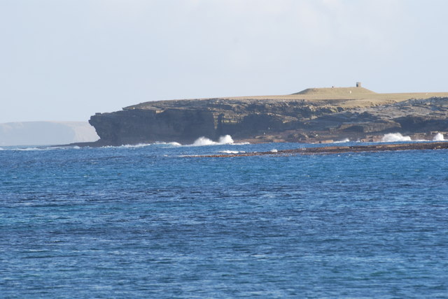
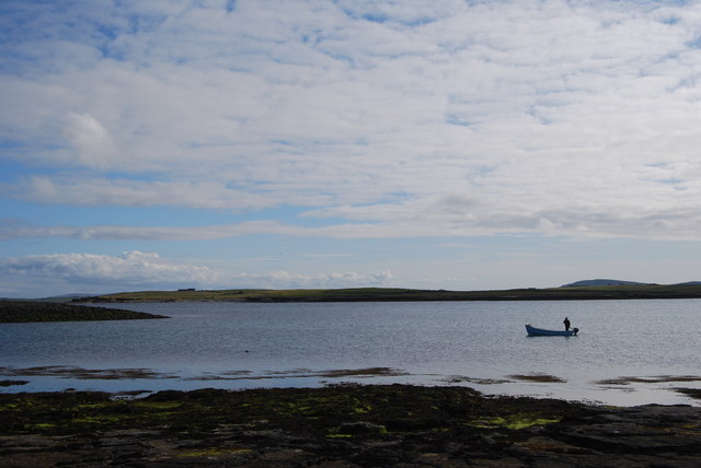
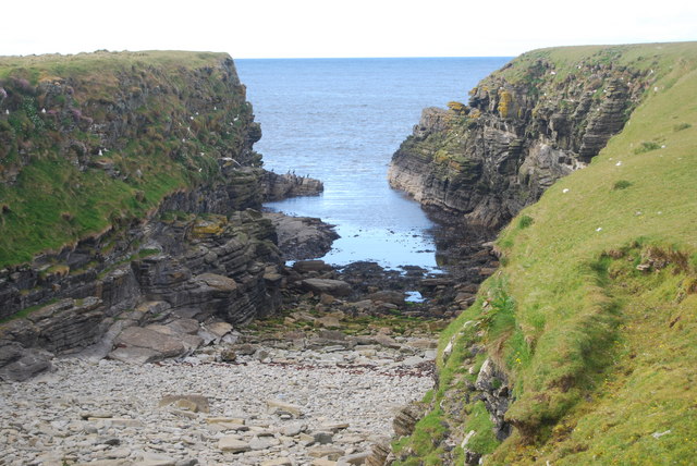
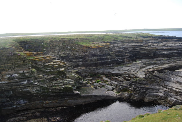
The Bay of Hookin is a picturesque inlet located on the island of Orkney, off the northeastern coast of Scotland. Nestled between the rugged cliffs and rolling hills, this bay offers stunning natural beauty and a tranquil atmosphere.
Stretching for about 2 kilometers, the Bay of Hookin is a popular spot for visitors seeking a peaceful escape. The bay's crystal-clear waters are ideal for swimming and other water activities, attracting both locals and tourists during the warmer months. The sandy beach that lines the bay provides a perfect place for sunbathing and picnicking, while the surrounding dunes offer a sense of privacy and seclusion.
The Bay of Hookin is also renowned for its rich wildlife. The area is a haven for birdwatchers, with various bird species such as puffins, guillemots, and kittiwakes nesting along the cliffs. Seals can often be spotted lounging on the rocks, adding to the bay's natural charm.
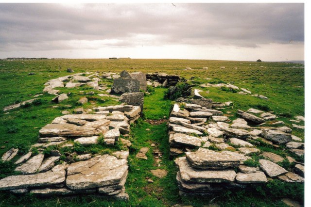
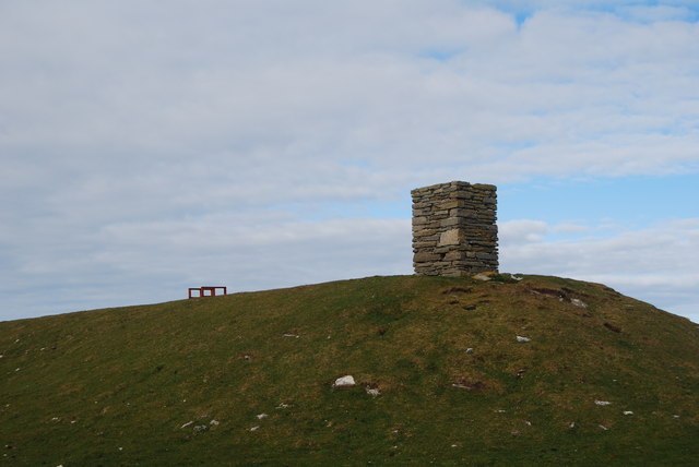
For those interested in history, the Bay of Hookin has a historical significance. It is believed to have been an important landing site for Viking ships during their expeditions, as Orkney has a strong Norse heritage. Ruins of ancient settlements and burial mounds can be found nearby, offering glimpses into the island's past.
Overall, the Bay of Hookin is a serene and captivating destination that showcases Orkney's natural beauty and historical significance. Whether you are seeking relaxation, outdoor activities, or a glimpse into the island's past, this bay offers something for everyone.
If you have any feedback on the listing, please let us know in the comments section below.
Bay of Hookin Images
Images are sourced within 2km of 59.346579/-2.8810961 or Grid Reference HY4951. Thanks to Geograph Open Source API. All images are credited.


Bay of Hookin is located at Grid Ref: HY4951 (Lat: 59.346579, Lng: -2.8810961)
Unitary Authority: Orkney Islands
Police Authority: Highlands and Islands
What 3 Words
///worth.majoring.recover. Near Pierowall, Orkney Islands
Nearby Locations
Related Wikis

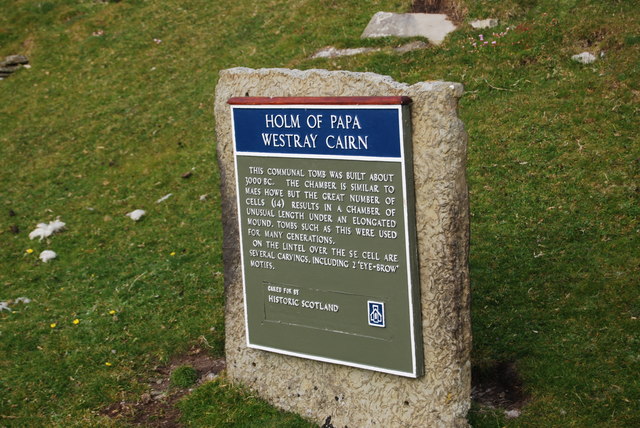
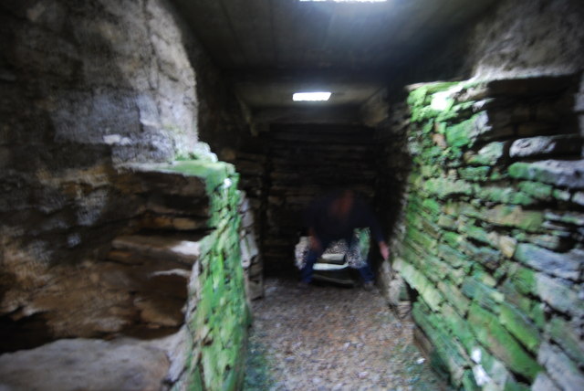
Holm of Papa
The Holm of Papa (or Holm of Papay, Holm of Papa Westray and known locally as the Papay Holm,) is a very small uninhabited island in the Orkney Islands...

Holland House, Papa Westray
Holland Farm is a historic farm complex located on the island of Papa Westray in Orkney, Scotland. The two-storey harled flagstone house with crow-stepped...

Papa Westray
Papa Westray () (Scots: Papa Westree), also known as Papay, is one of the Orkney Islands in Scotland, United Kingdom. The fertile soil has long been a...

Papa Westray Airport
Papa Westray Airport (IATA: PPW, ICAO: EGEP) is located 22 NM (41 km; 25 mi) north of Kirkwall Airport on Papa Westray, Orkney Islands, Scotland. The facility...
Nearby Amenities
Located within 500m of 59.346579,-2.8810961Have you been to Bay of Hookin?
Leave your review of Bay of Hookin below (or comments, questions and feedback).