Katie's Pow
Coastal Feature, Headland, Point in Orkney
Scotland
Katie's Pow

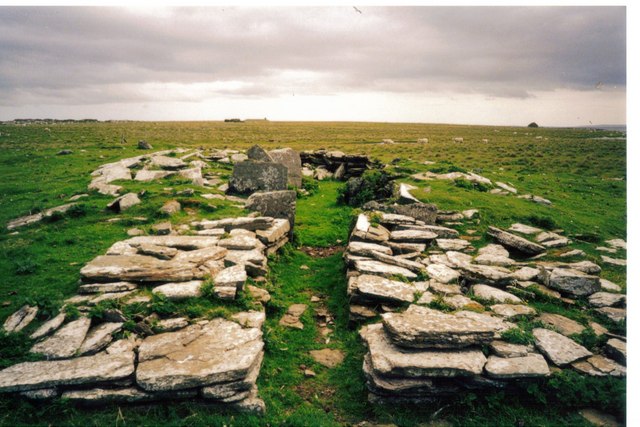
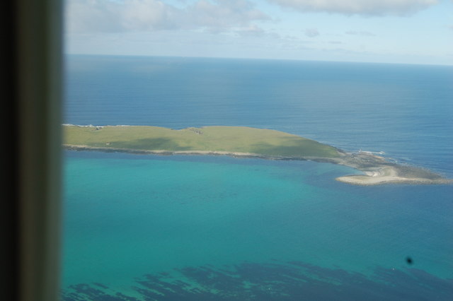
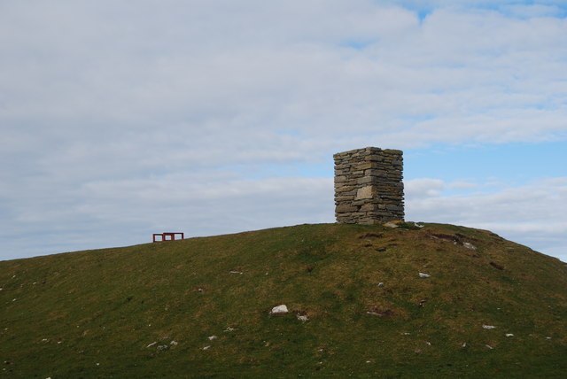
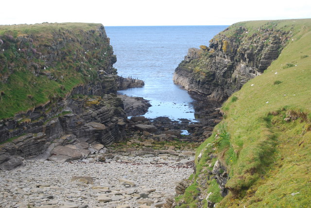
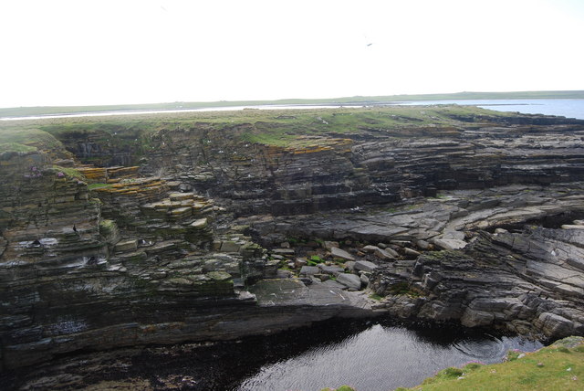
Katie's Pow, located in Orkney, is a prominent coastal feature that stands out as a headland or point along the rugged coastline. Situated in the northeastern part of the main island, this geological formation offers breathtaking views and showcases the natural beauty of Orkney's coastal landscape.
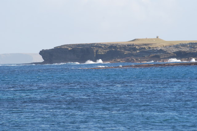
Rising majestically from the surrounding sea, Katie's Pow is characterized by its sheer cliffs and rocky outcrops. The headland juts out into the North Atlantic Ocean, forming a distinctive shape that captures the attention of visitors and locals alike. Its unique geological composition, consisting of layers of sandstone, conglomerate, and shale, showcases the region's rich geological history.
In addition to its geological significance, Katie's Pow is also renowned for its birdlife. The headland serves as a nesting site for various seabirds, including fulmars, puffins, and kittiwakes, making it a popular spot for birdwatching enthusiasts. The surrounding waters are home to diverse marine life, and sightings of seals and dolphins are not uncommon.
Access to Katie's Pow is relatively easy, with a well-maintained footpath leading visitors to the headland's edge. Once there, visitors can enjoy panoramic views of the surrounding coastline, the vast expanse of the ocean, and the nearby islands. The site also offers a unique opportunity to witness the power of the crashing waves against the cliffs, especially during stormy weather.
Overall, Katie's Pow in Orkney is a captivating coastal feature, providing a glimpse into the region's geological history and offering a haven for various species of birds and marine life. Its stunning beauty and accessibility make it a must-visit destination for nature enthusiasts and those seeking to explore the natural wonders of Orkney's coastline.
If you have any feedback on the listing, please let us know in the comments section below.
Katie's Pow Images
Images are sourced within 2km of 59.345628/-2.8810011 or Grid Reference HY4951. Thanks to Geograph Open Source API. All images are credited.


Katie's Pow is located at Grid Ref: HY4951 (Lat: 59.345628, Lng: -2.8810011)
Unitary Authority: Orkney Islands
Police Authority: Highlands and Islands
What 3 Words
///records.nursery.conductor. Near Pierowall, Orkney Islands
Nearby Locations
Related Wikis

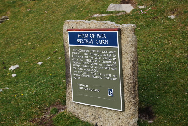
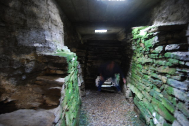
Holm of Papa
The Holm of Papa (or Holm of Papay, Holm of Papa Westray and known locally as the Papay Holm,) is a very small uninhabited island in the Orkney Islands...

Holland House, Papa Westray
Holland Farm is a historic farm complex located on the island of Papa Westray in Orkney, Scotland. The two-storey harled flagstone house with crow-stepped...

Papa Westray
Papa Westray () (Scots: Papa Westree), also known as Papay, is one of the Orkney Islands in Scotland, United Kingdom. The fertile soil has long been a...

Papa Westray Airport
Papa Westray Airport (IATA: PPW, ICAO: EGEP) is located 22 NM (41 km; 25 mi) north of Kirkwall Airport on Papa Westray, Orkney Islands, Scotland. The facility...

Knap of Howar
The Knap of Howar () on the island of Papa Westray in Orkney, Scotland is a Neolithic farmstead which may be the oldest preserved stone house in northern...

St Boniface's Church, Papa Westray
St Boniface's Church, Papa Westray is a historic church and graveyard located on the island of Papa Westray in Orkney, Scotland. The site of the church...
Westray Airport
Westray Airport (IATA: WRY, ICAO: EGEW) is an airport at Aikerness, on Westray in the Orkney Islands, Scotland. It is best known for being one of the two...

Quoygrew settlement, Westray
Quoygrew, Westray is the site of a medieval Norse settlement on the island of Westray in Orkney, Scotland. Established as a small farmstead most likely...
Nearby Amenities
Located within 500m of 59.345628,-2.8810011Have you been to Katie's Pow?
Leave your review of Katie's Pow below (or comments, questions and feedback).