Ascog Bay

Bay in Buteshire

Scotland

Ascog Bay

Sewage screening chamber on the sea front Another contributor has described this as disused toilets, and it would appear that the building has a dual function, both as public conveniences and as a sewage screening chamber. Outside, pipes run out into the sea, so hopefully the effluent would be clean by the time it hit the water.
Sewage screening chamber on the sea front Credit: Gordon Hatton

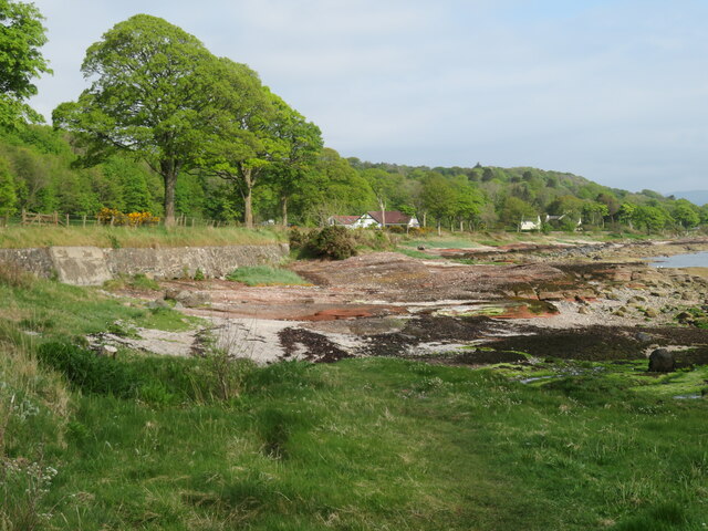
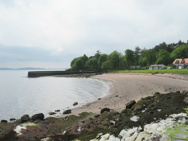
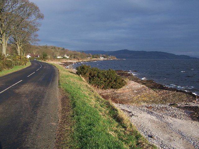
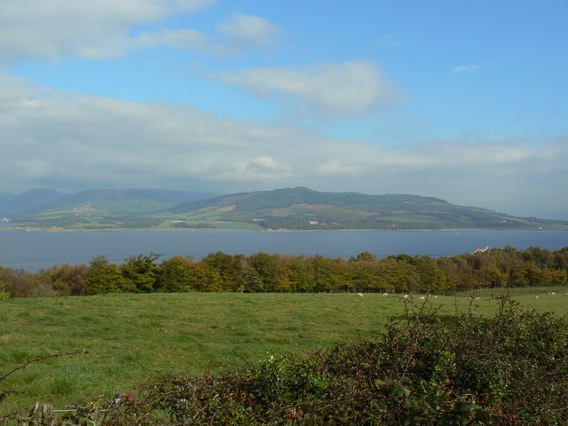
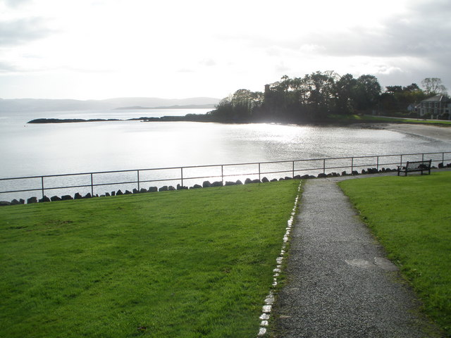
Ascog Bay is a picturesque bay located on the eastern coast of the Isle of Bute, in the county of Buteshire, Scotland. With its stunning natural beauty and diverse marine life, Ascog Bay attracts tourists and locals alike.

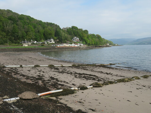
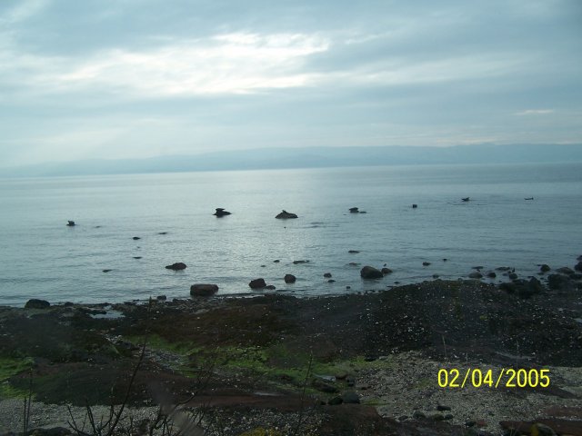
The bay stretches over a mile, offering a sheltered and sandy beach that is perfect for leisurely strolls and sunbathing. The soft sand and calm waters are also ideal for swimming and water sports during the warmer months. The bay is surrounded by rolling hills and lush greenery, providing a peaceful and tranquil atmosphere.

Ascog Bay is not only a haven for beach enthusiasts but also a popular spot for wildlife enthusiasts. The bay is home to a variety of marine species, including seals, dolphins, and porpoises. Birdwatchers can enjoy observing numerous seabirds, such as gulls, cormorants, and herons, that frequent the area.

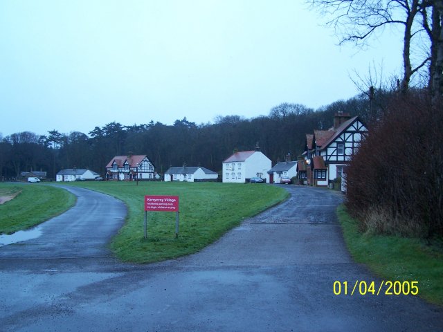
The bay is easily accessible, with a car park available for visitors. Additionally, there are several walking trails that lead to Ascog Bay, allowing visitors to immerse themselves in the natural beauty of the surrounding landscape.

The nearby Ascog Hall Gardens and Victorian Fernery add to the charm of the bay, offering visitors a chance to explore beautifully landscaped gardens and a unique collection of ferns.

Overall, Ascog Bay is a hidden gem in Buteshire, offering a perfect blend of natural beauty, recreational activities, and wildlife sightings for all nature enthusiasts to enjoy.

If you have any feedback on the listing, please let us know in the comments section below.
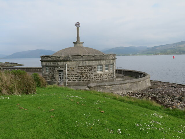
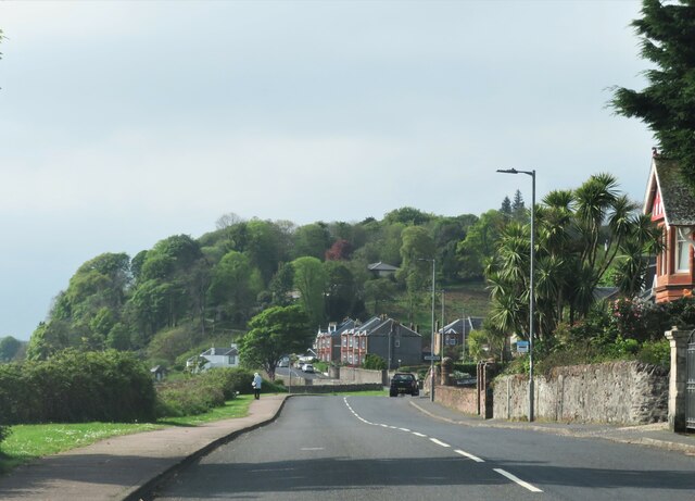
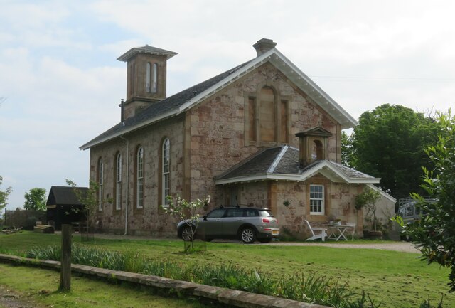
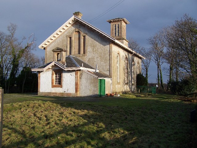
Ascog Bay Images

Images are sourced within 2km of 55.826892/-5.0232143 or Grid Reference NS1063. Thanks to Geograph Open Source API. All images are credited.
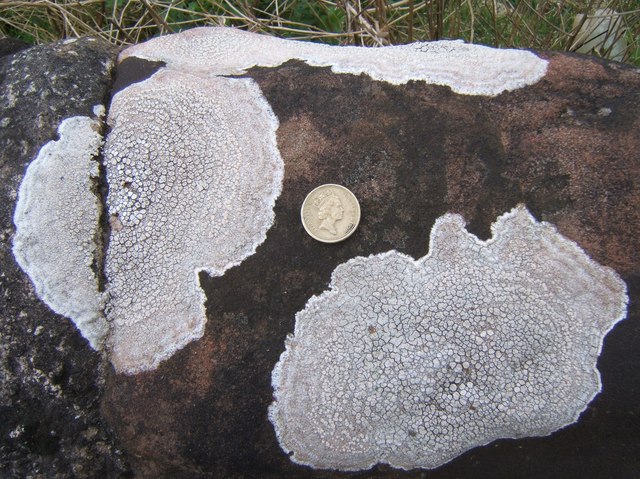
Sewage screening chamber on the sea front Another contributor has described this as disused toilets, and it would appear that the building has a dual function, both as public conveniences and as a sewage screening chamber. Outside, pipes run out into the sea, so hopefully the effluent would be clean by the time it hit the water.
Sewage screening chamber on the sea front
Another contributor has described this as disused toilets, and it would appear that the building has a dual function, both as public conveniences and as a sewage screening chamber. Outside, pipes run out into the sea, so hopefully the effluent would be clean by the time it hit the water.
A844 entering Montford The coast road entering Montford with more desirable villas lining the road. There is hardly a break in the development along the coast road from the far end of Poert Bannatyne to Ascog, south of this point. Almost all properties have a fine view out across the Firth of Clyde.
A844 entering Montford
The coast road entering Montford with more desirable villas lining the road. There is hardly a break in the development along the coast road from the far end of Poert Bannatyne to Ascog, south of this point. Almost all properties have a fine view out across the Firth of Clyde.
Beach at Ascog Rather a weedy corner with drainage pipes at what is otherwise an attractive small bay.
Beach at Ascog
Rather a weedy corner with drainage pipes at what is otherwise an attractive small bay.
Former church at Ascog This appears on the 1869 map as a 'Free Church', so presumably this is the same building. Rather unusual in design with a neat 'Italianate' tower. Now converted into a private residence.
Former church at Ascog
This appears on the 1869 map as a 'Free Church', so presumably this is the same building. Rather unusual in design with a neat 'Italianate' tower. Now converted into a private residence.
Shoreline south of Ascog Outcrops of old red sandstone along the shore here denote that we are in the Lowlands, geologically speaking. The Highland Boundary Fault is a few miles further north and runs across the island from the middle of Rothesay to Scalpsie Bay on the west coast.
Shoreline south of Ascog
Outcrops of old red sandstone along the shore here denote that we are in the Lowlands, geologically speaking. The Highland Boundary Fault is a few miles further north and runs across the island from the middle of Rothesay to Scalpsie Bay on the west coast.
Seashore rocks A large boulder on the shore with patches of smooth old red sandstone, and with large areas of the Bute Conglomerate [the knobbly stuff] of Devonian age.
Seashore rocks
A large boulder on the shore with patches of smooth old red sandstone, and with large areas of the Bute Conglomerate [the knobbly stuff] of Devonian age.
Kerrycroy Bay Pleasant bay on the east side of Bute. Here the main road cuts inland around the perimeter of the Mount Stuart estate.
Kerrycroy Bay
Pleasant bay on the east side of Bute. Here the main road cuts inland around the perimeter of the Mount Stuart estate.
Model Village Designed as a model village by Maria North, wife of the 2nd Marquess of Bute.
Model Village
Designed as a model village by Maria North, wife of the 2nd Marquess of Bute.
Seals
Seals
Bute, Ascog Church
Bute, Ascog Church
Bute, Shoreline Looking north near Ascog Bridge
Bute, Shoreline
Looking north near Ascog Bridge
Bute, Mid Ascog Farm
Rothesay, View over Bogany Wood Looking across to Toward Castle and Buachailean
Rothesay, View over Bogany Wood
Looking across to Toward Castle and Buachailean
Tower at the Ascog Patches This tower (BRB Fl (2) 5M) marks the isolated shallow area at the Ascog Patches.  The code for the tower shows that it is painted black-red-black, flashes twice per minute and is visible from 5 miles away.
Tower at the Ascog Patches
This tower (BRB Fl (2) 5M) marks the isolated shallow area at the Ascog Patches. The code for the tower shows that it is painted black-red-black, flashes twice per minute and is visible from 5 miles away.
The Ascog Patches tower This tower (BRB Fl (2) 5M) marks the isolated shallow area at the Ascog Patches. The code for the tower shows that it is painted black-red-black, flashes twice per minute and is visible from 5 miles away.
The Ascog Patches tower
This tower (BRB Fl (2) 5M) marks the isolated shallow area at the Ascog Patches. The code for the tower shows that it is painted black-red-black, flashes twice per minute and is visible from 5 miles away.
Lovely lichen The wall along the shore of Kerrycroy Bay has many outcrops of lichen - I have placed a £1 coin into this shot, to provide scale.
Lovely lichen
The wall along the shore of Kerrycroy Bay has many outcrops of lichen - I have placed a £1 coin into this shot, to provide scale.
Gateway to Ascog Hall Ascog is from the Norse 'askr-vig' = small-boat bay, cf Port Askaig on the Isle of Islay. The Ascog Hall Fernery has a glazed iron roof and was built c. 1870 - it was rescued from decline in 1986 and is now open to the public.  (This is a brilliant place - I hope to re-visit with viable camera-batteries!)
Gateway to Ascog Hall
Ascog is from the Norse 'askr-vig' = small-boat bay, cf Port Askaig on the Isle of Islay. The Ascog Hall Fernery has a glazed iron roof and was built c. 1870 - it was rescued from decline in 1986 and is now open to the public. (This is a brilliant place - I hope to re-visit with viable camera-batteries!)
Ascog Bay Bute
Ascog Bay Bute
Show me another place!

Ascog Bay is located at Grid Ref: NS1063 (Lat: 55.826892, Lng: -5.0232143)

Unitary Authority: Argyll and Bute

Police Authority: Argyll and West Dunbartonshire

What 3 Words

///pocketed.splat.plotter. Near Rothesay, Argyll & Bute

Related Wikis

Ascog

Ascog (Scottish Gaelic: Àsgaig) is a small village on the Isle of Bute, within Argyll and Bute council area, Scotland. The village is within the parish...
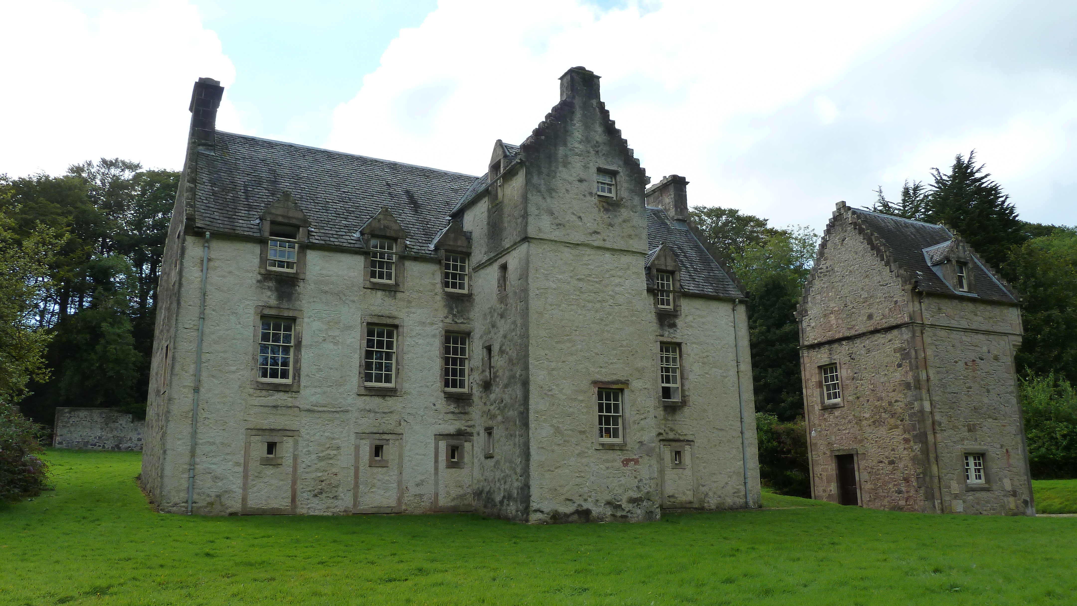
Ascog House

Ascog House is a large 17th-century mansion house at Ascog on the Isle of Bute, southwest Scotland. The house is in the care of the Landmark Trust, and...

Balmory Hall

Balmory Hall is a category A listed Victorian Italianate mansion located near Ascog in the Isle of Bute, Scotland, just west of Ascog House. The hall is...

Loch Ascog

Loch Ascog is a small reservoir on the east coast of the island of Bute, in the council area of Argyll and Bute, Scotland. The loch supplies water to the...

Rothesay

Rothesay ( ROTH-see; Scottish Gaelic: Baile Bhòid [ˈpalə ˈvɔːtʲ]) is the principal town on the Isle of Bute, in the council area of Argyll and Bute, Scotland...

Victoria Hospital, Rothesay

Victoria Hospital is a health facility in High Street, Rothesay, Scotland. It is managed by NHS Highland. == History == The facility has its origins in...

Rothesay Academy

Rothesay Academy is a secondary school in the town of Rothesay on the Isle of Bute. == Feeder schools == Rothesay Academy has 3 associated primary schools...

Bute FM

Bute FM is a Community Radio station for the Isle of Bute, broadcasting in stereo on 96.5 FM and simultaneously broadcasting online via a live internet...

Nearby Amenities

Located within 500m of 55.826892,-5.0232143
Ascog
Name Gd: Àsgaig
Name Sco: Ascok
Place: village
Wikidata: Q611747
Wikipedia: en:Ascog
Lat/Long: 55.8263611/-5.0224283
Bus Stop
Naptan AtcoCode: 60709022
Naptan NaptanCode: 54723925
Lat/Long: 55.8262176/-5.023878
Bus Stop
Lat/Long: 55.8235231/-5.0229747
Bus Stop
Lat/Long: 55.8304012/-5.0247418
Bus Stop
Lat/Long: 55.8232004/-5.0228561
Post Box
Post Box Type: wall
Ref: PA20 38
Royal Cypher: scottish_crown
Lat/Long: 55.8290528/-5.0249739
Power: pole
Lat/Long: 55.8267058/-5.0248513
Power: pole
Lat/Long: 55.8266629/-5.0273284
Power: pole
Lat/Long: 55.8269216/-5.0278479
Power: pole
Lat/Long: 55.8277016/-5.0284487
Power: pole
Lat/Long: 55.8283544/-5.0283631
Power: pole
Lat/Long: 55.8293548/-5.0282583
Power: pole
Lat/Long: 55.8303199/-5.0281604
Power: pole
Lat/Long: 55.8266788/-5.0264123
Telephone
Booth: K6
Covered: booth
Phone: +44 1700 504091
Lat/Long: 55.8259699/-5.022798
The data included in this document is from www.openstreetmap.org. The data is made available under ODbL.

Have you been to Ascog Bay?

Leave your review of Ascog Bay below (or comments, questions and feedback).