Loch Shira

Bay in Argyllshire

Scotland

Loch Shira

Track up to Dun na Cuaiche
Track up to Dun na Cuaiche Credit: Steven Brown

Loch Shira is a picturesque bay located in Argyllshire, Scotland. Situated approximately 11 miles south of the town of Inveraray, the bay is nestled between rolling hills and surrounded by stunning natural beauty. It stretches for about 3 miles and is a popular destination for tourists and locals alike.

The tranquil waters of Loch Shira are renowned for their clarity, offering a perfect spot for various water activities such as kayaking, sailing, and fishing. The bay is home to an abundance of fish species, including trout, salmon, and pike, making it a haven for anglers.

The surrounding area of Loch Shira is blessed with diverse wildlife and lush vegetation. Visitors can spot a wide range of bird species, including herons, ospreys, and ducks, making it a fantastic spot for birdwatching enthusiasts. The bay is also home to a variety of plant life, with its shores adorned with vibrant wildflowers and trees.

For those seeking a peaceful retreat, Loch Shira offers several camping and caravan sites along its shores, providing the perfect opportunity to immerse oneself in the natural surroundings. There are also charming cottages and bed and breakfast options available nearby for those looking for a more comfortable stay.

Overall, Loch Shira, Argyllshire, is a serene and idyllic bay that showcases the breathtaking beauty of Scotland's landscape. With its crystal-clear waters, diverse wildlife, and ample recreational opportunities, it is a must-visit destination for nature lovers and those seeking a tranquil escape.

If you have any feedback on the listing, please let us know in the comments section below.
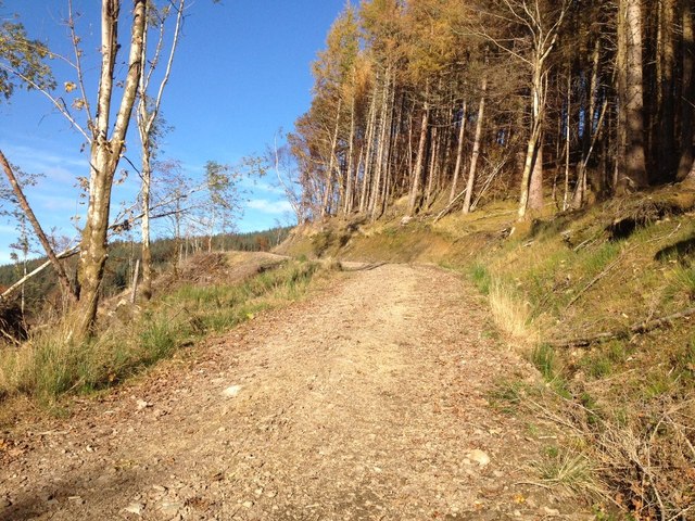
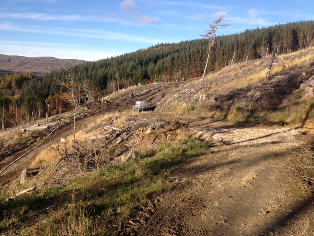
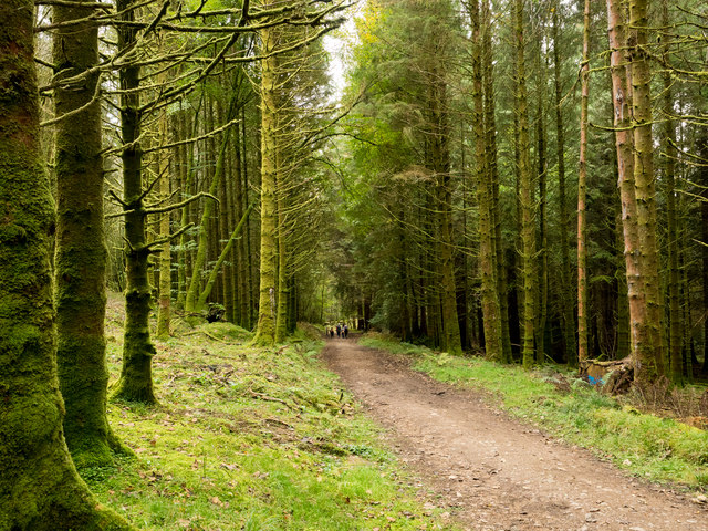
Loch Shira Images

Images are sourced within 2km of 56.23888/-5.0558633 or Grid Reference NN1009. Thanks to Geograph Open Source API. All images are credited.

Track up to Dun na Cuaiche
Felling activity near Inveraray
Woodland road The road is descending towards Inveraray Castle on the western slopes of Dùn na Cuaiche and is used on a walking ascent of that hill.
Woodland road
The road is descending towards Inveraray Castle on the western slopes of Dùn na Cuaiche and is used on a walking ascent of that hill.
Track on Dun na Cuaiche From just below a hairpin bend we look down the path that climbs to the top of Dun na Cuaiche.
Track on Dun na Cuaiche
From just below a hairpin bend we look down the path that climbs to the top of Dun na Cuaiche.
Woodland high on Dùn na Cuaiche Inveraray lies below on Loch Fyne.
Woodland high on Dùn na Cuaiche
Inveraray lies below on Loch Fyne.
Inveraray reflections The town of Inveraray reflected in Loch Fyne.
Inveraray reflections
The town of Inveraray reflected in Loch Fyne.
George Hotel, Inveraray Category A listed. Reference LB34995.
Dating from 1779.
George Hotel, Inveraray
Category A listed. Reference LB34995. Dating from 1779.
Vital Spark at Inveraray VIC 72, renamed Eilean Eisdeal, continued in operation as the last of the true working "puffers" into the mid 1990s. In 2006 she was again renamed as Vital Spark of Glasgow after the Inveraray writer Neil Munro's Para Handy stories.
Vital Spark at Inveraray
VIC 72, renamed Eilean Eisdeal, continued in operation as the last of the true working "puffers" into the mid 1990s. In 2006 she was again renamed as Vital Spark of Glasgow after the Inveraray writer Neil Munro's Para Handy stories.
Fisher Row, Inveraray Cottages on the Loch front.
Fisher Row, Inveraray
Cottages on the Loch front.
Inveraray War Memorial Unveiled 20 August 1922. Designed by Kellock Brown RAC, Glasgow. Built by George Mackenzie, estate clerk of works.
Inveraray War Memorial
Unveiled 20 August 1922. Designed by Kellock Brown RAC, Glasgow. Built by George Mackenzie, estate clerk of works.
War memorial at Inveraray
Inveraray
Inveraray
Inveraray ca. 1940 The prospect of the county town of Argyll and seat of the Campbell chiefs (whose famous castle lies out of view to the right), as seen by travellers approaching from Glasgow on the A83. Because of the tortuous landscape of mountains and lochs the main road has to enter from the north.  Loch Fyne, Scotland's longest sea loch separating the peninsulas of Cowal and Mid-Argyll, is on the left.

Prominent in the centre of this view is the tall slender spire of <a href="https://www.geograph.org.uk/photo/6208042">NN0908 : Glenaray and Inveraray Parish Church and Church Hall</a>. The church was completed in 1802 by the architect Robert Mylne for the 5th Duke of Argyll and the steeple rebuilt in 1838, surviving just over a century until taken down as unsafe in 1941. This image can thus be dated to no later than around 1940. As Frank Arneil Walker remarks in his 2000 Pevsner guide, the steeple emerging "from the roof ridge as a square plinth, [becoming] a domed octagonal belfry with engaged columns, before finally rising to an obelisk pinnacle" made a "(literally) crucial impact on the townscape" which has now been lost.
Inveraray ca. 1940
The prospect of the county town of Argyll and seat of the Campbell chiefs (whose famous castle lies out of view to the right), as seen by travellers approaching from Glasgow on the A83. Because of the tortuous landscape of mountains and lochs the main road has to enter from the north. Loch Fyne, Scotland's longest sea loch separating the peninsulas of Cowal and Mid-Argyll, is on the left. Prominent in the centre of this view is the tall slender spire of NN0908 : Glenaray and Inveraray Parish Church and Church Hall. The church was completed in 1802 by the architect Robert Mylne for the 5th Duke of Argyll and the steeple rebuilt in 1838, surviving just over a century until taken down as unsafe in 1941. This image can thus be dated to no later than around 1940. As Frank Arneil Walker remarks in his 2000 Pevsner guide, the steeple emerging "from the roof ridge as a square plinth, [becoming] a domed octagonal belfry with engaged columns, before finally rising to an obelisk pinnacle" made a "(literally) crucial impact on the townscape" which has now been lost.
Loch Fyne seen from Inveraray Loch Fyne (Gaelic: Loch Fìne) is a sea loch on the west coast of Argyll and Bute. It extends 40 miles inland from the Sound of Bute, making it the longest of the sea lochs. It is connected to the Sound of Jura by the Crinan Canal.
Loch Fyne seen from Inveraray
Loch Fyne (Gaelic: Loch Fìne) is a sea loch on the west coast of Argyll and Bute. It extends 40 miles inland from the Sound of Bute, making it the longest of the sea lochs. It is connected to the Sound of Jura by the Crinan Canal.
The pier, Inveraray A close-up of the ship, the "Vital Spark", can be seen in <a href="https://www.geograph.org.uk/photo/7261484">NN0908 : The Vital Spark, Inveraray</a>.
The pier, Inveraray
A close-up of the ship, the "Vital Spark", can be seen in NN0908 : The Vital Spark, Inveraray.
Loch Fyne at low tide seen from Inveraray Loch Fyne (Gaelic: Loch Fìne) is a sea loch on the west coast of Argyll and Bute. It extends 40 miles inland from the Sound of Bute, making it the longest of the sea lochs. It is connected to the Sound of Jura by the Crinan Canal.
Loch Fyne at low tide seen from Inveraray
Loch Fyne (Gaelic: Loch Fìne) is a sea loch on the west coast of Argyll and Bute. It extends 40 miles inland from the Sound of Bute, making it the longest of the sea lochs. It is connected to the Sound of Jura by the Crinan Canal.
Show me another place!

Loch Shira is located at Grid Ref: NN1009 (Lat: 56.23888, Lng: -5.0558633)

Unitary Authority: Argyll and Bute

Police Authority: Argyll and West Dunbartonshire

What 3 Words

///target.lessening.butter. Near Inveraray, Argyll & Bute

Nearby Locations

Loch Shira

Related Wikis

River Shira

River Shira (Scottish Gaelic: Siara / Abhainn Siara) is the river that runs for about 7 miles through Glen Shira, originating to the north-east at 350...

Inveraray Castle

Inveraray Castle (pronounced invə-REHRUH or invə-REHREH; Scottish Gaelic Caisteal Inbhir Aora [ˈkʰaʃtʲəl̪ˠ iɲɪɾʲˈɯːɾə]) is a country house near Inveraray...
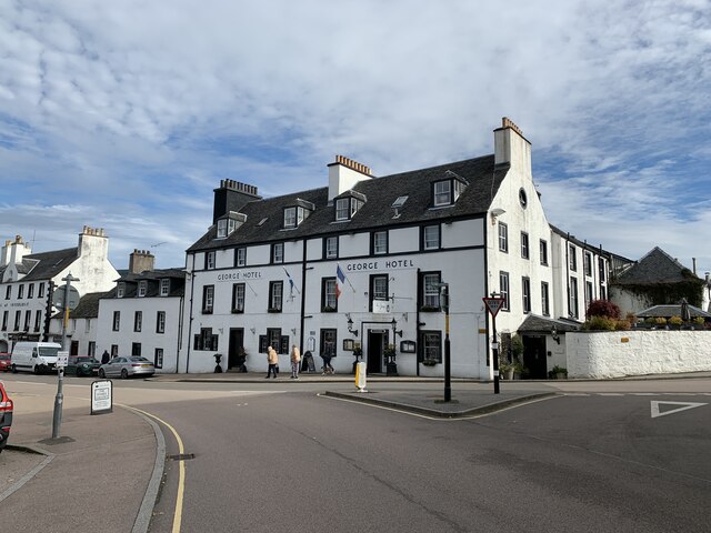
Inveraray

Inveraray ( or ; Scottish Gaelic: Inbhir Aora pronounced [iɲɪɾʲˈɯːɾə] meaning "mouth of the Aray") is a town in Argyll and Bute, Scotland. It is on the...
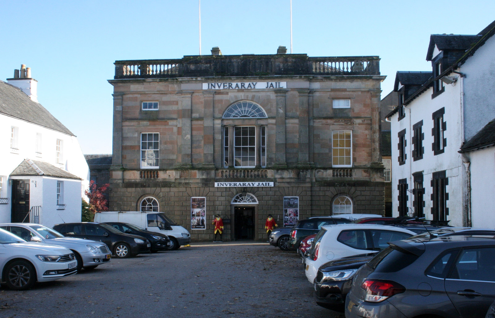
Inveraray Jail

Inveraray Jail is a former prison and courthouse in Church Square, Inveraray, Argyll and Bute, Scotland. It was built in 1820 and is a Category A listed...

Inveraray Bell Tower

The Duke's Tower, also known as Inveraray Bell Tower, is the detached bell tower of All Saints' Church, Inveraray, Argyll and Bute, Scotland. Standing...

St Catherines, Argyll

St Catherines; (Scottish Gaelic: Cill Chaitrìona) is a village, on the Cowal peninsula in Argyll and Bute, Scottish Highlands. It is located on the banks...
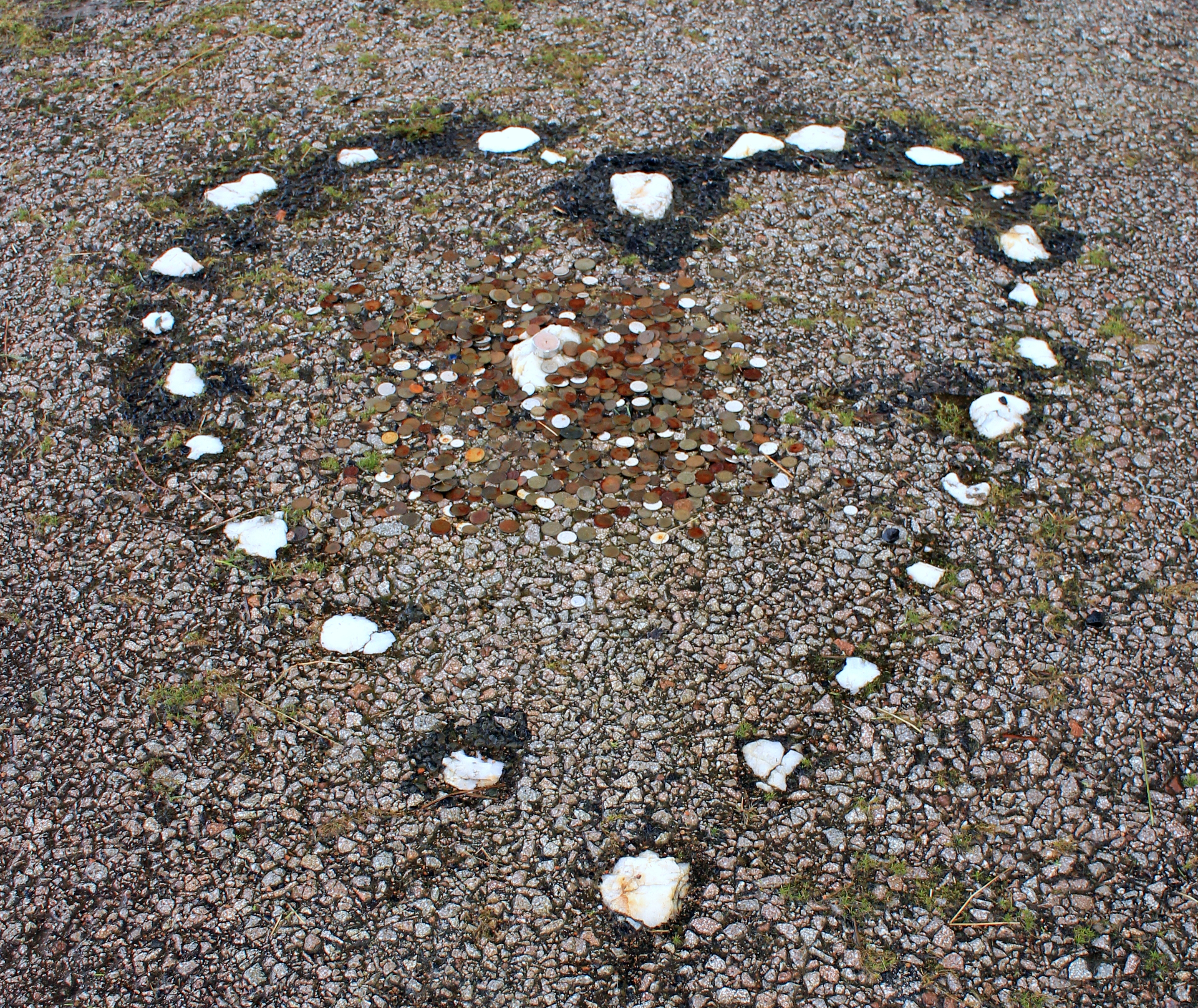
The Tinkers' Heart

The Tinkers' Heart is a Scottish Travellers' commemorative monument near Loch Fyne in Argyll and Bute, Scotland. It is also known as the Gypsy's Heart...

Combined Operations Training Centre

The Combined Operations Training Centre, also known as No.1 Combined Training Centre, Inveraray was a military installation on the banks of Loch Fyne near...

Nearby Amenities

Located within 500m of 56.23888,-5.0558633
Power: pole
Lat/Long: 56.2420518/-5.0604326
Power: pole
Lat/Long: 56.2413781/-5.0612453
The data included in this document is from www.openstreetmap.org. The data is made available under ODbL.

Have you been to Loch Shira?

Leave your review of Loch Shira below (or comments, questions and feedback).