Poll Craigavaig
Bay in Inverness-shire
Scotland
Poll Craigavaig
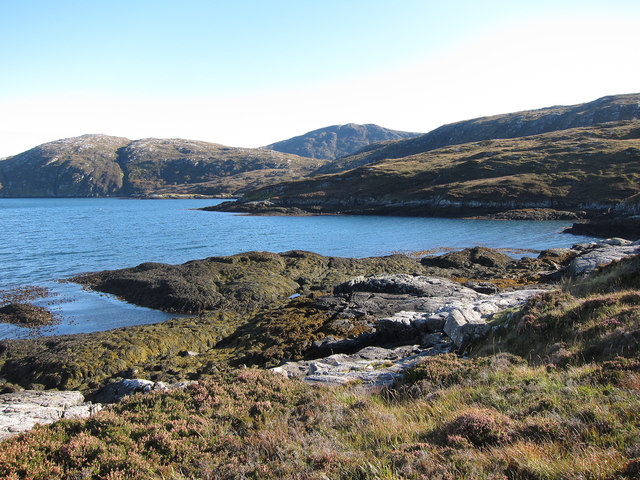
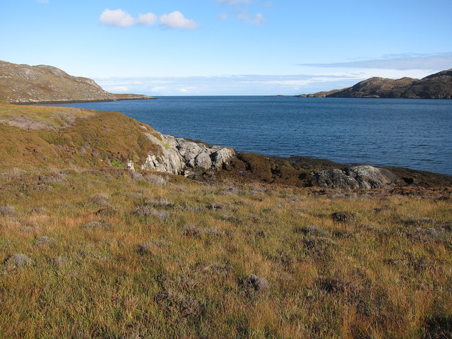
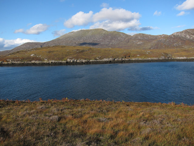
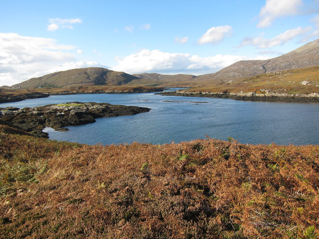
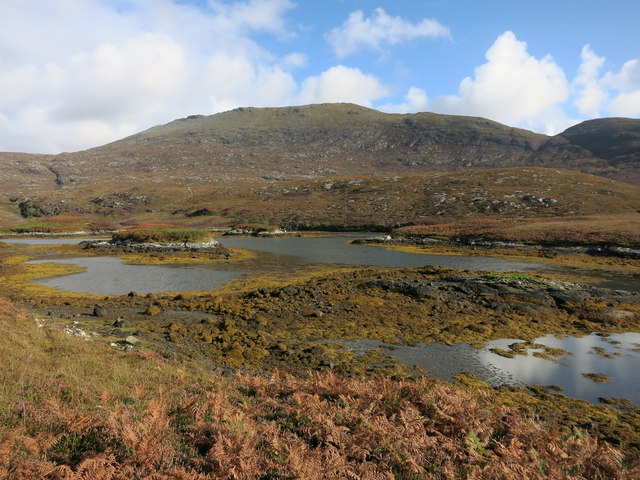
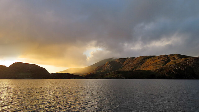
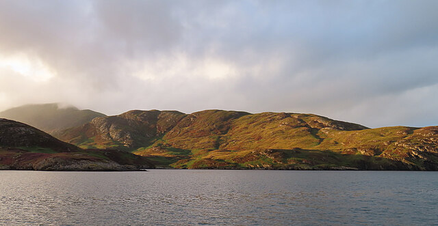
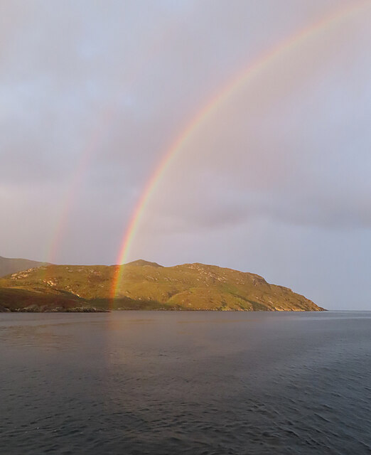
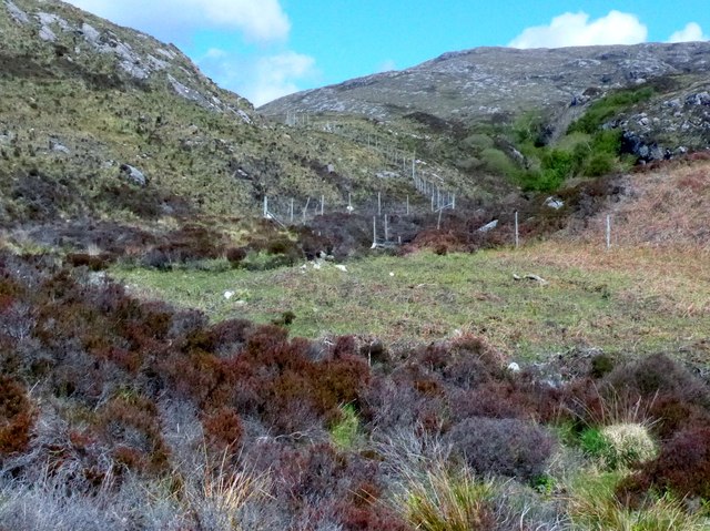
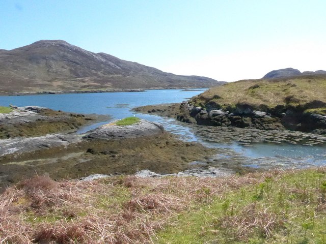
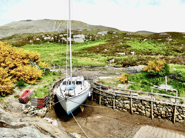
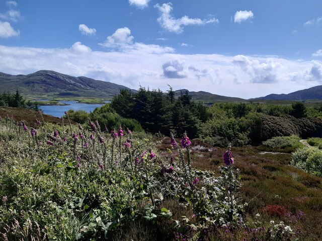
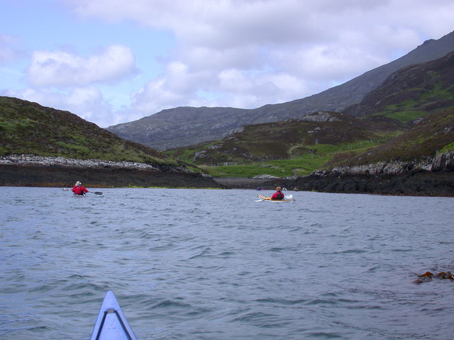
Poll Craigavaig, located in Inverness-shire, is a picturesque bay nestled along the rugged coast of Scotland. Surrounded by rolling hills and breathtaking natural beauty, this bay offers a serene and tranquil escape for visitors.
The bay, with its pristine sandy beach, is a popular destination for locals and tourists alike. The crystal-clear waters provide an ideal spot for swimming, sunbathing, and water sports activities such as kayaking and paddleboarding. The bay is also a haven for wildlife enthusiasts, as it is home to a variety of seabirds and marine life.
The surrounding landscape is dominated by dramatic cliffs, providing stunning panoramic views of the bay and the North Sea beyond. Hiking trails wind their way along the coastline, offering visitors the opportunity to explore the area's natural wonders and discover hidden coves and caves.
For those seeking tranquility, the bay is an excellent spot for picnicking or simply soaking up the peaceful atmosphere. The absence of commercial development in the immediate vicinity ensures an unspoiled and untouched environment.
Access to Poll Craigavaig is relatively easy, with a parking area available for visitors. The bay is also within close proximity to other attractions in Inverness-shire, making it an ideal day trip destination.
In summary, Poll Craigavaig in Inverness-shire is a stunning bay characterized by its sandy beach, clear waters, and breathtaking natural beauty. With its peaceful atmosphere and abundance of outdoor activities, it offers a perfect escape for nature lovers and those seeking a tranquil seaside retreat.
If you have any feedback on the listing, please let us know in the comments section below.
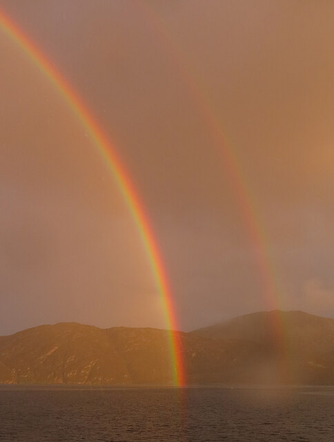
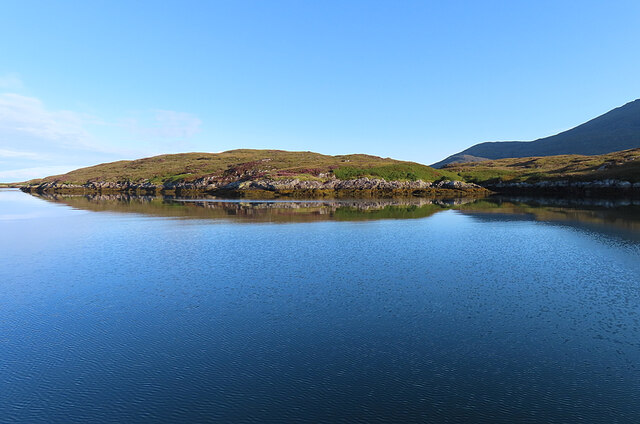
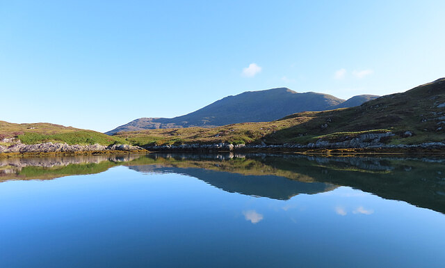
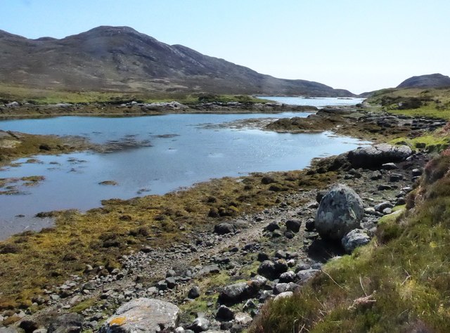
Poll Craigavaig Images
Images are sourced within 2km of 57.224222/-7.3043424 or Grid Reference NF7927. Thanks to Geograph Open Source API. All images are credited.
Poll Craigavaig is located at Grid Ref: NF7927 (Lat: 57.224222, Lng: -7.3043424)
Unitary Authority: Na h-Eileanan an Iar
Police Authority: Highlands and Islands
What 3 Words
///cashiers.situation.drainage. Near Lochboisdale, Na h-Eileanan Siar
Nearby Locations
Related Wikis

Beinn Mhòr (South Uist)
Beinn Mhòr is a mountain on the island of South Uist in the Outer Hebrides of Scotland. With a height of 620 metres (2,034 ft), it is the highest point...

South Uist
South Uist (Scottish Gaelic: Uibhist a Deas, [ˈɯ.ɪʃtʲ ə ˈtʲes̪] ; Scots: Sooth Uist) is the second-largest island of the Outer Hebrides in Scotland. At...

Stuley
Stuley is an island lying to the east of South Uist in the Outer Hebrides, Scotland. It lies off the section of coastline between Loch Eynort and Loch...

Milton (South Uist)
Milton (Scottish Gaelic: Geàrraidh Bhailteas) is the name of a tack or tenant farm on the island of South Uist in the Outer Hebrides, Scotland. It was...

Bornish
Bornish (Scottish Gaelic: Bòrnais) is a village and community council area on South Uist in the Outer Hebrides, Scotland. Bornish is also within the civil...

Askernish
Askernish (Scottish Gaelic: Àisgearnais, Aisgernis) is a crofting community on South Uist, in the Outer Hebrides, Scotland. Askernish is in the parish...

Auratote
Auratote (Scottish Gaelic: Oratobht) is a location on South Uist in the Outer Hebrides, Scotland. Auratote is within the parish of South Uist. == References... ==

Daliburgh
Daliburgh (Scottish Gaelic: Dalabrog) is a crofting township on South Uist, in the Outer Hebrides, Scotland. Daliburgh is situated 1+1⁄2 miles (2.5 kilometres...
Nearby Amenities
Located within 500m of 57.224222,-7.3043424Have you been to Poll Craigavaig?
Leave your review of Poll Craigavaig below (or comments, questions and feedback).