East Gill Force

Waterfall in Yorkshire Richmondshire

England

East Gill Force

Fields and barns in Stonesdale The fields are bound with drystone walls.

Drystone walls are built without mortar, and their stability – they can stand for 200 years – is due to the skill of the craftsmen who place rough boulders and angular stones together.

Many drystone walls were constructed as part of the enclosure of open grazing. They were especially useful in areas too exposed for hedgerows to survive and where stones were readily available.

Most drystone walls are wider at the base than at the crown, and are often capped with coping stones. A typical wall has two outer layers of large, flattish stones enclosing an inner ‘heart’ of smaller, rounder stones. Often it is reinforced with ‘through bands’ of even larger, flat stones which can also be used as stiles.

The very dryness of a wall makes it more likely to endure wind and frost and to act as shelter for livestock as well as a boundary.
Fields and barns in Stonesdale Credit: Maigheach-gheal

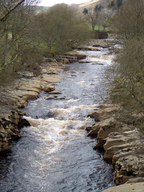
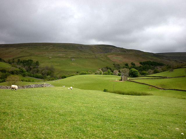
East Gill Force is a picturesque waterfall located in Yorkshire, England. Situated within the stunning scenery of Swaledale, it is a popular destination for nature lovers and hikers alike. The waterfall is nestled within a wooded area, adding to its charm and providing a tranquil atmosphere.

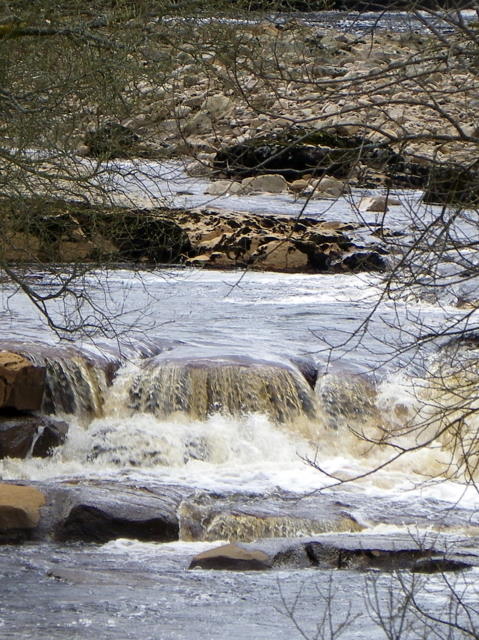
East Gill Force is fed by the East Gill Beck, a small river that flows through the region. The water cascades down a series of rocky steps, creating a beautiful spectacle as it plunges into a pool below. The height of the waterfall reaches approximately 10 meters, making it an impressive sight to behold.

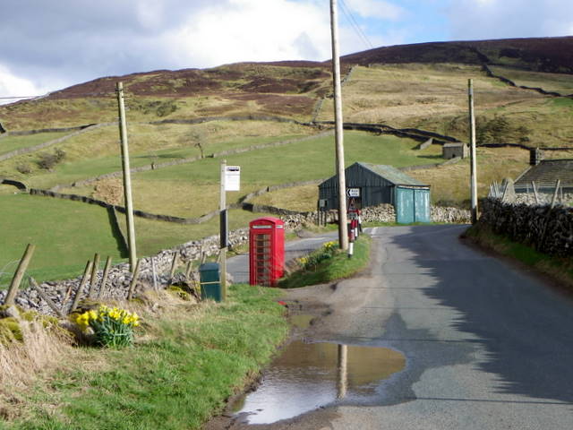
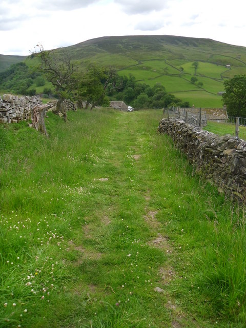
Access to East Gill Force is relatively easy, with a well-maintained footpath leading visitors to the viewing point. Along the way, hikers can enjoy the surrounding natural beauty, including lush greenery, wildflowers, and native wildlife. The peaceful ambiance and the soothing sound of rushing water make it an ideal location for relaxation and contemplation.

Photographers are particularly drawn to East Gill Force due to its photogenic qualities. The interplay of light and shadow, combined with the vibrant colors of the surrounding flora, provides ample opportunities for capturing stunning images. It is not uncommon to find photographers setting up their tripods to capture the waterfall from different angles.

Overall, East Gill Force offers a delightful experience for visitors seeking natural beauty and a sense of tranquility. Its accessibility, combined with its scenic surroundings, make it a must-visit destination for anyone exploring Yorkshire's breathtaking landscapes.

If you have any feedback on the listing, please let us know in the comments section below.

East Gill Force Images

Images are sourced within 2km of 54.405037/-2.1613658 or Grid Reference NY8901. Thanks to Geograph Open Source API. All images are credited.

Fields and barns in Stonesdale The fields are bound with drystone walls.

Drystone walls are built without mortar, and their stability – they can stand for 200 years – is due to the skill of the craftsmen who place rough boulders and angular stones together.

Many drystone walls were constructed as part of the enclosure of open grazing. They were especially useful in areas too exposed for hedgerows to survive and where stones were readily available.

Most drystone walls are wider at the base than at the crown, and are often capped with coping stones. A typical wall has two outer layers of large, flattish stones enclosing an inner ‘heart’ of smaller, rounder stones. Often it is reinforced with ‘through bands’ of even larger, flat stones which can also be used as stiles.

The very dryness of a wall makes it more likely to endure wind and frost and to act as shelter for livestock as well as a boundary.
Fields and barns in Stonesdale
The fields are bound with drystone walls. Drystone walls are built without mortar, and their stability – they can stand for 200 years – is due to the skill of the craftsmen who place rough boulders and angular stones together. Many drystone walls were constructed as part of the enclosure of open grazing. They were especially useful in areas too exposed for hedgerows to survive and where stones were readily available. Most drystone walls are wider at the base than at the crown, and are often capped with coping stones. A typical wall has two outer layers of large, flattish stones enclosing an inner ‘heart’ of smaller, rounder stones. Often it is reinforced with ‘through bands’ of even larger, flat stones which can also be used as stiles. The very dryness of a wall makes it more likely to endure wind and frost and to act as shelter for livestock as well as a boundary.
River Swale from Park Bridge The River Swale is the northernmost tributary of the Yorkshire Ouse with its headwaters located in the eastern Yorkshire Dales, from where it flows in an easterly direction towards Richmond.
River Swale from Park Bridge
The River Swale is the northernmost tributary of the Yorkshire Ouse with its headwaters located in the eastern Yorkshire Dales, from where it flows in an easterly direction towards Richmond.
River Swale from Park Bridge The name Swale in Old English means 'swilling and fast flowing'. It certainly is when viewed from Park Bridge.
River Swale from Park Bridge
The name Swale in Old English means 'swilling and fast flowing'. It certainly is when viewed from Park Bridge.
Methodist Chapel, Keld The chapel dates from 1841 and is a sad sight now that it is boarded up.
Methodist Chapel, Keld
The chapel dates from 1841 and is a sad sight now that it is boarded up.
Date stone, Keld Methodist Chapel For a wider view of the chapel <a href="https://www.geograph.org.uk/photo/2403594">NY8900 : Methodist Chapel, Keld</a>
Date stone, Keld Methodist Chapel
For a wider view of the chapel NY8900 : Methodist Chapel, Keld
Village scene, Keld A K6 telephone box stands beside the narrow road that passes the main part of the village.

In 1935, the Post Office commissioned a new kiosk from Sir Giles Gilbert Scott to celebrate the Jubilee of King George V.  The K6 Jubilee Kiosk, as it is known, was similar to the K2 box, being made of cast iron and painted red but was 25% lighter in weight.  By the end of the 1930s there were 20,000 K6 telephone boxes in use all over the UK.
Village scene, Keld
A K6 telephone box stands beside the narrow road that passes the main part of the village. In 1935, the Post Office commissioned a new kiosk from Sir Giles Gilbert Scott to celebrate the Jubilee of King George V. The K6 Jubilee Kiosk, as it is known, was similar to the K2 box, being made of cast iron and painted red but was 25% lighter in weight. By the end of the 1930s there were 20,000 K6 telephone boxes in use all over the UK.
Village scene, Keld The former institute stands on the right and former manse, which is now the United Reformed Church stands at the bottom of the lane.
Village scene, Keld
The former institute stands on the right and former manse, which is now the United Reformed Church stands at the bottom of the lane.
United Reformed Church, Keld The building is the former manse and is dated 1860.
United Reformed Church, Keld
The building is the former manse and is dated 1860.
Date stone, Keld Chapel The date stone is on the United Reformed Church <a href="https://www.geograph.org.uk/photo/2403691">NY8901 : United Reformed Church, Keld</a>
Date stone, Keld Chapel
The date stone is on the United Reformed Church NY8901 : United Reformed Church, Keld
Sundial, Keld Chapel The sundial is on the United Reformed Church <a href="https://www.geograph.org.uk/photo/2403691">NY8901 : United Reformed Church, Keld</a>

Sundials or sun clocks are considered to be the oldest known device for the measurement of time and one of the most ancient scientific instruments.
The oldest known true sundial was built around 1500BC in Egypt. Shaped like a letter 'L' the length of the shadow cast by the vertical leg along the horizontal leg indicated the time. The Romans perfected the horizontal sundial we know today and invented portable travelling versions.
Sundial, Keld Chapel
The sundial is on the United Reformed Church NY8901 : United Reformed Church, Keld Sundials or sun clocks are considered to be the oldest known device for the measurement of time and one of the most ancient scientific instruments. The oldest known true sundial was built around 1500BC in Egypt. Shaped like a letter 'L' the length of the shadow cast by the vertical leg along the horizontal leg indicated the time. The Romans perfected the horizontal sundial we know today and invented portable travelling versions.
Bench Mark, Keld Chapel The bench mark is to be found on the south face of the building.  For a view of the building <a href="https://www.geograph.org.uk/photo/2403691">NY8901 : United Reformed Church, Keld</a> and for further information on the bench mark and others in the area <span class="nowrap"><a title="http://www.bench-marks.org.uk/bm37903" rel="nofollow ugc noopener" href="http://www.bench-marks.org.uk/bm37903">Link</a><img style="margin-left:2px;" alt="External link" title="External link - shift click to open in new window" src="https://s1.geograph.org.uk/img/external.png" width="10" height="10"/></span>
Bench Mark, Keld Chapel
The bench mark is to be found on the south face of the building. For a view of the building NY8901 : United Reformed Church, Keld and for further information on the bench mark and others in the area LinkExternal link
Bellcote, Old School The stone bellcote on the old school in Keld is inscribed with the name W. Metcalfe and the date 1847.

The Metcalfe family originated in Swaledale and Wensleydale and are now scattered the world over.
Bellcote, Old School
The stone bellcote on the old school in Keld is inscribed with the name W. Metcalfe and the date 1847. The Metcalfe family originated in Swaledale and Wensleydale and are now scattered the world over.
War Memorial, Keld The war memorial remembers those of the village who lost their lives during the Great War (1914-1918).

The names on the memorial are:  

Richard Alderson
Thomas Clarkson
Wm Waller Hutchinson
Robert Rukin

We will remember them.
War Memorial, Keld
The war memorial remembers those of the village who lost their lives during the Great War (1914-1918). The names on the memorial are: Richard Alderson Thomas Clarkson Wm Waller Hutchinson Robert Rukin We will remember them.
Aygill near Angram The small green hill resembles a Norman motte but is more likely to be simply a glacial deposit of boulder clay.
Aygill near Angram
The small green hill resembles a Norman motte but is more likely to be simply a glacial deposit of boulder clay.
Sheep pasture near Keld The quintessential upper Swaledale scene of green pastures, field barns and sheep happily caught in a brief patch of sun. The River Swale runs in a wooded gorge beyond with Beldi Hill above, the scene of much lead mining, once a mainstay of the local economy.
Sheep pasture near Keld
The quintessential upper Swaledale scene of green pastures, field barns and sheep happily caught in a brief patch of sun. The River Swale runs in a wooded gorge beyond with Beldi Hill above, the scene of much lead mining, once a mainstay of the local economy.
Recently harvested grass fields near Keld The black plastic bales of silage are in the valley of the Skeb Skeugh stream. Keld village in the middle distance sits above the wooded course of the upper Swale.
Recently harvested grass fields near Keld
The black plastic bales of silage are in the valley of the Skeb Skeugh stream. Keld village in the middle distance sits above the wooded course of the upper Swale.
Pennine way. Looking back towards Keld.
Pennine way.
Looking back towards Keld.
Pennine way. Looking south along path.
Pennine way.
Looking south along path.
Show me another place!

East Gill Force is located at Grid Ref: NY8901 (Lat: 54.405037, Lng: -2.1613658)

Division: North Riding

Administrative County: North Yorkshire

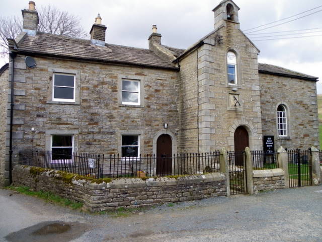
District: Richmondshire

Police Authority: North Yorkshire

What 3 Words

///trombone.hotspot.crispy. Near Kirkby Stephen, Cumbria

Related Wikis

East Gill Force

East Gill Force is a waterfall in Swaledale, 330 yards (300 m) east of the hamlet of Keld, in the Yorkshire Dales National Park, North Yorkshire, England...

Kisdon Force

Kisdon Force is a series of waterfalls on the River Swale in Swaledale, England. The falls are situated within the Yorkshire Dales National Park in the...

Keld, North Yorkshire

Keld is a village in the English county of North Yorkshire. It is in Swaledale, and the Yorkshire Dales National Park. The name derives from the Viking...

Catrake Force

Catrake Force is a waterfall on the River Swale in North Yorkshire, England. It is not visible from the road but is accessible via a campsite in Keld....

Nearby Amenities

Located within 500m of 54.405037,-2.1613658
Catrake Force
Image: https://www.geograph.org.uk/photo/519367
Waterway: waterfall
Wikidata: Q37779
Wikipedia: en:Catrake Force
Lat/Long: 54.4070083/-2.1671791
Keld
Place: hamlet
Wikidata: Q3695942
Wikipedia: en:Keld, North Yorkshire
Lat/Long: 54.405855/-2.1664319
East Gill Force (upper)
Image: https://www.geograph.org.uk/photo/5105644
Waterway: waterfall
Wikidata: Q5328445
Wikipedia: en:East Gill Force
Lat/Long: 54.4053284/-2.1610951
Toilets
Lat/Long: 54.4062404/-2.1677412
Kisdon Force
Image: https://www.geograph.org.uk/photo/613040
Waterway: waterfall
Wikidata: Q4584456
Wikipedia: en:Kisdon Force
Lat/Long: 54.4041573/-2.1576273
Birk Hill
Natural: peak
Source: OS OpenData StreetView
Lat/Long: 54.4035042/-2.158482
Beldi Hill
Natural: peak
Source: OS OpenData StreetView
Lat/Long: 54.405259/-2.1539115
Cafe
Rukins Tea Shop
Lat/Long: 54.4062539/-2.1665351
Rukin's Park Lodge Campsite
Tourism: camp_site
Website: https://rukins-keld.co.uk/
Lat/Long: 54.4048428/-2.1664373
Bus Stop
Keld
Bench: no
Bus: yes
Public Transport: platform
Shelter: no
Tactile Paving: no
Lat/Long: 54.403628/-2.1670131
Telephone
Booth: K6
Covered: booth
Image: https://www.geograph.org.uk/photo/1729186
Listed Status: Grade II
Wikidata: Q26639327
Lat/Long: 54.4035463/-2.1668388
East Stonesdale
Place: farm
Lat/Long: 54.4066098/-2.1631967
Barrier: stile
Foot: yes
Lat/Long: 54.4020368/-2.156678
Information: guidepost
Tourism: information
Lat/Long: 54.4054867/-2.1611639
Historic Amenity: post_box
Note: I highly suspect this one is gone now as there is a brand new box to the right of the entrance to the carpark (as mapped).
Post Box Type: lamp
Source: survey
Lat/Long: 54.4057688/-2.1664356
East Gill Force (lower)
Image: https://www.geograph.org.uk/photo/4636531
Waterway: waterfall
Lat/Long: 54.4048635/-2.1613949
Grit Bin
Lat/Long: 54.4050942/-2.1668758
Clock
Display: sundial
Image: https://www.geograph.org.uk/photo/2404016
Lat/Long: 54.4055176/-2.1663486
Bench
Lat/Long: 54.4058865/-2.1661807
Post Box
Post Box Type: lamp
Royal Cypher: EIIR
Royal Cypher Wikidata: Q33102113
Lat/Long: 54.4039201/-2.1667772
Defibrillator
Emergency: defibrillator
Indoor: no
Lat/Long: 54.4057954/-2.1666552
Historic: memorial
Image: https://www.geograph.org.uk/photo/2868592
Memorial: war_memorial
Lat/Long: 54.4033415/-2.1666764
Hiking: yes
Image: https://www.geograph.org.uk/photo/5837220
Information: guidepost
Tourism: information
Lat/Long: 54.404681/-2.1631722
Power: pole
Lat/Long: 54.4051674/-2.1664444
Barrier: entrance
Lat/Long: 54.4037381/-2.1667857
Power: pole
Lat/Long: 54.4056513/-2.1672973
Power: pole
Lat/Long: 54.4036733/-2.1639526
Power: pole
Lat/Long: 54.4046327/-2.1655981
Power: pole
Lat/Long: 54.4040792/-2.1646486
Power: pole
Lat/Long: 54.4030722/-2.1644528
Power: pole
Lat/Long: 54.4023115/-2.1650784
Power: pole
Lat/Long: 54.4014594/-2.1657731
Power: pole
Lat/Long: 54.4037568/-2.1687256
Power: pole
Lat/Long: 54.4042326/-2.1661654
Power: pole
Lat/Long: 54.4039645/-2.1667602
Power: pole
Lat/Long: 54.4038427/-2.1674167
Power: pole
Lat/Long: 54.4037061/-2.1681073
Power: pole
Lat/Long: 54.4040199/-2.168448
Power: pole
Lat/Long: 54.4043368/-2.1687967
Bench
Backrest: yes
Source: survey
Lat/Long: 54.4054421/-2.161146
Bench
Backrest: yes
Source: survey
Lat/Long: 54.4054424/-2.1611948
Information: guidepost
Tourism: information
Lat/Long: 54.4032799/-2.1604954
Information: guidepost
Tourism: information
Lat/Long: 54.4031769/-2.1587647
Information: guidepost
Tourism: information
Lat/Long: 54.4020193/-2.1566905
Grit Bin
Lat/Long: 54.4060229/-2.1664779
Entrance: main
Lat/Long: 54.4058216/-2.1666217
Bench
Backrest: yes
Material: wood
Lat/Long: 54.4058354/-2.1665978
Bench
Backrest: yes
Material: wood
Lat/Long: 54.4058049/-2.166637
Post Box
Ref: DL11 22
Royal Cypher: EIIR
Royal Cypher Wikidata: Q33102113
Lat/Long: 54.4060424/-2.1664544
Cafe
Keld Green Cafe
Cuisine: coffee_shop;sandwich
Opening Hours: Th-Tu 09:00-16:30
Outdoor Seating: yes
Phone: +44 1748898778
Lat/Long: 54.4042234/-2.1684019
The data included in this document is from www.openstreetmap.org. The data is made available under ODbL.

Have you been to East Gill Force?

Leave your review of East Gill Force below (or comments, questions and feedback).