Keld Hill

Hill, Mountain in Yorkshire Richmondshire

England

Keld Hill

Swinner Gill Ford This ford at Swinner Gill is found on the bridleway between Muker and Keld. A video of the ford can be viewed at:
<span class="nowrap"><a title="https://youtu.be/pRj-GMUVvRE" rel="nofollow ugc noopener" href="https://youtu.be/pRj-GMUVvRE">Link</a><img style="margin-left:2px;" alt="External link" title="External link - shift click to open in new window" src="https://s1.geograph.org.uk/img/external.png" width="10" height="10"/></span>
Swinner Gill Ford Credit: John Walton

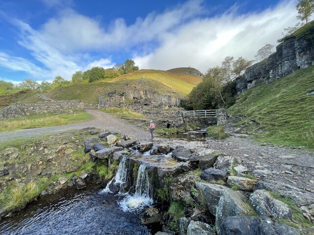
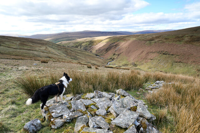
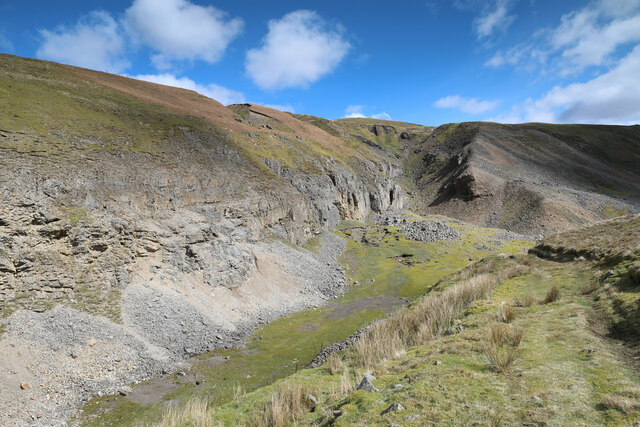
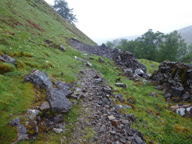
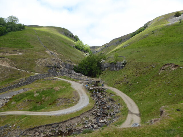
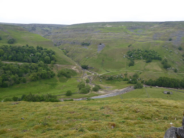
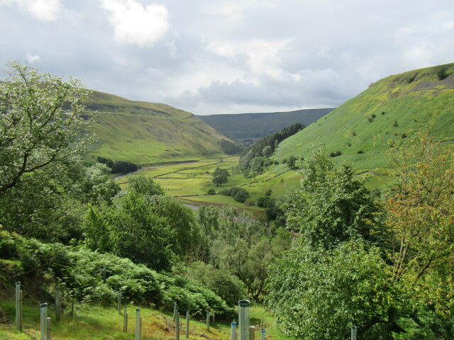
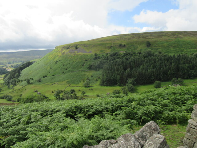
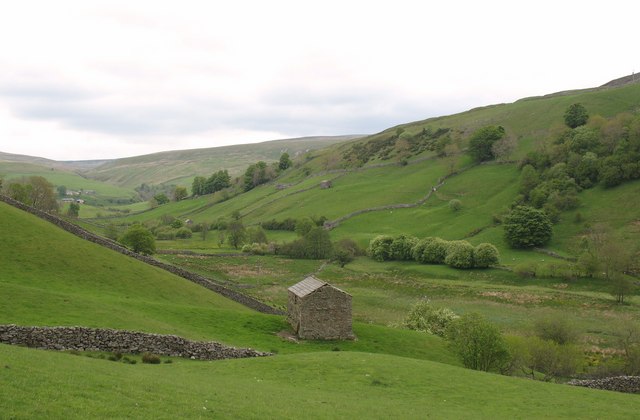
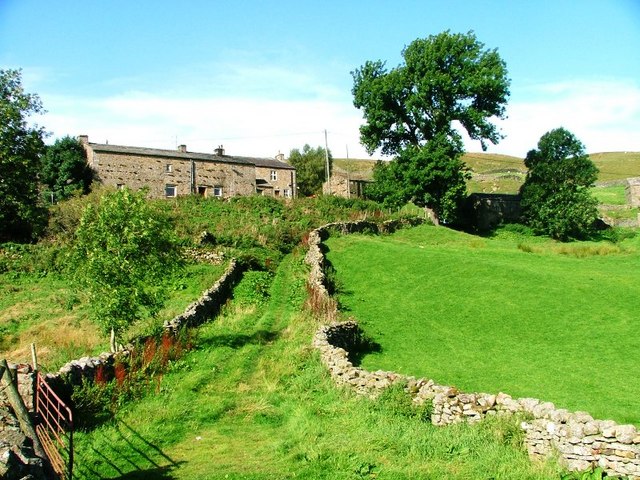
Keld Hill is a prominent hill located in the county of Yorkshire, England. Situated in the heart of the picturesque Yorkshire Dales, it forms a part of the stunning landscape that draws tourists and outdoor enthusiasts from around the world. Rising to an elevation of approximately 1,359 feet (414 meters), Keld Hill offers magnificent panoramic views of the surrounding valleys and rolling hills.

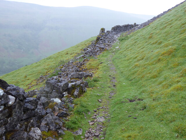
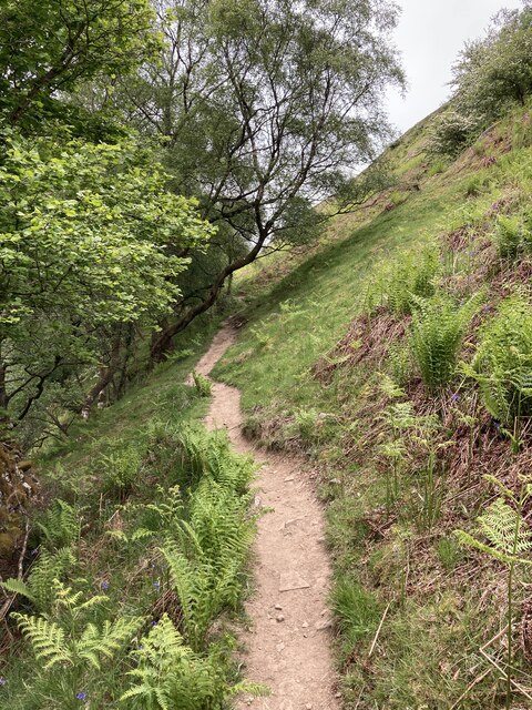
The hill is characterized by its steep slopes and rugged terrain, which make it a challenging yet rewarding destination for hikers and climbers. The ascent to the summit can be accessed via several well-marked trails that wind through the enchanting countryside, passing by quaint villages, babbling brooks, and ancient stone walls.

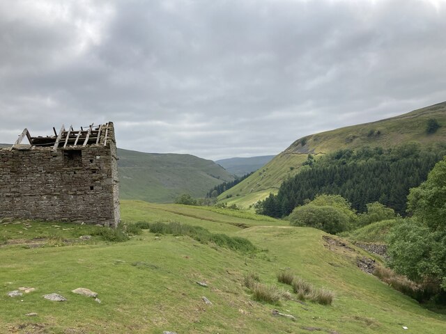
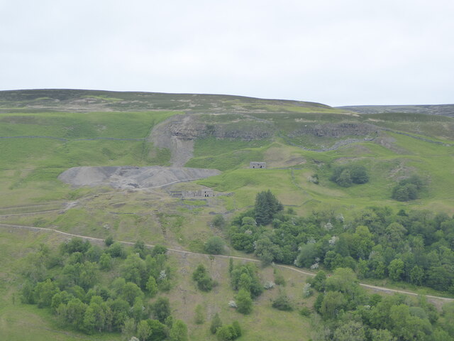
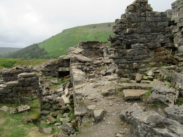
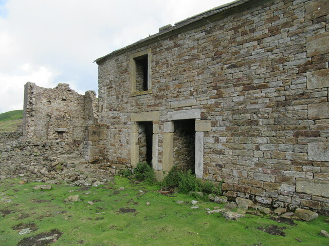
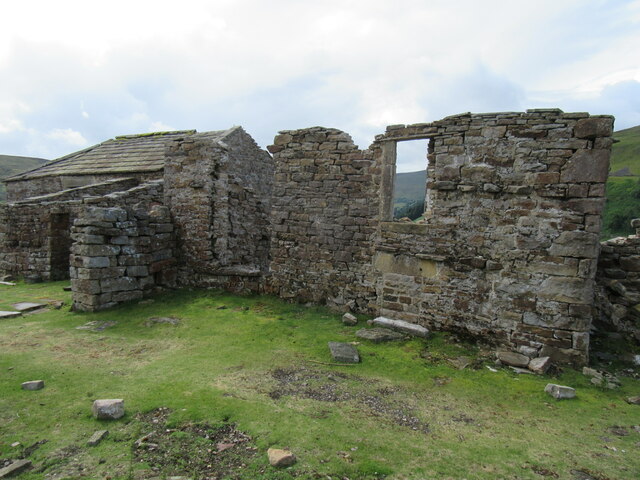
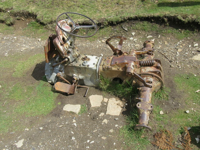
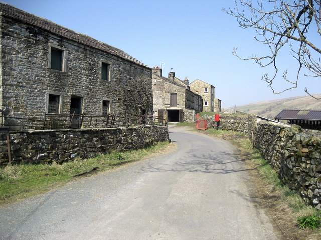
Keld Hill is also known for its rich cultural and historical significance. The area is dotted with remnants of its past, including the ruins of old mining sites and sheep farming structures. These serve as a reminder of the region's traditional industries and way of life.

The hill and its surroundings are home to a diverse range of flora and fauna, supporting a variety of wildlife. Visitors may encounter grazing sheep, rabbits, and a wide array of bird species, including peregrine falcons, red grouse, and curlews.

As part of the Yorkshire Dales National Park, Keld Hill is protected and preserved for future generations to enjoy. Its natural beauty, combined with its cultural heritage, make it a popular destination for those seeking peace, tranquility, and a connection to nature.

If you have any feedback on the listing, please let us know in the comments section below.

Keld Hill Images

Images are sourced within 2km of 54.40632/-2.1697515 or Grid Reference NY8901. Thanks to Geograph Open Source API. All images are credited.

Swinner Gill Ford This ford at Swinner Gill is found on the bridleway between Muker and Keld. A video of the ford can be viewed at:
<span class="nowrap"><a title="https://youtu.be/pRj-GMUVvRE" rel="nofollow ugc noopener" href="https://youtu.be/pRj-GMUVvRE">Link</a><img style="margin-left:2px;" alt="External link" title="External link - shift click to open in new window" src="https://s1.geograph.org.uk/img/external.png" width="10" height="10"/></span>
Swinner Gill Ford
This ford at Swinner Gill is found on the bridleway between Muker and Keld. A video of the ford can be viewed at: LinkExternal link
East Gill from south of Long Gill The rather indistinct and intermittent quad bike tracks that form the only guide to the easiest route on the east bank of East Gill have just made a rather precarious and boggy crossing of Long Gill and ascended back onto firm ground. This pile of stones (it hardly qualifies as a cairn) commands a view over East Gill as it cuts down on its way to join the River Swale down a series of waterfalls into the Keld Gorge.
East Gill from south of Long Gill
The rather indistinct and intermittent quad bike tracks that form the only guide to the easiest route on the east bank of East Gill have just made a rather precarious and boggy crossing of Long Gill and ascended back onto firm ground. This pile of stones (it hardly qualifies as a cairn) commands a view over East Gill as it cuts down on its way to join the River Swale down a series of waterfalls into the Keld Gorge.
Lead mining scars at Beldi Hill Remarkably invisible from the popular public bridleway along the Swale left bank in Keld Gorge just a quarter kilometre to the south, the Beldi Hill workings have left a huge scar. A large chunk has been washed out of Hall Edge by hushing (a crude but effective form of hydraulic mining) over a long period, with the ore being transported to facilities downhill and to the east for smelting into lead.
Lead mining scars at Beldi Hill
Remarkably invisible from the popular public bridleway along the Swale left bank in Keld Gorge just a quarter kilometre to the south, the Beldi Hill workings have left a huge scar. A large chunk has been washed out of Hall Edge by hushing (a crude but effective form of hydraulic mining) over a long period, with the ore being transported to facilities downhill and to the east for smelting into lead.
The Pennine Way near Rukin Wood
The Pennine Way above Rukin Wood
Ruined barn above West Wood
Waterfall in Swinner Gill
Looking up Swinner Gill There are ruined buildings beside the footbridge which are remnants of the lead mining industry.
Looking up Swinner Gill
There are ruined buildings beside the footbridge which are remnants of the lead mining industry.
Looking across Swaledale towards Crackpot Hall
Looking across Swaledale towards Swinner Gill
Ruined mining building in Swinner Gill By the waterfall in Swinner Gill.
Ruined mining building in Swinner Gill
By the waterfall in Swinner Gill.
Swinner Gill waterfall One of the many waterfalls in this area.
Swinner Gill waterfall
One of the many waterfalls in this area.
Swaledale near Crackpot Hall Looking south.
Swaledale near Crackpot Hall
Looking south.
Crackpot Hall The remains of Crackpot Hall.
Crackpot Hall
The remains of Crackpot Hall.
Crackpot Hall 2 The remains of Crackpot Hall.
Crackpot Hall 2
The remains of Crackpot Hall.
Crackpot Hall view The view from Crackpot Hall.
Crackpot Hall view
The view from Crackpot Hall.
Remains of tractor The rusting remains of a tractor.
Remains of tractor
The rusting remains of a tractor.
Show me another place!

Keld Hill is located at Grid Ref: NY8901 (Lat: 54.40632, Lng: -2.1697515)

Division: North Riding

Administrative County: North Yorkshire

District: Richmondshire

Police Authority: North Yorkshire

What 3 Words

///cones.belong.ditching. Near Kirkby Stephen, Cumbria

Related Wikis

Keld, North Yorkshire

Keld is a village in the English county of North Yorkshire. It is in Swaledale, and the Yorkshire Dales National Park. The name derives from the Viking...
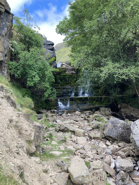
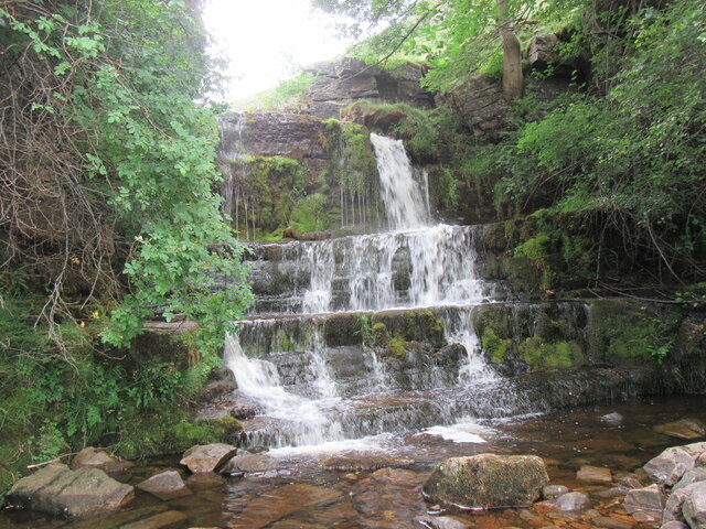
East Gill Force

East Gill Force is a waterfall in Swaledale, 330 yards (300 m) east of the hamlet of Keld, in the Yorkshire Dales National Park, North Yorkshire, England...

Catrake Force

Catrake Force is a waterfall on the River Swale in North Yorkshire, England. It is not visible from the road but is accessible via a campsite in Keld....

Wain Wath Force

Wain Wath Force is a waterfall on the River Swale in the Yorkshire Dales National Park, North Yorkshire, England. The falls are at grid reference NY883015...

Kisdon Force

Kisdon Force is a series of waterfalls on the River Swale in Swaledale, England. The falls are situated within the Yorkshire Dales National Park in the...

West Stonesdale

West Stonesdale is a hamlet in the Yorkshire Dales, North Yorkshire, England. The secluded village is near Keld to the south, Tan Hill to the north and...

Angram Bottoms

Angram Bottoms (grid reference SD891999) is a 9.8 hectares (24 acres) biological Site of Special Scientific Interest (SSSI) near to the village of Angram...

Angram, Richmondshire

Angram is a hamlet in the Yorkshire Dales in the Richmondshire district of North Yorkshire, England. It is situated near to Keld to the north and Thwaite...

Nearby Amenities

Located within 500m of 54.40632,-2.1697515
Rainby Force
Waterway: waterfall
Lat/Long: 54.4088755/-2.1755067
Waterway: waterfall
Lat/Long: 54.4081112/-2.1728086
Catrake Force
Image: https://www.geograph.org.uk/photo/519367
Waterway: waterfall
Wikidata: Q37779
Wikipedia: en:Catrake Force
Lat/Long: 54.4070083/-2.1671791
Keld
Place: hamlet
Wikidata: Q3695942
Wikipedia: en:Keld, North Yorkshire
Lat/Long: 54.405855/-2.1664319
Toilets
Lat/Long: 54.4062404/-2.1677412
Ford: yes
Lat/Long: 54.4095252/-2.1663004
Cafe
Rukins Tea Shop
Lat/Long: 54.4062539/-2.1665351
Access: yes
Barrier: entrance
Lat/Long: 54.4069346/-2.1726322
Rukin's Park Lodge Campsite
Tourism: camp_site
Website: https://rukins-keld.co.uk/
Lat/Long: 54.4048428/-2.1664373
Bus Stop
Keld
Bench: no
Bus: yes
Public Transport: platform
Shelter: no
Tactile Paving: no
Lat/Long: 54.403628/-2.1670131
Telephone
Booth: K6
Covered: booth
Image: https://www.geograph.org.uk/photo/1729186
Listed Status: Grade II
Wikidata: Q26639327
Lat/Long: 54.4035463/-2.1668388
East Stonesdale
Place: farm
Lat/Long: 54.4066098/-2.1631967
Historic Amenity: post_box
Note: I highly suspect this one is gone now as there is a brand new box to the right of the entrance to the carpark (as mapped).
Post Box Type: lamp
Source: survey
Lat/Long: 54.4057688/-2.1664356
Currack Force
Waterway: waterfall
Lat/Long: 54.4098687/-2.1744091
Hoggarth's Leap
Description: Wedding cake style ie tiered
Waterway: waterfall
Lat/Long: 54.4079742/-2.1723929
Waterway: waterfall
Lat/Long: 54.4082544/-2.1732582
Grit Bin
Lat/Long: 54.4050942/-2.1668758
Clock
Display: sundial
Image: https://www.geograph.org.uk/photo/2404016
Lat/Long: 54.4055176/-2.1663486
Natural: sinkhole
Lat/Long: 54.4093441/-2.1674003
Bench
Lat/Long: 54.4058865/-2.1661807
Post Box
Post Box Type: lamp
Royal Cypher: EIIR
Royal Cypher Wikidata: Q33102113
Lat/Long: 54.4039201/-2.1667772
Defibrillator
Emergency: defibrillator
Indoor: no
Lat/Long: 54.4057954/-2.1666552
Historic: memorial
Image: https://www.geograph.org.uk/photo/2868592
Memorial: war_memorial
Lat/Long: 54.4033415/-2.1666764
Hiking: yes
Image: https://www.geograph.org.uk/photo/5837220
Information: guidepost
Tourism: information
Lat/Long: 54.404681/-2.1631722
Power: pole
Lat/Long: 54.4051674/-2.1664444
Barrier: entrance
Lat/Long: 54.4037381/-2.1667857
Power: pole
Lat/Long: 54.407125/-2.1691614
Power: pole
Lat/Long: 54.4066723/-2.1686733
Power: pole
Lat/Long: 54.4056513/-2.1672973
Power: pole
Lat/Long: 54.4036733/-2.1639526
Power: pole
Lat/Long: 54.4046327/-2.1655981
Power: pole
Lat/Long: 54.4040792/-2.1646486
Power: pole
Lat/Long: 54.4030722/-2.1644528
Power: pole
Lat/Long: 54.4098346/-2.1734912
Power: pole
Lat/Long: 54.4098136/-2.1734865
Power: pole
Lat/Long: 54.4093558/-2.1731915
Power: pole
Lat/Long: 54.4086689/-2.1727462
Power: pole
Lat/Long: 54.4082069/-2.1724331
Power: pole
Lat/Long: 54.4074521/-2.1719456
Power: pole
Lat/Long: 54.4063429/-2.1706702
Power: pole
Lat/Long: 54.4037568/-2.1687256
Power: pole
Lat/Long: 54.4042326/-2.1661654
Power: pole
Lat/Long: 54.4039645/-2.1667602
Power: pole
Lat/Long: 54.4038427/-2.1674167
Power: pole
Lat/Long: 54.4037061/-2.1681073
Power: pole
Lat/Long: 54.4040199/-2.168448
Power: pole
Lat/Long: 54.4060213/-2.1709438
Power: pole
Lat/Long: 54.4056115/-2.1703872
Power: pole
Lat/Long: 54.4062727/-2.1708861
Power: pole
Lat/Long: 54.4051408/-2.1698105
Power: pole
Lat/Long: 54.4047123/-2.1692741
Power: pole
Lat/Long: 54.4043368/-2.1687967
Grit Bin
Lat/Long: 54.4060229/-2.1664779
Entrance: main
Lat/Long: 54.4058216/-2.1666217
Bench
Backrest: yes
Material: wood
Lat/Long: 54.4058354/-2.1665978
Bench
Backrest: yes
Material: wood
Lat/Long: 54.4058049/-2.166637
Post Box
Ref: DL11 22
Royal Cypher: EIIR
Royal Cypher Wikidata: Q33102113
Lat/Long: 54.4060424/-2.1664544
Cafe
Keld Green Cafe
Cuisine: coffee_shop;sandwich
Opening Hours: Th-Tu 09:00-16:30
Outdoor Seating: yes
Phone: +44 1748898778
Lat/Long: 54.4042234/-2.1684019
The data included in this document is from www.openstreetmap.org. The data is made available under ODbL.

Have you been to Keld Hill?

Leave your review of Keld Hill below (or comments, questions and feedback).