Arnabuil

Island in Shetland

Scotland

Arnabuil

Papa Stour and Foula Taken on the B9078 between Burnside and Eshaness, Shetland, I am looking out towards the islands of Papa Stour (left of shot) and Foula beyond.
Papa Stour and Foula Credit: Carroll Pierce

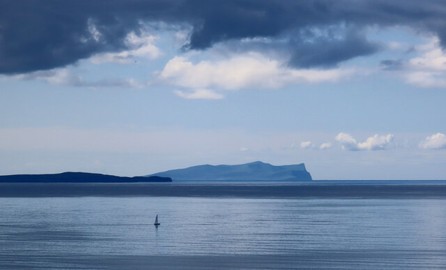
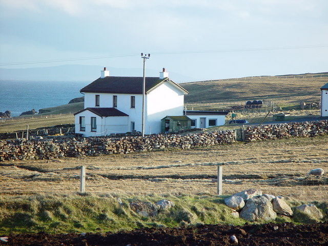
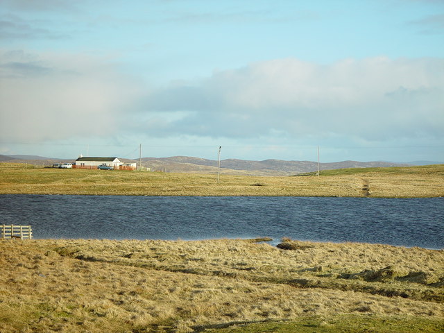
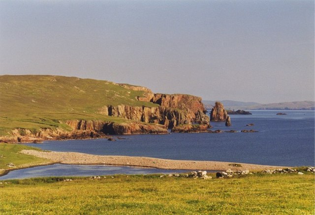
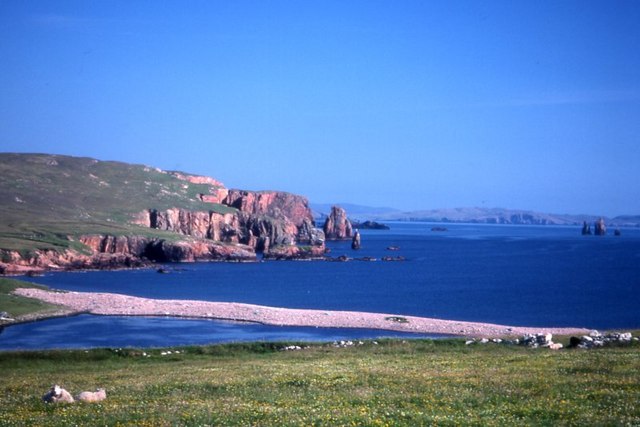
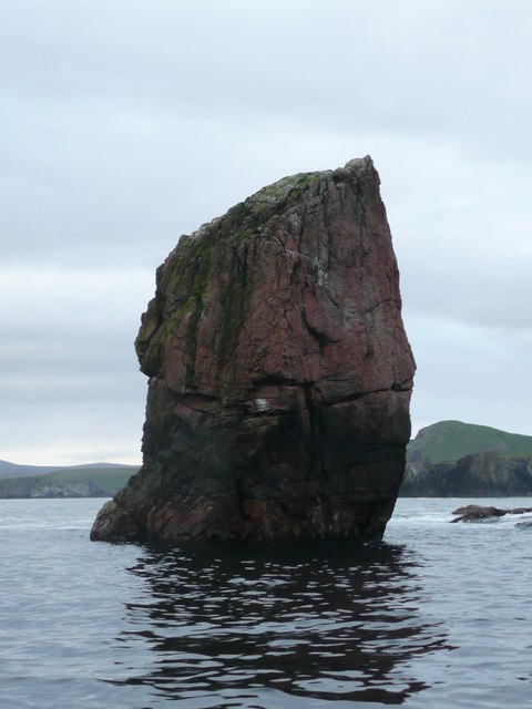
Arnabuil is a small island located in the Shetland archipelago, which is part of Scotland. Situated in the North Sea, Arnabuil is known for its rugged coastline, stunning natural beauty, and rich history. The island is roughly one square mile in size, making it a haven for nature lovers and those seeking a tranquil escape.

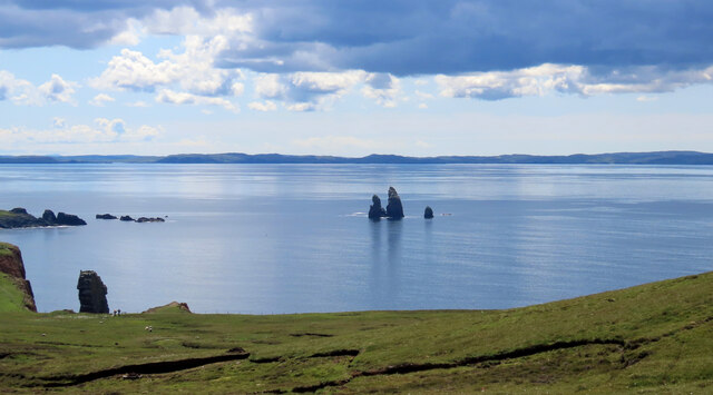
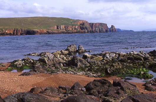
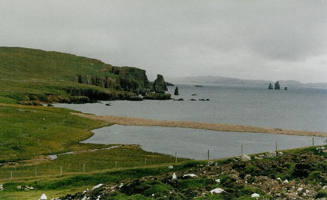
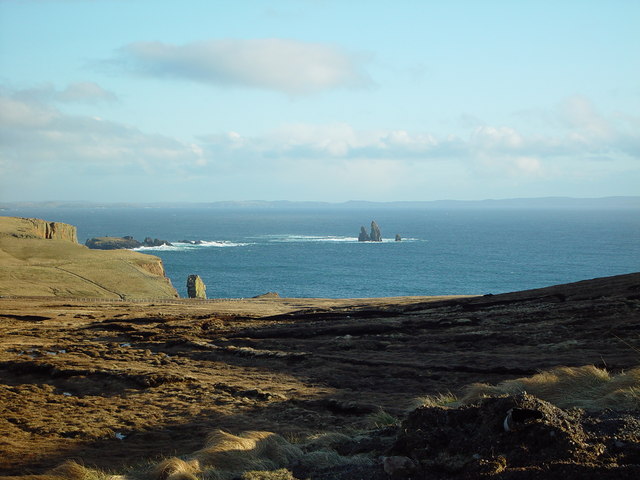
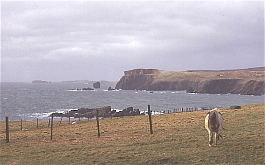
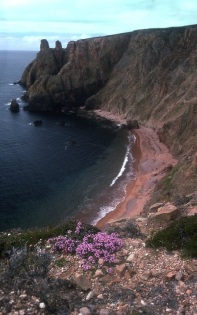
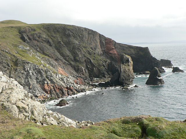
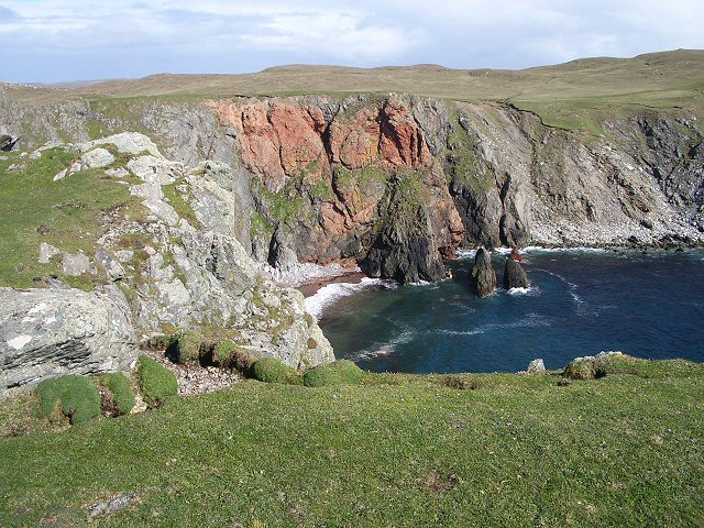
The landscape of Arnabuil is characterized by rolling hills, heather-covered moorlands, and dramatic cliffs that drop into the sea. The island is home to a diverse range of flora and fauna, including seabirds, otters, and seals. It also boasts several picturesque sandy beaches, such as the popular West Sandwick Beach, which offers breathtaking views of the surrounding ocean.

Despite its small size, Arnabuil has a fascinating history. Evidence of human occupation on the island dates back thousands of years, with archaeological sites revealing ancient settlements and burial grounds. The island was likely inhabited by Norse settlers during the Viking era and played a significant role in Shetland's historical development.

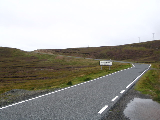
Today, Arnabuil remains largely uninhabited, with no permanent residents. However, it attracts visitors who appreciate its untouched wilderness and the opportunity for outdoor activities such as hiking, birdwatching, and fishing. The island can be accessed by boat from the nearby mainland or other Shetland islands.

In summary, Arnabuil is a captivating island in the Shetland archipelago, offering stunning landscapes, a rich history, and a chance to experience the natural beauty of Scotland's northernmost reaches.

If you have any feedback on the listing, please let us know in the comments section below.

Arnabuil Images

Images are sourced within 2km of 60.47969/-1.5337307 or Grid Reference HU2577. Thanks to Geograph Open Source API. All images are credited.

Papa Stour and Foula Taken on the B9078 between Burnside and Eshaness, Shetland, I am looking out towards the islands of Papa Stour (left of shot) and Foula beyond.
Papa Stour and Foula
Taken on the B9078 between Burnside and Eshaness, Shetland, I am looking out towards the islands of Papa Stour (left of shot) and Foula beyond.
The Drongs Taken from the B9078 between Burnside and Eshaness, Shetland, I am looking across Sand Wick to the sea stacks known at The Drongs. Papa Stour can be seen in the distance.
The Drongs
Taken from the B9078 between Burnside and Eshaness, Shetland, I am looking across Sand Wick to the sea stacks known at The Drongs. Papa Stour can be seen in the distance.
Brae Wick This is looking south-east from Braewick towards the red granite cliffs of The Neap
Brae Wick
This is looking south-east from Braewick towards the red granite cliffs of The Neap
Brae Wick and the Drongs View from the roadside above Braewick village.  In the foreground is Braewick Loch, beyond the beach is Brae Wick (the bay) itself.  Out to sea, the bizarre formation of the Drongs.
Brae Wick and the Drongs
View from the roadside above Braewick village. In the foreground is Braewick Loch, beyond the beach is Brae Wick (the bay) itself. Out to sea, the bizarre formation of the Drongs.
Braewick Cottage, Braewick, Shetland A relatively modern house set on the north side of Brae Wick.
Braewick Cottage, Braewick, Shetland
A relatively modern house set on the north side of Brae Wick.
View over Heads of Grocken, Eshaness, Shetland Looking out over the Heads of Grocken with 'The Drongs' the sea stacks in the distance.
View over Heads of Grocken, Eshaness, Shetland
Looking out over the Heads of Grocken with 'The Drongs' the sea stacks in the distance.
Helga water, near Hillswick, Shetland Shetland is unlikely ever to have a hosepipe ban, there are many many lochs and plentiful rainfall. This is Helga Water near the road to Eshaness.
Helga water, near Hillswick, Shetland
Shetland is unlikely ever to have a hosepipe ban, there are many many lochs and plentiful rainfall. This is Helga Water near the road to Eshaness.
Heads of Grocken Looking across the square from above Hillswick on a stormy winter's day. The pony was very inquisitive, and didn't want to be photographed in profile!
Heads of Grocken
Looking across the square from above Hillswick on a stormy winter's day. The pony was very inquisitive, and didn't want to be photographed in profile!
Lagoon at Braewick
Lagoon at Braewick
Brae Wick The beach-head loch of Brae Wick with the bay beyond. The Drongs can just be seen on the far right.
Brae Wick
The beach-head loch of Brae Wick with the bay beyond. The Drongs can just be seen on the far right.
The Drongs Taken from the Heads of Grocken.
The Drongs
Taken from the Heads of Grocken.
Heads of Grocken Small sea-stacks off the Heads of Grocken, with the Drongs in the distance.
Heads of Grocken
Small sea-stacks off the Heads of Grocken, with the Drongs in the distance.
Beach between Heads of Grocken and the Neap
Entering Eshaness
Entering Eshaness
The Drongs This is an amazing rock formation, as seen from Gordi Stack.
The Drongs
This is an amazing rock formation, as seen from Gordi Stack.
Cliffs and stack The view south from this point is spectacular.

(The stack and the point to the right lie in this grid square, while the cliff to the left is in <a href="https://www.geograph.org.uk/gridref/HU2775">HU2775</a>).
Cliffs and stack
The view south from this point is spectacular. (The stack and the point to the right lie in this grid square, while the cliff to the left is in HU2775).
Opposite a red cliff Looking across the short turf of this promontory at a red cliff across the bay.
Opposite a red cliff
Looking across the short turf of this promontory at a red cliff across the bay.
Stumpy Drong, The Drongs This is the smallest of the Drong Sea Stacks. The others are in the next grid square. It is around 15m high and was climbed in 1992 at Severe.
Stumpy Drong, The Drongs
This is the smallest of the Drong Sea Stacks. The others are in the next grid square. It is around 15m high and was climbed in 1992 at Severe.
Show me another place!

Arnabuil is located at Grid Ref: HU2577 (Lat: 60.47969, Lng: -1.5337307)

Unitary Authority: Shetland Islands

Police Authority: Highlands and Islands

What 3 Words

///coverings.widget.tricks. Near Brae, Shetland Islands

Related Wikis

The Drongs

The Drongs are a group of sea stacks off the coast of Hillswick Ness, Northmavine, Shetland, Scotland. They lie to the west of the Isle of Westerhouse...

Hillswick

Hillswick is a small village in Northmavine, on the shore of the Atlantic Ocean and lies to the north-north west of Mainland, Shetland, the most northerly...

Tangwick Haa

Tangwick Haa is an historic house and museum in Esha Ness, Northmavine, Shetland. The building has two stories in a rectangular layout and along with the...

Braehoulland

Braehoulland is a hamlet on Mainland, in Shetland, Scotland. Braehoulland is situated within the parish of Northmaven. Eshaness Community Centre is located...

Esha Ness

Esha Ness, also spelled Eshaness, is a peninsula on the west coast of Northmavine, on the island of Mainland, Shetland, Scotland. Esha Ness Lighthouse...

Johnnie Notions

John Williamson (c. 1730 – c. 1803), more commonly known by the nickname Johnnie Notions (pronounced [ˌdʒoni ˈnoʃəns], JOH-nee-NOH-shəns) was a self-taught...
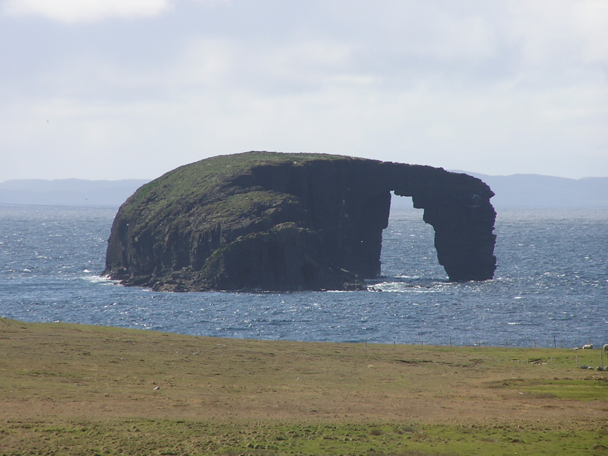
Dore Holm

The Dore Holm is a small uninhabited islet off the south coast of Esha Ness, located in the north-west of Mainland, Shetland, Scotland. Its natural arch...

Assater

Assater (also spelled Assetter) is a hamlet on Mainland, in Shetland, Scotland. Assater is situated in the parish of Northmaven. It is about 1.3 miles...

Have you been to Arnabuil?

Leave your review of Arnabuil below (or comments, questions and feedback).