Tainga Skerries
Island in Shetland
Scotland
Tainga Skerries
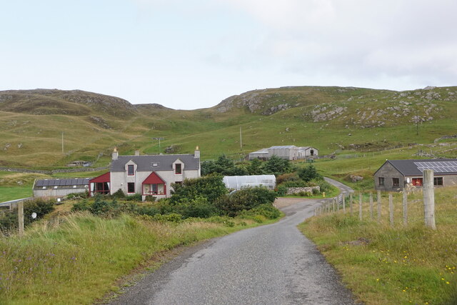
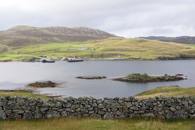
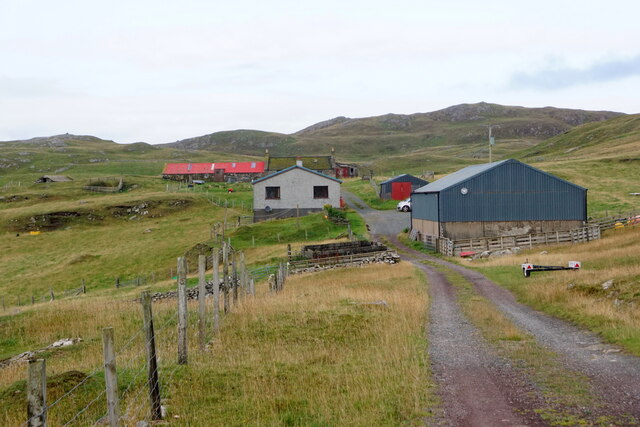
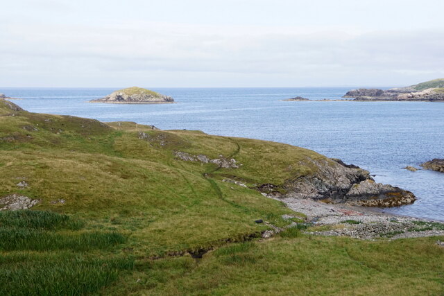
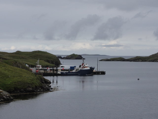
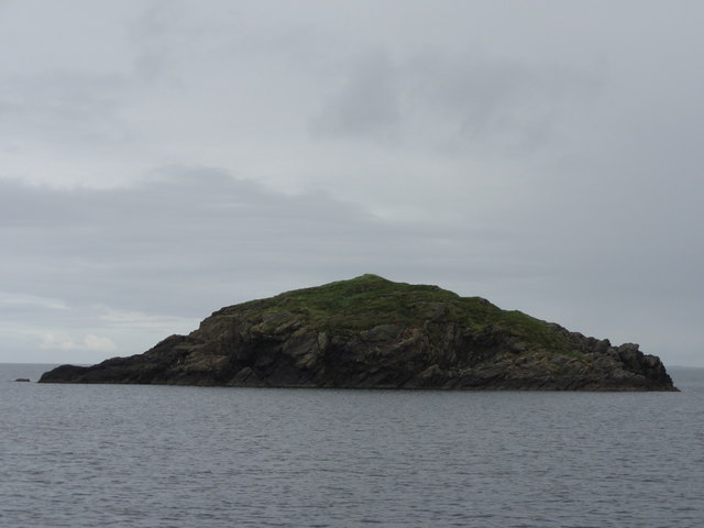
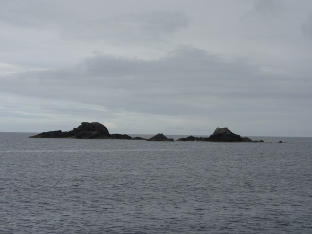
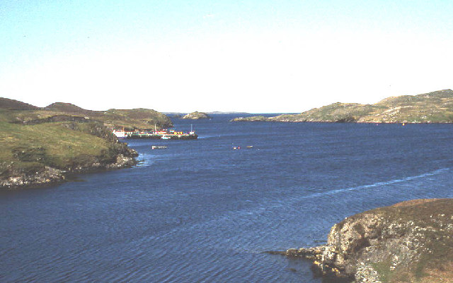
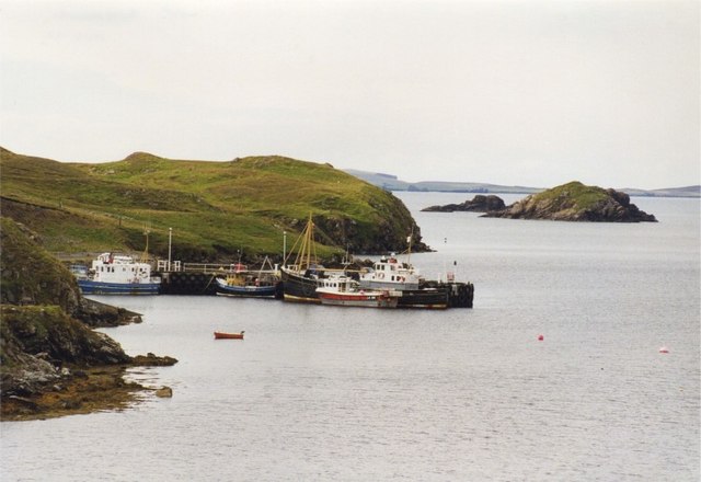
Tainga Skerries, located in the Shetland Islands, is a picturesque group of small islands situated off the northeastern coast of Scotland. Comprising several islets and skerries, this stunning archipelago is known for its rugged beauty, abundant wildlife, and historical significance.
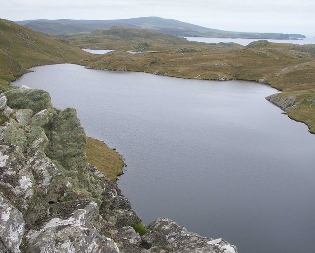
The islands of Tainga Skerries are formed by ancient volcanic activity, resulting in dramatic cliffs and rocky shores. These geological features provide a habitat for a diverse range of marine species, making it a popular spot for birdwatching and marine life enthusiasts. Visitors can observe colonies of seabirds such as puffins, guillemots, and razorbills, as well as seals and otters that inhabit the surrounding waters.
Tainga Skerries also holds historical significance, with archaeological evidence suggesting human occupation dating back to the Neolithic period. The islands are believed to have been used as a fishing and hunting base by early settlers. The remains of ancient stone structures and burial sites can still be seen, providing a glimpse into the lives of these early inhabitants.
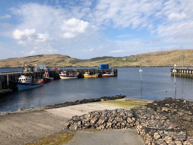
Access to Tainga Skerries is mainly by boat, with several local operators offering guided tours and wildlife excursions. The islands can be explored on foot, with some paths and trails available for visitors to enjoy the breathtaking coastal scenery and observe the wildlife up close.
In summary, Tainga Skerries in the Shetland Islands is a captivating destination, offering a combination of natural beauty, rich history, and abundant wildlife. Whether it is exploring the rugged cliffs, spotting seabirds, or discovering ancient archaeological sites, Tainga Skerries offers a unique and unforgettable experience for nature lovers and history enthusiasts alike.
If you have any feedback on the listing, please let us know in the comments section below.
Tainga Skerries Images
Images are sourced within 2km of 60.312264/-1.5384522 or Grid Reference HU2558. Thanks to Geograph Open Source API. All images are credited.


Tainga Skerries is located at Grid Ref: HU2558 (Lat: 60.312264, Lng: -1.5384522)
Unitary Authority: Shetland Islands
Police Authority: Highlands and Islands
What 3 Words
///sank.fleet.fattening. Near Walls, Shetland Islands
Nearby Locations
Related Wikis

Broch of West Burrafirth
The Broch of West Burrafirth is an Iron Age broch located on the west side of Mainland, Shetland (grid reference HU25625720). == Location == The broch...

Brindister, West Mainland
Brindister is a settlement on the West Mainland of Shetland, Scotland. It is within the parish of Sandsting, and on the western shore of Brindister Voe...

Bousta
Bousta is a settlement on Mainland, in Shetland, Scotland. Bousta is situated in the parish of Walls and Sandness.Scott's Hawkweed is native to the pastures...

Vementry
Vementry (Old Norse: "Vemunðarey") is an uninhabited Scottish island in Shetland on the north side of the West Mainland, lying south of Muckle Roe. �...

Linga (near Vementry)
Linga is one of the Shetland Islands, near Vementry. It is one of many islands in Shetland called Linga. The island is uninhabited. == Geography and... ==

Clousta
Clousta is a hamlet on Mainaland, in the island's west, Shetland, Scotland. Approximately seventy people live here, many of whom are commuters, but local...

Sandness
Sandness (the "d" is not pronounced locally) is a headland and district in the west of Shetland Mainland, Scotland. Sandness was a civil parish, which...
Brei Holm
Brei Holm is a tiny tidal islet in the western Shetland Islands. It is due east of Papa Stour, to which it is connected at low tide, just outside Housa...
Have you been to Tainga Skerries?
Leave your review of Tainga Skerries below (or comments, questions and feedback).