Skerries of Tunasdaal

Island in Shetland

Scotland

Skerries of Tunasdaal

Vivilie Loch, Culswick, from the air
Vivilie Loch, Culswick, from the air Credit: Mike Pennington

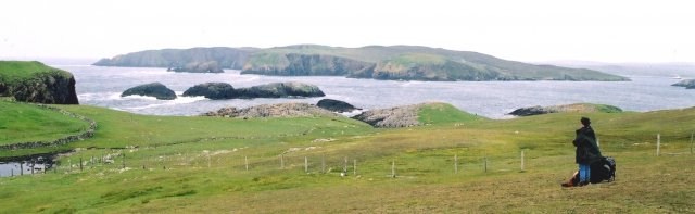
Skerries of Tunasdaal is a group of small islands located off the coast of Shetland, Scotland. Situated in the North Atlantic Ocean, these rocky isles are a part of the larger Shetland Islands archipelago. The Skerries consist of two main islands, the North Skerry and the South Skerry, along with several smaller islets.

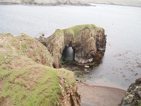
The Skerries of Tunasdaal are known for their rugged and wild natural beauty. The islands are predominantly made up of steep cliffs, with some reaching heights of over 50 meters. These cliffs provide important nesting sites for various seabird species, including puffins, guillemots, and razorbills. Birdwatchers flock to the Skerries to observe the rich avian diversity and witness the dramatic sight of birds diving into the sea to catch fish.

In addition to its ornithological significance, the Skerries are also home to a diverse range of marine life. The surrounding waters are teeming with seals, dolphins, and even occasional sightings of whales. The rocky shores and shallow waters make the Skerries an ideal spot for snorkeling and diving, allowing visitors to explore the underwater world and encounter vibrant marine ecosystems.

Due to their remote location, the Skerries of Tunasdaal offer a tranquil and untouched environment, making them an appealing destination for nature enthusiasts and those seeking solitude. However, visitors should be aware that access to the Skerries is limited and weather-dependent, as the islands are often subject to strong winds and rough seas. Nonetheless, for those lucky enough to experience the Skerries of Tunasdaal, it is a truly unforgettable and awe-inspiring natural wonder.

If you have any feedback on the listing, please let us know in the comments section below.

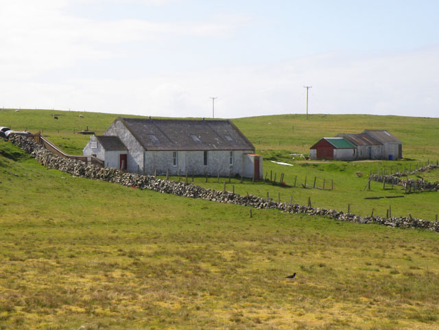
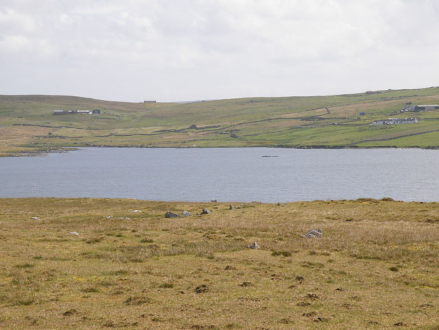
Skerries of Tunasdaal Images

Images are sourced within 2km of 60.2055/-1.5366144 or Grid Reference HU2546. Thanks to Geograph Open Source API. All images are credited.

Vivilie Loch, Culswick, from the air
Gronataing, near Walls, from the air
Looking Towards Muckle Flaes and Vaila from Culswick This is the view to seaward from the path to the broch at Culswick. The humps of rock in the middle distance, which is in square, conceal sea caves. Muckle Flaes is the rocky island just offshore, and the island is Vaila.
Looking Towards Muckle Flaes and Vaila from Culswick
This is the view to seaward from the path to the broch at Culswick. The humps of rock in the middle distance, which is in square, conceal sea caves. Muckle Flaes is the rocky island just offshore, and the island is Vaila.
Natural rock arch on the island of Vaila
Track to Culswick The track from the Loch of Sotersta towards Culswick.
Track to Culswick
The track from the Loch of Sotersta towards Culswick.
Ward of Culswick Trig pillar at top of hill looking westwards with Isle of Vaila in foreground and Foula in the distance
Ward of Culswick
Trig pillar at top of hill looking westwards with Isle of Vaila in foreground and Foula in the distance
Rock formation Rock formation on top of hill just to the NE of the trigpoint, (shown behind rock) with Foula on the horizon
Rock formation
Rock formation on top of hill just to the NE of the trigpoint, (shown behind rock) with Foula on the horizon
Lonely phone box on dull summer day Not much more to say really - except that the weather closed in completely just after I took this photo at 1:45pm...
Lonely phone box on dull summer day
Not much more to say really - except that the weather closed in completely just after I took this photo at 1:45pm...
The end of the road, Whitesness This was also the end of my Geographing session for the day, as the weather closed in making photography impossible - at 1:47 pm on a July afternoon!
The end of the road, Whitesness
This was also the end of my Geographing session for the day, as the weather closed in making photography impossible - at 1:47 pm on a July afternoon!
Loch of Sotersta Fairly large loch near Culswick with several old ruined remains around its banks.
Loch of Sotersta
Fairly large loch near Culswick with several old ruined remains around its banks.
Heading for Culswick Broch Wide grassy track passing by drystane wall and ruins of former habitation.
Heading for Culswick Broch
Wide grassy track passing by drystane wall and ruins of former habitation.
By the Loch of Sotersta Loch set on low grassland with the Ward of Culswick in the background. The hilltop would have been used as a look-out point (Ward = Watch).
By the Loch of Sotersta
Loch set on low grassland with the Ward of Culswick in the background. The hilltop would have been used as a look-out point (Ward = Watch).
Keolki Field View northwards from the Broch of Culswick to the rocky coast at Keolki Field, Whites Ness and Gruting Voe.
Keolki Field
View northwards from the Broch of Culswick to the rocky coast at Keolki Field, Whites Ness and Gruting Voe.
The Houb, Grunnavoe, Walls On a wet day with driving rain.
The Houb, Grunnavoe, Walls
On a wet day with driving rain.
Fields at Whitesness, Walls
Phone box at Vadlure, Walls Still with a phone inside, but with the door wedged open.
Phone box at Vadlure, Walls
Still with a phone inside, but with the door wedged open.
Boat approaching a pier near Vadlure, Walls
Grunivoe, Walls Most of the maps refer to place in the area as Grunnavoe, but this house is named Grunivoe on some maps.
Grunivoe, Walls
Most of the maps refer to place in the area as Grunnavoe, but this house is named Grunivoe on some maps.
Show me another place!

Skerries of Tunasdaal is located at Grid Ref: HU2546 (Lat: 60.2055, Lng: -1.5366144)

Unitary Authority: Shetland Islands

Police Authority: Highlands and Islands

What 3 Words

///careless.releases.samplers. Near Walls, Shetland Islands

Related Wikis

Broch of Culswick

The Broch of Culswick (also Culswick Broch) is an unexcavated coastal broch in the Shetland Islands of Scotland (grid reference HU25384481). It has...

Linga, Vaila Sound

Linga is one of the Shetland Islands, near Vaila and Walls on Mainland, Shetland. Its highest elevation is 28 metres (91 ft). In 2014 and 2018 it was...

Vaila

Vaila (Old Norse: "Valey") is an island in Shetland, Scotland, lying south of the Westland peninsula of the Shetland Mainland. It has an area of 327 hectares...

Walls, Shetland

Walls, known locally as Waas (Old Norse: Vagar = "Sheltered Bays" (voes) - the Ordnance Survey added the "ll" as they thought it was a corruption of "walls...

Gruting

Gruting is a hamlet on the island of Mainland, Shetland in Scotland. It is about 1 kilometre (0.62 mi) southwest of the archaeological site of Stanydale...

Burrastow

Burrastow is a location on the west shore of Vaila Sound near the village of Walls on the Shetland Mainland, Scotland. There are two small piers and the...

Browland

Browland is a village on Mainland in Shetland, Scotland situated about 1.9 miles (3 km) east north east of Walls. Browland is within the parish of Sandsting...

Stanydale Temple

Stanydale Temple is a Neolithic site on Mainland, Shetland, Scotland. It is located in a field to the south of the modern village of Stanydale, roughly...

Have you been to Skerries of Tunasdaal?

Leave your review of Skerries of Tunasdaal below (or comments, questions and feedback).