Eilean Dubh

Island in Sutherland

Scotland

Eilean Dubh

Lime kilns on Ard Neackie The four large lime kilns were built in 1870. The Reay estate produced large amounts of lime here and on the nearby island of Eilean Choraidh and loaded it into ships at the quay.
Lime kilns on Ard Neackie Credit: Russel Wills

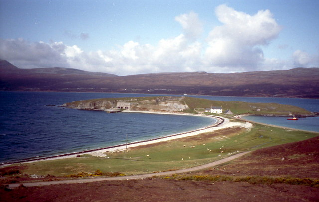
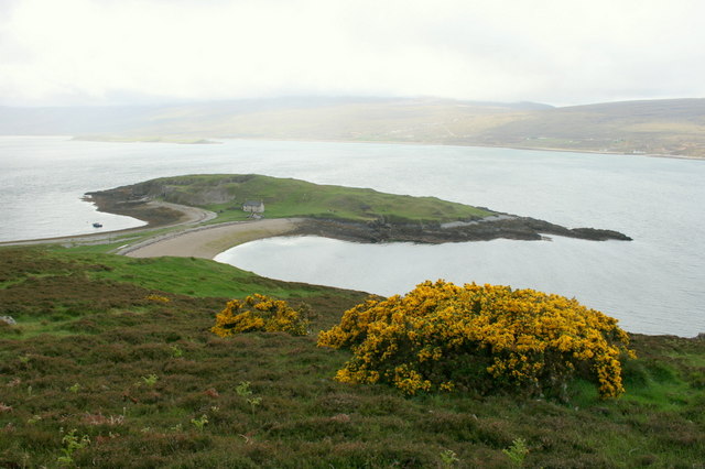
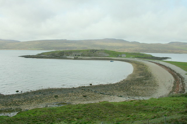
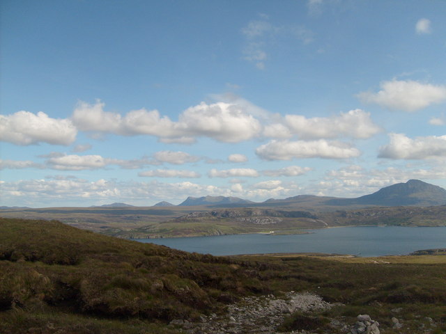
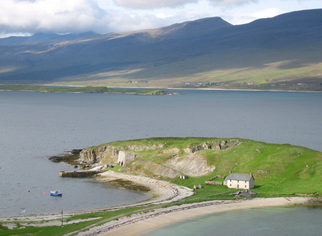
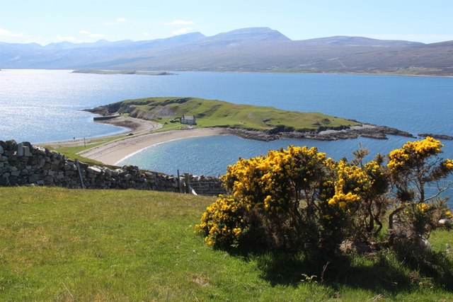
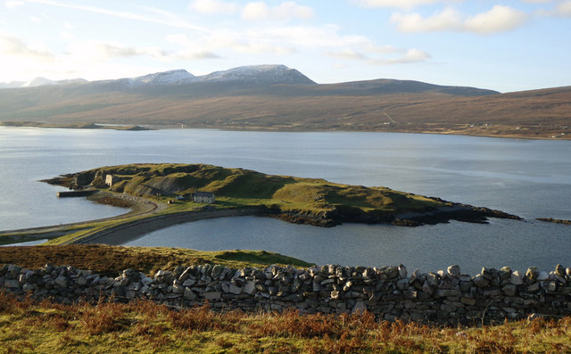
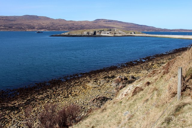
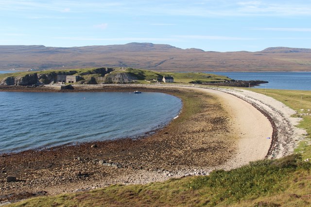
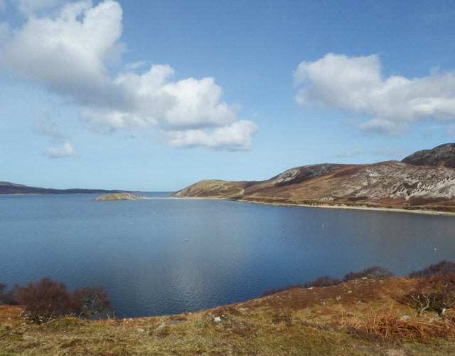
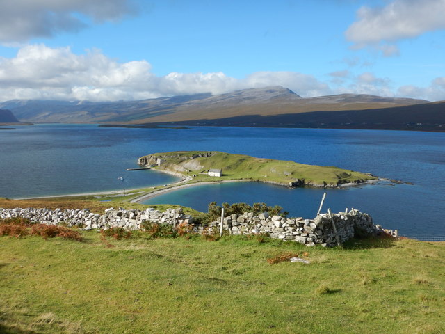
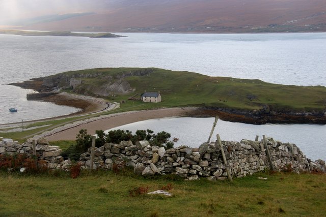
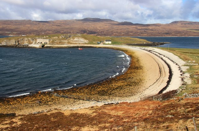
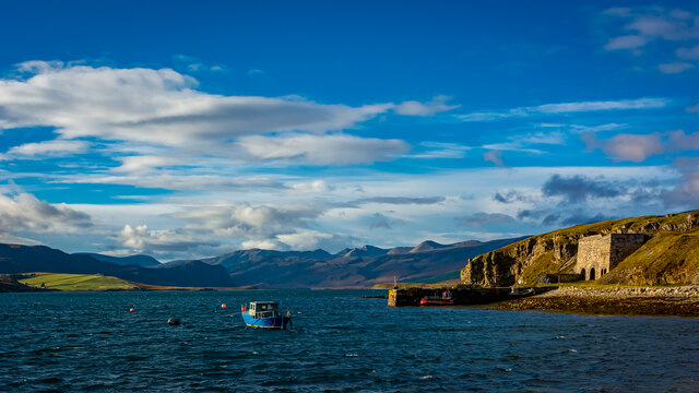
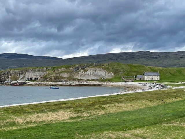
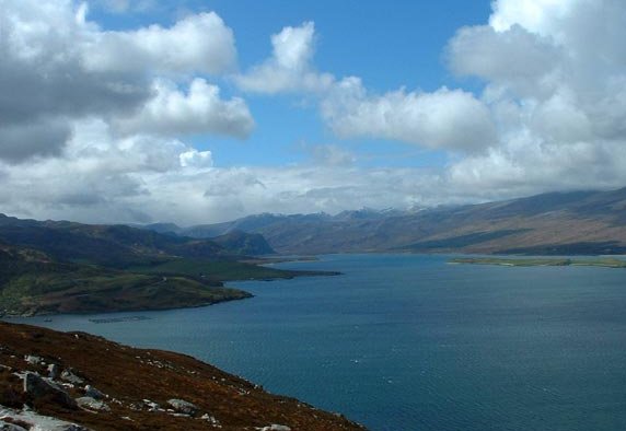
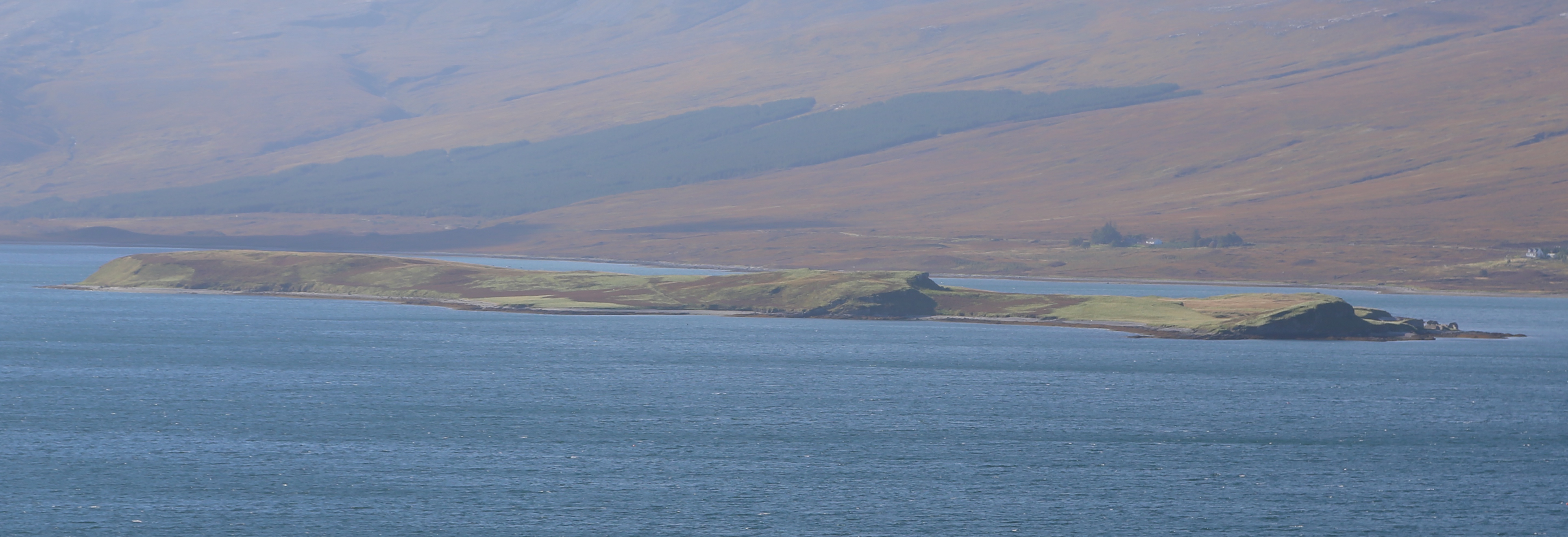
Eilean Dubh is a small island located off the coast of Sutherland, in the northernmost region of Scotland. The island is situated in the Atlantic Ocean, approximately 2 miles off the mainland. It covers an area of around 0.2 square miles and is characterized by its rugged and rocky terrain.

Eilean Dubh is uninhabited and offers a remote and peaceful retreat for nature enthusiasts and adventure seekers. The island is home to an abundance of wildlife, including various bird species such as puffins, guillemots, and razorbills. Seals can also often be spotted lounging on the rocks surrounding the island.

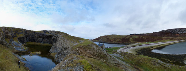
The island's landscape is dominated by cliffs and rocky outcrops, providing breathtaking views of the surrounding sea and coastline. It is a popular spot for hiking and birdwatching, with several walking trails crisscrossing the island.

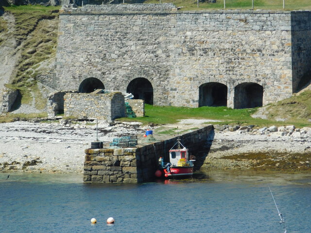
Eilean Dubh has a rich history, with archaeological evidence suggesting human activity dating back over 5,000 years. The island is known to have been used as a temporary settlement by early inhabitants of Sutherland, and remnants of ancient structures can still be found scattered across the island.

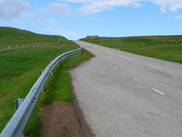
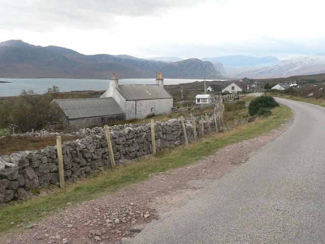
Access to Eilean Dubh is by boat, with regular ferry services available from nearby ports. Visitors are advised to check weather conditions before planning a trip to the island, as the area is known for its unpredictable weather patterns. Despite its remote location, Eilean Dubh offers a unique and captivating experience for those seeking a tranquil escape in the rugged beauty of the Scottish Highlands.

If you have any feedback on the listing, please let us know in the comments section below.

Eilean Dubh Images

Images are sourced within 2km of 58.510884/-4.6852485 or Grid Reference NC4361. Thanks to Geograph Open Source API. All images are credited.

Lime kilns on Ard Neackie The four large lime kilns were built in 1870. The Reay estate produced large amounts of lime here and on the nearby island of Eilean Choraidh and loaded it into ships at the quay.
Lime kilns on Ard Neackie
The four large lime kilns were built in 1870. The Reay estate produced large amounts of lime here and on the nearby island of Eilean Choraidh and loaded it into ships at the quay.
Gorse in full bloom overlooking Ard Neackie Loch Eriboll and its environs offer some of Scotland's finest and wildest scenery.
Gorse in full bloom overlooking Ard Neackie
Loch Eriboll and its environs offer some of Scotland's finest and wildest scenery.
The pier and lime kilns of Ard Neackie
Loch Eriboll &  Árd Neackie From the end of the mountain path between Beinn Ceannabeinne & Meall Meadhonach (a small cairn is just visible). Ben Loyal & Ben Hope can also be seen in the background.
Loch Eriboll & Árd Neackie
From the end of the mountain path between Beinn Ceannabeinne & Meall Meadhonach (a small cairn is just visible). Ben Loyal & Ben Hope can also be seen in the background.
Ard Neackie and pier Ard Neakie was used as the eastern terminus of the Heilam Ferry, which crossed the loch to the Heilam Inn on the west bank of the loch at Portnancon. The ferry ceased operation in the 1890s when the road around the loch was completed, but the ferry house built in 1831 still stands, though sadly increasingly derelict. Ard Neakie is also notable for the four large lime kilns built in 1870. The Reay estate produced large amounts of lime here and on the nearby island of Eilean Choraidh and loaded it into ships.

Almost an island, Ard Neackie is linked to the mainland by a tombolo.
Ard Neackie and pier
Ard Neakie was used as the eastern terminus of the Heilam Ferry, which crossed the loch to the Heilam Inn on the west bank of the loch at Portnancon. The ferry ceased operation in the 1890s when the road around the loch was completed, but the ferry house built in 1831 still stands, though sadly increasingly derelict. Ard Neakie is also notable for the four large lime kilns built in 1870. The Reay estate produced large amounts of lime here and on the nearby island of Eilean Choraidh and loaded it into ships. Almost an island, Ard Neackie is linked to the mainland by a tombolo.
Ard Neakie quarry
Ard Neakie quarry
Àrd Neackie, Loch Eriboll
Àrd Neackie Almost an island.
Àrd Neackie
Almost an island.
The A838 above Ard Neackie
Àrd Neackie, Loch Eriboll Old limekilns supplied the local area with lime.
The small vessel off the point is on NATO exercises.
Àrd Neackie, Loch Eriboll
Old limekilns supplied the local area with lime. The small vessel off the point is on NATO exercises.
Àrd Neackie, Loch Eriboll
View towards Àrd Neackie Showing the A838 rising towards Heilam, on the right of the tombolo.
View towards Àrd Neackie
Showing the A838 rising towards Heilam, on the right of the tombolo.
View of Ard Neackie and Loch Eriboll
Àrd Neackie, Loch Eriboll
Ard Neackie Lime Kilns and Pier
Ard Neackie lime kilns and pier On the shore of Loch Eriboll
Ard Neackie lime kilns and pier
On the shore of Loch Eriboll
Ard Neackie Limekilns Taken using 16x zoom
Ard Neackie Limekilns
Taken using 16x zoom
Show me another place!

Eilean Dubh is located at Grid Ref: NC4361 (Lat: 58.510884, Lng: -4.6852485)

Unitary Authority: Highland

Police Authority: Highlands and Islands

What 3 Words

///allowable.shine.cork. Near Oldshoremore, Highland

Related Wikis

Portnancon

Portnacon is a small remote crofting township, and former fishing station, on the west shore of Loch Eriboll in Sutherland, Scottish Highlands in the...

Loch Eriboll

Loch Eriboll (Scottish Gaelic: "Loch Euraboil") is a 16 km (9.9 mi) long sea loch on the north coast of Scotland, which has been used for centuries as...

Laid, Sutherland

Laid is a remote, linear crofting township scattered along the A838 road on the western shore of the sea loch, Loch Eriboll in Sutherland in the northern...

Eilean Choraidh

Eilean Choraidh, also known as Horse Island is an island in Loch Eriboll in Sutherland on the north coast of Scotland. It is about 26 hectares (64 acres...

Nearby Amenities

Located within 500m of 58.510884,-4.6852485
Source: PGS
Lat/Long: 58.5099753/-4.6927857
Source: PGS
Lat/Long: 58.5086744/-4.6912385
Source: PGS
Lat/Long: 58.5084699/-4.6912654
Source: PGS
Lat/Long: 58.5082114/-4.6909296
Source: PGS
Lat/Long: 58.5079575/-4.6910434
Created By: almien_coastlines
Source: PGS
Lat/Long: 58.508049/-4.690634
Source: PGS
Lat/Long: 58.5084431/-4.6896882
Source: PGS
Lat/Long: 58.5083388/-4.68819
Created By: almien_coastlines
Source: PGS
Lat/Long: 58.508213/-4.687952
Created By: almien_coastlines
Source: PGS
Lat/Long: 58.508343/-4.687713
Source: PGS
Lat/Long: 58.5086928/-4.6869718
Source: PGS
Lat/Long: 58.5091805/-4.6861495
Source: PGS
Lat/Long: 58.5094672/-4.6856339
Created By: almien_coastlines
Source: PGS
Lat/Long: 58.509787/-4.685092
Created By: almien_coastlines
Source: PGS
Lat/Long: 58.509917/-4.684853
Created By: almien_coastlines
Source: PGS
Lat/Long: 58.510049/-4.684616
Created By: almien_coastlines
Source: PGS
Lat/Long: 58.510179/-4.684377
Created By: almien_coastlines
Source: PGS
Lat/Long: 58.510311/-4.684139
Created By: almien_coastlines
Source: PGS
Lat/Long: 58.510442/-4.6839
Created By: almien_coastlines
Source: PGS
Lat/Long: 58.510573/-4.683662
Created By: almien_coastlines
Source: PGS
Lat/Long: 58.510704/-4.683423
Source: PGS
Lat/Long: 58.5109247/-4.6832933
Source: PGS
Lat/Long: 58.5114269/-4.6829034
Source: PGS
Lat/Long: 58.5117306/-4.6827609
Source: PGS
Lat/Long: 58.5123445/-4.6824596
Source: PGS
Lat/Long: 58.5129634/-4.6821877
Source: PGS
Lat/Long: 58.5129434/-4.6861332
Source: PGS
Lat/Long: 58.5132971/-4.6858412
Source: PGS
Lat/Long: 58.5137113/-4.6855343
Source: PGS
Lat/Long: 58.5141048/-4.6857689
Source: PGS
Lat/Long: 58.5144601/-4.6851828
Source: PGS
Lat/Long: 58.5145548/-4.684497
Source: PGS
Lat/Long: 58.5149819/-4.6844893
Source: PGS
Lat/Long: 58.5152146/-4.6839498
Source: PGS
Lat/Long: 58.5143783/-4.6841491
Source: PGS
Lat/Long: 58.5141663/-4.6845358
Source: PGS
Lat/Long: 58.5139309/-4.6849643
Source: PGS
Lat/Long: 58.5137848/-4.6845531
Source: PGS
Lat/Long: 58.5139675/-4.6839323
Source: PGS
Lat/Long: 58.5144852/-4.6837218
The data included in this document is from www.openstreetmap.org. The data is made available under ODbL.

Have you been to Eilean Dubh?

Leave your review of Eilean Dubh below (or comments, questions and feedback).