Trostan Isle
Island in Kirkcudbrightshire
Scotland
Trostan Isle

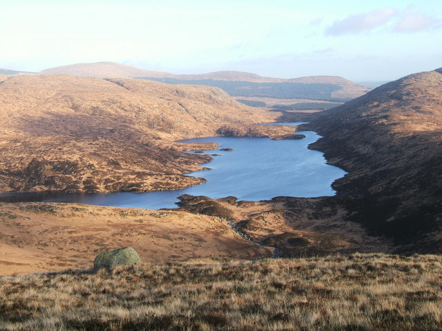
Trostan Isle is a small island located off the coast of Kirkcudbrightshire, Scotland. Situated in the Irish Sea, it is approximately 2 kilometers in length and 1 kilometer wide, covering an area of about 1.5 square kilometers. The island is known for its rugged and picturesque landscape, with steep cliffs and rocky shores.
The vegetation on Trostan Isle is predominantly heather and grass, providing a habitat for a variety of bird species, including gulls, fulmars, and cormorants. The surrounding waters are rich in marine life, making it a popular spot for fishing and birdwatching enthusiasts.
Access to Trostan Isle is limited, as there are no regular ferry services to the island. However, it can be reached by private boat or kayak, with several landing points available along its coastline. The island has no permanent residents, but it is occasionally visited by hikers and nature lovers who come to explore its unspoiled beauty.
Historically, Trostan Isle has had a few human settlements, dating back to ancient times. Ruins of stone structures and burial sites can still be found on the island, providing a glimpse into its past. The island's name is believed to have Celtic origins, although its exact meaning is uncertain.
Overall, Trostan Isle offers a tranquil and untouched natural environment, making it a hidden gem for those seeking a remote and peaceful escape amid the picturesque landscapes of Kirkcudbrightshire.
If you have any feedback on the listing, please let us know in the comments section below.
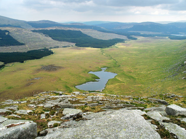
Trostan Isle Images
Images are sourced within 2km of 55.084597/-4.4487915 or Grid Reference NX4379. Thanks to Geograph Open Source API. All images are credited.


Trostan Isle is located at Grid Ref: NX4379 (Lat: 55.084597, Lng: -4.4487915)
Unitary Authority: Dumfries and Galloway
Police Authority: Dumfries and Galloway
What 3 Words
///shuttle.giraffes.bills. Near Newton Stewart, Dumfries & Galloway
Nearby Locations
Related Wikis

Round Loch of Glenhead
The Round Loch of Glenhead is a small upland single basin loch in Dumfries and Galloway. It is situated within Galloway Forest Park to the west of the...
Loch Valley
Loch Valley is a loch in Galloway Forest Park to the east of Buchan Hill, north of the Rig of the Jarkness and southwest of Craignaw. It drains via Gairland...

Battle of Glen Trool
The Battle of Glen Trool was a minor engagement in the First War of Scottish Independence, fought in April 1307. Glen Trool is a narrow glen in the Southern...

Lamachan Hill
Lamachan Hill is a hill in the Minnigaff Hills, a sub-range of the Galloway Hills range, part of the Southern Uplands of Scotland. It is the highest hill...

Loch Trool
Loch Trool is a narrow, freshwater loch in Galloway, in the Southern Uplands in south-west Scotland. It lies in an elevated position in Glen Trool in the...

Loch Neldricken
Loch Neldricken is a loch in Galloway to the south-east of Merrick, south of Craig Neldricken and west of Craignaw. The loch is almost bisected by a long...
Silver Flowe-Merrick Kells
Situated in south-west Scotland, the Silver Flowe-Merrick Kells biosphere reserve is composed of two separate sites. Silver Flowe is a unique bog formation...

Glen Trool
Glen Trool (Scottish Gaelic: Gleann an t-Sruthail) is a glen in the Southern Uplands, Galloway, Scotland. It contains Loch Trool which is fed by several...
Have you been to Trostan Isle?
Leave your review of Trostan Isle below (or comments, questions and feedback).