Hun Dale

Valley in Yorkshire Scarborough

England

Hun Dale

Bryherstones Country Inn, Cloughton Newlands Popular food-orientated pub on the road out of Cloughton towards Staintondale.
Bryherstones Country Inn, Cloughton Newlands Credit: Stephen McKay

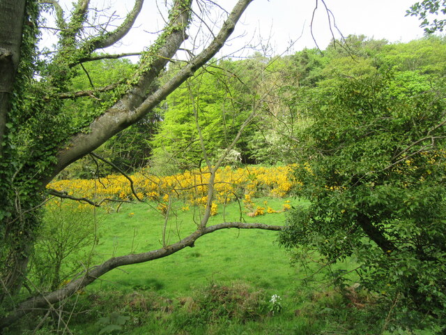
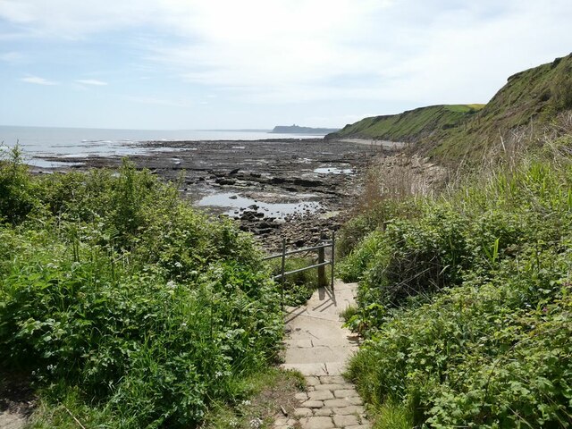
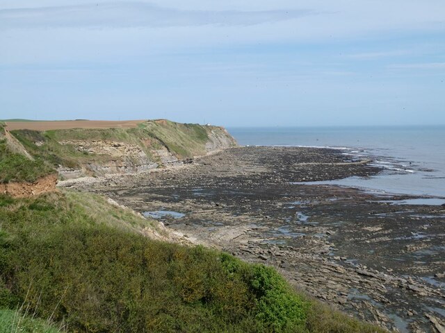
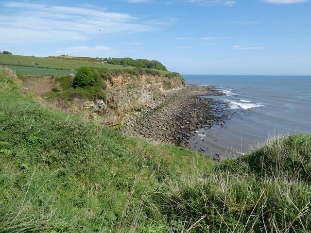
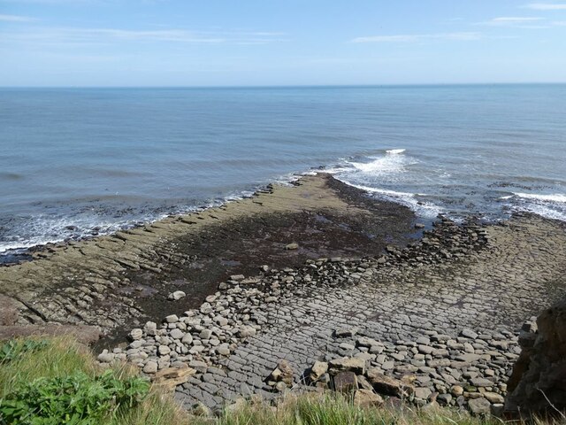
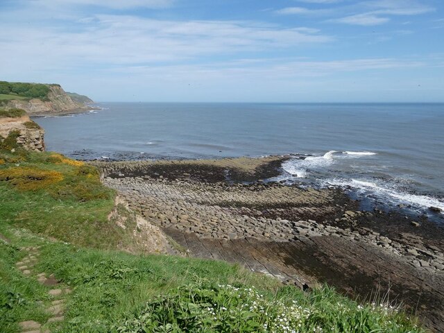
Hun Dale is a picturesque valley located in the county of Yorkshire, England. Nestled within the rolling hills of the North York Moors National Park, it offers a serene and idyllic setting for nature lovers and outdoor enthusiasts.

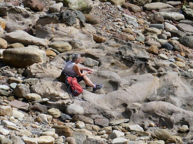
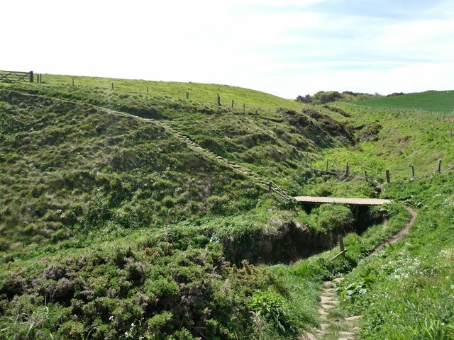
The valley is characterized by its lush green meadows, rocky outcrops, and meandering river, which flows through the heart of the dale. The river, known as the River Hun, adds to the charm of the area as it gurgles and cascades over small waterfalls, creating a soothing and tranquil ambiance.

Hun Dale is renowned for its diverse wildlife, making it a popular destination for birdwatchers and wildlife enthusiasts. Visitors may catch a glimpse of various species of birds, including peregrine falcons, kestrels, and barn owls, as well as other animals such as deer, badgers, and foxes.

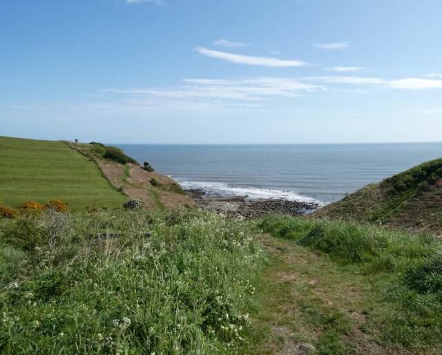
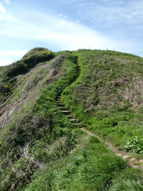
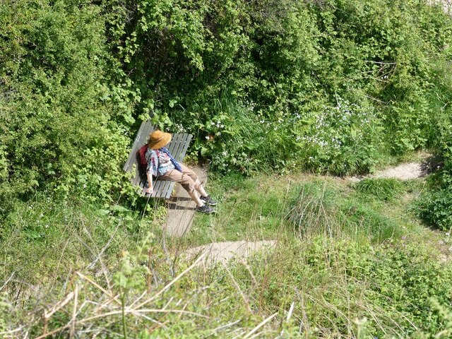
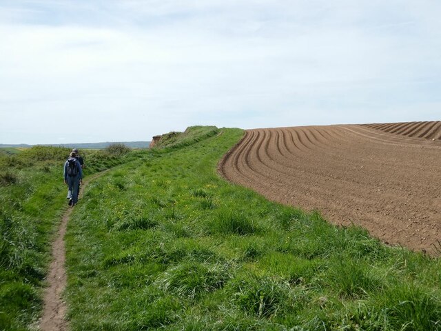
The valley also boasts an array of walking trails, allowing visitors to explore its beauty on foot. From leisurely strolls along the riverbank to more challenging hikes up the surrounding hills, there is something to suit all abilities and preferences. One of the most popular routes is the Hun Dale Circular Walk, which offers stunning views of the valley and its surroundings.

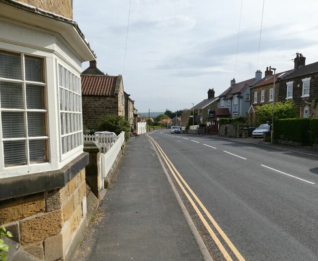
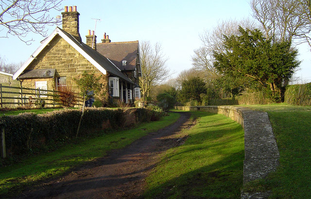
Located near the village of Hunmanby, Hun Dale is easily accessible by road, with ample parking available. The area also offers a range of accommodation options, including cozy bed and breakfasts and charming country inns, ensuring visitors can fully immerse themselves in the beauty and tranquility of the valley.

If you have any feedback on the listing, please let us know in the comments section below.

Hun Dale Images

Images are sourced within 2km of 54.337808/-0.42819303 or Grid Reference TA0294. Thanks to Geograph Open Source API. All images are credited.

Bryherstones Country Inn, Cloughton Newlands Popular food-orientated pub on the road out of Cloughton towards Staintondale.
Bryherstones Country Inn, Cloughton Newlands
Popular food-orientated pub on the road out of Cloughton towards Staintondale.
Cloughton Newlands The board advertises the Bryherstones Country Inn, opposite the entrance to its car park, 'real ale, real food, real people'.
Cloughton Newlands
The board advertises the Bryherstones Country Inn, opposite the entrance to its car park, 'real ale, real food, real people'.
Newlands Dale Looking east from the old railway line.
Newlands Dale
Looking east from the old railway line.
Cloughton High Street The main A171 Whitby to Scarborough road.
Cloughton High Street
The main A171 Whitby to Scarborough road.
Pond beside Salt Pans Road Occupied by two Shelduck. The line of trees beyond flanks the Cinder Path (the railway path from Scarborough to Whitby). Houses on Hood Lane <a href="https://www.geograph.org.uk/gridref/TA0195">TA0195</a> in the background.
Pond beside Salt Pans Road
Occupied by two Shelduck. The line of trees beyond flanks the Cinder Path (the railway path from Scarborough to Whitby). Houses on Hood Lane TA0195 in the background.
Cloughton Wyke Seen from the end of Salt Pans Road.
Cloughton Wyke
Seen from the end of Salt Pans Road.
Steps on the Cleveland Way Climbing south at Cloughton Wyke.
Steps on the Cleveland Way
Climbing south at Cloughton Wyke.
Cloughton Wyke South side of the bay.
Cloughton Wyke
South side of the bay.
Taking a break at Crook Ness On a stainless steel memorial bench just above the shore.
Taking a break at Crook Ness
On a stainless steel memorial bench just above the shore.
Resting on the shore at Crook Ness
Path down to the shore  at Crook Ness Scarborough Castle can be seen on the far headland.
Path down to the shore at Crook Ness
Scarborough Castle can be seen on the far headland.
Furrows  in a field Beside the Cleveland Way at Crook Ness.
Furrows in a field
Beside the Cleveland Way at Crook Ness.
The coast at Burniston Looking north from the Cleveland Way.
The coast at Burniston
Looking north from the Cleveland Way.
Ploughed field beside the Cleveland Way Near Burniston.
Ploughed field beside the Cleveland Way
Near Burniston.
The cliffs at Cloughton Wyke
A dip in the path On the Cleveland Way at Hun Dale.
A dip in the path
On the Cleveland Way at Hun Dale.
Hundale Scar Spectacular wave-cut platform seen from the Cleveland Way.
Hundale Scar
Spectacular wave-cut platform seen from the Cleveland Way.
Hundale Scar Spectacular wave-cut platform seen from the Cleveland Way.
Hundale Scar
Spectacular wave-cut platform seen from the Cleveland Way.
Show me another place!

Hun Dale is located at Grid Ref: TA0294 (Lat: 54.337808, Lng: -0.42819303)

Division: North Riding

Administrative County: North Yorkshire

District: Scarborough

Police Authority: North Yorkshire

What 3 Words

///universal.pins.pills. Near Burniston, North Yorkshire

Related Wikis

Cloughton railway station

Cloughton railway station was a railway station on the Scarborough & Whitby Railway. It opened on 16 July 1885, and served the North Yorkshire village...

Cloughton

Cloughton (pronounced Clow-tun) is a small village and civil parish in the Scarborough district of North Yorkshire, England. == Description == It is situated...

Burniston

Burniston is a village and civil parish in the Scarborough borough of North Yorkshire, England. It is situated about four miles north of Scarborough itself...

Hayburn Wyke railway station

Hayburn Wyke railway station was a railway station on the Scarborough & Whitby Railway, 7 miles from Scarborough. It opened on 16 July 1885, and served...

Scalby Manor, Scarborough

Scalby Manor near Scarborough, North Yorkshire was built in 1885 by Edwin Brough. He was the leading breeder and trainer in England of bloodhounds at his...

Staintondale railway station

Staintondale railway station, also known as Stainton Dale railway station, was 8 miles (13 km) north of Scarborough and served the hamlet of Staintondale...

Crowdon

Crowdon is a village in the Scarborough district of North Yorkshire, England. == References == The geographic coordinates are from the Ordnance Survey...

Scalby railway station

Scalby railway station was a railway station on the Scarborough & Whitby Railway. == History == The station opened on 16 July 1885, and served the village...

Nearby Amenities

Located within 500m of 54.337808,-0.42819303
Source: PGS
Lat/Long: 54.3357255/-0.4214861
Source: PGS
Lat/Long: 54.3369487/-0.4220429
Source: PGS
Lat/Long: 54.3375634/-0.4224142
Source: PGS
Lat/Long: 54.3379706/-0.4225174
Source: PGS
Lat/Long: 54.3385433/-0.4232334
Source: PGS
Lat/Long: 54.3389072/-0.423541
Source: PGS
Lat/Long: 54.3393115/-0.424619
Source: PGS
Lat/Long: 54.3394039/-0.4250302
Source: PGS
Lat/Long: 54.3395091/-0.4258244
Source: PGS
Lat/Long: 54.3395905/-0.4266435
Source: PGS
Lat/Long: 54.3399834/-0.4284151
Source: PGS
Lat/Long: 54.3399369/-0.4297674
Source: PGS
Lat/Long: 54.3397758/-0.431702
Source: PGS
Lat/Long: 54.3398429/-0.4324444
Source: PGS
Lat/Long: 54.3404553/-0.4328901
Source: PGS
Lat/Long: 54.3407596/-0.4327104
Source: PGS
Lat/Long: 54.3410067/-0.4326268
Source: PGS
Lat/Long: 54.3413323/-0.4325258
Information: route_marker
Tourism: information
Lat/Long: 54.3401932/-0.4334557
Information: route_marker
Tourism: information
Lat/Long: 54.3408401/-0.4330682
The data included in this document is from www.openstreetmap.org. The data is made available under ODbL.

Have you been to Hun Dale?

Leave your review of Hun Dale below (or comments, questions and feedback).