Hundale Point

Coastal Feature, Headland, Point in Yorkshire Scarborough

England

Hundale Point

Cloughton Newlands The board advertises the Bryherstones Country Inn, opposite the entrance to its car park, 'real ale, real food, real people'.
Cloughton Newlands Credit: Stephen McKay

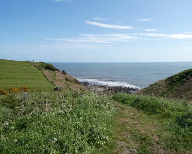
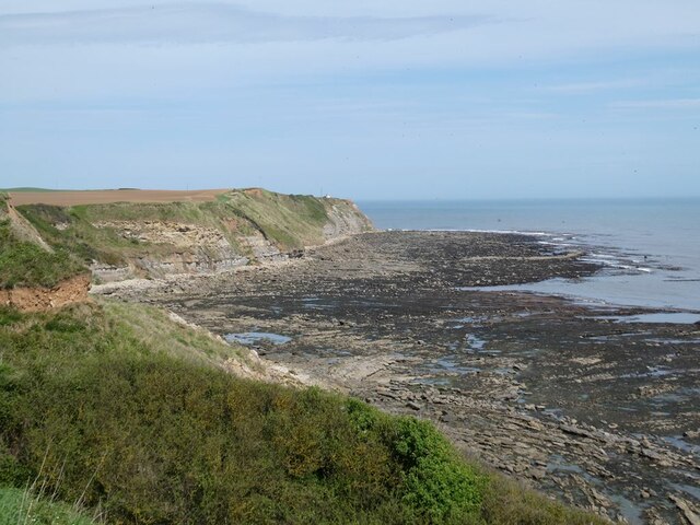
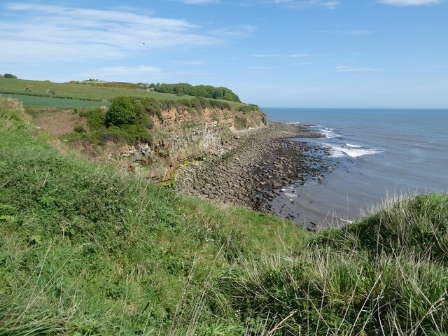
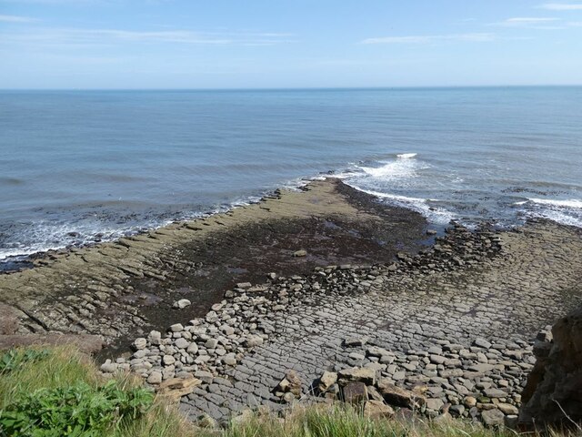
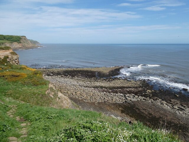
Hundale Point is a prominent coastal feature located in Yorkshire, England. Situated on the eastern coast, it is a headland that juts out into the North Sea, forming a distinct point along the coastline. With its unique geographic features and stunning natural beauty, Hundale Point has become a popular destination for locals and tourists alike.

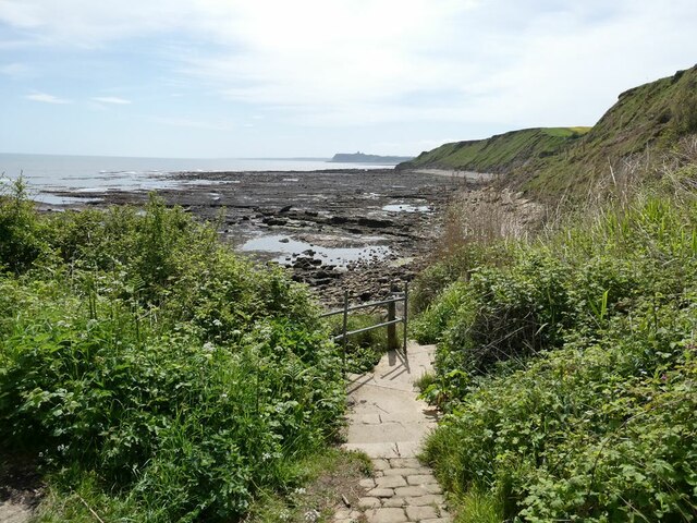
The headland is characterized by its rugged cliffs, which provide breathtaking views of the surrounding sea and coastline. The cliffs are composed of layers of sedimentary rock, showcasing the geological history of the area. Visitors can witness the power of the pounding waves against the cliffs, creating a dramatic spectacle.

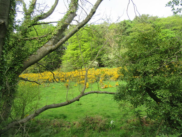
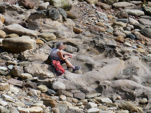
The point is also home to a variety of wildlife, making it a haven for nature enthusiasts. Seabirds such as gulls, puffins, and kittiwakes can be spotted nesting in the cliffs, while seals and dolphins are often seen swimming in the waters below. The coastal vegetation adds to the charm of Hundale Point, with patches of grass, wildflowers, and shrubs dotting the landscape.

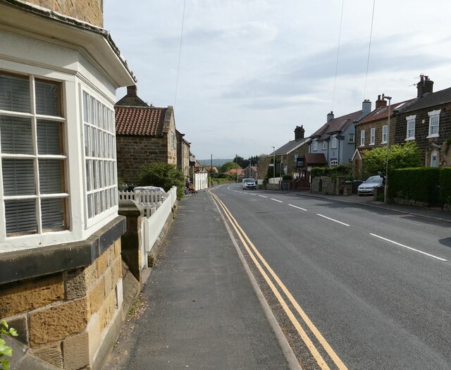
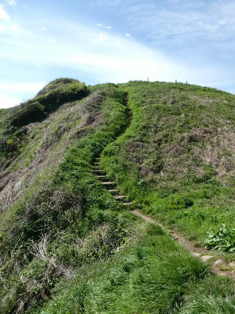
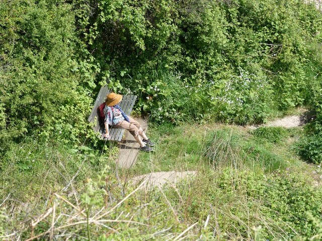
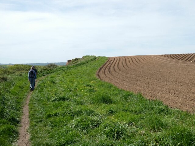
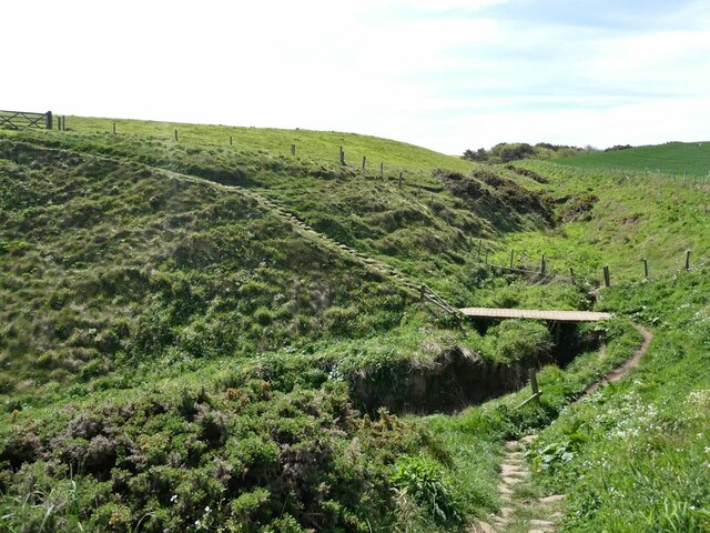
Access to Hundale Point is relatively easy, with a well-maintained footpath leading from the nearby village. The path offers stunning views along the way, making the journey as enjoyable as the destination itself. Additionally, there are picnic spots and benches along the cliff edge, providing visitors with the opportunity to relax and take in the scenic surroundings.

Overall, Hundale Point is a captivating coastal feature with its rugged cliffs, diverse wildlife, and stunning views. It is an ideal location for hiking, birdwatching, or simply enjoying the beauty of nature.

If you have any feedback on the listing, please let us know in the comments section below.

Hundale Point Images

Images are sourced within 2km of 54.338287/-0.42214504 or Grid Reference TA0294. Thanks to Geograph Open Source API. All images are credited.

Cloughton Newlands The board advertises the Bryherstones Country Inn, opposite the entrance to its car park, 'real ale, real food, real people'.
Cloughton Newlands
The board advertises the Bryherstones Country Inn, opposite the entrance to its car park, 'real ale, real food, real people'.
Newlands Dale Looking east from the old railway line.
Newlands Dale
Looking east from the old railway line.
Cloughton High Street The main A171 Whitby to Scarborough road.
Cloughton High Street
The main A171 Whitby to Scarborough road.
Pond beside Salt Pans Road Occupied by two Shelduck. The line of trees beyond flanks the Cinder Path (the railway path from Scarborough to Whitby). Houses on Hood Lane <a href="https://www.geograph.org.uk/gridref/TA0195">TA0195</a> in the background.
Pond beside Salt Pans Road
Occupied by two Shelduck. The line of trees beyond flanks the Cinder Path (the railway path from Scarborough to Whitby). Houses on Hood Lane TA0195 in the background.
Cloughton Wyke Seen from the end of Salt Pans Road.
Cloughton Wyke
Seen from the end of Salt Pans Road.
Steps on the Cleveland Way Climbing south at Cloughton Wyke.
Steps on the Cleveland Way
Climbing south at Cloughton Wyke.
Cloughton Wyke South side of the bay.
Cloughton Wyke
South side of the bay.
Taking a break at Crook Ness On a stainless steel memorial bench just above the shore.
Taking a break at Crook Ness
On a stainless steel memorial bench just above the shore.
Resting on the shore at Crook Ness
Path down to the shore  at Crook Ness Scarborough Castle can be seen on the far headland.
Path down to the shore at Crook Ness
Scarborough Castle can be seen on the far headland.
Furrows  in a field Beside the Cleveland Way at Crook Ness.
Furrows in a field
Beside the Cleveland Way at Crook Ness.
The coast at Burniston Looking north from the Cleveland Way.
The coast at Burniston
Looking north from the Cleveland Way.
Ploughed field beside the Cleveland Way Near Burniston.
Ploughed field beside the Cleveland Way
Near Burniston.
The cliffs at Cloughton Wyke
A dip in the path On the Cleveland Way at Hun Dale.
A dip in the path
On the Cleveland Way at Hun Dale.
Hundale Scar Spectacular wave-cut platform seen from the Cleveland Way.
Hundale Scar
Spectacular wave-cut platform seen from the Cleveland Way.
Hundale Scar Spectacular wave-cut platform seen from the Cleveland Way.
Hundale Scar
Spectacular wave-cut platform seen from the Cleveland Way.
Furrows in a field Near Long Nab.
Furrows in a field
Near Long Nab.
Show me another place!

Hundale Point is located at Grid Ref: TA0294 (Lat: 54.338287, Lng: -0.42214504)

Division: North Riding

Administrative County: North Yorkshire

District: Scarborough

Police Authority: North Yorkshire

What 3 Words

///otherwise.puff.breakaway. Near Burniston, North Yorkshire

Related Wikis

Cloughton railway station

Cloughton railway station was a railway station on the Scarborough & Whitby Railway. It opened on 16 July 1885, and served the North Yorkshire village...

Cloughton

Cloughton (pronounced Clow-tun) is a small village and civil parish in the Scarborough district of North Yorkshire, England. == Description == It is situated...

Burniston

Burniston is a village and civil parish in the Scarborough borough of North Yorkshire, England. It is situated about four miles north of Scarborough itself...

Hayburn Wyke railway station

Hayburn Wyke railway station was a railway station on the Scarborough & Whitby Railway, 7 miles from Scarborough. It opened on 16 July 1885, and served...

Nearby Amenities

Located within 500m of 54.338287,-0.42214504
Source: PGS
Lat/Long: 54.3349236/-0.4213986
Source: PGS
Lat/Long: 54.3357255/-0.4214861
Source: PGS
Lat/Long: 54.3369487/-0.4220429
Source: PGS
Lat/Long: 54.3375634/-0.4224142
Source: PGS
Lat/Long: 54.3379706/-0.4225174
Source: PGS
Lat/Long: 54.3385433/-0.4232334
Source: PGS
Lat/Long: 54.3389072/-0.423541
Source: PGS
Lat/Long: 54.3393115/-0.424619
Source: PGS
Lat/Long: 54.3394039/-0.4250302
Source: PGS
Lat/Long: 54.3395091/-0.4258244
Source: PGS
Lat/Long: 54.3395905/-0.4266435
Source: PGS
Lat/Long: 54.3399834/-0.4284151
The data included in this document is from www.openstreetmap.org. The data is made available under ODbL.

Have you been to Hundale Point?

Leave your review of Hundale Point below (or comments, questions and feedback).