Open Dale

Valley in Yorkshire Ryedale

England

Open Dale

Gatehowe Road approaching the summit Looking along the road from Howe Hill to Hanging Grimston.
Gatehowe Road approaching the summit Credit: DS Pugh

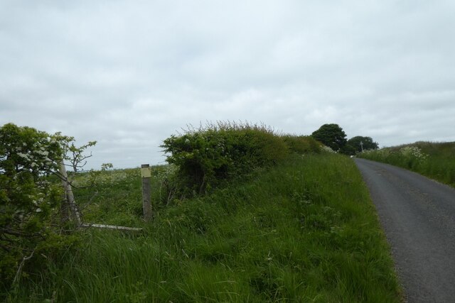
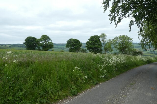
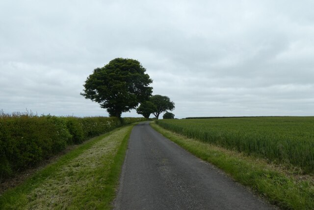
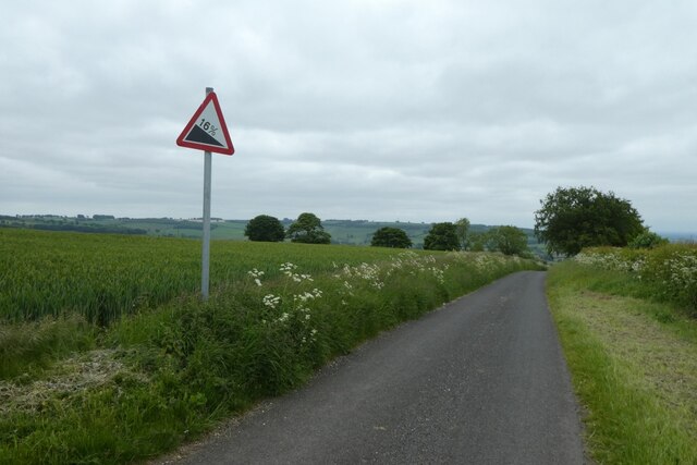
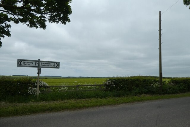
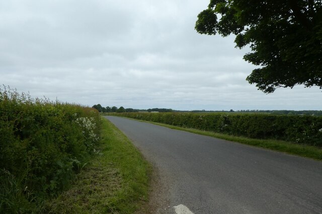
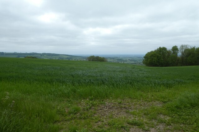
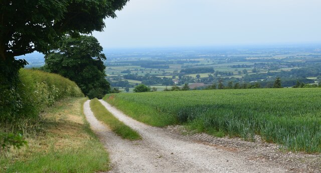
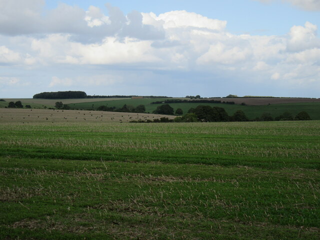
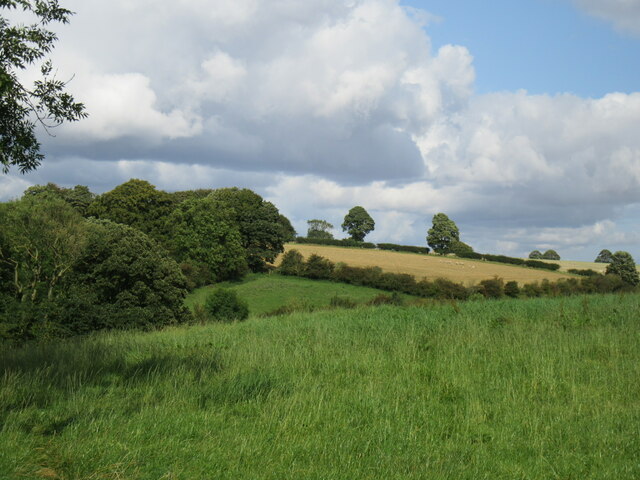
Open Dale is a picturesque valley located in the county of Yorkshire, England. Nestled amidst the rolling hills and verdant countryside, this idyllic valley offers breathtaking views and a tranquil atmosphere. The valley stretches for approximately 5 miles and is renowned for its natural beauty and rich history.

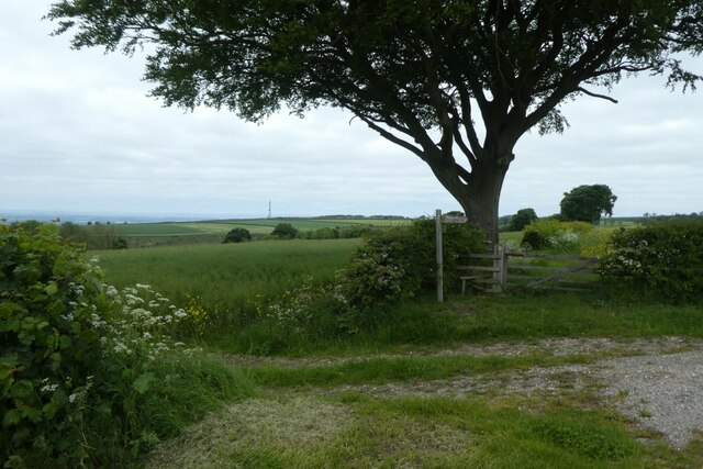
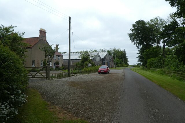
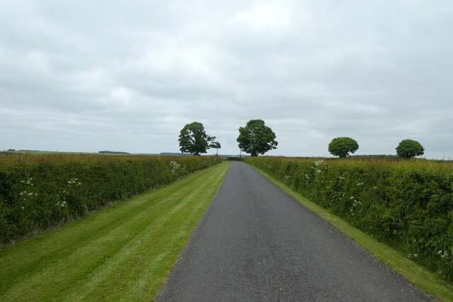
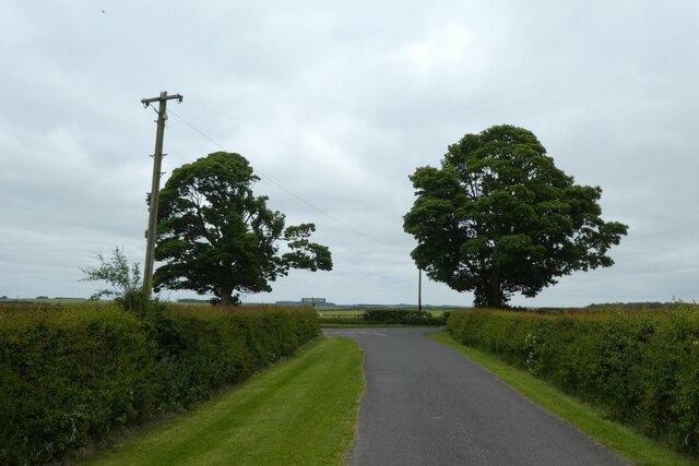
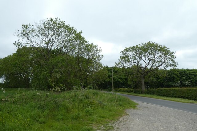
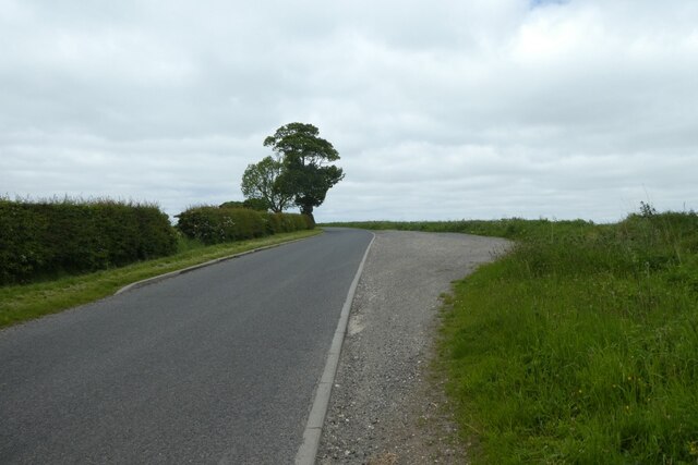
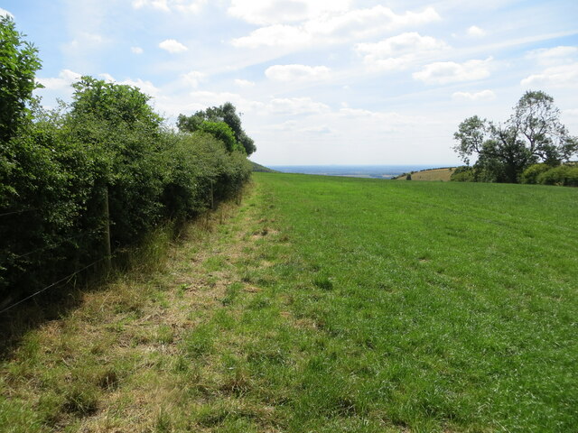
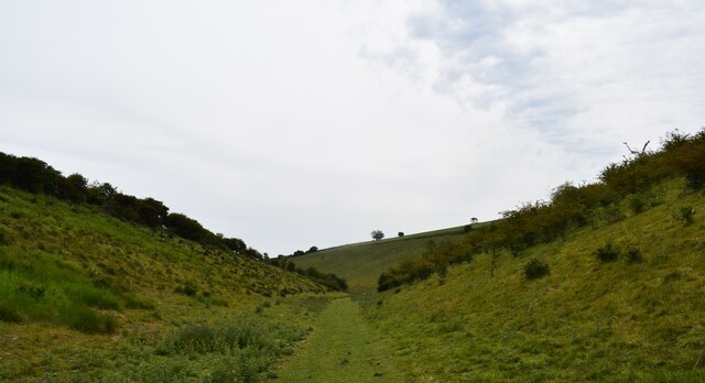
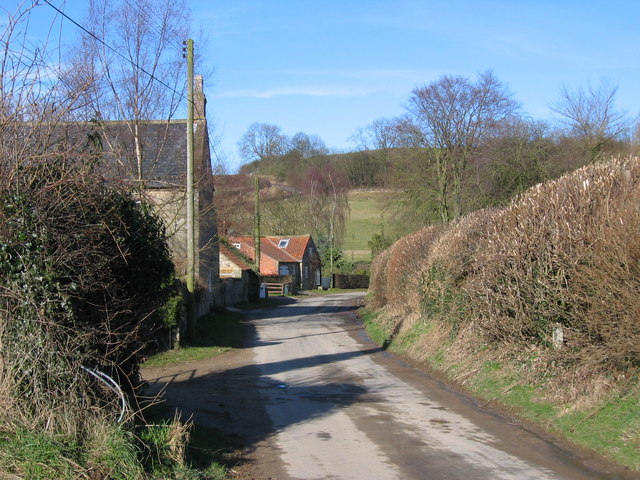
Open Dale is adorned with lush green meadows, dotted with charming farms and cottages, making it a perfect destination for those seeking a peaceful retreat or a leisurely stroll through nature. The valley is crisscrossed by babbling brooks and streams, adding to its enchanting allure. The surrounding hills provide a stunning backdrop, with their majestic presence and vibrant flora and fauna.

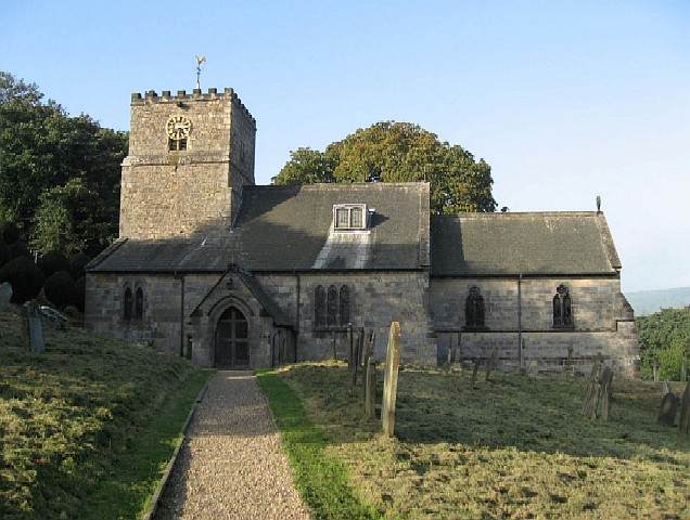
The history of Open Dale is evident in its ancient stone structures and remnants of old settlements. The valley was once a thriving community, sustained by farming and sheep rearing. Today, visitors can still witness the remnants of old stone walls and traditional farm buildings that stand as a testament to the valley's rich past.

Outdoor enthusiasts will find plenty of opportunities for exploration and adventure in Open Dale. The valley is intersected by numerous footpaths, offering hikers and walkers a chance to discover its hidden treasures. The trails lead to panoramic viewpoints, charming villages, and even ancient ruins, providing a glimpse into the region's fascinating history.

Open Dale is also home to a diverse range of wildlife, making it a haven for nature lovers. Birdwatchers can spot various species of birds soaring through the skies, while wildlife enthusiasts may catch a glimpse of deer, rabbits, and other small mammals that inhabit the valley.

In conclusion, Open Dale in Yorkshire is a stunning valley that captivates visitors with its natural beauty, rich history, and peaceful ambiance. Whether it's exploring the countryside, immersing in local history, or simply enjoying the tranquility, this hidden gem in Yorkshire offers a truly unforgettable experience.

If you have any feedback on the listing, please let us know in the comments section below.

Open Dale Images

Images are sourced within 2km of 54.031019/-0.77212414 or Grid Reference SE8060. Thanks to Geograph Open Source API. All images are credited.

Gatehowe Road approaching the summit Looking along the road from Howe Hill to Hanging Grimston.
Gatehowe Road approaching the summit
Looking along the road from Howe Hill to Hanging Grimston.
Fields beside Gatehowe Road Looking down the road from Hanging Grimston.
Fields beside Gatehowe Road
Looking down the road from Hanging Grimston.
Road near Hanging Grimston Looking along Gatehowe Road. A path heads towards Acklam from the corner.
Road near Hanging Grimston
Looking along Gatehowe Road. A path heads towards Acklam from the corner.
Descent sign on Gatehowe Road Looking down the road from Hanging Grimston to Howe Hill.
Descent sign on Gatehowe Road
Looking down the road from Hanging Grimston to Howe Hill.
Footpath from Gatehowe Road A footpath heads across to Acklam. The radio transmitter at Acklam Wold is visible on the left.
Footpath from Gatehowe Road
A footpath heads across to Acklam. The radio transmitter at Acklam Wold is visible on the left.
Wold Farm Looking along Gatehowe Road in Hanging Grimston.
Wold Farm
Looking along Gatehowe Road in Hanging Grimston.
Gatehowe Road at Hanging Grimston Looking towards the junction with the Roman Road.
Gatehowe Road at Hanging Grimston
Looking towards the junction with the Roman Road.
Junction of Gatehowe Road Looking along Gatehowe Road towards the Roman Road.
Junction of Gatehowe Road
Looking along Gatehowe Road towards the Roman Road.
Sign post and telegraph pole Looking across the junction with Gatehowe Road.
Sign post and telegraph pole
Looking across the junction with Gatehowe Road.
Roman road towards Acklam Looking along the road from the junction with Gatehowe Road.
Roman road towards Acklam
Looking along the road from the junction with Gatehowe Road.
Road to Uncleby Wold Looking along the road on top of the Wolds. The telegraph pole ahead is marked GPO 24L 52 indicating it was owned by the GPO (now BT), is 24 feet in length and a 'light' post, and the pole was produced in 1952.
Road to Uncleby Wold
Looking along the road on top of the Wolds. The telegraph pole ahead is marked GPO 24L 52 indicating it was owned by the GPO (now BT), is 24 feet in length and a 'light' post, and the pole was produced in 1952.
Road towards Hanging Grimston Looking along the Roman Road on top of the Wolds towards Hanging Grimston.
Road towards Hanging Grimston
Looking along the Roman Road on top of the Wolds towards Hanging Grimston.
Field above Harpers Barn Plantation Looking across an arable field above Washpit Dale.
Field above Harpers Barn Plantation
Looking across an arable field above Washpit Dale.
Field edge footpath on Hanging Grimston Wold Looking south-westward.
Field edge footpath on Hanging Grimston Wold
Looking south-westward.
The Chalkland Way in Milham Dale Close to Thixendale Grange.
The Chalkland Way in Milham Dale
Close to Thixendale Grange.
Lane above the Vale of York. On the edge of the Wolds.
Lane above the Vale of York.
On the edge of the Wolds.
Hanging Grimston Wold Looking NE from the road.
Hanging Grimston Wold
Looking NE from the road.
Acklam Wold At the top of Brownmoor Dale.
Acklam Wold
At the top of Brownmoor Dale.
Show me another place!

Open Dale is located at Grid Ref: SE8060 (Lat: 54.031019, Lng: -0.77212414)

Division: East Riding

Administrative County: North Yorkshire

District: Ryedale

Police Authority: North Yorkshire

What 3 Words

///laws.massaging.trek. Near Kirby Underdale, East Yorkshire

Related Wikis

Uncleby

Uncleby is a hamlet in the East Riding of Yorkshire, England. It forms part of the civil parish of Kirby Underdale. It is situated approximately 6.5 miles...

Kirby Underdale

Kirby Underdale is a village and civil parish in the East Riding of Yorkshire, England. It is situated approximately six miles (ten kilometres) north...

Painsthorpe Abbey

Painsthorpe Abbey was a short-lived monastery of the Anglican Order of St. Benedict. It was established in 1902 at Painsthorpe in the East Riding of Yorkshire...

Minster FM

Minster FM was an Independent Local Radio station serving York and the surrounding areas such as Selby, Tadcaster, Thirsk, Northallerton and Goole. The...

Painsthorpe

Painsthorpe is a hamlet in the East Riding of Yorkshire, England. It is located about 1 mile (1.6 km) east of the village of Kirby Underdale, the area...

Buckrose

Buckrose was a wapentake of the historic East Riding of Yorkshire, England consisting of the north-west part of the county; its territory is now partly...

Acklam, Ryedale

Acklam is a small village and civil parish in North Yorkshire, England. It is situated approximately 12 miles (20 km) north-east of York city centre and...

Garrowby

Garrowby is a hamlet in the East Riding of Yorkshire, England. It is situated approximately 5 miles (8 km) north of Pocklington town centre. It lies to...

Nearby Amenities

Located within 500m of 54.031019,-0.77212414
Natural: spring
Lat/Long: 54.0348779/-0.7730563
Natural: spring
Lat/Long: 54.0349442/-0.7729951
Depth: 0.2
Ford: yes
Seasonal: no
Lat/Long: 54.0277309/-0.771086
Material: wood
Power: pole
Lat/Long: 54.0268915/-0.7693079
Material: wood
Power: pole
Lat/Long: 54.0271929/-0.7701775
Material: wood
Power: pole
Lat/Long: 54.0276444/-0.7714937
Material: wood
Power: pole
Lat/Long: 54.0280658/-0.7727697
Material: wood
Power: pole
Lat/Long: 54.0285448/-0.7742039
Material: wood
Power: pole
Lat/Long: 54.0288542/-0.7751304
Material: wood
Power: pole
Lat/Long: 54.0291585/-0.776006
Line Management: branch
Material: wood
Power: pole
Lat/Long: 54.0295551/-0.7772168
Material: wood
Power: pole
Lat/Long: 54.0297273/-0.77782
Material: wood
Power: pole
Lat/Long: 54.0299987/-0.7787374
Material: wood
Power: pole
Lat/Long: 54.0288193/-0.7777427
The data included in this document is from www.openstreetmap.org. The data is made available under ODbL.

Have you been to Open Dale?

Leave your review of Open Dale below (or comments, questions and feedback).