Northern Dale

Valley in Derbyshire Derbyshire Dales

England

Northern Dale

Temporary path closure Part of the Derwent Valley Heritage Way. The path is being strengthened but there is a way round via some steps to the left. The bridge on the right carries the railway between Matlock and Darley Dale.
Temporary path closure Credit: Bill Boaden

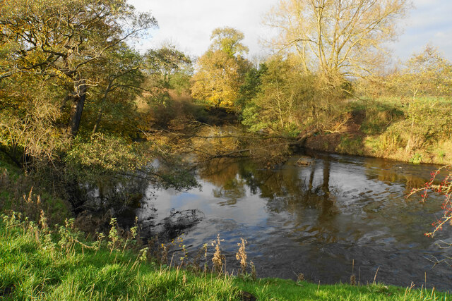
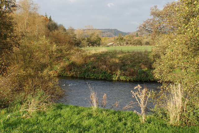
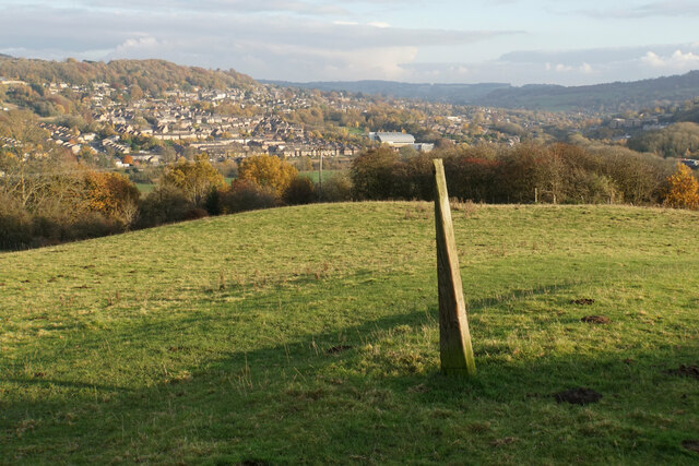
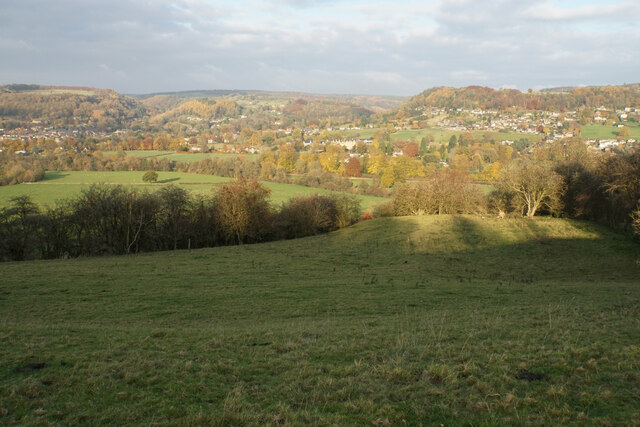
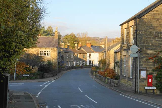
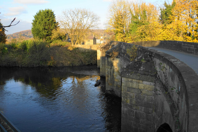
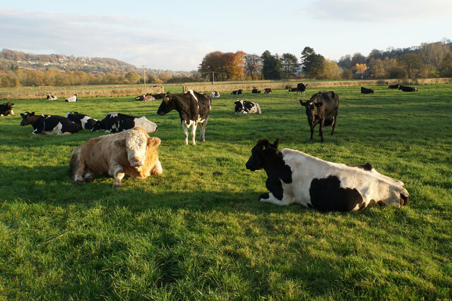
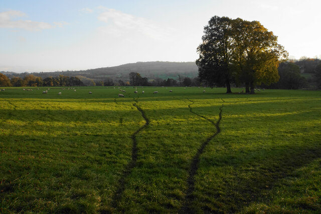
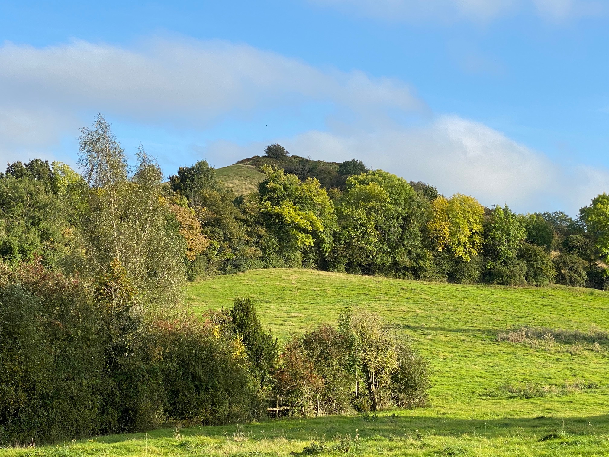
Northern Dale, located in the county of Derbyshire, is a picturesque valley nestled within the rolling hills of the Peak District in England. The Dale is renowned for its breathtaking natural beauty, with its tranquil landscapes and idyllic countryside setting. The valley is characterized by its lush green meadows, meandering streams, and dense woodlands, creating a haven for wildlife and providing a perfect escape for nature enthusiasts.

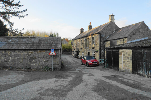
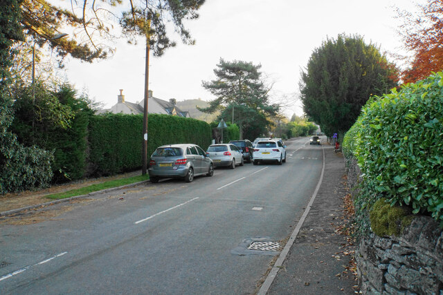
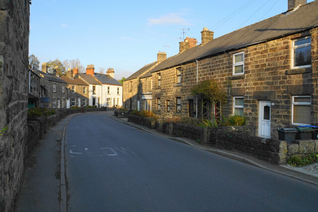
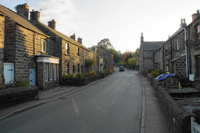
The village of Northern Dale itself is a charming and quaint settlement, with traditional stone houses and buildings that exude a sense of history and heritage. The local community is welcoming and friendly, and visitors can expect warm hospitality during their stay. The village is home to a handful of amenities, including a cozy pub, a small grocery store, and a post office, offering convenience to both residents and tourists.

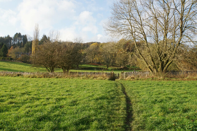
For those seeking outdoor adventures, Northern Dale offers a plethora of activities. The valley is crisscrossed by a network of walking trails, offering breathtaking views of the surrounding countryside. There are also opportunities for cycling, horseback riding, and fishing in the nearby rivers and ponds. The valley is also home to several nature reserves and protected areas, showcasing its commitment to environmental conservation.

Overall, Northern Dale is a hidden gem within Derbyshire, offering a serene and peaceful retreat for individuals looking to escape the hustle and bustle of city life. Its natural beauty, coupled with its warm community and range of outdoor activities, make it a must-visit destination for nature lovers and those seeking tranquility in the heart of the English countryside.

If you have any feedback on the listing, please let us know in the comments section below.

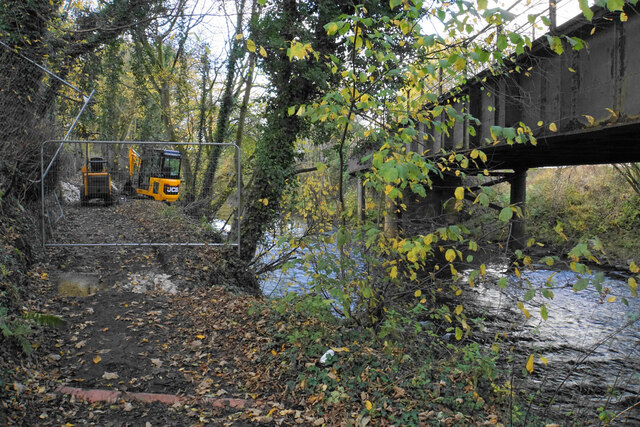
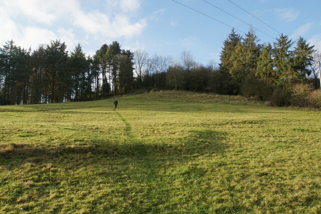
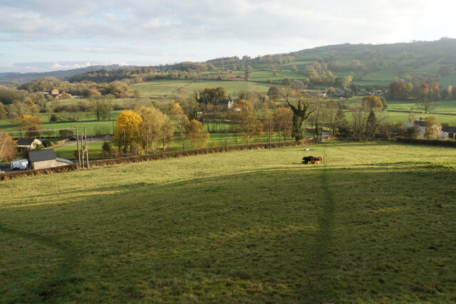
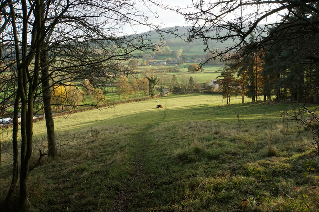
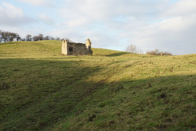
Northern Dale Images

Images are sourced within 2km of 53.141563/-1.5974032 or Grid Reference SK2760. Thanks to Geograph Open Source API. All images are credited.

Temporary path closure Part of the Derwent Valley Heritage Way. The path is being strengthened but there is a way round via some steps to the left. The bridge on the right carries the railway between Matlock and Darley Dale.
Temporary path closure
Part of the Derwent Valley Heritage Way. The path is being strengthened but there is a way round via some steps to the left. The bridge on the right carries the railway between Matlock and Darley Dale.
River Derwent near Ashton Farm A bend in the river. A branch from the far bank has fallen across it.
River Derwent near Ashton Farm
A bend in the river. A branch from the far bank has fallen across it.
Footpath to Oker Part of the Derwent Valley Heritage Way, the path has followed the valley bottom of the Derwent.
Footpath to Oker
Part of the Derwent Valley Heritage Way, the path has followed the valley bottom of the Derwent.
River Derwent near Oker
Path up to Oaker A small hill but it is worth going up for the view.
Path up to Oaker
A small hill but it is worth going up for the view.
Grazing land on the south side of Oaker Looking down towards Snitterton.
Grazing land on the south side of Oaker
Looking down towards Snitterton.
Path off Oaker Descending the southern side.
Path off Oaker
Descending the southern side.
Ruined barn on Oaker The land is still used for grazing.
Ruined barn on Oaker
The land is still used for grazing.
Post on Oaker A wedge-shaped wooden post, which may mark the path across the top of this hill. Behind you can see the northern end of Matlock around Dimple.
Post on Oaker
A wedge-shaped wooden post, which may mark the path across the top of this hill. Behind you can see the northern end of Matlock around Dimple.
The eastern side of Oaker Looking down into the Derwent valley below Darley Dale. The hill is shading the foreground from the low November sun.
The eastern side of Oaker
Looking down into the Derwent valley below Darley Dale. The hill is shading the foreground from the low November sun.
Footpath arriving at Darley Bridge It comes out in a passage next to the Three Stags Heads pub.
Footpath arriving at Darley Bridge
It comes out in a passage next to the Three Stags Heads pub.
Eversleigh Rise The B5057 climbing out of Darley Bridge towards Wensley. It is a bit narrow but this is not the narrowest point in the village.
Eversleigh Rise
The B5057 climbing out of Darley Bridge towards Wensley. It is a bit narrow but this is not the narrowest point in the village.
Main Road. Darley Bridge The B5057 is just getting to the narrowest part through the village
Main Road. Darley Bridge
The B5057 is just getting to the narrowest part through the village
Main Road, Darley Bridge The narrowest part of the B5057 through the village.
Main Road, Darley Bridge
The narrowest part of the B5057 through the village.
Main Road, Darley Bridge The B5057 passing through the village in low afternoon sun.
Main Road, Darley Bridge
The B5057 passing through the village in low afternoon sun.
Darley Bridge The bridge carrying the B5057 over the River Derwent, from which the village derives its name.
Darley Bridge
The bridge carrying the B5057 over the River Derwent, from which the village derives its name.
Cattle by Flatts Farm Grazing on the flood plain of the River Derwent.
Cattle by Flatts Farm
Grazing on the flood plain of the River Derwent.
Sheep tracks near Normanhurst Farm Sheep are grazing on the flood plain of the River Derwent. The sun is sinking behind the hills to the west.
Sheep tracks near Normanhurst Farm
Sheep are grazing on the flood plain of the River Derwent. The sun is sinking behind the hills to the west.
Show me another place!

Northern Dale is located at Grid Ref: SK2760 (Lat: 53.141563, Lng: -1.5974032)

Administrative County: Derbyshire

District: Derbyshire Dales

Police Authority: Derbyshire

What 3 Words

///romantics.shirtless.flicked. Near Matlock, Derbyshire

Related Wikis

Oker, Derbyshire

Oker is a hamlet in Derbyshire, located in South Darley parish, with groups of houses along two sides of Oker Hill. The houses are largely older limestone...

South Darley

South Darley is a civil parish in the Derbyshire Dales. It is a largely rural parish and covers the villages of Darley Bridge, Wensley and the hamlets...

Snitterton

Snitterton is a hamlet in Derbyshire, England, in South Darley parish, of some fifteen properties including two working farms and Snitterton Hall, a late...

Snitterton Hall

Snitterton Hall is a late medieval manor house in Snitterton in South Darley parish, near Matlock, Derbyshire, England, and within the Peak District National...

Nearby Amenities

Located within 500m of 53.141563,-1.5974032
Ele: 196.0000000
Lat/Long: 53.1403504/-1.6034585
Ele: 190.0000000
Lat/Long: 53.1408714/-1.6032856
Ele: 190.0000000
Lat/Long: 53.1410454/-1.6032538
Barrier: stile
Ele: 185.0000000
Stile: squeezer
Lat/Long: 53.141542/-1.603079
Ele: 185.0000000
Lat/Long: 53.1415907/-1.6030409
Ele: 182.0000000
Lat/Long: 53.1424423/-1.603297
Barrier: stile
Ele: 122.0000000
Material: stone
Source: survey;gps
Stile: squeezer
Lat/Long: 53.1448675/-1.5994745
Ele: 120
Lat/Long: 53.1445955/-1.599064
Barrier: stile
Ele: 119.0000000
Material: stone
Source: survey;gps
Stile: squeezer
Lat/Long: 53.142433/-1.5949887
Barrier: stile
Ele: 118.0000000
Material: wood
Source: survey;gps
Steps: 1
Stile: stepover
Lat/Long: 53.1417895/-1.5934648
Barrier: stile
Material: stone
Source: survey
Stile: squeezer
Lat/Long: 53.1427268/-1.6021363
Barrier: stile
Source: survey;gps
Stile: squeezer
Lat/Long: 53.1440843/-1.5984262
Power: pole
Lat/Long: 53.1374437/-1.5988621
The data included in this document is from www.openstreetmap.org. The data is made available under ODbL.

Have you been to Northern Dale?

Leave your review of Northern Dale below (or comments, questions and feedback).