Holme Leas Clough

Valley in Yorkshire

England

Holme Leas Clough

Southdale Road - Queen Street
Southdale Road - Queen Street Credit: Betty Longbottom

Holme Leas Clough is a picturesque valley located in Yorkshire, England. Nestled amidst the rolling hills and lush greenery, this scenic landscape offers a tranquil retreat for nature enthusiasts and hikers alike.

The valley is characterized by its meandering stream, which gracefully flows through the heart of the clough. The gentle babbling of the water adds to the serenity of the surroundings, creating a soothing ambiance for visitors to enjoy.

The valley is home to a diverse range of flora and fauna, making it a haven for wildlife enthusiasts. The rich biodiversity includes a variety of plant species, such as wildflowers, ferns, and mosses. These vibrant colors add to the visual appeal of the valley, especially during the spring and summer months.

Holme Leas Clough also boasts an extensive network of walking trails, offering visitors the opportunity to explore the valley’s natural wonders. These paths wind through the valley, providing stunning views of the surrounding countryside and the chance to spot wildlife along the way.

For those seeking a more adventurous experience, the clough offers rock climbing opportunities on its steep cliffs. Experienced climbers can test their skills and enjoy breathtaking vistas from the top.

Overall, Holme Leas Clough is a hidden gem in Yorkshire, boasting a combination of natural beauty and recreational opportunities. Whether you are looking for a peaceful retreat or an active outdoor adventure, this valley has something to offer for everyone.

If you have any feedback on the listing, please let us know in the comments section below.

Holme Leas Clough Images

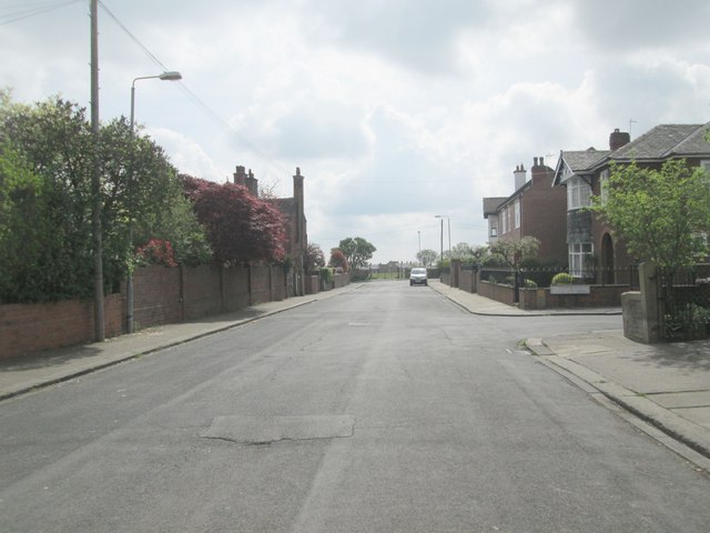
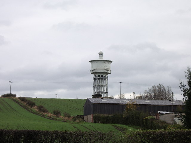
Images are sourced within 2km of 53.689042/-1.5927477 or Grid Reference SE2621. Thanks to Geograph Open Source API. All images are credited.

Southdale Road - Queen Street
The Green - viewed from Southdale Road
Dimple Wells Road - The Green
Footpath alongside Cricket Ground - end of Stoneleigh
Ossett Cricket Club Ground - viewed from Stoneleigh
Lime Street - looking towards Station Road
Belgrave Street - looking towards Lime Street
Belgrave Avenue - Belgrave Street
Southdale Junior School The grounds of Southdale junior school in Ossett.
Southdale Junior School
The grounds of Southdale junior school in Ossett.
Dimple Well Lodge Hotel & Restaurant - The Green
Healey Road - The Green
South Street - Healey Road
Guildford Street - looking towards Healey Road
Dimple Wells Lane - viewed from Guildford Street
Footpath - Healey Road
Grove Street - Healey Road
Dimple Gardens - Healey Road
Footpath to Runtlings Runtlings is a suburb of Ossett and can be seen at the top of the hill. This is a gentle climb away from the River Calder.
Footpath to Runtlings
Runtlings is a suburb of Ossett and can be seen at the top of the hill. This is a gentle climb away from the River Calder.
Show me another place!

Holme Leas Clough is located at Grid Ref: SE2621 (Lat: 53.689042, Lng: -1.5927477)

Division: West Riding

Unitary Authority: Wakefield

Police Authority: West Yorkshire

What 3 Words

///piano.putty.stress. Near Ossett, West Yorkshire

Related Wikis

Chickenley Heath railway station

Chickenley Heath railway station served the village of Chickenley, in the historical county of West Riding of Yorkshire, England, from 1877 to 1909 on...

Chickenley

Chickenley is a suburban village in the Borough of Kirklees, West Yorkshire, England. It is part of Dewsbury after being originally a farming hamlet,...

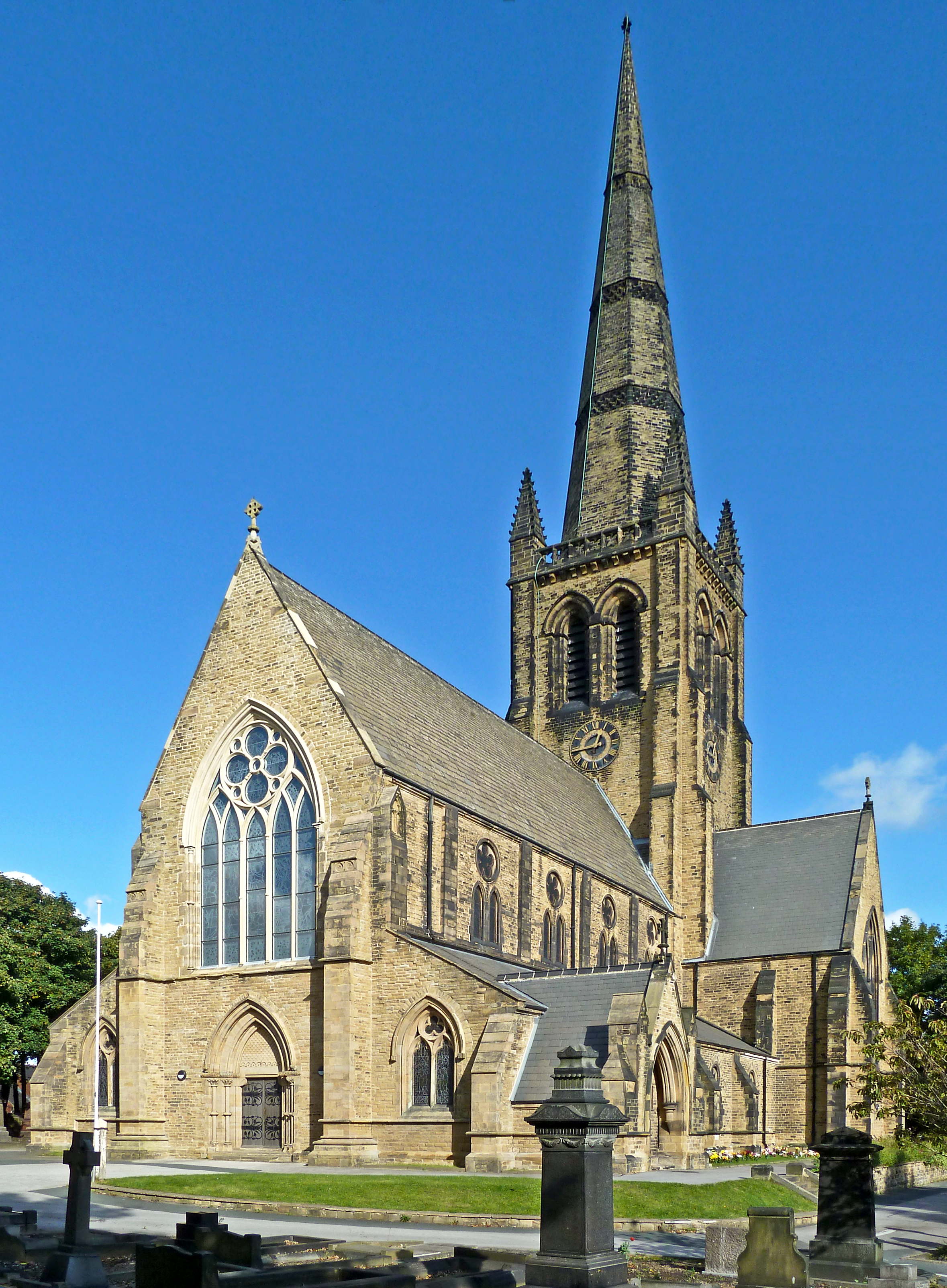
Trinity Church, Ossett

The Church of the Holy and Undivided Trinity, more commonly known as Trinity Church, is the main Church of England parish church for the market town of...

Gawthorpe, Wakefield

Gawthorpe is a village to the north of Ossett, in the Wakefield district, in the county of West Yorkshire, England. It is roughly midway between Wakefield...

Nearby Amenities

Located within 500m of 53.689042,-1.5927477
Crossing
Crossing: island
Lat/Long: 53.6915432/-1.5969745
Bus Stop
Dewsbury Road Ashleigh Gardens
Local Ref: 45020441
Naptan AtcoCode: 450020441
Naptan Bearing: NW
Naptan CommonName: Dewsbury Road Ashleigh Gardens
Naptan Crossing: Ashleigh Gardens
Naptan Indicator: Stop 45020441
Naptan Landmark: Garage
Naptan PlusbusZoneRef: LEEDS
Naptan ShortCommonName: Ashleigh Gardens
Naptan Street: Dewsbury Road
Naptan Verified: yes
Source: naptan_import
Lat/Long: 53.6911252/-1.5885641
Noexit: yes
Lat/Long: 53.6884845/-1.5852962
Crossing
Lat/Long: 53.6912551/-1.5888304
Crossing
Lat/Long: 53.6912907/-1.5887768
Bus Stop
Dewsbury Road Ashleigh Gardens
Local Ref: 45020440
Naptan AtcoCode: 450020440
Naptan Bearing: SE
Naptan CommonName: Dewsbury Road Ashleigh Gardens
Naptan Crossing: Ashleigh Gardens
Naptan Indicator: Stop 45020440
Naptan Landmark: Garage
Naptan PlusbusZoneRef: LEEDS
Naptan ShortCommonName: Ashleigh Gardens
Naptan Street: Dewsbury Road
Naptan Verified: yes
Ref: 45020440
Source: naptan_import
Lat/Long: 53.6909323/-1.587785
Fast Food
Sea Urchin
Addr City: Ossett
Addr Postcode: WF5 9PE
Addr Street: Dewsbury Road
Fhrs Id: 1371414
Lat/Long: 53.6900814/-1.5856816
Pub
The Hammer and Stithy
Addr City: Ossett
Addr Housenumber: 164
Addr Postcode: WF5 9PE
Addr Street: Dewsbury Road
Fhrs Id: 314160
Lat/Long: 53.6907516/-1.5871685
Note: FIXME
Lat/Long: 53.6908452/-1.5886427
Note: FIXME
Lat/Long: 53.690459/-1.5880945
Bus Stop
Kingsway Leeds Road
Local Ref: 45020415
Naptan AtcoCode: 450020415
Naptan Bearing: N
Naptan CommonName: Kingsway Leeds Road
Naptan Crossing: Leeds Road
Naptan Indicator: Stop 45020415
Naptan Landmark: Garage
Naptan PlusbusZoneRef: LEEDS
Naptan ShortCommonName: Leeds Road
Naptan Street: Kingsway
Naptan Verified: yes
Ref: 45020415
Source: naptan_import
Lat/Long: 53.6908918/-1.5892984
Bus Stop
Kingsway Leeds Road
Local Ref: 45020414
Naptan AtcoCode: 450020414
Naptan Bearing: S
Naptan CommonName: Kingsway Leeds Road
Naptan Crossing: Leeds Road
Naptan Indicator: Stop 45020414
Naptan Landmark: Garage
Naptan PlusbusZoneRef: LEEDS
Naptan ShortCommonName: Leeds Road
Naptan Street: Kingsway
Naptan Verified: yes
Ref: 45020414
Source: naptan_import
Lat/Long: 53.6907114/-1.5890237
Crossing
Lat/Long: 53.6889231/-1.5889084
Turning Circle
Lat/Long: 53.6905622/-1.5916654
Bus Stop
Kingsway Deneside
Local Ref: 45020412
Naptan AtcoCode: 450020412
Naptan Bearing: S
Naptan CommonName: Kingsway Deneside
Naptan Crossing: Deneside
Naptan Indicator: Stop 45020412
Naptan PlusbusZoneRef: LEEDS
Naptan ShortCommonName: Deneside
Naptan Street: Kingsway
Naptan Verified: yes
Ref: 45020412
Source: naptan_import
Lat/Long: 53.6878877/-1.5887262
Bus Stop
Kingsway Deneside
Local Ref: 45020413
Naptan AtcoCode: 450020413
Naptan Bearing: N
Naptan CommonName: Kingsway Deneside
Naptan Crossing: Deneside
Naptan Indicator: Stop 45020413
Naptan PlusbusZoneRef: LEEDS
Naptan ShortCommonName: Deneside
Naptan Street: Kingsway
Naptan Verified: yes
Ref: 45020413
Source: naptan_import
Lat/Long: 53.6879293/-1.5889858
Power: substation
Lat/Long: 53.6857615/-1.5904317
Bus Stop
Kingsway Holmefield
Bus: yes
Local Ref: 45020411
Naptan AtcoCode: 450020411
Naptan Bearing: N
Naptan CommonName: Kingsway Holmefield
Naptan Crossing: Holme Field
Naptan Indicator: Stop 45020411
Naptan PlusbusZoneRef: LEEDS
Naptan ShortCommonName: Holme Field
Naptan Street: Kingsway
Naptan Verified: yes
Public Transport: platform
Ref: 45020411
Source: naptan_import
Lat/Long: 53.6859621/-1.5888327
Bus Stop
Kingsway Holmfield
Bus: yes
Local Ref: 45024893
Naptan AtcoCode: 450024893
Naptan Bearing: S
Naptan CommonName: Kingsway Holmfield
Naptan Crossing: Holmes Leas Drive
Naptan Indicator: Stop 45024893
Naptan PlusbusZoneRef: LEEDS
Naptan ShortCommonName: Holmfield
Naptan Street: Kingsway
Naptan Verified: yes
Public Transport: platform
Ref: 45020410
Source: naptan_import
Lat/Long: 53.6860791/-1.5885646
Barrier: bollard
Lat/Long: 53.6891019/-1.5965559
Crossing
Lat/Long: 53.6915104/-1.5959607
Pub
White Rose Pool and Snooker Club
Addr City: Ossett
Addr Country: GB
Addr Housenumber: 580
Addr Postcode: WF5 9QJ
Addr Street: Wakefield Road
Fhrs Id: 229162
Source Addr: FHRS Open Data
Lat/Long: 53.6913392/-1.5926372
Bus Stop
Wakefield Road Co-operative Street
Layby: yes
Local Ref: 45015286
Naptan AtcoCode: 450015286
Naptan Bearing: E
Naptan CommonName: Wakefield Road Co-operative Street
Naptan Crossing: Co-operative Street
Naptan Indicator: Stop 45015286
Naptan PlusbusZoneRef: LEEDS
Naptan ShortCommonName: Co-operation Street
Naptan Street: Wakefield Road
Naptan Verified: yes
Ref: 45015286
Shelter: no
Source: naptan_import
Lat/Long: 53.6915978/-1.5956133
Bus Stop
Wakefield Road Watson Avenue
Layby: yes
Local Ref: 45015285
Naptan AtcoCode: 450015285
Naptan Bearing: W
Naptan CommonName: Wakefield Road Watson Avenue
Naptan Crossing: Watson Avenue
Naptan Indicator: Stop 45015285
Naptan Notes: Shelter conversion S4
Naptan PlusbusZoneRef: LEEDS
Naptan ShortCommonName: Watson Avenue
Naptan Street: Wakefield Road
Naptan Verified: yes
Ref: 45015285
Shelter: yes
Source: naptan_import
Lat/Long: 53.691423/-1.5962264
Bus Stop
Wakefield Road Chickenley Lane
Local Ref: 45020442
Naptan AtcoCode: 450020442
Naptan Bearing: E
Naptan CommonName: Wakefield Road Chickenley Lane
Naptan Crossing: Chickenley Lane
Naptan Indicator: Stop 45020442
Naptan Landmark: Parish Hall
Naptan PlusbusZoneRef: LEEDS
Naptan ShortCommonName: Chickenley Lane
Naptan Street: Wakefield Road
Naptan Verified: yes
Ref: 45020422
Source: naptan_import
Lat/Long: 53.6914381/-1.594357
Bus Stop
Chickenley Lane Co-operative Street
Local Ref: 45020443
Naptan AtcoCode: 450020443
Naptan Bearing: SW
Naptan CommonName: Chickenley Lane Co-operative Street
Naptan Crossing: Nr-Opp Cooperative Street
Naptan Indicator: Stop 45020443
Naptan PlusbusZoneRef: LEEDS
Naptan ShortCommonName: Co-operative Street
Naptan Street: Chickenley Lane
Naptan Verified: yes
Ref: 45020443
Source: naptan_import
Lat/Long: 53.6909114/-1.5952089
Post Box
Operator: Royal Mail
Post Box Type: pillar
Ref: WF12 209
Lat/Long: 53.68947/-1.5974412
Bus Stop
Chickenley Lane Hazel Crescent
Local Ref: 45020444
Naptan AtcoCode: 450020444
Naptan Bearing: SW
Naptan CommonName: Chickenley Lane Hazel Crescent
Naptan Crossing: Hazel Crescent
Naptan Indicator: Stop 45020444
Naptan PlusbusZoneRef: LEEDS
Naptan ShortCommonName: Hazel Crescent
Naptan Street: Chickenley Lane
Naptan Verified: yes
Ref: 45020444
Source: naptan_import
Lat/Long: 53.6894645/-1.5974994
Bus Stop
Hazel Avenue Maple Road
Local Ref: 45020200
Naptan AtcoCode: 450020200
Naptan Bearing: N
Naptan CommonName: Hazel Avenue Maple Road
Naptan Crossing: Maple Road
Naptan Indicator: Stop 45020200
Naptan PlusbusZoneRef: LEEDS
Naptan ShortCommonName: Maple Road
Naptan Street: Hazel Avenue
Naptan Verified: no
Ref: 45020200
Source: naptan_import
Lat/Long: 53.6874642/-1.5974951
Place Of Worship
St Thomas More Catholic Church
Denomination: catholic
Religion: christian
Lat/Long: 53.6874502/-1.5997995
Post Box
Operator: Royal Mail
Post Box Type: lamp
Ref: WF12 19
Lat/Long: 53.6914085/-1.5963491
Note: FIXME
Lat/Long: 53.6910297/-1.5947808
Bus Stop
Chickenley Lane Queen Street
Local Ref: 45020446
Naptan AtcoCode: 450020446
Naptan Bearing: NE
Naptan CommonName: Chickenley Lane Queen Street
Naptan Crossing: Queen Street
Naptan Indicator: Stop 45020446
Naptan PlusbusZoneRef: LEEDS
Naptan ShortCommonName: Queen Street
Naptan Street: Chickenley Lane
Naptan Verified: yes
Ref: 45020466
Source: naptan_import
Lat/Long: 53.688583/-1.5991466
Note: FIXME
Lat/Long: 53.6859592/-1.5968963
Post Box
Operator: Royal Mail
Post Box Type: wall
Ref: WF5 31
Royal Cypher: GR
Royal Cypher Wikidata: Q33102273
Lat/Long: 53.6917323/-1.5893653
Bus Stop
Hazel Crescent Chickenley Lane
Local Ref: 45020198
Naptan AtcoCode: 450020198
Naptan Bearing: E
Naptan CommonName: Hazel Crescent Chickenley Lane
Naptan Crossing: Hazel Avenue
Naptan Indicator: Stop 45020198
Naptan PlusbusZoneRef: LEEDS
Naptan ShortCommonName: Hazel Avenue
Naptan Street: Hazel Crescent
Naptan Verified: yes
Ref: 45020198
Source: naptan_import
Lat/Long: 53.6892708/-1.5967088
Bus Stop
Hazel Crescent Chickenley Lane
Local Ref: 45020199
Naptan AtcoCode: 450020199
Naptan Bearing: NE
Naptan CommonName: Hazel Crescent Chickenley Lane
Naptan Crossing: Hazel Crescent
Naptan Indicator: Stop 45020199
Naptan PlusbusZoneRef: LEEDS
Naptan ShortCommonName: Hazel Crescent
Naptan Street: Hazel Avenue
Naptan Verified: yes
Ref: 45020199
Source: naptan_import
Lat/Long: 53.689074/-1.5969832
Bus Stop
Mapel Road Hazel Drive
Local Ref: 45020401
Naptan AtcoCode: 450020401
Naptan Bearing: E
Naptan CommonName: Mapel Road Hazel Drive
Naptan Crossing: Hazel Drive
Naptan Indicator: Stop 45020401
Naptan PlusbusZoneRef: LEEDS
Naptan ShortCommonName: Hazel Drive
Naptan Street: Maple Road
Naptan Verified: no
Ref: 45020401
Source: naptan_import
Lat/Long: 53.6871333/-1.5972289
Bus Stop
Chickenley Lane School Street
Local Ref: 45020445
Naptan AtcoCode: 450020445
Naptan Bearing: NE
Naptan CommonName: Chickenley Lane School Street
Naptan Crossing: School Street
Naptan Indicator: Stop 45020445
Naptan PlusbusZoneRef: LEEDS
Naptan ShortCommonName: School Street
Naptan Street: Chickenley Lane
Naptan Verified: yes
Ref: 45020445
Source: naptan_import
Lat/Long: 53.6898563/-1.5970817
Brand: Skoda
Operator: DM Keith
Shop: car
Lat/Long: 53.6916396/-1.5901356
Chickenley Heath Branch
Historic Railway: station
Railway: site
Wikidata: Q106390511
Wikipedia: en:Chickenley Heath railway station
Lat/Long: 53.6919358/-1.5959489
Parking
Access: customers
Lat/Long: 53.6915367/-1.59788
Fast Food
Indus Indian Takeaway
Addr City: Ossett
Addr Housenumber: 187
Addr Postcode: WF5 9PE
Addr Street: Dewsbury Road
Cuisine: indian
Fhrs Id: 1098907
Takeaway: yes
Lat/Long: 53.6906017/-1.5874574
Fast Food
Babylon Pizza
Addr City: Ossett
Addr Housenumber: 187
Addr Postcode: WF5 9PE
Addr Street: Dewsbury Road
Cuisine: pizza
Fhrs Id: 1436068
Takeaway: yes
Lat/Long: 53.6906231/-1.587507
Fast Food
Munchies Sandwich Bar
Addr City: Ossett
Addr Housename: The Old Chapel
Addr Postcode: WF5 9PE
Addr Street: Dewsbury Road
Cuisine: sandwich
Fhrs Id: 283969
Takeaway: yes
Lat/Long: 53.6904825/-1.5865803
Generator Method: photovoltaic
Generator Output Electricity: yes
Generator Source: solar
Generator Type: solar_photovoltaic_panel
Location: roof
Power: generator
Lat/Long: 53.6882049/-1.5961021
Generator Method: photovoltaic
Generator Output Electricity: yes
Generator Source: solar
Generator Type: solar_photovoltaic_panel
Location: roof
Power: generator
Lat/Long: 53.6882399/-1.5962201
Generator Method: photovoltaic
Generator Output Electricity: yes
Generator Source: solar
Generator Type: solar_photovoltaic_panel
Location: roof
Power: generator
Lat/Long: 53.6887068/-1.5976578
Generator Method: photovoltaic
Generator Output Electricity: yes
Generator Source: solar
Generator Type: solar_photovoltaic_panel
Location: roof
Power: generator
Lat/Long: 53.6884479/-1.5987119
Generator Method: photovoltaic
Generator Output Electricity: yes
Generator Source: solar
Generator Type: solar_photovoltaic_panel
Location: roof
Power: generator
Lat/Long: 53.6878396/-1.5967378
Slimming World
Addr City: Ossett
Addr Housenumber: 4
Addr Postcode: WF5 8BU
Addr Street: Kingsway Mews
Fhrs Id: 1023888
Lat/Long: 53.6903475/-1.5883076
Generator Method: photovoltaic
Generator Output Electricity: yes
Generator Source: solar
Generator Type: solar_photovoltaic_panel
Location: roof
Power: generator
Lat/Long: 53.6909818/-1.5984827
Generator Method: photovoltaic
Generator Output Electricity: yes
Generator Source: solar
Generator Type: solar_photovoltaic_panel
Location: roof
Power: generator
Lat/Long: 53.6909866/-1.5985363
Generator Method: photovoltaic
Generator Output Electricity: yes
Generator Source: solar
Generator Type: solar_photovoltaic_panel
Location: roof
Power: generator
Lat/Long: 53.6892887/-1.597273
Generator Method: photovoltaic
Generator Output Electricity: yes
Generator Source: solar
Generator Type: solar_photovoltaic_panel
Location: roof
Power: generator
Lat/Long: 53.6894206/-1.5967768
Generator Method: photovoltaic
Generator Output Electricity: yes
Generator Source: solar
Generator Type: solar_photovoltaic_panel
Location: roof
Power: generator
Lat/Long: 53.6893809/-1.596699
Generator Method: photovoltaic
Generator Output Electricity: yes
Generator Source: solar
Generator Type: solar_photovoltaic_panel
Location: roof
Power: generator
Lat/Long: 53.6906769/-1.5962752
Generator Method: photovoltaic
Generator Output Electricity: yes
Generator Source: solar
Generator Type: solar_photovoltaic_panel
Location: roof
Power: generator
Lat/Long: 53.6921349/-1.5971228
Generator Method: photovoltaic
Generator Output Electricity: yes
Generator Source: solar
Generator Type: solar_photovoltaic_panel
Location: roof
Power: generator
Lat/Long: 53.6921397/-1.5971952
Generator Method: photovoltaic
Generator Output Electricity: yes
Generator Source: solar
Generator Type: solar_photovoltaic_panel
Location: roof
Power: generator
Lat/Long: 53.6912884/-1.5947463
Generator Method: photovoltaic
Generator Output Electricity: yes
Generator Source: solar
Generator Type: solar_photovoltaic_panel
Location: roof
Power: generator
Lat/Long: 53.6888917/-1.5962537
Generator Method: photovoltaic
Generator Output Electricity: yes
Generator Source: solar
Generator Type: solar_photovoltaic_panel
Location: roof
Power: generator
Lat/Long: 53.6888456/-1.5961599
Generator Method: photovoltaic
Generator Output Electricity: yes
Generator Source: solar
Generator Type: solar_photovoltaic_panel
Location: roof
Power: generator
Lat/Long: 53.6887646/-1.5960365
Generator Method: photovoltaic
Generator Output Electricity: yes
Generator Source: solar
Generator Type: solar_photovoltaic_panel
Location: roof
Power: generator
Lat/Long: 53.6883421/-1.5967473
Generator Method: photovoltaic
Generator Output Electricity: yes
Generator Source: solar
Generator Type: solar_photovoltaic_panel
Location: roof
Power: generator
Lat/Long: 53.6880213/-1.5967956
Generator Method: photovoltaic
Generator Output Electricity: yes
Generator Source: solar
Generator Type: solar_photovoltaic_panel
Location: roof
Power: generator
Lat/Long: 53.6874621/-1.596133
Generator Method: photovoltaic
Generator Output Electricity: yes
Generator Source: solar
Generator Type: solar_photovoltaic_panel
Location: roof
Power: generator
Lat/Long: 53.6870222/-1.5975922
Generator Method: photovoltaic
Generator Output Electricity: yes
Generator Source: solar
Generator Type: solar_photovoltaic_panel
Location: roof
Power: generator
Lat/Long: 53.6873255/-1.5977611
Generator Method: photovoltaic
Generator Output Electricity: yes
Generator Source: solar
Generator Type: solar_photovoltaic_panel
Location: roof
Power: generator
Lat/Long: 53.687397/-1.5981125
Generator Method: photovoltaic
Generator Output Electricity: yes
Generator Source: solar
Generator Type: solar_photovoltaic_panel
Location: roof
Power: generator
Lat/Long: 53.6869523/-1.5986329
Generator Method: photovoltaic
Generator Output Electricity: yes
Generator Source: solar
Generator Type: solar_photovoltaic_panel
Location: roof
Power: generator
Lat/Long: 53.6877857/-1.5974354
Generator Method: photovoltaic
Generator Output Electricity: yes
Generator Source: solar
Generator Type: solar_photovoltaic_panel
Location: roof
Power: generator
Lat/Long: 53.6877952/-1.597489
The data included in this document is from www.openstreetmap.org. The data is made available under ODbL.

Have you been to Holme Leas Clough?

Leave your review of Holme Leas Clough below (or comments, questions and feedback).