Smallden Clough

Valley in Yorkshire

England

Smallden Clough

Temporary bridge on the TPT diversion at Dunford Bridge This is a temporary bridge on the Trans Pennine Trail diversion at Dunford Bridge. It came into use in late 2021 and will remain until seven electricity pylons have been removed. The cable will be buried under the TPT.
Temporary bridge on the TPT diversion at Dunford Bridge Credit: Dave Pickersgill

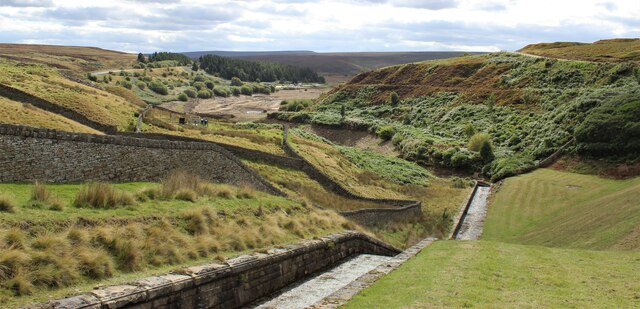
Smallden Clough is a picturesque valley located in the heart of Yorkshire, England. Nestled amidst the rolling hills and lush green landscapes, this hidden gem offers a tranquil and idyllic escape for nature lovers and outdoor enthusiasts alike.

The valley is characterized by its enchanting beauty, with a meandering stream that runs through the heart of the clough, creating a soothing soundtrack of babbling water. The rugged cliffs that flank the valley add to its dramatic charm, providing a stunning backdrop for hikers and climbers.

Flora and fauna thrive in this unspoiled natural haven. The valley is home to a diverse range of plant species, including wildflowers, ferns, and ancient trees that line the walking trails. Birdwatchers will delight in the abundance of avian life, with various species of birds, such as owls, woodpeckers, and warblers, making the clough their home.

For those seeking adventure, Smallden Clough offers a range of activities. The numerous walking trails cater to all levels of fitness, from leisurely strolls along the valley floor to challenging hikes up the surrounding hills. Rock climbers can test their skills on the rugged cliffs, while anglers can try their luck at fly fishing in the crystal-clear waters of the stream.

Visitors to Smallden Clough can also explore the charming nearby villages, where traditional stone cottages and cozy pubs await. The valley's proximity to the Yorkshire Dales National Park offers further opportunities for exploration, making it an ideal base for outdoor enthusiasts.

In summary, Smallden Clough is a natural paradise, offering breathtaking scenery, diverse wildlife, and a range of activities for visitors to enjoy. Whether seeking tranquility or adventure, this hidden gem in Yorkshire is a must-visit destination for nature lovers.

If you have any feedback on the listing, please let us know in the comments section below.

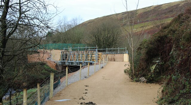
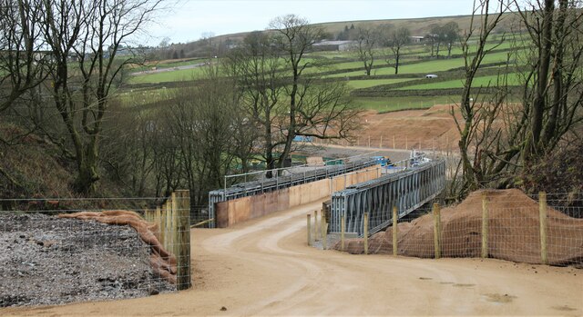
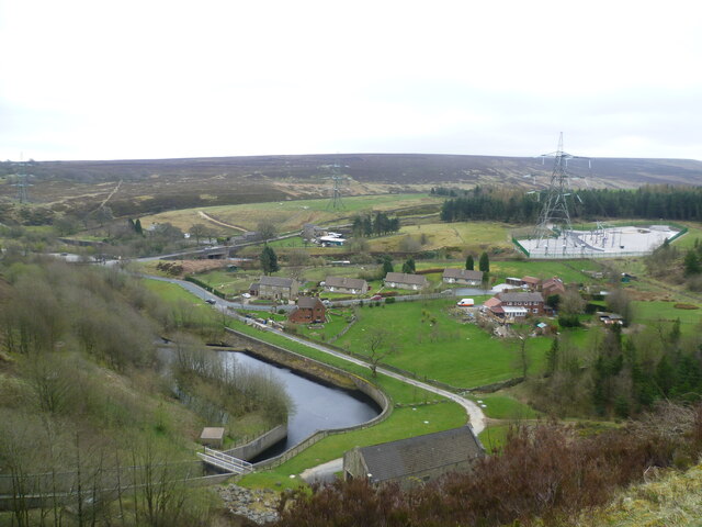
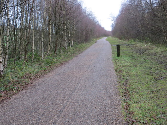
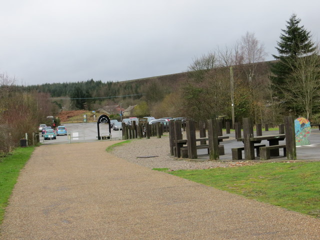
Smallden Clough Images

Images are sourced within 2km of 53.514269/-1.7699283 or Grid Reference SE1501. Thanks to Geograph Open Source API. All images are credited.

Temporary bridge on the TPT diversion at Dunford Bridge This is a temporary bridge on the Trans Pennine Trail diversion at Dunford Bridge. It came into use in late 2021 and will remain until seven electricity pylons have been removed. The cable will be buried under the TPT.
Temporary bridge on the TPT diversion at Dunford Bridge
This is a temporary bridge on the Trans Pennine Trail diversion at Dunford Bridge. It came into use in late 2021 and will remain until seven electricity pylons have been removed. The cable will be buried under the TPT.
Bridge on the Trans Pennine Trail diversion This is a new (permanent) bridge on the Trans Pennine Trail diversion at Dunford Bridge. It came into use in late 2021. The diversion will remain until seven electricity pylons have been removed. The cable will be buried under the TPT.
Bridge on the Trans Pennine Trail diversion
This is a new (permanent) bridge on the Trans Pennine Trail diversion at Dunford Bridge. It came into use in late 2021. The diversion will remain until seven electricity pylons have been removed. The cable will be buried under the TPT.
Dunford Bridge View from the dam walkway of Winscar Reservoir
Dunford Bridge
View from the dam walkway of Winscar Reservoir
Post Box at Townhead S36 698. Royal Mail list this box as 'Townhead'.
Post Box at Townhead
S36 698. Royal Mail list this box as 'Townhead'.
The run-off to Winscar Reservoir The run-off to Winscar Reservoir, showing the low water level.
The run-off to Winscar Reservoir
The run-off to Winscar Reservoir, showing the low water level.
Winscar Reservoir Dam, Dunford Bridge
Upper Windleden Reservoir near Dunford Bridge
Trig Point on South Nab east of Woodhead Pass
The Snow Road (track) east of South Nab
Old milestone On the A628 before the road drops down to cross Saltersbrook Bridge is this most westerly milestone from the 32 miles Doncaster/Saltersbrook tollroad, 1740-1871.   It was last painted in 2006 for the Peak District National Park.   It is at the far side of the ditch and gets hidden in vegetation.   The painted diamond shape may be a benchmark.  Grade II listed  1315029.
Old milestone
On the A628 before the road drops down to cross Saltersbrook Bridge is this most westerly milestone from the 32 miles Doncaster/Saltersbrook tollroad, 1740-1871. It was last painted in 2006 for the Peak District National Park. It is at the far side of the ditch and gets hidden in vegetation. The painted diamond shape may be a benchmark. Grade II listed 1315029.
Old milestone Having clambered into and out of the ditch, this is the back of the milestone and the view across the A628 to the north.   The reservoir is Upper Windleden.  Lower Windleden is out of sight.
Old milestone
Having clambered into and out of the ditch, this is the back of the milestone and the view across the A628 to the north. The reservoir is Upper Windleden. Lower Windleden is out of sight.
Old Boundary Marker on Snailsden Bridge, Dunford Water Company Boundary Marker set in a drystone wall on Snailsden Bridge crossing Harden Dike, leading to Harden Reservoir. Dunford parish. Inscribed D H W / W B. In the early 1860's the Dewsbury and Heckmondwike Water Works Board purchased five parcels of land a few miles South of Holmfirth to build reservoirs. The first two, Snailsden and Harden, are ringed by about 90 boundary stones which can be found on 19C maps marked as "stones".

Milestone Society National ID: YW_DUNF51em
Old Boundary Marker on Snailsden Bridge, Dunford
Water Company Boundary Marker set in a drystone wall on Snailsden Bridge crossing Harden Dike, leading to Harden Reservoir. Dunford parish. Inscribed D H W / W B. In the early 1860's the Dewsbury and Heckmondwike Water Works Board purchased five parcels of land a few miles South of Holmfirth to build reservoirs. The first two, Snailsden and Harden, are ringed by about 90 boundary stones which can be found on 19C maps marked as "stones". Milestone Society National ID: YW_DUNF51em
Track to Lady Cross
Track to Lady Cross
The Woodhead Road from Fiddlers Flat Lorries on the A628 Road, pictured on a fine and mild Thursday in early September.
The Woodhead Road from Fiddlers Flat
Lorries on the A628 Road, pictured on a fine and mild Thursday in early September.
Ordnance Survey Cut Mark This can be found on the wall of the parapet of the bridge over the River Don.
For more detail see : <span class="nowrap"><a title="http://www.bench-marks.org.uk/bm41412" rel="nofollow ugc noopener" href="http://www.bench-marks.org.uk/bm41412">Link</a><img style="margin-left:2px;" alt="External link" title="External link - shift click to open in new window" src="https://s1.geograph.org.uk/img/external.png" width="10" height="10"/></span>
Ordnance Survey Cut Mark
This can be found on the wall of the parapet of the bridge over the River Don. For more detail see : LinkExternal link
The Trans Pennine Trail to the south of Townhead Looking eastward along the disused railway line.
The Trans Pennine Trail to the south of Townhead
Looking eastward along the disused railway line.
The Trans Pennine Trail and Car Park at Dunford Bridge Looking westward.
The Trans Pennine Trail and Car Park at Dunford Bridge
Looking westward.
Upper Don trail Dunford Bridge
Show me another place!

Smallden Clough is located at Grid Ref: SE1501 (Lat: 53.514269, Lng: -1.7699283)

Division: West Riding

Unitary Authority: Barnsley

Police Authority: South Yorkshire

What 3 Words

///civic.baseless.potato. Near Holmfirth, West Yorkshire

Related Wikis

Dunford Bridge railway station

Dunford Bridge railway station was a railway station that served the village of Dunford Bridge on the Sheffield, Ashton-under-Lyne and Manchester Railway...
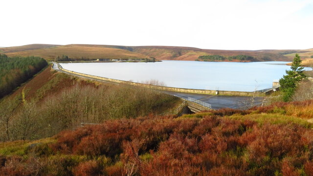
Winscar Reservoir

Winscar Reservoir (also known as Winscar dam), is a compensation reservoir on the headwaters of the River Don in South Yorkshire, England. The reservoir...

Dunford Bridge

Dunford Bridge is a remote hamlet in the civil parish of Dunford, lying northwest of Sheffield in South Yorkshire, England, 1.3 miles (2 km) from the...

Dunford

Dunford is a civil parish in the Metropolitan Borough of Barnsley, 14.5 miles (23.3 km) northwest of Sheffield in South Yorkshire, England. It lies in...

Longdendale

Longdendale is a valley in the Peak District of England, north of Glossop and southwest of Holmfirth. The name means "long wooded valley" and the valley...

Carlecotes

Carlecotes is a village in the metropolitan borough of Barnsley in South Yorkshire, England. Carlecotes is within Dunford civil parish. The village is...

Hade Edge

Hade Edge is a small village to the south of Holmfirth and southeast of Hepworth in West Yorkshire, England. It is in the parish of Holme Valley and the...

Hazlehead Bridge railway station

Hazlehead Bridge railway station was a railway station on the Sheffield, Ashton-under-Lyne and Manchester Railway's Woodhead Line. It served villages scattered...

Nearby Amenities

Located within 500m of 53.514269,-1.7699283
Turning Circle
Don View
Lat/Long: 53.5177235/-1.7664849
Covered: no
Leisure: picnic_table
Source: survey
Lat/Long: 53.5149341/-1.7713364
Post Box
Collection Plate Date: 2023-09-13
Collection Times: Mo-Fr 09:00; Sa 07:00
Colour: red
Material: metal
Operator: Royal Mail
Operator Wikidata: Q638098
Post Box Type: wall
Ref: S36 667D
Royal Cypher: EIIR
Royal Cypher Wikidata: Q33102113
Source: survey
Lat/Long: 53.5167697/-1.7640688
Description: 11 panels
Generator Method: photovoltaic
Generator Output Electricity: yes
Generator Source: solar
Generator Type: solar_photovoltaic_panel
Note: roof household
Power: generator
Lat/Long: 53.5167901/-1.764171
Barrier: cattle_grid
Lat/Long: 53.5112839/-1.7748007
Power: pole
Lat/Long: 53.5170401/-1.7647172
Power: pole
Lat/Long: 53.5133336/-1.7656875
Power: pole
Lat/Long: 53.5162993/-1.7648533
Power: pole
Lat/Long: 53.515584/-1.7650122
Power: pole
Lat/Long: 53.5149971/-1.7644268
Power: pole
Lat/Long: 53.5142411/-1.7646146
Power: pole
Lat/Long: 53.5124002/-1.7667536
Power: pole
Lat/Long: 53.511812/-1.7668904
Power: pole
Lat/Long: 53.5112825/-1.7670098
Power: pole
Lat/Long: 53.5110089/-1.7680465
Power: pole
Lat/Long: 53.5107561/-1.7690201
Power: pole
Lat/Long: 53.5105113/-1.7699763
Power: pole
Lat/Long: 53.5102904/-1.7708212
Power: pole
Lat/Long: 53.5100591/-1.7716795
The data included in this document is from www.openstreetmap.org. The data is made available under ODbL.

Have you been to Smallden Clough?

Leave your review of Smallden Clough below (or comments, questions and feedback).