Priest Clough

Valley in Yorkshire

England

Priest Clough

View of St Chad Church, Saddleworth Link to Church Website <span class="nowrap"><a title="https://www.cofeinsaddleworth.org.uk/st-chad-saddleworth-parish-church" rel="nofollow ugc noopener" href="https://www.cofeinsaddleworth.org.uk/st-chad-saddleworth-parish-church">Link</a><img style="margin-left:2px;" alt="External link" title="External link - shift click to open in new window" src="https://s1.geograph.org.uk/img/external.png" width="10" height="10"/></span>
View of St Chad Church, Saddleworth Credit: Philip Cornwall

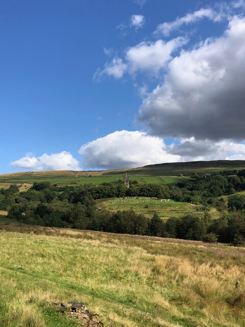
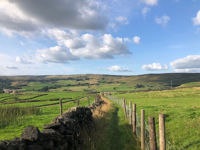
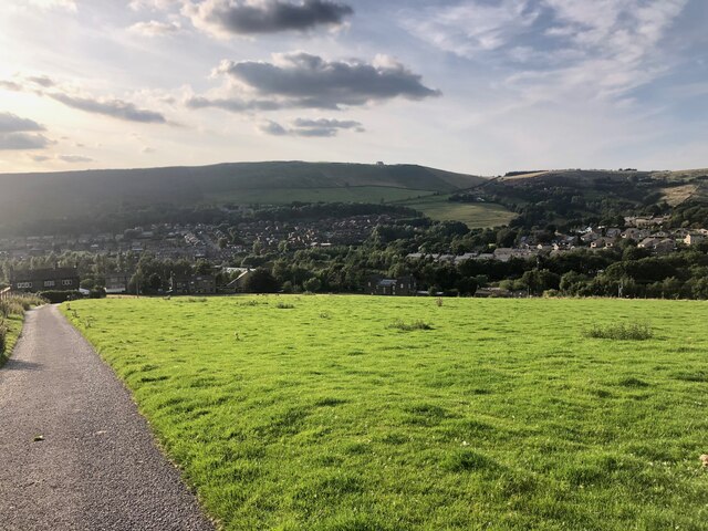
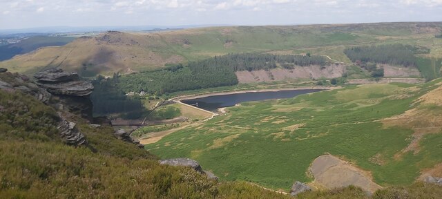
Priest Clough is a picturesque valley located in the county of Yorkshire, England. Nestled amidst the vast and stunning landscape, it is situated near the small village of Yetminster. The valley is characterized by its rolling hills, lush green meadows, and a meandering river that flows through its heart.

The area surrounding Priest Clough is abundant in natural beauty, with dense woodlands and diverse wildlife. The valley serves as a haven for nature lovers and outdoor enthusiasts, offering a range of activities such as hiking, bird-watching, and photography. The tranquil atmosphere of the valley provides a perfect escape from the hustle and bustle of city life.

The name "Priest Clough" is derived from the presence of an ancient priest's hut that once stood in the area. The historical significance of this site adds a sense of intrigue and mystery to the valley, attracting history enthusiasts and archaeologists alike.

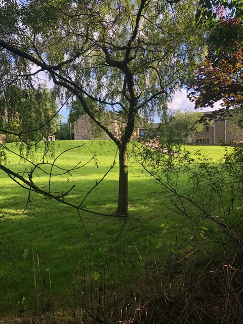
In addition to its natural allure, Priest Clough is also known for its charming stone cottages and traditional Yorkshire architecture. These structures offer a glimpse into the rural lifestyle of the region and provide a sense of nostalgia for visitors.

Overall, Priest Clough, Yorkshire, is a hidden gem that showcases the exquisite beauty of the English countryside. With its breathtaking landscapes, rich history, and peaceful ambiance, it is a destination that captivates visitors and leaves a lasting impression.

If you have any feedback on the listing, please let us know in the comments section below.

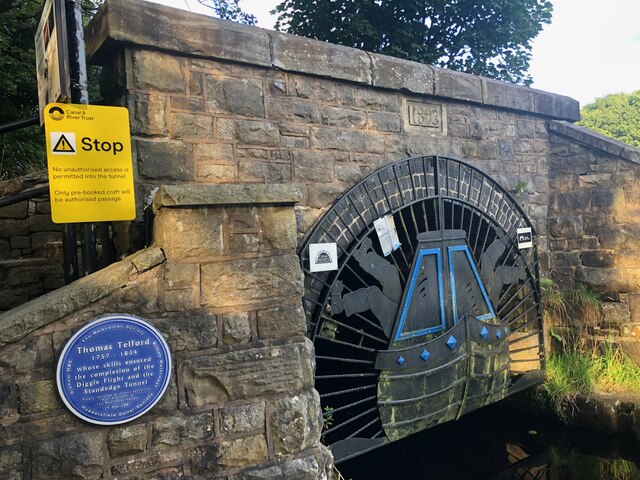
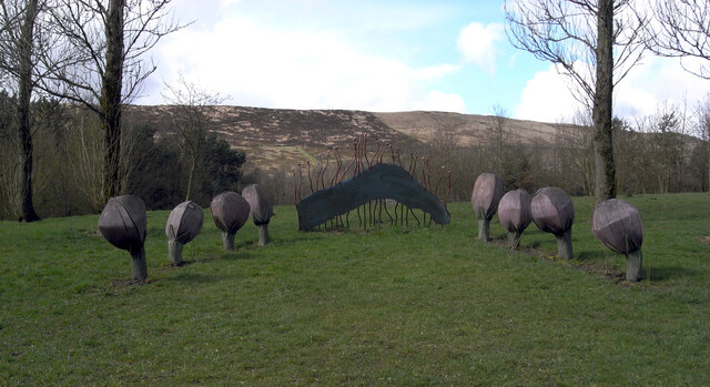
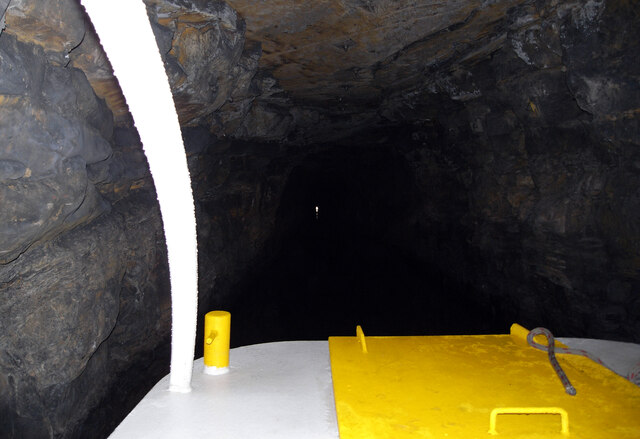
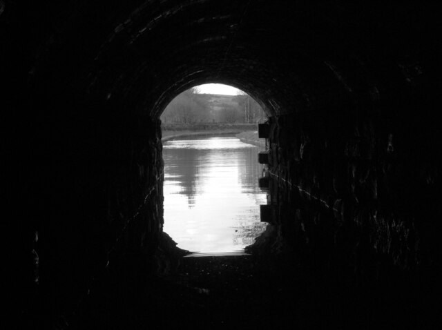
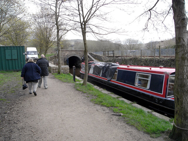
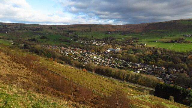
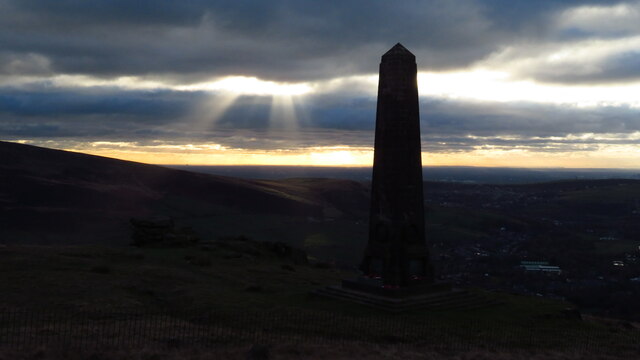
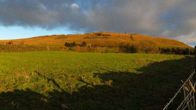
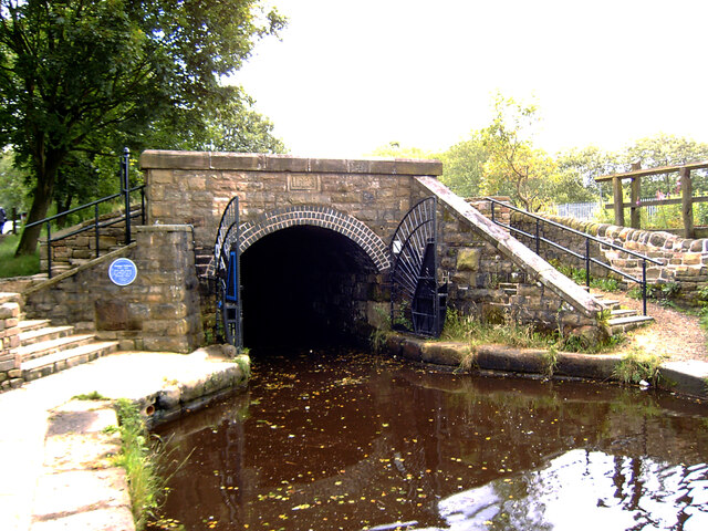
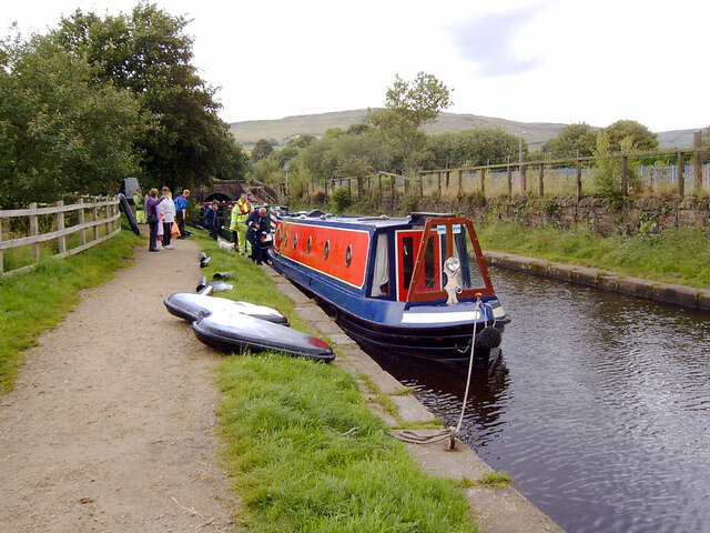
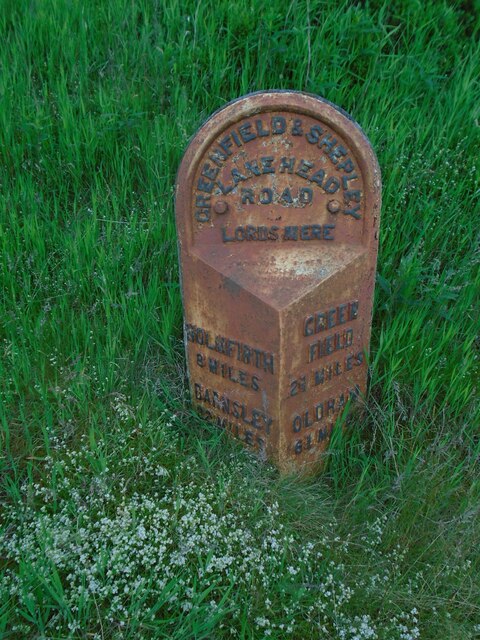
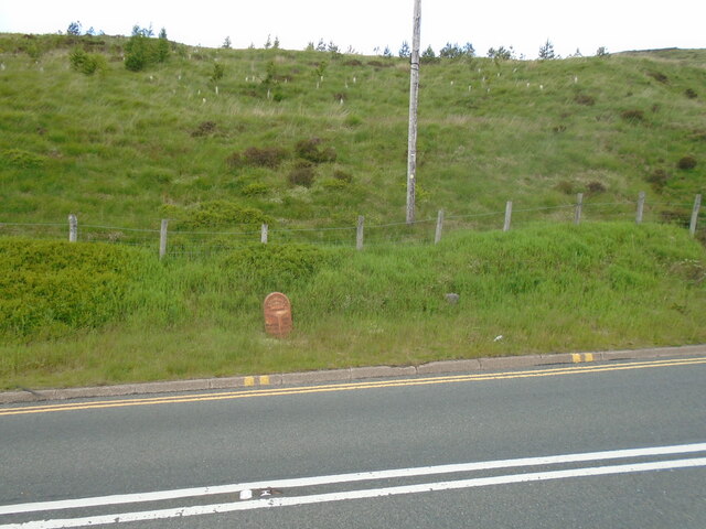
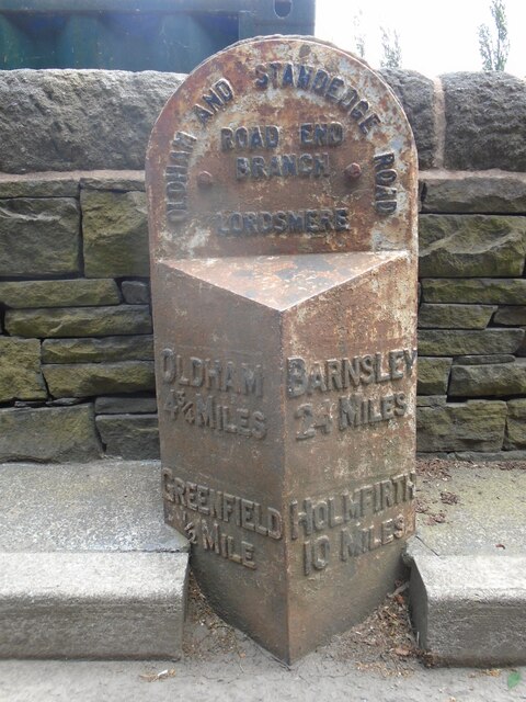
Priest Clough Images

Images are sourced within 2km of 53.550164/-1.9920983 or Grid Reference SE0005. Thanks to Geograph Open Source API. All images are credited.

View of St Chad Church, Saddleworth Link to Church Website <span class="nowrap"><a title="https://www.cofeinsaddleworth.org.uk/st-chad-saddleworth-parish-church" rel="nofollow ugc noopener" href="https://www.cofeinsaddleworth.org.uk/st-chad-saddleworth-parish-church">Link</a><img style="margin-left:2px;" alt="External link" title="External link - shift click to open in new window" src="https://s1.geograph.org.uk/img/external.png" width="10" height="10"/></span>
View of St Chad Church, Saddleworth
Link to Church Website LinkExternal link
Grounds of Running Hill Head Farm
Footpath descending from Running Hill Head
View over Diggle from track connecting Back o'th Lee Farm to Lee Side
Entrance to Standedge Canal Tunnel, Diggle The Huddersfield Narrow Canal opened in 1811. It runs for just under 20 miles from Lock 1E, where it joins the Huddersfield Broad Canal at the rear of the University of Huddersfield campus, to the junction with the Ashton Canal at Whitelands Basin in Ashton-under-Lyne. It crosses the Pennines by means of 74 locks and the Standedge Tunnel.
Entrance to Standedge Canal Tunnel, Diggle
The Huddersfield Narrow Canal opened in 1811. It runs for just under 20 miles from Lock 1E, where it joins the Huddersfield Broad Canal at the rear of the University of Huddersfield campus, to the junction with the Ashton Canal at Whitelands Basin in Ashton-under-Lyne. It crosses the Pennines by means of 74 locks and the Standedge Tunnel.
Sculpture by the Huddersfield Narrow Canal near Diggle The Huddersfield Narrow Canal opened in 1811. It runs for just under 20 miles from Lock 1E, where it joins the Huddersfield Broad Canal at the rear of the University of Huddersfield campus, to the junction with the Ashton Canal at Whitelands Basin in Ashton-under-Lyne. It crosses the Pennines by means of 74 locks and the Standedge Tunnel.
Sculpture by the Huddersfield Narrow Canal near Diggle
The Huddersfield Narrow Canal opened in 1811. It runs for just under 20 miles from Lock 1E, where it joins the Huddersfield Broad Canal at the rear of the University of Huddersfield campus, to the junction with the Ashton Canal at Whitelands Basin in Ashton-under-Lyne. It crosses the Pennines by means of 74 locks and the Standedge Tunnel.
Approaching the West Portal of the Standedge Tunnel The Huddersfield Narrow Canal opened in 1811. It runs for just under 20 miles from Lock 1E, where it joins the Huddersfield Broad Canal at the rear of the University of Huddersfield campus, to the junction with the Ashton Canal at Whitelands Basin in Ashton-under-Lyne. It crosses the Pennines by means of 74 locks and the Standedge Tunnel.
Approaching the West Portal of the Standedge Tunnel
The Huddersfield Narrow Canal opened in 1811. It runs for just under 20 miles from Lock 1E, where it joins the Huddersfield Broad Canal at the rear of the University of Huddersfield campus, to the junction with the Ashton Canal at Whitelands Basin in Ashton-under-Lyne. It crosses the Pennines by means of 74 locks and the Standedge Tunnel.
The Huddersfield Narrow Canal seen through the West Portal of the Standedge Tunnel The Huddersfield Narrow Canal opened in 1811. It runs for just under 20 miles from Lock 1E, where it joins the Huddersfield Broad Canal at the rear of the University of Huddersfield campus, to the junction with the Ashton Canal at Whitelands Basin in Ashton-under-Lyne. It crosses the Pennines by means of 74 locks and the Standedge Tunnel.
The Huddersfield Narrow Canal seen through the West Portal of the Standedge Tunnel
The Huddersfield Narrow Canal opened in 1811. It runs for just under 20 miles from Lock 1E, where it joins the Huddersfield Broad Canal at the rear of the University of Huddersfield campus, to the junction with the Ashton Canal at Whitelands Basin in Ashton-under-Lyne. It crosses the Pennines by means of 74 locks and the Standedge Tunnel.
The West Portal of the Standedge Tunnel, Huddersfield Narrow Canal The Huddersfield Narrow Canal opened in 1811. It runs for just under 20 miles from Lock 1E, where it joins the Huddersfield Broad Canal at the rear of the University of Huddersfield campus, to the junction with the Ashton Canal at Whitelands Basin in Ashton-under-Lyne. It crosses the Pennines by means of 74 locks and the Standedge Tunnel.
The West Portal of the Standedge Tunnel, Huddersfield Narrow Canal
The Huddersfield Narrow Canal opened in 1811. It runs for just under 20 miles from Lock 1E, where it joins the Huddersfield Broad Canal at the rear of the University of Huddersfield campus, to the junction with the Ashton Canal at Whitelands Basin in Ashton-under-Lyne. It crosses the Pennines by means of 74 locks and the Standedge Tunnel.
Diggle from Harrop Edge
Pots & Pans Monument & Greenfield This war memorial was erected in 1923 to honour the 259 people from the villages of Saddleworth who died during the first world war and was located here specifically to be visible from the villages in the area. When plans were submitted for the war memorial there was much opposition from local people who wanted a memorial in the village rather than on top of a bleak hill.
Pots & Pans Monument & Greenfield
This war memorial was erected in 1923 to honour the 259 people from the villages of Saddleworth who died during the first world war and was located here specifically to be visible from the villages in the area. When plans were submitted for the war memorial there was much opposition from local people who wanted a memorial in the village rather than on top of a bleak hill.
Late afternoon sunlight on Pots & Pans Monument near Greenfield
The West Portal of the Standedge Tunnel, Huddersfield Narrow Canal The Standedge Tunnels are four parallel tunnels through the Pennines between Marsden, West Yorkshire and Diggle, Greater Manchester. Three of them are railway tunnels and the fourth, and earliest, carries the Huddersfield Narrow Canal.
The canal tunnel was built between 1794 and 1811; initial work was supervised by Benjamin Outram but it was completed under the direction of Thomas Telford. It only allows one-way traffic but it is the longest (4984m), deepest and highest canal tunnel in Britain.
The three railway tunnels were built in 1848 (single track), 1871 (single track) and 1894 (double track). Only the last of these remains in use.
All four tunnels are connected to each other by cross-tunnels.
The West Portal of the Standedge Tunnel, Huddersfield Narrow Canal
The Standedge Tunnels are four parallel tunnels through the Pennines between Marsden, West Yorkshire and Diggle, Greater Manchester. Three of them are railway tunnels and the fourth, and earliest, carries the Huddersfield Narrow Canal. The canal tunnel was built between 1794 and 1811; initial work was supervised by Benjamin Outram but it was completed under the direction of Thomas Telford. It only allows one-way traffic but it is the longest (4984m), deepest and highest canal tunnel in Britain. The three railway tunnels were built in 1848 (single track), 1871 (single track) and 1894 (double track). Only the last of these remains in use. All four tunnels are connected to each other by cross-tunnels.
Narrowboats outside the West Portal of the Standedge Tunnel, Huddersfield Narrow Canal The Huddersfield Narrow Canal opened in 1811. It runs for just under 20 miles from Lock 1E, where it joins the Huddersfield Broad Canal at the rear of the University of Huddersfield campus, to the junction with the Ashton Canal at Whitelands Basin in Ashton-under-Lyne. It crosses the Pennines by means of 74 locks and the Standedge Tunnel.
Narrowboats outside the West Portal of the Standedge Tunnel, Huddersfield Narrow Canal
The Huddersfield Narrow Canal opened in 1811. It runs for just under 20 miles from Lock 1E, where it joins the Huddersfield Broad Canal at the rear of the University of Huddersfield campus, to the junction with the Ashton Canal at Whitelands Basin in Ashton-under-Lyne. It crosses the Pennines by means of 74 locks and the Standedge Tunnel.
Old milestone The 2 miles from Greenfield West Riding CC milestone, now in Greater Manchester, is on the west side of the A635.  The 3 mile stone minus its attachment was seen in 2002 but has since disappeared altogether.  Many of the milestones in this area known as Saddleworth were painted several years ago.   Now ready for a repaint although the legends can be read.  Neither the 2 or 3 mile stones were 'listed'.
Old milestone
The 2 miles from Greenfield West Riding CC milestone, now in Greater Manchester, is on the west side of the A635. The 3 mile stone minus its attachment was seen in 2002 but has since disappeared altogether. Many of the milestones in this area known as Saddleworth were painted several years ago. Now ready for a repaint although the legends can be read. Neither the 2 or 3 mile stones were 'listed'.
Old milestone The Greenfield and Shepley Lane Head tollroad existed from 1823 to the early 1880s.   About 2 metres to the right of the West Riding CC milestone can just be made out an old stone at the edge of the uncut longer grass.   It is thought that this is a milestone from the turnpike era although no inscription can be made out.
Old milestone
The Greenfield and Shepley Lane Head tollroad existed from 1823 to the early 1880s. About 2 metres to the right of the West Riding CC milestone can just be made out an old stone at the edge of the uncut longer grass. It is thought that this is a milestone from the turnpike era although no inscription can be made out.
Old milestone This milestone is not quite like any of the other late 19C West Riding CC milestones so may be an early replacement.  There is no raised edge to the top section and the lettering is a different style.   It is on the A669 Chew Valley Road near St Mary's CE school.   This area was once in the West Riding but now Greater Manchester.
Old milestone
This milestone is not quite like any of the other late 19C West Riding CC milestones so may be an early replacement. There is no raised edge to the top section and the lettering is a different style. It is on the A669 Chew Valley Road near St Mary's CE school. This area was once in the West Riding but now Greater Manchester.
Yeoman Hey Reservoir from above Ashway Gap
Show me another place!

Priest Clough is located at Grid Ref: SE0005 (Lat: 53.550164, Lng: -1.9920983)

Division: West Riding

Unitary Authority: Oldham

Police Authority: Greater Manchester

What 3 Words

///blushes.joins.complies. Near Diggle, Manchester

Related Wikis

Saddleworth

Saddleworth is a civil parish of the Metropolitan Borough of Oldham in Greater Manchester, England. It comprises several villages and hamlets as well as...

Uppermill railway station

Uppermill Railway Station served the village of Uppermill in Oldham. It was built by the London and North Western Railway on their Micklehurst Line from...

Uppermill

Uppermill is a village in the civil parish of Saddleworth in the Metropolitan Borough of Oldham, Greater Manchester, England. Historically in the West...

Greenfield, Greater Manchester

Greenfield is a village in the civil parish of Saddleworth in the Metropolitan Borough of Oldham, in Greater Manchester, England. It is 4 miles (6.4 km...

Saddleworth Museum

Saddleworth Museum is an independent museum in Uppermill village, Saddleworth, Metropolitan Borough of Oldham, Greater Manchester, England. It is a registered...

Saddleworth railway station

Saddleworth railway station, on the Huddersfield Line in Dobcross to the north of Uppermill, opened in August 1849 and closed to passengers in October...

Moorgate railway station (Greater Manchester)

Moorgate Halt railway station was opened on 1 January 1912 on the London and North Western Railway route from Stalybridge to Huddersfield. The station...

Dobcross

Dobcross is a village in the civil parish of Saddleworth in the Metropolitan Borough of Oldham in Greater Manchester, England. It is in a valley in the...

Nearby Amenities

Located within 500m of 53.550164,-1.9920983
Pob Green
Alt Name Ur: پاب گرین
Name Ur: پوب گرین
Place: hamlet
Lat/Long: 53.5534716/-1.9874372
Post Box
Collection Times: Mo-Fr 09:00
Colour: red
Ref: OL3 139
Royal Cypher: EIIR
Royal Cypher Wikidata: Q33102113
Lat/Long: 53.5500193/-1.9973854
Crossing
Lat/Long: 53.5509146/-1.9914582
Pub
The Cross Keys
Brand: JW Lees
Wikidata: Q26639043
Lat/Long: 53.5530926/-1.9886445
Turning Circle
Lat/Long: 53.5489058/-1.9965626
Turning Circle
Source: Bing
Lat/Long: 53.5514705/-1.9988871
Bench
Backrest: yes
Check Date: 2021-05-04
Lat/Long: 53.5495801/-1.9994977
Barrier: stile
Stile: squeezer
Lat/Long: 53.5499331/-1.9917333
Drinking Water: no
Natural: spring
Lat/Long: 53.5467322/-1.9901774
Barrier: stile
Material: wood
Source: survey;gps
Stile: stepover
Lat/Long: 53.5461056/-1.9904504
Barrier: stile
Material: wood
Source: survey;gps
Stile: squeezer
Lat/Long: 53.5464695/-1.9919026
Barrier: stile
Material: wood
Source: survey;gps
Stile: stepover
Lat/Long: 53.5466059/-1.9926654
Barrier: stile
Material: stone
Source: survey;gps
Stile: squeezer
Lat/Long: 53.5467336/-1.9937722
Barrier: stile
Foot: yes
Material: wood
Stile: stepover
Lat/Long: 53.5533698/-1.9883259
Noexit: yes
Lat/Long: 53.5525084/-1.9982613
Generator Method: photovoltaic
Generator Output Electricity: yes
Generator Source: solar
Generator Type: solar_photovoltaic_panel
Location: roof
Power: generator
Lat/Long: 53.5511355/-1.9994414
Generator Method: photovoltaic
Generator Output Electricity: yes
Generator Source: solar
Generator Type: solar_photovoltaic_panel
Location: roof
Power: generator
Lat/Long: 53.5493591/-1.9960497
Bench
Backrest: yes
Direction: 347
Material: steel
Seats Separated: no
Survey Date: 2023-11-08
Two Sided: no
Lat/Long: 53.5528183/-1.9912301
Barrier: stile
Material: wood
Stile: stepover
Lat/Long: 53.5486604/-1.9950962
Bench
Backrest: yes
Lat/Long: 53.5497237/-1.997864
Bench
Backrest: yes
Lat/Long: 53.549748/-1.9977832
Kerb: raised
Lat/Long: 53.5503535/-1.9959633
Barrier: stile
Material: stone
Stile: squeezer
Lat/Long: 53.5526767/-1.9970383
Bench
Backrest: yes
Lat/Long: 53.5542054/-1.9901716
Bench
Backrest: yes
Lat/Long: 53.554195/-1.9899971
Bench
Backrest: yes
Lat/Long: 53.5541922/-1.9899399
Bench
Backrest: yes
Lat/Long: 53.5541541/-1.9899235
Clock
Display: sundial
Support: pedestal
Lat/Long: 53.5541766/-1.9902674
Drinking Water: no
Natural: spring
Lat/Long: 53.5488631/-1.9866048
Material: wood
Power: pole
Lat/Long: 53.5463012/-1.990161
Power: pole
Lat/Long: 53.5529211/-1.9868375
Material: wood
Power: pole
Lat/Long: 53.5479405/-1.9900332
Material: wood
Power: pole
Lat/Long: 53.5471204/-1.9900951
Material: wood
Power: pole
Lat/Long: 53.548704/-1.9899636
Material: wood
Power: pole
Lat/Long: 53.5492537/-1.989403
Material: wood
Power: pole
Lat/Long: 53.5499078/-1.9887916
Material: wood
Power: pole
Lat/Long: 53.5501057/-1.989879
Material: wood
Power: pole
Lat/Long: 53.5506474/-1.9880458
Material: wood
Power: pole
Lat/Long: 53.5513846/-1.9873014
Pob Green
Frequency: 50
Power: pole
Ref: 322708
Transformer: distribution
Voltage Primary: 11000
Voltage Secondary: 240
Lat/Long: 53.5521201/-1.9870739
Material: wood
Power: pole
Lat/Long: 53.5507132/-1.9931281
Material: wood
Power: pole
Lat/Long: 53.5503159/-1.9910514
Material: wood
Power: pole
Lat/Long: 53.5505604/-1.9923526
Material: wood
Power: pole
Transformer: distribution
Voltage Primary: 11000
Voltage Secondary: 240
Lat/Long: 53.5509472/-1.9943158
Grit Bin
Lat/Long: 53.5508647/-1.99938
Turning Circle
Lat/Long: 53.5482759/-1.993487
Noexit: yes
Lat/Long: 53.5514358/-1.9966698
Entrance: yes
Lat/Long: 53.5542261/-1.9902319
Grit Bin
Colour: yellow
Lat/Long: 53.5471455/-1.9937504
Grit Bin
Lat/Long: 53.5521182/-1.9859931
Bus Stop
Well Meadow Lane
Bench: no
Bin: no
Bus: yes
Lit: no
Naptan AtcoCode: 1800EDH4101
Naptan Bearing: E
Naptan CommonName: Well Meadow Lane
Naptan Indicator: E-bound
Naptan Street: Well Meadow Lane
Naptan Verified: no
Network: TfGM
Public Transport: platform
Shelter: no
Source: naptan;bing;naptan_compare_tool
Tactile Paving: no
Lat/Long: 53.5502821/-1.9991484
Bus Stop
Well Meadow Lane
Bench: no
Bin: no
Bus: yes
Lit: yes
Naptan AtcoCode: 1800EDH4111
Naptan Bearing: W
Naptan CommonName: Well Meadow Lane
Naptan Indicator: W-bound
Naptan Street: Well Meadow Lane
Naptan Verified: no
Network: TfGM
Public Transport: platform
Shelter: no
Source: naptan;bing;naptan_compare_tool
Tactile Paving: no
Lat/Long: 53.5501992/-1.9991115
Noexit: yes
Lat/Long: 53.5517537/-1.9915693
Grit Bin
Lat/Long: 53.5505544/-1.9913916
Grit Bin
Lat/Long: 53.5528626/-1.9913337
Grit Bin
Colour: yellow
Lat/Long: 53.5498322/-1.9977379
Door: hinged
Entrance: yes
Lat/Long: 53.5524034/-1.9985606
Defibrillator
Access: yes
Defibrillator Location: On the outside wall of the Church Inn
Emergency: defibrillator
Indoor: no
Lat/Long: 53.5536832/-1.9900654
Entrance: main
Lat/Long: 53.5537274/-1.990073
Bench
Lat/Long: 53.5518805/-1.991999
Advertising: board
Support: pole
Lat/Long: 53.5526696/-1.9914005
The data included in this document is from www.openstreetmap.org. The data is made available under ODbL.

Have you been to Priest Clough?

Leave your review of Priest Clough below (or comments, questions and feedback).