Shaws

Settlement in Yorkshire

England

Shaws

View of St Chad Church, Saddleworth Link to Church Website <span class="nowrap"><a title="https://www.cofeinsaddleworth.org.uk/st-chad-saddleworth-parish-church" rel="nofollow ugc noopener" href="https://www.cofeinsaddleworth.org.uk/st-chad-saddleworth-parish-church">Link</a><img style="margin-left:2px;" alt="External link" title="External link - shift click to open in new window" src="https://s1.geograph.org.uk/img/external.png" width="10" height="10"/></span>
View of St Chad Church, Saddleworth Credit: Philip Cornwall

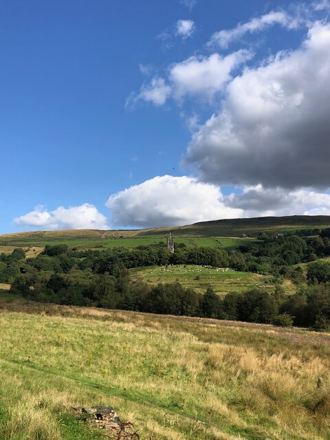
Shaws is a small village located in the county of Yorkshire, England. Situated within the Metropolitan Borough of Kirklees, Shaws is nestled in the picturesque countryside, surrounded by rolling hills and lush green fields. The village is conveniently positioned approximately five miles southwest of the bustling town of Huddersfield.

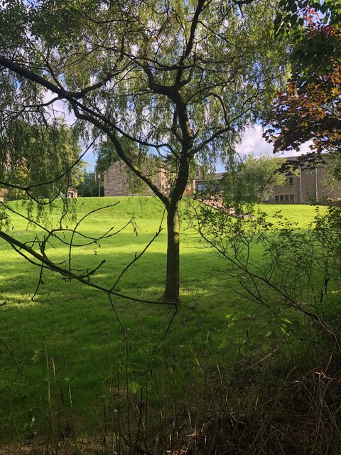
Shaws is a quintessential English countryside hamlet, known for its tranquil atmosphere and close-knit community. The village primarily consists of traditional stone-built houses, giving it a charming and timeless appeal. The local architecture reflects the area's rich history and heritage.

Despite its small size, Shaws offers a range of amenities to cater to the needs of its residents. These include a local pub, a village hall, and a primary school. The village hall serves as a hub for community events and gatherings, fostering a strong sense of camaraderie among the villagers.

The surrounding countryside provides ample opportunities for outdoor activities and exploration. Residents and visitors can enjoy scenic walks, cycling routes, and horse riding trails. The nearby Peak District National Park offers stunning vistas and is a popular destination for nature enthusiasts.

For those seeking a more urban experience, the nearby town of Huddersfield offers a wider range of amenities, including shopping centers, restaurants, and cultural attractions.

In summary, Shaws is a charming village in Yorkshire, known for its tranquility, close-knit community, and stunning natural surroundings. It provides a peaceful retreat for those looking to escape the hustle and bustle of city life while still being within reach of larger towns and amenities.

If you have any feedback on the listing, please let us know in the comments section below.
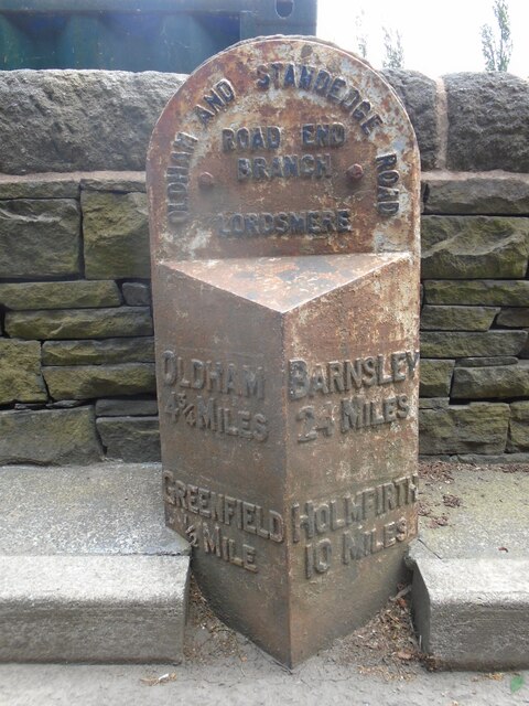
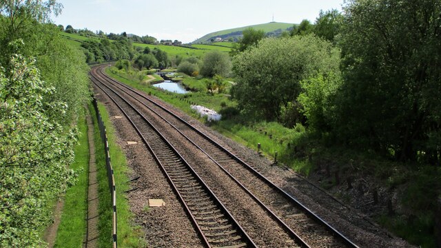
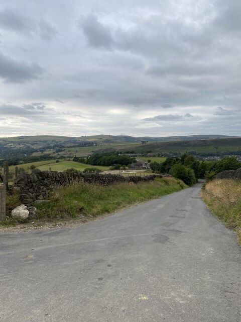
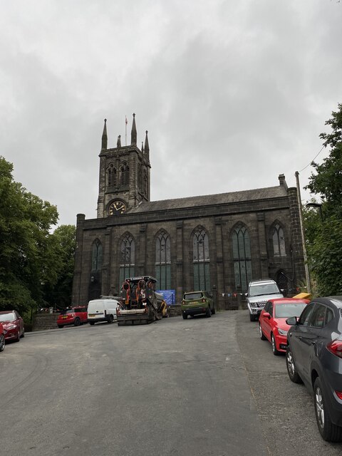
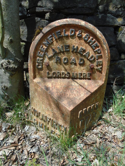
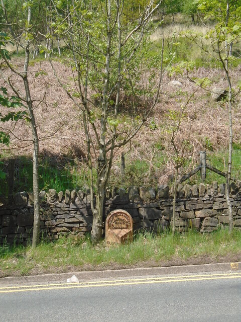
Shaws Images

Images are sourced within 2km of 53.545023/-2.0012595 or Grid Reference SE0005. Thanks to Geograph Open Source API. All images are credited.

View of St Chad Church, Saddleworth Link to Church Website <span class="nowrap"><a title="https://www.cofeinsaddleworth.org.uk/st-chad-saddleworth-parish-church" rel="nofollow ugc noopener" href="https://www.cofeinsaddleworth.org.uk/st-chad-saddleworth-parish-church">Link</a><img style="margin-left:2px;" alt="External link" title="External link - shift click to open in new window" src="https://s1.geograph.org.uk/img/external.png" width="10" height="10"/></span>
View of St Chad Church, Saddleworth
Link to Church Website LinkExternal link
Grounds of Running Hill Head Farm
Pots & Pans Monument & Greenfield This war memorial was erected in 1923 to honour the 259 people from the villages of Saddleworth who died during the first world war and was located here specifically to be visible from the villages in the area. When plans were submitted for the war memorial there was much opposition from local people who wanted a memorial in the village rather than on top of a bleak hill.
Pots & Pans Monument & Greenfield
This war memorial was erected in 1923 to honour the 259 people from the villages of Saddleworth who died during the first world war and was located here specifically to be visible from the villages in the area. When plans were submitted for the war memorial there was much opposition from local people who wanted a memorial in the village rather than on top of a bleak hill.
Late afternoon sunlight on Pots & Pans Monument near Greenfield
Old milestone This milestone is not quite like any of the other late 19C West Riding CC milestones so may be an early replacement.  There is no raised edge to the top section and the lettering is a different style.   It is on the A669 Chew Valley Road near St Mary's CE school.   This area was once in the West Riding but now Greater Manchester.
Old milestone
This milestone is not quite like any of the other late 19C West Riding CC milestones so may be an early replacement. There is no raised edge to the top section and the lettering is a different style. It is on the A669 Chew Valley Road near St Mary's CE school. This area was once in the West Riding but now Greater Manchester.
Railway and Canal Together View south from large footbridge that serves Ravenstones Drive
Railway and Canal Together
View south from large footbridge that serves Ravenstones Drive
Running Hill Lane
Running Hill Lane
St Chad's Saddleworth
OS Cut Mark - Saddleworth, Saint Chad's Church <span class="nowrap"><a title="https://www.bench-marks.org.uk/bm83022" rel="nofollow ugc noopener" href="https://www.bench-marks.org.uk/bm83022">Link</a><img style="margin-left:2px;" alt="External link" title="External link - shift click to open in new window" src="https://s1.geograph.org.uk/img/external.png" width="10" height="10"/></span>
OS Cut Mark - Saddleworth, Saint Chad's Church
Location of OS Cut Mark - Saddleworth, Saint Chad's Church
A surprising find, Kinders Lane, Greenfield The building on the left is Dolefield Barn while on the right is part of Fur Lane Farm with a building looking like a former weaver's cottage. The surprise was the green and red lump in the field. This is a steam powered hydraulic pumping engine by Henry Berry of Leeds. It is a horizontal twin tandem compound steam engine with four single acting hydraulic pumps straddling the Laird type crosshead guides on each side. It can apparently be run on compressed air. It was recovered from a scrapyard in the Doncaster area and has been named 'Proud Mary'. It bears an uncanny resemblance to the engine that was at Storey Brothers xylonite works at Cattawade in Suffolk and it is very tempting to think it is the same as it is such an unusual beast. This is the engine at Cattawade - <a href="https://www.geograph.org.uk/photo/1649917">TM1032 : Steam hydraulic pumping engine</a>.
A surprising find, Kinders Lane, Greenfield
The building on the left is Dolefield Barn while on the right is part of Fur Lane Farm with a building looking like a former weaver's cottage. The surprise was the green and red lump in the field. This is a steam powered hydraulic pumping engine by Henry Berry of Leeds. It is a horizontal twin tandem compound steam engine with four single acting hydraulic pumps straddling the Laird type crosshead guides on each side. It can apparently be run on compressed air. It was recovered from a scrapyard in the Doncaster area and has been named 'Proud Mary'. It bears an uncanny resemblance to the engine that was at Storey Brothers xylonite works at Cattawade in Suffolk and it is very tempting to think it is the same as it is such an unusual beast. This is the engine at Cattawade - TM1032 : Steam hydraulic pumping engine.
Proud Mary, Kinders Lane, Greenfield This is a steam powered hydraulic pumping engine by Henry Berry of Leeds. It is a horizontal twin tandem compound steam engine with four single acting hydraulic pumps straddling the Laird type crosshead guides on each side. It can apparently be run on compressed air. It was recovered from a scrapyard in the Doncaster area and has been named 'Proud Mary'. It bears an uncanny resemblance to the engine that was at Storey Brothers xylonite works at Cattawade in Suffolk and it is very tempting to think it is the same as it is such an unusual beast. This is the engine at Cattawade - <a href="https://www.geograph.org.uk/photo/1649917">TM1032 : Steam hydraulic pumping engine</a>.
Proud Mary, Kinders Lane, Greenfield
This is a steam powered hydraulic pumping engine by Henry Berry of Leeds. It is a horizontal twin tandem compound steam engine with four single acting hydraulic pumps straddling the Laird type crosshead guides on each side. It can apparently be run on compressed air. It was recovered from a scrapyard in the Doncaster area and has been named 'Proud Mary'. It bears an uncanny resemblance to the engine that was at Storey Brothers xylonite works at Cattawade in Suffolk and it is very tempting to think it is the same as it is such an unusual beast. This is the engine at Cattawade - TM1032 : Steam hydraulic pumping engine.
Proud Mary, Kinders Lane, Greenfield This is a steam powered hydraulic pumping engine by Henry Berry of Leeds. It is a horizontal twin tandem compound steam engine with four single acting hydraulic pumps straddling the Laird type crosshead guides on each side. It can apparently be run on compressed air. It was recovered from a scrapyard in the Doncaster area and has been named 'Proud Mary'. It bears an uncanny resemblance to the engine that was at Storey Brothers xylonite works at Cattawade in Suffolk and it is very tempting to think it is the same as it is such an unusual beast. This is the engine at Cattawade - <a href="https://www.geograph.org.uk/photo/1649917">TM1032 : Steam hydraulic pumping engine</a>. The engine does really slope with the flywheel end being lower.
Proud Mary, Kinders Lane, Greenfield
This is a steam powered hydraulic pumping engine by Henry Berry of Leeds. It is a horizontal twin tandem compound steam engine with four single acting hydraulic pumps straddling the Laird type crosshead guides on each side. It can apparently be run on compressed air. It was recovered from a scrapyard in the Doncaster area and has been named 'Proud Mary'. It bears an uncanny resemblance to the engine that was at Storey Brothers xylonite works at Cattawade in Suffolk and it is very tempting to think it is the same as it is such an unusual beast. This is the engine at Cattawade - TM1032 : Steam hydraulic pumping engine. The engine does really slope with the flywheel end being lower.
Proud Mary, Kinders Lane, Greenfield This is a steam powered hydraulic pumping engine by Henry Berry of Leeds. It is a horizontal twin tandem compound steam engine with four single acting hydraulic pumps straddling the Laird type crosshead guides on each side. It can apparently be run on compressed air. It was recovered from a scrapyard in the Doncaster area and has been named 'Proud Mary'. It bears an uncanny resemblance to the engine that was at Storey Brothers xylonite works at Cattawade in Suffolk and it is very tempting to think it is the same as it is such an unusual beast. This is the engine at Cattawade - <a href="https://www.geograph.org.uk/photo/1649917">TM1032 : Steam hydraulic pumping engine</a>.
Proud Mary, Kinders Lane, Greenfield
This is a steam powered hydraulic pumping engine by Henry Berry of Leeds. It is a horizontal twin tandem compound steam engine with four single acting hydraulic pumps straddling the Laird type crosshead guides on each side. It can apparently be run on compressed air. It was recovered from a scrapyard in the Doncaster area and has been named 'Proud Mary'. It bears an uncanny resemblance to the engine that was at Storey Brothers xylonite works at Cattawade in Suffolk and it is very tempting to think it is the same as it is such an unusual beast. This is the engine at Cattawade - TM1032 : Steam hydraulic pumping engine.
Proud Mary, Kinders Lane, Greenfield This is a steam powered hydraulic pumping engine by Henry Berry of Leeds. It is a horizontal twin tandem compound steam engine with four single acting hydraulic pumps straddling the Laird type crosshead guides on each side. It can apparently be run on compressed air. It was recovered from a scrapyard in the Doncaster area and has been named 'Proud Mary'. It bears an uncanny resemblance to the engine that was at Storey Brothers xylonite works at Cattawade in Suffolk and it is very tempting to think it is the same as it is such an unusual beast
Proud Mary, Kinders Lane, Greenfield
This is a steam powered hydraulic pumping engine by Henry Berry of Leeds. It is a horizontal twin tandem compound steam engine with four single acting hydraulic pumps straddling the Laird type crosshead guides on each side. It can apparently be run on compressed air. It was recovered from a scrapyard in the Doncaster area and has been named 'Proud Mary'. It bears an uncanny resemblance to the engine that was at Storey Brothers xylonite works at Cattawade in Suffolk and it is very tempting to think it is the same as it is such an unusual beast
Shaws Lane The lane changes from a well surfaced route to a rough track at this point
Shaws Lane
The lane changes from a well surfaced route to a rough track at this point
Old milestone This West Riding CC milestone dated 1893/94 was painted in 2010 but not dug out.   Now virtually all traces of paint except on the legends have been weathered away.   Under ground level on the left face is BARNSLEY/23 MILES and on the right OLDHAM 5¾ MILES.   This area was in the West Riding until 1974 when it was 'given away'.  The milestone is Grade II listed.
Old milestone
This West Riding CC milestone dated 1893/94 was painted in 2010 but not dug out. Now virtually all traces of paint except on the legends have been weathered away. Under ground level on the left face is BARNSLEY/23 MILES and on the right OLDHAM 5¾ MILES. This area was in the West Riding until 1974 when it was 'given away'. The milestone is Grade II listed.
Old milestone The milestone below the hillside up to Alderman's Hill.  And the tree has grown too.
Old milestone
The milestone below the hillside up to Alderman's Hill. And the tree has grown too.
Show me another place!

Shaws is located at Grid Ref: SE0005 (Lat: 53.545023, Lng: -2.0012595)

Division: West Riding

Unitary Authority: Oldham

Police Authority: Greater Manchester

What 3 Words

///harmless.squirted.song. Near Diggle, Manchester

Related Wikis

Uppermill railway station

Uppermill Railway Station served the village of Uppermill in Oldham. It was built by the London and North Western Railway on their Micklehurst Line from...

Saddleworth Museum

Saddleworth Museum is an independent museum in Uppermill village, Saddleworth, Metropolitan Borough of Oldham, Greater Manchester, England. It is a registered...

Uppermill

Uppermill is a village in the civil parish of Saddleworth in the Metropolitan Borough of Oldham, Greater Manchester, England. Historically in the West...

Saddleworth

Saddleworth is a civil parish of the Metropolitan Borough of Oldham in Greater Manchester, England. It comprises several villages and hamlets as well as...

Moorgate railway station (Greater Manchester)

Moorgate Halt railway station was opened on 1 January 1912 on the London and North Western Railway route from Stalybridge to Huddersfield. The station...

Greenfield, Greater Manchester

Greenfield is a village in the civil parish of Saddleworth in the Metropolitan Borough of Oldham, in Greater Manchester, England. It is 4 miles (6.4 km...

Huddersfield Narrow Canal

The Huddersfield Narrow Canal is an inland waterway in northern England. It runs just under 20 miles (32 km) from Lock 1E at the rear of the University...

Greenfield railway station

Greenfield railway station in the village of Greenfield, Greater Manchester, England, is on the Huddersfield Line 12 miles (20 km) northeast of Manchester...

Nearby Amenities

Located within 500m of 53.545023,-2.0012595
Uppermill
Is In: Saddleworth, Oldham, Greater Manchester, England, UK
Name Ur: اپر مل
Place: village
Population: 11191
Population Date: 2021
Wikidata: Q7899068
Lat/Long: 53.5475135/-2.0066494
Huddersfield Narrow Canal lock 21W
Material: wood
Ref: 21W
Seamark Type: gate
Waterway: lock_gate
Lat/Long: 53.5459289/-2.0084222
Waterway: turning_point
Lat/Long: 53.546952/-2.0080987
Library
Uppermill Library
Opening Hours: Mo-Fr 09:00-17:00; Sa 10:00-13:00
Website: https://www.oldham.gov.uk/info/200395/find_a_library/724/uppermill_library
Wheelchair: yes
Lat/Long: 53.5481034/-2.0064252
Noexit: yes
Lat/Long: 53.5462884/-2.0034377
Turning Circle
Lat/Long: 53.5483403/-2.0028598
Seamark Type: gate
Waterway: lock_gate
Lat/Long: 53.54573/-2.0084459
Bus Stop
Uppermill, Oldham Road / outside Wade Lock
Bench: no
Bin: no
Bus: yes
Lit: yes
Naptan AtcoCode: 1800ED13061
Naptan Bearing: N
Naptan CommonName: Oldham Road/Wade Lock
Naptan Indicator: Nr Open Land
Naptan Landmark: HOUSE 2
Naptan NaptanCode: manamwta
Naptan PlusbusZoneRef: MNCRPIC
Naptan ShortCommonName: Wade Lock
Naptan Street: OLDHAM ROAD
Naptan Verified: no
Network: TfGM
Operator: TfGM
Public Transport: platform
Shelter: no
Source: naptan_import
Tactile Paving: yes
Lat/Long: 53.5455493/-2.0086023
Bus Stop
Uppermill, High Street / opposite Hare & Hounds
Bench: no
Bin: no
Bus: yes
Lit: yes
Naptan AtcoCode: 1800ED13071
Naptan Bearing: NE
Naptan CommonName: High Street/Hare and Hounds
Naptan Indicator: Nat West Bank
Naptan Landmark: NATWEST BANK
Naptan NaptanCode: manamwtd
Naptan PlusbusZoneRef: MNCRPIC
Naptan ShortCommonName: Hare and Hounds
Naptan Street: HIGH STREET
Naptan Verified: no
Network: TfGM
Operator: TfGM
Public Transport: platform
Shelter: no
Source: naptan_import
Tactile Paving: no
Lat/Long: 53.5478236/-2.0061879
Bus Stop
Uppermill, High Street / outside Hare & Hounds
Bench: no
Bus: yes
Lit: yes
Naptan AtcoCode: 1800ED13081
Naptan Bearing: SW
Naptan CommonName: High Street/Hare and Hounds
Naptan Indicator: Hare And Hounds
Naptan Landmark: HARE AND HOUNDS
Naptan NaptanCode: manamwtg
Naptan PlusbusZoneRef: MNCRPIC
Naptan ShortCommonName: Hare and Hounds
Naptan Street: HIGH STREET
Naptan Verified: no
Network: TfGM
Operator: TfGM
Public Transport: platform
Shelter: no
Source: naptan_import
Tactile Paving: no
Lat/Long: 53.5480753/-2.0057805
Turning Circle
Lat/Long: 53.5443175/-2.0014588
Turning Circle
Lat/Long: 53.5481062/-1.9990102
Kerb: no
Lat/Long: 53.5455786/-1.9951496
Saddleworth Real Ale Company
Check Date: 2023-08-05
Shop: alcohol
Lat/Long: 53.5482706/-2.0055345
Noexit: yes
Lat/Long: 53.542648/-2.0036062
Karben
Disused Amenity: restaurant
Lat/Long: 53.5475359/-2.0062587
Post Office
Uppermill Post Office
Addr Postcode: OL3 6HA
Branch: Uppermill
Brand: Post Office
Brand Wikidata: Q1783168
Check Date: 2023-05-28
Contact Website: https://www.postoffice.co.uk/branch-finder/301424x/uppermill
Ref Pol Id: 140186
Wheelchair: no
Lat/Long: 53.5472815/-2.0065335
Barrier: cycle_barrier
Bicycle: yes
Cycle Barrier: double
Cycle Barrier Installation: fixed
Foot: yes
Horse: no
Motor Vehicle: no
Lat/Long: 53.549133/-2.0019695
Paul's Quality Meats
Addr City: Uppermill
Addr Housenumber: 82
Addr Postcode: OL3 6AX
Addr Street: High Street
Opening Hours: Mo-Fr 07:30-17:30; Sa 07:30-16:30
Shop: butcher
Lat/Long: 53.5486944/-2.0051139
Noexit: yes
Lat/Long: 53.5480974/-2.0049811
Man Made: chimney
Material: stone
Lat/Long: 53.5464244/-2.0061931
Generator Method: photovoltaic
Generator Output Electricity: yes
Generator Source: solar
Generator Type: solar_photovoltaic_panel
Location: roof
Power: generator
Lat/Long: 53.5469985/-2.0035246
Generator Method: photovoltaic
Generator Output Electricity: yes
Generator Source: solar
Generator Type: solar_photovoltaic_panel
Location: roof
Power: generator
Lat/Long: 53.5439482/-2.0027888
Generator Method: photovoltaic
Generator Output Electricity: yes
Generator Source: solar
Generator Type: solar_photovoltaic_panel
Location: roof
Power: generator
Lat/Long: 53.5439378/-2.0028558
Pharmacy
Strachan's Chemists
Addr Housenumber: 7
Addr Postcode: OL3 6AU
Addr Street: New Street
Check Date: 2023-08-13
Dispensing: yes
Drive Through: no
Healthcare: pharmacy
Lat/Long: 53.5487012/-2.0047712
Suki's Wardrobe
Addr City: Uppermill
Addr Housenumber: 86
Addr Street: High Street
Check Date: 2023-08-13
Clothes: women
Shop: clothes
Website: https://www.sukiswardrobe.co.uk/
Lat/Long: 53.5488088/-2.005123
Cafe
Kobe Coffee
Addr City: Uppermill
Addr Housenumber: 36
Addr Postcode: OL3 6HR
Addr Street: High Street
Changing Table: yes
Changing Table Location: wheelchair_toilet
Source Addr: business card
Website: https://www.kobecoffee.co.uk/
Lat/Long: 53.5469098/-2.0069548
Telephone
Booth: K6
Check Date: 2021-05-05
Colour: red
Covered: booth
Lat/Long: 53.5466736/-2.0075045
Restaurant
Muse
Website: https://www.museuppermill.com/
Lat/Long: 53.5468133/-2.0073591
Restaurant
Sorella
Addr City: Uppermill
Addr Housenumber: 38
Addr Street: High Street
Check Date: 2023-05-28
Cuisine: italian
Lat/Long: 53.5469705/-2.0068917
Cafe
Weaver & Wilde Coffee House
Addr City: Uppermill
Addr Housenumber: 42
Addr Postcode: OL3 6HA
Addr Street: High Street
Phone: +44 1457 878725
Website: https://www.weaverandwilde.co.uk/
Lat/Long: 53.5471038/-2.0067671
Addr City: Uppermill
Addr Housenumber: 40
Addr Street: High Street
Lat/Long: 53.5470189/-2.0068485
Kirkham
Brand Website: https://www.kirkham-property.co.uk/
Office: estate_agent
Lat/Long: 53.5471681/-2.0069903
Lucy Cobb
Shop: clothes
Lat/Long: 53.5471157/-2.0070385
Age UK
Brand: Age UK
Brand Wikidata: Q4691850
Brand Wikipedia: en:Age UK
Shop: charity
Lat/Long: 53.547279/-2.0069629
Cafe
The Cake Kitchen
Addr City: Uppermill
Addr Housenumber: 39
Addr Street: High Street
Outdoor Seating: yes
Lat/Long: 53.5473344/-2.0068764
JBH
Addr City: Uppermill
Addr Housenumber: 43
Addr Street: High Street
Office: accountant
Lat/Long: 53.5474073/-2.0067979
Arjento
Shop: jewelry
Lat/Long: 53.5474348/-2.0067805
Saddleworth Outdoor
Shop: outdoor
Lat/Long: 53.5474663/-2.0067611
Cafe
Fika
Check Date: 2023-05-28
Lat/Long: 53.5473846/-2.006423
Addr City: Uppermill
Addr Housenumber: 44
Addr Street: High Street
Disused Shop: yes
Lat/Long: 53.5472018/-2.0066472
Fast Food
Hei Hei
Addr City: Uppermill
Addr Housenumber: 26
Addr Street: High Street
Cuisine: chinese;thai
Delivery: yes
Takeaway: yes
Website: https://www.heiheieaterie.co.uk/
Lat/Long: 53.5464536/-2.0073958
Noexit: yes
Lat/Long: 53.5460209/-2.0073745
Noexit: yes
Lat/Long: 53.5455624/-2.0044977
Barrier: kissing_gate
Bicycle: no
Foot: yes
Horse: no
Motor Vehicle: no
Lat/Long: 53.5465564/-1.9993001
Crossing
Button Operated: yes
Crossing: traffic_signals
Crossing Island: no
Crossing Markings: yes
Crossing Ref: pelican
Tactile Paving: yes
Traffic Signals Sound: yes
Traffic Signals Vibration: yes
Lat/Long: 53.5487943/-2.0052521
Crossing
Button Operated: yes
Crossing: traffic_signals
Crossing Island: no
Crossing Ref: pelican
Tactile Paving: yes
Traffic Signals Sound: yes
Traffic Signals Vibration: yes
Lat/Long: 53.5474048/-2.0065678
Post Box
Brand: Royal Mail
Brand Wikidata: Q638098
Brand Wikipedia: en:Royal Mail
Collection Times: Mo-Fr 17:00
Colour: red
Drive Through: no
Operator: Royal Mail
Operator Wikidata: Q638098
Ref: OL3 203
Royal Cypher: EIIR
Royal Cypher Wikidata: Q33102113
Lat/Long: 53.5468327/-2.0015492
Post Box
Brand: Royal Mail
Brand Wikidata: Q638098
Brand Wikipedia: en:Royal Mail
Collection Times: Mo-Fr 09:00
Operator: Royal Mail
Operator Wikidata: Q638098
Ref: OL3 123
Royal Cypher: EIIR
Royal Cypher Wikidata: Q33102113
Lat/Long: 53.5488088/-2.0039565
Historic: memorial
Inscription: To the glorious memory of the men of saddleworth who gave their lives in the cause of liberty and justice in the world war 1939 - 1945
Material: stone
Memorial: war_memorial
Lat/Long: 53.5478107/-2.0065886
Post Box
Post Box Type: lamp
Lat/Long: 53.5416961/-2.0048594
Barrier: bollard
Lat/Long: 53.5486212/-2.0039377
Barrier: bollard
Lat/Long: 53.5486238/-2.0039094
Entrance: main
Lat/Long: 53.5481857/-2.0045715
Bench
Backrest: yes
Lat/Long: 53.5477854/-2.0064368
Bench
Backrest: yes
Lat/Long: 53.5479771/-2.0063962
Artist Name: Thompson Dagnall
Artwork Type: sculpture
Material: wood
Note: Thompson, 62, was commissioned to transform the trunk of a cherry tree which was cut down in size due to decay.
Tourism: artwork
Lat/Long: 53.547959/-2.0065808
Ammon Wrigley Statue
Artist Name: James Collins
Artwork Type: statue
Material: metal
Memorial: statue
Statue: human
Tourism: artwork
Lat/Long: 53.5462394/-2.0080661
Waste Basket
Colour: black
Material: metal
Lat/Long: 53.5491113/-2.0019706
Waste Basket
Lat/Long: 53.5490386/-2.0022795
Generator Method: photovoltaic
Generator Output Electricity: yes
Generator Source: solar
Generator Type: solar_photovoltaic_panel
Power: generator
Lat/Long: 53.5472197/-2.0028605
Barrier: stile
Lat/Long: 53.544516/-1.9961559
Barrier: stile
Material: wood
Stile: stepover
Lat/Long: 53.5438319/-1.9989319
Barrier: stile
Material: wood
Stile: stepover
Lat/Long: 53.542999/-2.0008255
Barrier: stile
Material: wood
Stile: stepover
Lat/Long: 53.5428066/-1.9994496
Barrier: stile
Material: wood
Stile: stepover
Lat/Long: 53.5420222/-1.9981243
Danny & Co Barbers
Addr City: Uppermill
Addr Street: Mill Street
Male: yes
Shop: hairdresser
Lat/Long: 53.5463389/-2.0072006
Barrier: stile
Stile: stepover
Lat/Long: 53.5415822/-1.9981789
Barrier: stile
Stile: stepover
Lat/Long: 53.5444899/-1.9993822
Barrier: stile
Lat/Long: 53.5437365/-2.0006365
Defibrillator
Access: yes
Defibrillator Location: To the left of the front door of the Civic Hall
Emergency: defibrillator
Indoor: no
Lat/Long: 53.5474344/-2.0047822
Waste Basket
Lat/Long: 53.5453993/-2.0027592
Waste Basket
Lat/Long: 53.546061/-2.0029783
Material: wood
Power: pole
Lat/Long: 53.5455295/-1.9941228
Material: wood
Power: pole
Lat/Long: 53.5454763/-1.9938222
Material: wood
Power: pole
Lat/Long: 53.5449405/-1.9946413
Material: wood
Power: pole
Lat/Long: 53.5452284/-1.9959863
Material: wood
Power: pole
Lat/Long: 53.5446057/-1.9964718
Material: wood
Power: pole
Lat/Long: 53.5439794/-1.9969549
Material: wood
Power: pole
Lat/Long: 53.5432499/-1.997528
Line Management: branch
Material: wood
Power: pole
Lat/Long: 53.5426823/-1.9979686
Material: wood
Power: pole
Lat/Long: 53.5427464/-1.9989607
Material: wood
Power: pole
Lat/Long: 53.5421907/-1.9983537
Noexit: yes
Lat/Long: 53.5465419/-2.0035318
Generator Method: photovoltaic
Generator Output Electricity: yes
Generator Source: solar
Generator Type: solar_photovoltaic_panel
Power: generator
Lat/Long: 53.545099/-2.0001326
Man Made: street_cabinet
Utility: telecom
Lat/Long: 53.5477458/-2.0032066
Bench
Backrest: yes
Lat/Long: 53.546314/-2.0014573
Noexit: yes
Lat/Long: 53.5470579/-1.9986483
Barrier: stile
Material: wood
Stile: stepover
Lat/Long: 53.5435637/-1.9971681
Barrier: stile
Material: wood
Stile: stepover
Lat/Long: 53.5435361/-1.9970987
Generator Method: photovoltaic
Generator Output Electricity: yes
Generator Source: solar
Generator Type: solar_photovoltaic_panel
Power: generator
Lat/Long: 53.5469152/-2.0041501
Drinking Water: no
Natural: spring
Lat/Long: 53.5460305/-2.0058033
Grit Bin
Access: yes
Colour: yellow
Material: plastic
Lat/Long: 53.5460003/-1.9989218
Generator Method: photovoltaic
Generator Output Electricity: yes
Generator Source: solar
Generator Type: solar_photovoltaic_panel
Power: generator
Lat/Long: 53.5415291/-2.0043818
Generator Method: photovoltaic
Generator Output Electricity: yes
Generator Source: solar
Generator Type: solar_photovoltaic_panel
Power: generator
Lat/Long: 53.5414912/-2.0043101
Grit Bin
Lat/Long: 53.5475145/-1.9985111
Grit Bin
Lat/Long: 53.5475714/-1.9997487
Bench
Backrest: yes
Lat/Long: 53.5458565/-2.0073416
Grit Bin
Lat/Long: 53.5436607/-2.0053566
Material: wood
Power: pole
Lat/Long: 53.5427958/-1.9999178
Material: wood
Power: pole
Lat/Long: 53.5428599/-2.0009314
Grit Bin
Lat/Long: 53.5442489/-2.0023177
Bicycle Parking
Lat/Long: 53.5467281/-2.0078316
Information: board
Tourism: information
Lat/Long: 53.5464857/-2.0081493
Bench
Backrest: yes
Lat/Long: 53.5461797/-2.0081213
The DIY Centre
Shop: hardware
Lat/Long: 53.5477334/-2.006038
Toilets
Access: yes
Description: Public toilet inside the Post Office
Fee: no
Wheelchair: no
Lat/Long: 53.5472809/-2.0064767
Bus Stop
Greenfield, soutbound Carr Lane
Bus: yes
Naptan AtcoCode: 1800EDH2651
Naptan Bearing: S
Naptan CommonName: Carr Lane
Naptan Indicator: S-bound
Naptan Street: Carr Lane
Naptan Verified: no
Network: TfGM
Operator: TfGM
Public Transport: platform
Source: naptan;bing;naptan_compare_tool
Lat/Long: 53.5422324/-2.0045467
Bus Stop
Carr Lane
Bus: yes
Naptan AtcoCode: 1800EDH2631
Naptan Bearing: N
Naptan CommonName: Carr Lane
Naptan Indicator: N-bound
Naptan Street: Carr Lane
Naptan Verified: no
Network: TfGM
Public Transport: platform
Source: naptan;bing;naptan_compare_tool
Lat/Long: 53.5422344/-2.0046812
Bus Stop
Rush Hill Road
Bench: no
Bin: no
Bus: yes
Lit: no
Naptan AtcoCode: 1800EDH2871
Naptan Bearing: W
Naptan CommonName: Rush Hill Road
Naptan Indicator: W-bound
Naptan Street: Rush Hill Road
Naptan Verified: no
Network: TfGM
Public Transport: platform
Shelter: no
Source: naptan;bing;naptan_compare_tool
Tactile Paving: no
Lat/Long: 53.544791/-2.0048663
Bus Stop
Rush Hill Road
Bench: no
Bin: no
Bus: yes
Lit: no
Naptan AtcoCode: 1800EDH3801
Naptan Bearing: E
Naptan CommonName: Rush Hill Road
Naptan Indicator: E-bound
Naptan Street: Rush Hill Road
Naptan Verified: no
Network: TfGM
Public Transport: platform
Shelter: no
Source: naptan;bing;naptan_compare_tool
Tactile Paving: no
Lat/Long: 53.5449438/-2.0048814
Bus Stop
Church Road
Bench: no
Bin: no
Bus: yes
Kerb: raised
Kerb Approach Aid: no
Lit: no
Naptan AtcoCode: 1800EDH2021
Naptan Bearing: E
Naptan CommonName: Church Road
Naptan Indicator: E-bound
Naptan Street: Church Road
Naptan Verified: no
Network: TfGM
Passenger Information Display: no
Public Transport: platform
Shelter: no
Source: naptan;bing;naptan_compare_tool
Tactile Paving: no
Lat/Long: 53.5490926/-2.0026143
Bus Stop
Uppermill, SE-bound Bridge Street
Bus: yes
Naptan AtcoCode: 1800EDH2621
Naptan Bearing: SE
Naptan CommonName: Bridge Street
Naptan Indicator: SE-bound
Naptan Street: Bridge Street
Naptan Verified: no
Network: TfGM
Operator: TfGM
Public Transport: platform
Source: naptan;bing;naptan_compare_tool
Lat/Long: 53.5458785/-2.0072961
Bus Stop
Bridge Street
Bus: yes
Naptan AtcoCode: 1800EDH3781
Naptan Bearing: NW
Naptan CommonName: Bridge Street
Naptan Indicator: NW-bound
Naptan Street: Bridge Street
Naptan Verified: no
Network: TfGM
Public Transport: platform
Source: naptan;bing;naptan_compare_tool
Lat/Long: 53.5457976/-2.0074923
Uppermill
Historic Railway: station
Railway: site
Wikidata: Q7899070
Wikipedia: en:Uppermill railway station
Lat/Long: 53.5477843/-2.0021151
Man Made: cross
Material: stone
Lat/Long: 53.5478807/-2.0067599
Room 14
Addr City: Uppermill
Addr Housenumber: 9
Addr Street: New Street
Clothes: men
Shop: clothes
Website: https://room14menswear.co.uk/
Lat/Long: 53.5487065/-2.0046788
Freedom Travel
Shop: travel_agency
Website: https://www.freedom-travel.net/
Lat/Long: 53.5473399/-2.0064759
Mark Lowe
Office: financial_advisor
Lat/Long: 53.54763/-2.0061674
Entrance: yes
Lat/Long: 53.545271/-2.0030996
Door: hinged
Entrance: main
Level: 0
Wheelchair: yes
Lat/Long: 53.5480463/-2.006427
Bench
Backrest: yes
Direction: 115
Lat/Long: 53.5463905/-2.0048843
Bench
Backrest: yes
Direction: 100
Lat/Long: 53.5461961/-2.0050184
Bench
Backrest: yes
Direction: 80
Lat/Long: 53.5458869/-2.0050908
Atm
Cash In: no
Currency GBP: yes
Indoor: yes
Lat/Long: 53.547841/-2.0056809
Bench
Backrest: yes
Lat/Long: 53.5478587/-2.0068082
Bench
Backrest: yes
Lat/Long: 53.5480284/-2.006725
Defibrillator
Access: yes
Defibrillator Location: on wall to left of front door
Emergency: defibrillator
Indoor: no
Lat/Long: 53.5470351/-2.0065294
The Flower Shop
Shop: florist
Website: https://www.uppermillflowers.co.uk/
Lat/Long: 53.5487451/-2.0051218
Village Pets
Addr City: Uppermill
Addr Housenumber: 4
Addr Street: Court Street
Opening Hours: Mo-Fr 08:30-17:00
Phone: +44 1457 872612
Shop: pet
Lat/Long: 53.5477352/-2.0059589
Blush Boutique
Clothes: wedding
Shop: clothes
Lat/Long: 53.5485593/-2.0052132
Seftons
Office: accountant
Lat/Long: 53.5484941/-2.0053152
NK Hair
Shop: hairdresser
Lat/Long: 53.5484486/-2.0053612
Cafe
Veloce
Lat/Long: 53.5483939/-2.0054192
WW
Clothes: women
Shop: clothes
Lat/Long: 53.5483507/-2.0054652
Bar
Albion Tap
Lat/Long: 53.5482281/-2.0053555
Parking Space
Parking Space: disabled
Lat/Long: 53.5482627/-2.0044076
Parking Space
Parking Space: disabled
Lat/Long: 53.5482309/-2.0043888
Parking Space
Parking Space: disabled
Lat/Long: 53.5481974/-2.004366
Colour: white
Marker: post
Material: plastic
Utility: gas
Lat/Long: 53.5433358/-1.9992187
Marker: pole
Material: metal
Utility: gas
Lat/Long: 53.5437571/-2.0039
Marker: post
Material: concrete
Utility: yes
Lat/Long: 53.5434011/-2.0051011
Marker: post
Material: concrete
Utility: yes
Lat/Long: 53.5433796/-2.0051685
The data included in this document is from www.openstreetmap.org. The data is made available under ODbL.

Have you been to Shaws?

Leave your review of Shaws below (or comments, questions and feedback).