Heathfields

Settlement in Yorkshire

England

Heathfields

View of St Chad Church, Saddleworth Link to Church Website <span class="nowrap"><a title="https://www.cofeinsaddleworth.org.uk/st-chad-saddleworth-parish-church" rel="nofollow ugc noopener" href="https://www.cofeinsaddleworth.org.uk/st-chad-saddleworth-parish-church">Link</a><img style="margin-left:2px;" alt="External link" title="External link - shift click to open in new window" src="https://s1.geograph.org.uk/img/external.png" width="10" height="10"/></span>
View of St Chad Church, Saddleworth Credit: Philip Cornwall

Heathfields is a charming village located in the county of Yorkshire, England. Situated amidst rolling countryside and picturesque landscapes, it offers a peaceful and idyllic setting for its residents. With a population of around 2,000 people, it has managed to retain its small-town charm and close-knit community spirit.

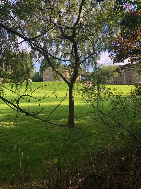
The village is known for its rich history, with evidence of human settlement dating back to the Bronze Age. This historical significance is reflected in the local architecture, with several well-preserved buildings from different eras. The main street is lined with quaint cottages and traditional shops, giving it a timeless appeal.

Heathfields boasts a range of amenities, including a village hall, a primary school, and a local pub. The village hall serves as a hub for community events, hosting regular gatherings and activities that bring residents together. The primary school is highly regarded for its academic standards and nurturing environment, attracting families from the surrounding areas.

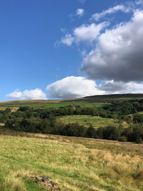
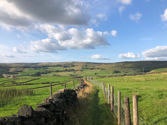
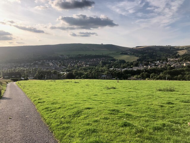
The natural beauty of the area is a major draw for both residents and visitors. Heathfields is surrounded by verdant hills and lush farmland, providing ample opportunities for outdoor activities such as hiking, cycling, and horseback riding. The village also benefits from its proximity to a nature reserve, which is home to a diverse range of flora and fauna.

Overall, Heathfields offers a tranquil and picturesque lifestyle, with its rich history, strong community spirit, and stunning natural surroundings. It is an ideal place for those seeking a slower pace of life and a close connection to nature.

If you have any feedback on the listing, please let us know in the comments section below.
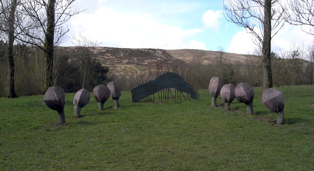
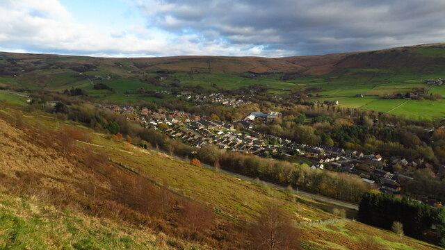
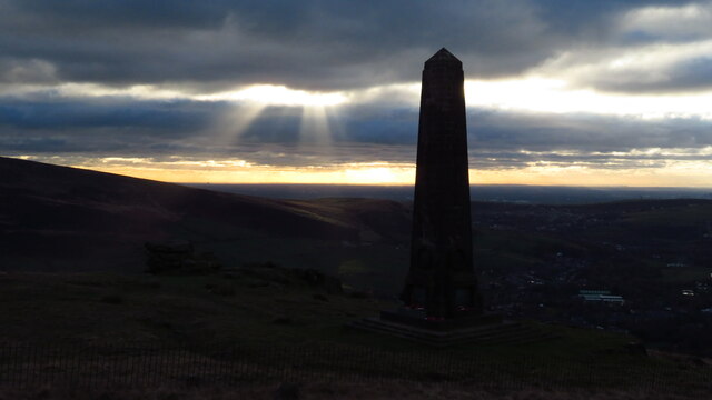
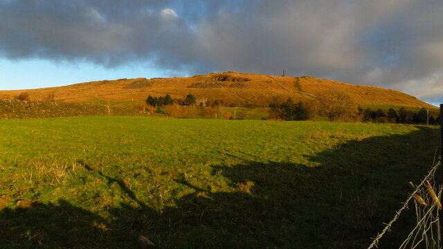
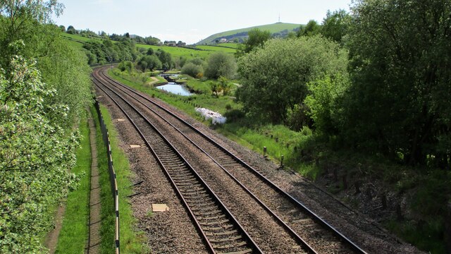
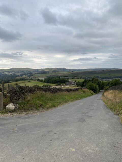
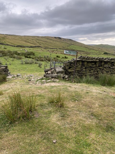
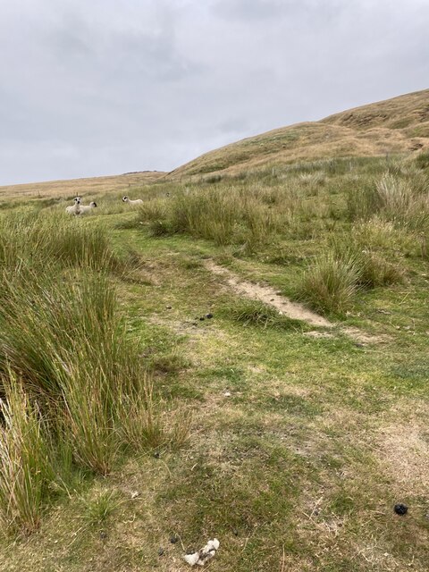
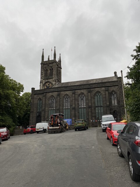
Heathfields Images

Images are sourced within 2km of 53.549877/-1.9976827 or Grid Reference SE0005. Thanks to Geograph Open Source API. All images are credited.

View of St Chad Church, Saddleworth Link to Church Website <span class="nowrap"><a title="https://www.cofeinsaddleworth.org.uk/st-chad-saddleworth-parish-church" rel="nofollow ugc noopener" href="https://www.cofeinsaddleworth.org.uk/st-chad-saddleworth-parish-church">Link</a><img style="margin-left:2px;" alt="External link" title="External link - shift click to open in new window" src="https://s1.geograph.org.uk/img/external.png" width="10" height="10"/></span>
View of St Chad Church, Saddleworth
Link to Church Website LinkExternal link
Grounds of Running Hill Head Farm
Footpath descending from Running Hill Head
View over Diggle from track connecting Back o'th Lee Farm to Lee Side
Sculpture by the Huddersfield Narrow Canal near Diggle The Huddersfield Narrow Canal opened in 1811. It runs for just under 20 miles from Lock 1E, where it joins the Huddersfield Broad Canal at the rear of the University of Huddersfield campus, to the junction with the Ashton Canal at Whitelands Basin in Ashton-under-Lyne. It crosses the Pennines by means of 74 locks and the Standedge Tunnel.
Sculpture by the Huddersfield Narrow Canal near Diggle
The Huddersfield Narrow Canal opened in 1811. It runs for just under 20 miles from Lock 1E, where it joins the Huddersfield Broad Canal at the rear of the University of Huddersfield campus, to the junction with the Ashton Canal at Whitelands Basin in Ashton-under-Lyne. It crosses the Pennines by means of 74 locks and the Standedge Tunnel.
Diggle from Harrop Edge
Pots & Pans Monument & Greenfield This war memorial was erected in 1923 to honour the 259 people from the villages of Saddleworth who died during the first world war and was located here specifically to be visible from the villages in the area. When plans were submitted for the war memorial there was much opposition from local people who wanted a memorial in the village rather than on top of a bleak hill.
Pots & Pans Monument & Greenfield
This war memorial was erected in 1923 to honour the 259 people from the villages of Saddleworth who died during the first world war and was located here specifically to be visible from the villages in the area. When plans were submitted for the war memorial there was much opposition from local people who wanted a memorial in the village rather than on top of a bleak hill.
Late afternoon sunlight on Pots & Pans Monument near Greenfield
Old milestone The 2 miles from Greenfield West Riding CC milestone, now in Greater Manchester, is on the west side of the A635.  The 3 mile stone minus its attachment was seen in 2002 but has since disappeared altogether.  Many of the milestones in this area known as Saddleworth were painted several years ago.   Now ready for a repaint although the legends can be read.  Neither the 2 or 3 mile stones were 'listed'.
Old milestone
The 2 miles from Greenfield West Riding CC milestone, now in Greater Manchester, is on the west side of the A635. The 3 mile stone minus its attachment was seen in 2002 but has since disappeared altogether. Many of the milestones in this area known as Saddleworth were painted several years ago. Now ready for a repaint although the legends can be read. Neither the 2 or 3 mile stones were 'listed'.
Old milestone The Greenfield and Shepley Lane Head tollroad existed from 1823 to the early 1880s.   About 2 metres to the right of the West Riding CC milestone can just be made out an old stone at the edge of the uncut longer grass.   It is thought that this is a milestone from the turnpike era although no inscription can be made out.
Old milestone
The Greenfield and Shepley Lane Head tollroad existed from 1823 to the early 1880s. About 2 metres to the right of the West Riding CC milestone can just be made out an old stone at the edge of the uncut longer grass. It is thought that this is a milestone from the turnpike era although no inscription can be made out.
Old milestone This milestone is not quite like any of the other late 19C West Riding CC milestones so may be an early replacement.  There is no raised edge to the top section and the lettering is a different style.   It is on the A669 Chew Valley Road near St Mary's CE school.   This area was once in the West Riding but now Greater Manchester.
Old milestone
This milestone is not quite like any of the other late 19C West Riding CC milestones so may be an early replacement. There is no raised edge to the top section and the lettering is a different style. It is on the A669 Chew Valley Road near St Mary's CE school. This area was once in the West Riding but now Greater Manchester.
Huddersfield Narrow Canal feed channel From Diggle Reservoir
Huddersfield Narrow Canal feed channel
From Diggle Reservoir
Railway and Canal Together View south from large footbridge that serves Ravenstones Drive
Railway and Canal Together
View south from large footbridge that serves Ravenstones Drive
Running Hill Lane
Running Hill Lane
Public Footpath Sign
Path towards Broadstone Hill
St Chad's Saddleworth
OS Cut Mark - Saddleworth, Saint Chad's Church <span class="nowrap"><a title="https://www.bench-marks.org.uk/bm83022" rel="nofollow ugc noopener" href="https://www.bench-marks.org.uk/bm83022">Link</a><img style="margin-left:2px;" alt="External link" title="External link - shift click to open in new window" src="https://s1.geograph.org.uk/img/external.png" width="10" height="10"/></span>
OS Cut Mark - Saddleworth, Saint Chad's Church
Show me another place!

Heathfields is located at Grid Ref: SE0005 (Lat: 53.549877, Lng: -1.9976827)

Division: West Riding

Unitary Authority: Oldham

Police Authority: Greater Manchester

What 3 Words

///surfer.munch.supposing. Near Diggle, Manchester

Related Wikis

Saddleworth

Saddleworth is a civil parish of the Metropolitan Borough of Oldham in Greater Manchester, England. It comprises several villages and hamlets as well as...

Uppermill railway station

Uppermill Railway Station served the village of Uppermill in Oldham. It was built by the London and North Western Railway on their Micklehurst Line from...

Uppermill

Uppermill is a village in the civil parish of Saddleworth in the Metropolitan Borough of Oldham, Greater Manchester, England. Historically in the West...

Greenfield, Greater Manchester

Greenfield is a village in the civil parish of Saddleworth in the Metropolitan Borough of Oldham, in Greater Manchester, England. It is 4 miles (6.4 km...

Saddleworth Museum

Saddleworth Museum is an independent museum in Uppermill village, Saddleworth, Metropolitan Borough of Oldham, Greater Manchester, England. It is a registered...

Saddleworth railway station

Saddleworth railway station, on the Huddersfield Line in Dobcross to the north of Uppermill, opened in August 1849 and closed to passengers in October...

Moorgate railway station (Greater Manchester)

Moorgate Halt railway station was opened on 1 January 1912 on the London and North Western Railway route from Stalybridge to Huddersfield. The station...

Dobcross

Dobcross is a village in the civil parish of Saddleworth in the Metropolitan Borough of Oldham in Greater Manchester, England. It is in a valley in the...

Nearby Amenities

Located within 500m of 53.549877,-1.9976827
Post Box
Collection Times: Mo-Fr 09:00
Colour: red
Ref: OL3 139
Royal Cypher: EIIR
Royal Cypher Wikidata: Q33102113
Lat/Long: 53.5500193/-1.9973854
Crossing
Lat/Long: 53.5509146/-1.9914582
Turning Circle
Source: Bing
Lat/Long: 53.5520414/-2.0014491
Turning Circle
Lat/Long: 53.5483403/-2.0028598
Bus Stop
High Street/Uppermill Turning Area
Bench: no
Bus: yes
Naptan AtcoCode: 1800ED08111
Naptan Bearing: S
Naptan CommonName: High Street/Uppermill Turning Area
Naptan Indicator: Turning Circle
Naptan Landmark: TURNING CIRCLE
Naptan NaptanCode: manamdmp
Naptan Notes: MAIN ROAD AMENDED
Naptan PlusbusZoneRef: MNCRPIC
Naptan ShortCommonName: Uppermill Turning
Naptan Street: HIGH STREET
Naptan Verified: no
Network: TfGM
Public Transport: platform
Shelter: no
Source: naptan_import
Tactile Paving: no
Lat/Long: 53.5504334/-2.0046144
Bus Stop
High Street/Uppermill Turning Area
Bench: no
Bus: yes
Naptan AtcoCode: 1800ED08121
Naptan Bearing: E
Naptan CommonName: High Street/Uppermill Turning Area
Naptan Indicator: Turning Circle
Naptan Landmark: TURNING CIRCLE
Naptan NaptanCode: manamdmt
Naptan Notes: MAIN ROAD AMENDED
Naptan PlusbusZoneRef: MNCRPIC
Naptan ShortCommonName: Uppermill Turning
Naptan Street: HIGH STREET
Naptan Verified: no
Network: TfGM
Public Transport: platform
Shelter: no
Source: naptan_import
Tactile Paving: no
Lat/Long: 53.5504315/-2.0048556
Bus Stop
High Street/Uppermill Turning Area
Bench: no
Bus: yes
Naptan AtcoCode: 1800ED08131
Naptan Bearing: S
Naptan CommonName: High Street/Uppermill Turning Area
Naptan Indicator: Opp Mill
Naptan Landmark: TURNING CIRCLE
Naptan NaptanCode: manamdmw
Naptan Notes: MAIN ROAD
Naptan PlusbusZoneRef: MNCRPIC
Naptan ShortCommonName: Uppermill Turning
Naptan Street: HIGH STREET
Naptan Verified: no
Network: TfGM
Public Transport: platform
Shelter: no
Source: naptan_import
Tactile Paving: no
Lat/Long: 53.5503073/-2.0044546
Bus Stop
High Street/Uppermill Turning Area
Bench: no
Bus: yes
Naptan AtcoCode: 1800ED08241
Naptan Bearing: W
Naptan CommonName: Uppermill Turning Area
Naptan Indicator: Nr Sub Station
Naptan Landmark: TURNING CIRCLE
Naptan NaptanCode: MANAMDPD
Naptan Notes: MAIN ROAD AMENDED
Naptan PlusbusZoneRef: MNCRPIC
Naptan ShortCommonName: Uppermill Turning
Naptan Street: HIGH Street
Naptan Verified: no
Network: TfGM
Public Transport: platform
Shelter: no
Source: naptan_import
Tactile Paving: no
Lat/Long: 53.5501385/-2.0048077
Bus Stop
Uppermill, High Street / at Uppermill Turning Area
Bench: no
Bus: yes
Naptan AtcoCode: 1800ED11871
Naptan Bearing: W
Naptan CommonName: Uppermill Turning Circle
Naptan Indicator: Nr Police Stati
Naptan Landmark: FLATS
Naptan NaptanCode: MANTGDTD
Naptan Notes: MAIN ROAD AMENDED
Naptan PlusbusZoneRef: MNCRPIC
Naptan ShortCommonName: Uppermill Turning
Naptan Street: High Street
Naptan Verified: no
Network: TfGM
Operator: TfGM
Public Transport: platform
Shelter: no
Source: naptan_import
Tactile Paving: no
Lat/Long: 53.55018/-2.0050796
Bus Stop
Uppermill, High Street / Commercial Hotel (Stop B)
Bench: yes
Bus: yes
Lit: yes
Local Ref: B
Naptan AtcoCode: 1800ED13091
Naptan Bearing: S
Naptan CommonName: High Street/Commercial Hotel (Stop B)
Naptan Indicator: Stop B
Naptan Landmark: Uppermill Methodist Church
Naptan NaptanCode: manamwtj
Naptan PlusbusZoneRef: MNCRPIC
Naptan ShortCommonName: Commercial Hotel
Naptan Street: HIGH STREET
Naptan Verified: no
Network: TfGM
Operator: TfGM
Public Transport: platform
Ref: B
Shelter: yes
Source: naptan_import
Lat/Long: 53.5489909/-2.0051039
Turning Circle
Lat/Long: 53.5481062/-1.9990102
Turning Circle
Lat/Long: 53.5489058/-1.9965626
Noexit: yes
Lat/Long: 53.5506609/-2.0048981
Turning Circle
Source: Bing
Lat/Long: 53.5514705/-1.9988871
Bench
Backrest: yes
Check Date: 2021-05-04
Lat/Long: 53.5495801/-1.9994977
Barrier: cycle_barrier
Bicycle: yes
Cycle Barrier: double
Cycle Barrier Installation: fixed
Foot: yes
Horse: no
Motor Vehicle: no
Lat/Long: 53.549133/-2.0019695
Barrier: stile
Stile: squeezer
Lat/Long: 53.5499331/-1.9917333
Barrier: stile
Material: wood
Source: survey;gps
Stile: stepover
Lat/Long: 53.5466059/-1.9926654
Barrier: stile
Material: stone
Source: survey;gps
Stile: squeezer
Lat/Long: 53.5467336/-1.9937722
Noexit: yes
Lat/Long: 53.5525084/-1.9982613
Generator Method: photovoltaic
Generator Output Electricity: yes
Generator Source: solar
Generator Type: solar_photovoltaic_panel
Location: roof
Power: generator
Lat/Long: 53.5511355/-1.9994414
Generator Method: photovoltaic
Generator Output Electricity: yes
Generator Source: solar
Generator Type: solar_photovoltaic_panel
Location: roof
Power: generator
Lat/Long: 53.5493591/-1.9960497
Pharmacy
Strachan's Chemists
Addr Housenumber: 7
Addr Postcode: OL3 6AU
Addr Street: New Street
Check Date: 2023-08-13
Dispensing: yes
Drive Through: no
Healthcare: pharmacy
Lat/Long: 53.5487012/-2.0047712
Barrier: kissing_gate
Bicycle: no
Foot: yes
Horse: no
Motor Vehicle: no
Lat/Long: 53.5465564/-1.9993001
Post Box
Brand: Royal Mail
Brand Wikidata: Q638098
Brand Wikipedia: en:Royal Mail
Collection Times: Mo-Fr 17:00
Colour: red
Drive Through: no
Operator: Royal Mail
Operator Wikidata: Q638098
Ref: OL3 203
Royal Cypher: EIIR
Royal Cypher Wikidata: Q33102113
Lat/Long: 53.5468327/-2.0015492
Post Box
Brand: Royal Mail
Brand Wikidata: Q638098
Brand Wikipedia: en:Royal Mail
Collection Times: Mo-Fr 09:00
Operator: Royal Mail
Operator Wikidata: Q638098
Ref: OL3 123
Royal Cypher: EIIR
Royal Cypher Wikidata: Q33102113
Lat/Long: 53.5488088/-2.0039565
Barrier: stile
Material: wood
Stile: stepover
Lat/Long: 53.5486604/-1.9950962
Bench
Backrest: yes
Lat/Long: 53.5497237/-1.997864
Bench
Backrest: yes
Lat/Long: 53.549748/-1.9977832
Barrier: bollard
Lat/Long: 53.5486212/-2.0039377
Barrier: bollard
Lat/Long: 53.5486238/-2.0039094
Waste Basket
Lat/Long: 53.5501733/-2.0051128
Entrance: main
Lat/Long: 53.5481857/-2.0045715
Kerb: raised
Lat/Long: 53.5503535/-1.9959633
Waste Basket
Colour: black
Material: metal
Lat/Long: 53.5491113/-2.0019706
Waste Basket
Lat/Long: 53.550385/-2.0051859
Waste Basket
Lat/Long: 53.5516417/-2.0043187
Waste Basket
Lat/Long: 53.5505055/-2.0048125
Waste Basket
Lat/Long: 53.5508914/-2.0045661
Waste Basket
Lat/Long: 53.5490386/-2.0022795
Barrier: stile
Material: stone
Stile: squeezer
Lat/Long: 53.5526767/-1.9970383
Barrier: stile
Material: wood
Stile: stepover
Lat/Long: 53.5536878/-1.9973731
Barrier: stile
Step Count: 2
Stile: stepover
Lat/Long: 53.552646/-2.0007313
Generator Method: photovoltaic
Generator Output Electricity: yes
Generator Source: solar
Generator Type: solar_photovoltaic_panel
Power: generator
Lat/Long: 53.5472197/-2.0028605
Barrier: stile
Stile: squeezer
Lat/Long: 53.5542698/-1.9985068
Bench
Lat/Long: 53.55296/-1.9982226
Bench
Lat/Long: 53.5528886/-1.9981672
Material: wood
Power: pole
Lat/Long: 53.5507132/-1.9931281
Material: wood
Power: pole
Lat/Long: 53.5503159/-1.9910514
Material: wood
Power: pole
Lat/Long: 53.5505604/-1.9923526
Material: wood
Power: pole
Transformer: distribution
Voltage Primary: 11000
Voltage Secondary: 240
Lat/Long: 53.5509472/-1.9943158
Man Made: street_cabinet
Utility: telecom
Lat/Long: 53.5477458/-2.0032066
Bench
Backrest: yes
Lat/Long: 53.546314/-2.0014573
Noexit: yes
Lat/Long: 53.5470579/-1.9986483
Grit Bin
Access: yes
Colour: yellow
Material: plastic
Lat/Long: 53.5460003/-1.9989218
Grit Bin
Lat/Long: 53.5508647/-1.99938
Grit Bin
Lat/Long: 53.5475145/-1.9985111
Grit Bin
Lat/Long: 53.5475714/-1.9997487
Turning Circle
Lat/Long: 53.5482759/-1.993487
Noexit: yes
Lat/Long: 53.5514358/-1.9966698
Noexit: yes
Lat/Long: 53.5507146/-2.0050639
Grit Bin
Colour: yellow
Lat/Long: 53.5471455/-1.9937504
Bus Stop
Well Meadow Lane
Bench: no
Bin: no
Bus: yes
Lit: no
Naptan AtcoCode: 1800EDH4101
Naptan Bearing: E
Naptan CommonName: Well Meadow Lane
Naptan Indicator: E-bound
Naptan Street: Well Meadow Lane
Naptan Verified: no
Network: TfGM
Public Transport: platform
Shelter: no
Source: naptan;bing;naptan_compare_tool
Tactile Paving: no
Lat/Long: 53.5502821/-1.9991484
Bus Stop
Well Meadow Lane
Bench: no
Bin: no
Bus: yes
Lit: yes
Naptan AtcoCode: 1800EDH4111
Naptan Bearing: W
Naptan CommonName: Well Meadow Lane
Naptan Indicator: W-bound
Naptan Street: Well Meadow Lane
Naptan Verified: no
Network: TfGM
Public Transport: platform
Shelter: no
Source: naptan;bing;naptan_compare_tool
Tactile Paving: no
Lat/Long: 53.5501992/-1.9991115
Bus Stop
Church Road
Bench: no
Bin: no
Bus: yes
Kerb: raised
Kerb Approach Aid: no
Lit: no
Naptan AtcoCode: 1800EDH2021
Naptan Bearing: E
Naptan CommonName: Church Road
Naptan Indicator: E-bound
Naptan Street: Church Road
Naptan Verified: no
Network: TfGM
Passenger Information Display: no
Public Transport: platform
Shelter: no
Source: naptan;bing;naptan_compare_tool
Tactile Paving: no
Lat/Long: 53.5490926/-2.0026143
Noexit: yes
Lat/Long: 53.5517537/-1.9915693
Uppermill
Historic Railway: station
Railway: site
Wikidata: Q7899070
Wikipedia: en:Uppermill railway station
Lat/Long: 53.5477843/-2.0021151
Bus Stop
High Street/Uppermill Turning Area
Bench: no
Bus: yes
Naptan AtcoCode: 1800ED08141
Naptan Bearing: W
Naptan CommonName: Uppermill Turning Area
Naptan Indicator: nr
Naptan Landmark: TURNING CIRCLE
Naptan NaptanCode: MANAMDPA
Naptan Notes: MAIN ROAD AMENDED
Naptan PlusbusZoneRef: MNCRPIC
Naptan ShortCommonName: Uppermill Turning
Naptan Street: HIGH Street
Naptan Verified: no
Network: TfGM
Public Transport: platform
Shelter: no
Source: naptan_import
Tactile Paving: no
Lat/Long: 53.550183/-2.0045654
Grit Bin
Lat/Long: 53.5505544/-1.9913916
Grit Bin
Colour: yellow
Lat/Long: 53.5498322/-1.9977379
Room 14
Addr City: Uppermill
Addr Housenumber: 9
Addr Street: New Street
Clothes: men
Shop: clothes
Website: https://room14menswear.co.uk/
Lat/Long: 53.5487065/-2.0046788
Noexit: yes
Lat/Long: 53.5507083/-2.0033393
Bench
Lat/Long: 53.5528974/-1.9988854
Bench
Lat/Long: 53.55293/-1.998589
Door: hinged
Entrance: yes
Lat/Long: 53.5524034/-1.9985606
Parking Space
Parking Space: disabled
Lat/Long: 53.5482627/-2.0044076
Parking Space
Parking Space: disabled
Lat/Long: 53.5482309/-2.0043888
Parking Space
Parking Space: disabled
Lat/Long: 53.5481974/-2.004366
The data included in this document is from www.openstreetmap.org. The data is made available under ODbL.

Have you been to Heathfields?

Leave your review of Heathfields below (or comments, questions and feedback).