Shotton's Dean
Valley in Northumberland
England
Shotton's Dean
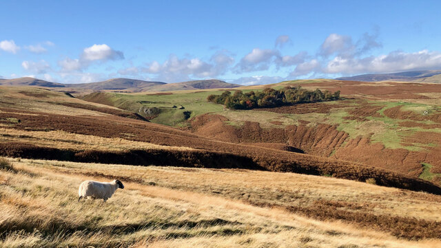
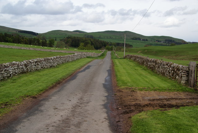
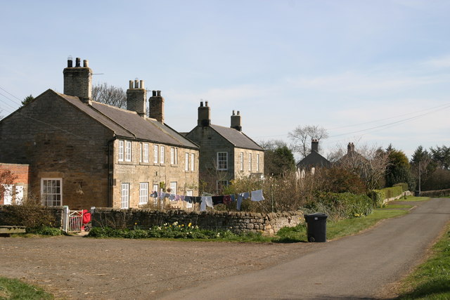
Shotton's Dean is a picturesque valley located in the county of Northumberland in northeastern England. Nestled within the beautiful countryside, this small but charming valley offers a tranquil escape from the hustle and bustle of city life.
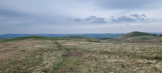
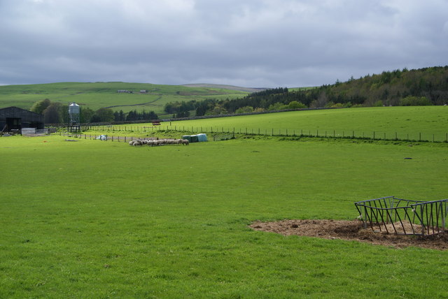
Surrounded by rolling hills and dense woodlands, Shotton's Dean boasts stunning natural beauty. The valley is home to a diverse range of flora and fauna, making it a haven for nature enthusiasts and wildlife lovers. Visitors can spot a variety of birds, mammals, and plant species as they explore the area.
The valley is crisscrossed by a meandering river, which adds to its enchanting atmosphere. The river offers the perfect setting for a leisurely stroll or a peaceful picnic by the water's edge. The sound of flowing water and the gentle rustling of leaves create a soothing ambiance that is truly rejuvenating.
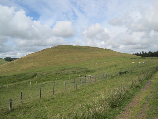
Shotton's Dean is also rich in history and heritage. The valley is dotted with remnants of ancient settlements, including prehistoric stone circles and Roman ruins. History buffs can delve into the past and uncover the stories that have shaped this area over centuries.
For those seeking outdoor adventures, Shotton's Dean provides ample opportunities for hiking, cycling, and horseback riding. Several well-marked trails crisscross the valley, offering breathtaking views and invigorating exercise.
Overall, Shotton's Dean is a hidden gem in Northumberland, offering a peaceful retreat surrounded by nature's splendor. Whether you are looking for a scenic walk, a historical exploration, or simply a place to unwind, this valley has something for everyone.
If you have any feedback on the listing, please let us know in the comments section below.
Shotton's Dean Images
Images are sourced within 2km of 55.408743/-1.9916175 or Grid Reference NU0012. Thanks to Geograph Open Source API. All images are credited.
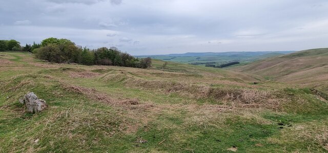
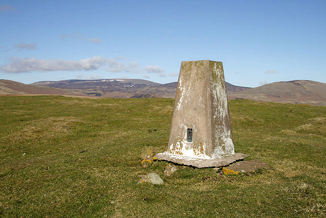
![Earthworks associated with prehistoric settlement "Earthwork remains of a partly enclosed late prehistoric settlement with at least 7 house platforms."
‘Heritage Gateway - Results’. 2012. Heritagegateway.org.uk &lt;<span class="nowrap"><a title="https://www.heritagegateway.org.uk/Gateway/Results_Single.aspx?uid=4f2e2525-4e67-42b6-bada-693f30be9b4c&amp;resourceID=19191" rel="nofollow ugc noopener" href="https://www.heritagegateway.org.uk/Gateway/Results_Single.aspx?uid=4f2e2525-4e67-42b6-bada-693f30be9b4c&amp;resourceID=19191">Link</a><img style="margin-left:2px;" alt="External link" title="External link - shift click to open in new window" src="https://s1.geograph.org.uk/img/external.png" width="10" height="10"/></span> &gt; [accessed 1 November 2022].](https://s2.geograph.org.uk/geophotos/07/32/89/7328922_b41bcaa7.jpg)

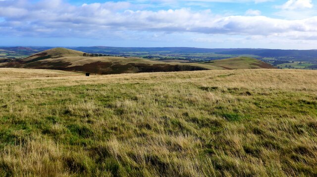
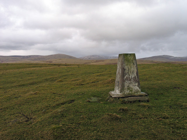
![Wether Hill Iron Age hillfort, palisade, enclosure, and ditch ‘Heritage Gateway - Results’. 2012. Heritagegateway.org.uk &lt;<span class="nowrap"><a title="https://www.heritagegateway.org.uk/Gateway/Results_Single.aspx?resourceID=304&amp;uid=1885610" rel="nofollow ugc noopener" href="https://www.heritagegateway.org.uk/Gateway/Results_Single.aspx?resourceID=304&amp;uid=1885610">Link</a><img style="margin-left:2px;" alt="External link" title="External link - shift click to open in new window" src="https://s1.geograph.org.uk/img/external.png" width="10" height="10"/></span> &gt; [accessed 28 October 2022]
‘Heritage Gateway - Results’. 2012. Heritagegateway.org.uk &lt;<span class="nowrap"><a title="https://www.heritagegateway.org.uk/Gateway/Results_Single.aspx?resourceID=304&amp;uid=1844678" rel="nofollow ugc noopener" href="https://www.heritagegateway.org.uk/Gateway/Results_Single.aspx?resourceID=304&amp;uid=1844678">Link</a><img style="margin-left:2px;" alt="External link" title="External link - shift click to open in new window" src="https://s1.geograph.org.uk/img/external.png" width="10" height="10"/></span> &gt; [accessed 28 October 2022]
‘Heritage Gateway - Results’. 2012. Heritagegateway.org.uk &lt;<span class="nowrap"><a title="https://www.heritagegateway.org.uk/Gateway/Results_Single.aspx?resourceID=304&amp;uid=1926688" rel="nofollow ugc noopener" href="https://www.heritagegateway.org.uk/Gateway/Results_Single.aspx?resourceID=304&amp;uid=1926688">Link</a><img style="margin-left:2px;" alt="External link" title="External link - shift click to open in new window" src="https://s1.geograph.org.uk/img/external.png" width="10" height="10"/></span> &gt; [accessed 28 October 2022]](https://s0.geograph.org.uk/geophotos/07/32/89/7328928_989b1be1.jpg)


Shotton's Dean is located at Grid Ref: NU0012 (Lat: 55.408743, Lng: -1.9916175)
Unitary Authority: Northumberland
Police Authority: Northumbria
What 3 Words
///finger.renovated.span. Near Whittingham, Northumberland
Nearby Locations
Related Wikis

Unthank, Alnham
Unthank is a hamlet and former civil parish, now in the parish of Alnham in Northumberland, England. In 1951 the parish had a population of 11. == History... ==

Alnham
Alnham is a hamlet and civil parish in Northumberland, England. It is about 14 miles (23 km) west of Alnwick, about 6 miles (9.7 km) from Scotland and...
Church of St Michael, Alnham
The Church of St Michael in Alnham, in the English county of Northumberland, is a medieval structure dating from circa 1200. Built on a Roman camp site...
Castle Knowe, Northumberland
Castle Knowe, also known as Clinch Castle, is the site of an Iron Age hillfort in Northumberland, England, about 1 mile south-east of the village of Ingram...

Eslington Park
Eslington Park is a privately owned 18th-century mansion house west of Whittingham, Northumberland, near the River Aln. It is the family seat of Lord...
Milbourne, Northumberland
Milbourne is a village and former civil parish 14 miles (23 km) from Morpeth, now in the parish of Ponteland, in the county of Northumberland, England...

Scrainwood
Scrainwood is a hamlet and former civil parish 20 miles (32 km) from Morpeth, now in the parish of Alnham, in the county of Northumberland, England. In...

Yetlington
Yetlington is a village in the civil parish of Callaly, in the county of Northumberland, England. Yetlington seems to have been known in the Middle Ages...
Have you been to Shotton's Dean?
Leave your review of Shotton's Dean below (or comments, questions and feedback).