Crow Plantation

Wood, Forest in Northumberland
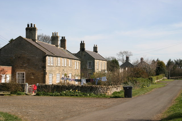
England

Crow Plantation

Middle Dean, Northumberland Looking over the perimeter of Middle Dean Hillfort, to the right is the deep gully of Middledean Burn,
Middle Dean, Northumberland Credit: Rebecca A Wills

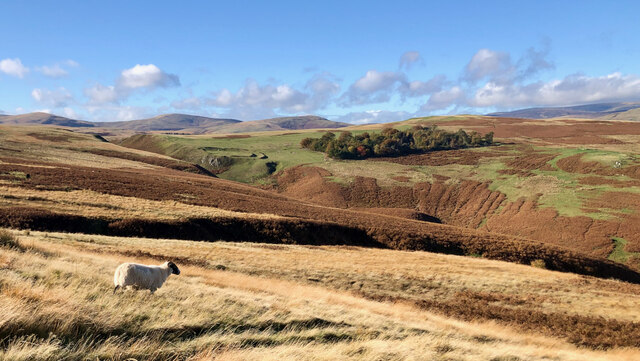
Crow Plantation is a picturesque woodland located in the county of Northumberland, England. Situated in the northern part of the county, it covers an area of approximately 500 acres. The plantation boasts a rich history dating back several centuries.

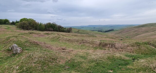
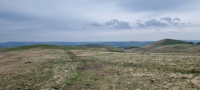
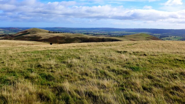
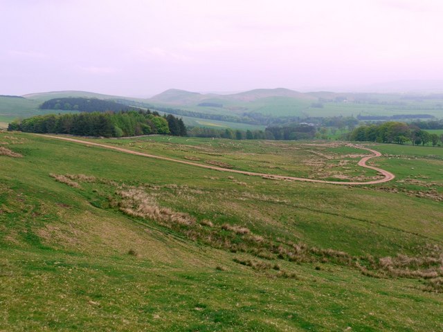
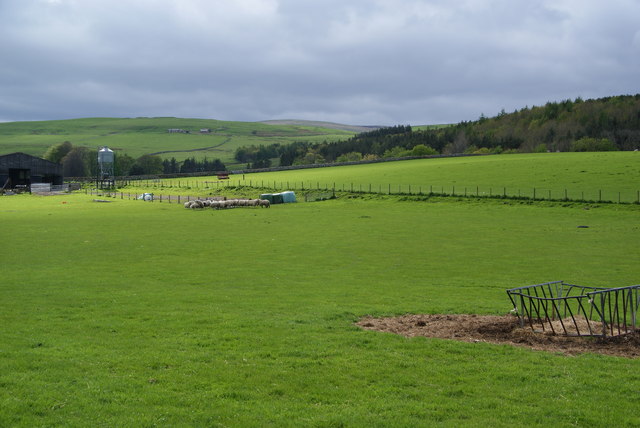
The woodland is predominantly composed of native tree species, such as oak, beech, and ash, creating a diverse and thriving ecosystem. The dense foliage provides a habitat for a wide variety of wildlife, including birds, squirrels, and deer. The ancient trees, some of which are several hundred years old, add a sense of grandeur and timelessness to the plantation.

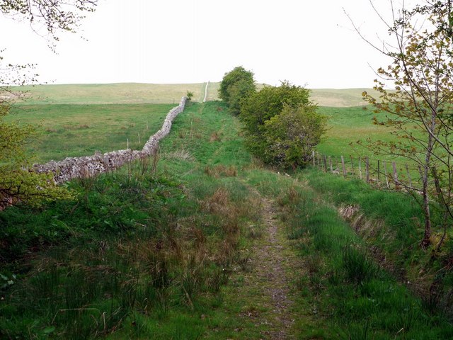
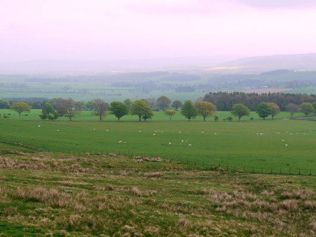
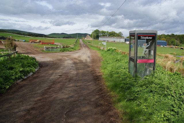
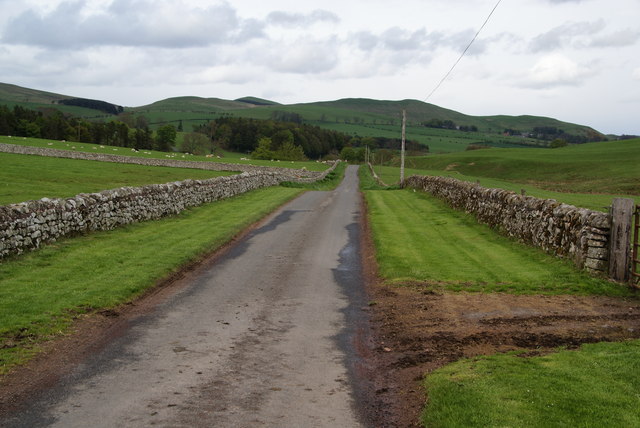
Crow Plantation offers a range of recreational activities for visitors to enjoy. There are several well-maintained walking trails that wind through the woodland, allowing visitors to explore its natural beauty at their own pace. These paths provide stunning views of the surrounding countryside and offer opportunities for birdwatching and photography.

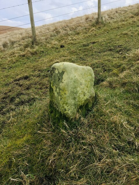
For those interested in the history of the area, Crow Plantation holds several archaeological sites, including the remains of an Iron Age settlement and a medieval hunting lodge. These historical features add depth and intrigue to the plantation.

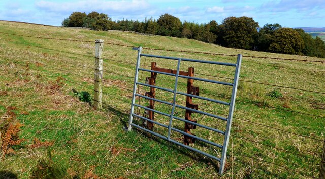
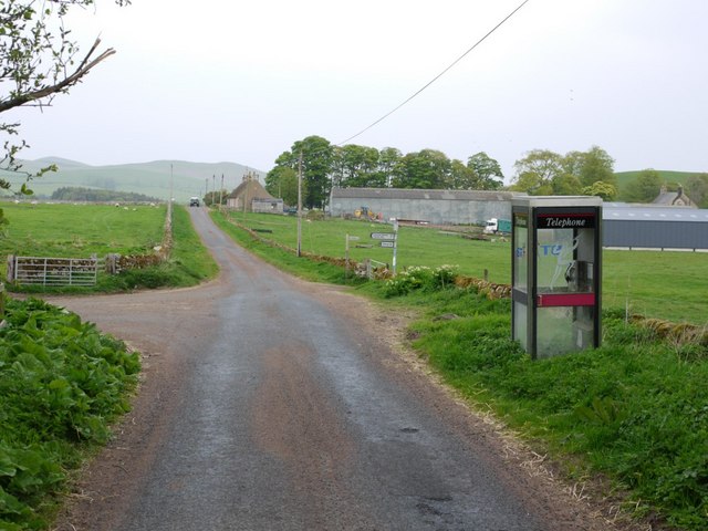
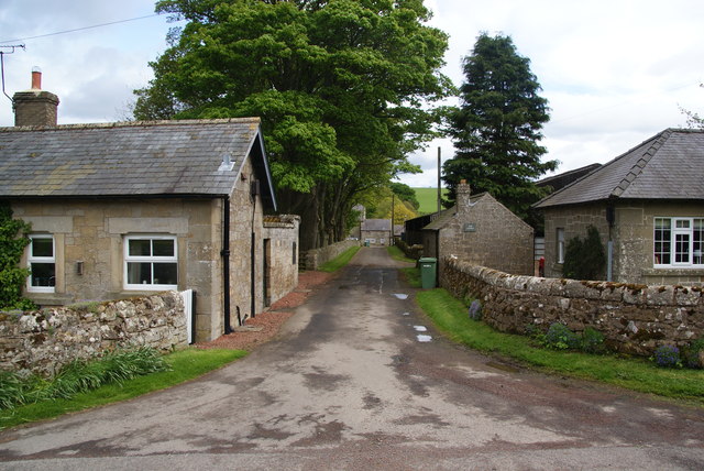
The woodland is easily accessible, with a car park located at the entrance. The plantation is open to the public year-round, and there is no admission fee, making it a popular destination for locals and tourists alike.

Overall, Crow Plantation is a captivating woodland that offers a blend of natural beauty, historical significance, and recreational opportunities. It is a must-visit location for nature enthusiasts and history buffs exploring Northumberland.

If you have any feedback on the listing, please let us know in the comments section below.

Crow Plantation Images

Images are sourced within 2km of 55.408977/-1.9993246 or Grid Reference NU0012. Thanks to Geograph Open Source API. All images are credited.

Middle Dean, Northumberland Looking over the perimeter of Middle Dean Hillfort, to the right is the deep gully of Middledean Burn,
Middle Dean, Northumberland
Looking over the perimeter of Middle Dean Hillfort, to the right is the deep gully of Middledean Burn,
Cochrane Pike, Northumberland Looking east-northeast from west of Cochrane Pike. In the middle distance (left to right) can be seen Wether Hill, West Hill and Old Fawdon Hill. On top of both Wether Hill and Old Fawden Hill can be found the remains of ancient settlements.
Cochrane Pike, Northumberland
Looking east-northeast from west of Cochrane Pike. In the middle distance (left to right) can be seen Wether Hill, West Hill and Old Fawdon Hill. On top of both Wether Hill and Old Fawden Hill can be found the remains of ancient settlements.
Interesting sheep pass(?) Temporarily blocked, but the structure is designed to be wired into a fence structure but leave a suitable gap.
Interesting sheep pass(?)
Temporarily blocked, but the structure is designed to be wired into a fence structure but leave a suitable gap.
Looking SE from Cochrane Pike
Earthworks associated with prehistoric settlement "Earthwork remains of a partly enclosed late prehistoric settlement with at least 7 house platforms."

‘Heritage Gateway - Results’. 2012. Heritagegateway.org.uk <<span class="nowrap"><a title="https://www.heritagegateway.org.uk/Gateway/Results_Single.aspx?uid=4f2e2525-4e67-42b6-bada-693f30be9b4c&resourceID=19191" rel="nofollow ugc noopener" href="https://www.heritagegateway.org.uk/Gateway/Results_Single.aspx?uid=4f2e2525-4e67-42b6-bada-693f30be9b4c&resourceID=19191">Link</a><img style="margin-left:2px;" alt="External link" title="External link - shift click to open in new window" src="https://s1.geograph.org.uk/img/external.png" width="10" height="10"/></span> > [accessed 1 November 2022].
Earthworks associated with prehistoric settlement
"Earthwork remains of a partly enclosed late prehistoric settlement with at least 7 house platforms." ‘Heritage Gateway - Results’. 2012. Heritagegateway.org.uk <LinkExternal link > [accessed 1 November 2022].
View to Old Fawdon Hill
Middledean Camp Viewed from across the precipitous Middledean Burn, the double earthbanks of the Iron Age fort known as Middledean Camp stands out against the smooth rounded hills of Breamish Valley in the Cheviots.

Double earthworks such as this are termed ‘bivallate’. Promontory hillforts are those which are defended by steep slopes on 2 or 3 sides. From this angle Middledean appears to have just the one side, but in fact the bluff extends around the south and east sides.

Hillforts and other prehistoric sites abound in these hills. It has long been established that they were built by ancient Britons about 2300 years ago. But what is not clear exactly why they were built. They do not seem to have been purely for defence. Middledean has several internal hut circles. It could have been seasonal accommodation for the people who practised transhumance when cattle were brought into the hills for summer grazing. Another possibility is that it may have had a ceremonial or ritual use.

For sources see my blog &lt;span class=&quot;nowrap&quot;&gt;&lt;a title=&quot;http://www.fhithich.uk/?p=30483&quot; rel=&quot;nofollow ugc noopener&quot; href=&quot;http://www.fhithich.uk/?p=30483&quot;&gt;Link&lt;/a&gt;&lt;img style=&quot;margin-left:2px;&quot; alt=&quot;External link&quot; title=&quot;External link - shift click to open in new window&quot; src=&quot;https://s1.geograph.org.uk/img/external.png&quot; width=&quot;10&quot; height=&quot;10&quot;/&gt;&lt;/span&gt;
Middledean Camp
Viewed from across the precipitous Middledean Burn, the double earthbanks of the Iron Age fort known as Middledean Camp stands out against the smooth rounded hills of Breamish Valley in the Cheviots. Double earthworks such as this are termed ‘bivallate’. Promontory hillforts are those which are defended by steep slopes on 2 or 3 sides. From this angle Middledean appears to have just the one side, but in fact the bluff extends around the south and east sides. Hillforts and other prehistoric sites abound in these hills. It has long been established that they were built by ancient Britons about 2300 years ago. But what is not clear exactly why they were built. They do not seem to have been purely for defence. Middledean has several internal hut circles. It could have been seasonal accommodation for the people who practised transhumance when cattle were brought into the hills for summer grazing. Another possibility is that it may have had a ceremonial or ritual use. For sources see my blog LinkExternal link
Old Boundary Marker Boundary Marker by a wire fence 960 metres northwest of Great Ryle and 1190 metres southwest of Old Fawdon Hill. Now on the boundary of Alnham and Ingram parishes but its function cannot be determined without it having an inscription.

Milestone Society National ID: NB_ALNING01bm
Old Boundary Marker
Boundary Marker by a wire fence 960 metres northwest of Great Ryle and 1190 metres southwest of Old Fawdon Hill. Now on the boundary of Alnham and Ingram parishes but its function cannot be determined without it having an inscription. Milestone Society National ID: NB_ALNING01bm
Salter's Road climbing Northfieldhead Hill This is a duplicate of a photo taken two years and one month earlier from the same location &lt;a href=&quot;https://www.geograph.org.uk/photo/1202743&quot;&gt;NT9811 : Salter&#039;s Road climbing Northfieldhead Hill&lt;/a&gt;
Salter's Road climbing Northfieldhead Hill
This is a duplicate of a photo taken two years and one month earlier from the same location NT9811 : Salter's Road climbing Northfieldhead Hill
Fields north-west of Northfieldhead
Track east of Northfieldhead Hill
Road junction, Alnham The farm buildings in the distance are at Alnham House, just visible on the right &lt;a href=&quot;https://www.geograph.org.uk/photo/2218690&quot;&gt;NT9910 : Alnham&lt;/a&gt;. The left hand turn is the road that passes Alnham Church and ends at Ewartly Shank several miles into the hills.
Road junction, Alnham
The farm buildings in the distance are at Alnham House, just visible on the right NT9910 : Alnham. The left hand turn is the road that passes Alnham Church and ends at Ewartly Shank several miles into the hills.
Pennylaws Farm, Alnham
Trig point on Hart Law Hart Law is a low hill among the Cheviots lying nearly north of the small settlement of Alnham. Hogdon Law, Cushat Law and Shill Moor can be seen in the distance.
Trig point on Hart Law
Hart Law is a low hill among the Cheviots lying nearly north of the small settlement of Alnham. Hogdon Law, Cushat Law and Shill Moor can be seen in the distance.
Road junction in the centre of Alnham Alnham is a thinly spread village, with the dwellings quite well scattered.
Road junction in the centre of Alnham
Alnham is a thinly spread village, with the dwellings quite well scattered.
Road to Alnham House The farm site has a few cottages at the entrance.
Road to Alnham House
The farm site has a few cottages at the entrance.
Road to Prendwick The road leaving Alnham to the north. It is following the Aln valley downstream at this point.
Road to Prendwick
The road leaving Alnham to the north. It is following the Aln valley downstream at this point.
Sheep near Alnham The village is dominated by farming.
Sheep near Alnham
The village is dominated by farming.
Show me another place!

Crow Plantation is located at Grid Ref: NU0012 (Lat: 55.408977, Lng: -1.9993246)

Unitary Authority: Northumberland

Police Authority: Northumbria

What 3 Words

///animated.quicksand.voters. Near Whittingham, Northumberland

Related Wikis

Unthank, Alnham

Unthank is a hamlet and former civil parish, now in the parish of Alnham in Northumberland, England. In 1951 the parish had a population of 11. == History... ==

Alnham

Alnham (, ) is a hamlet and civil parish in Northumberland, England. It is about 14 miles (23 km) west of Alnwick, and is about 6 miles (10 km) from the...

Church of St Michael, Alnham

The Church of St Michael in Alnham, in the English county of Northumberland, is a medieval structure dating from circa 1200. Built on a Roman camp site...

Milbourne, Northumberland

Milbourne is a village and former civil parish 14 miles (23 km) from Morpeth, now in the parish of Ponteland, in the county of Northumberland, England...

Nearby Amenities

Located within 500m of 55.408977,-1.9993246
Prendwick
Place: hamlet
Lat/Long: 55.4051578/-1.9989871
The data included in this document is from www.openstreetmap.org. The data is made available under ODbL.

Have you been to Crow Plantation?

Leave your review of Crow Plantation below (or comments, questions and feedback).