Near Harehill Clough

Valley in Cheshire

England

Near Harehill Clough

In Which Myriad? I've wanted to visit this spot for a while.  It's where the four Myriads SD, SE, SJ and SK meet.  Several people have obviously been here before as there's a geocache here.  We signed the visitor book in the box - the last person to have visited it before us today was on 31st. July 2021!  Pedantically, according to my GPS, the box position was about a metre too far north, but we left it where we found it!
In Which Myriad? Credit: Andy Beecroft

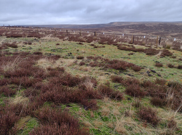
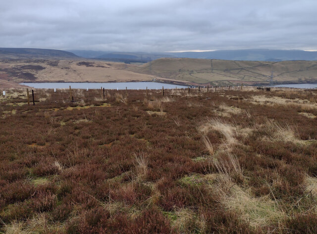
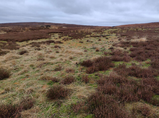
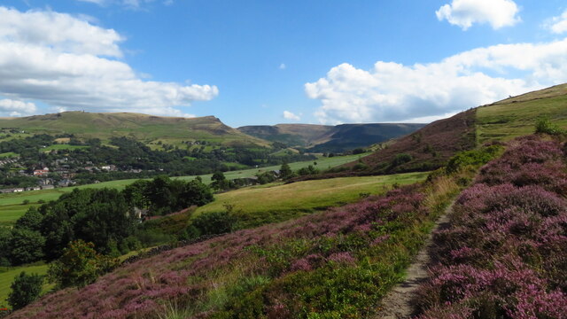
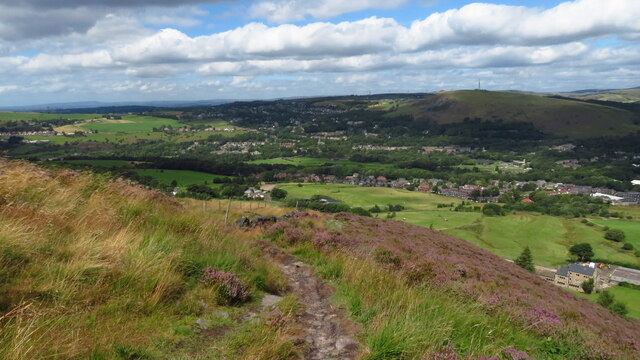
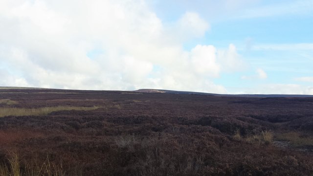
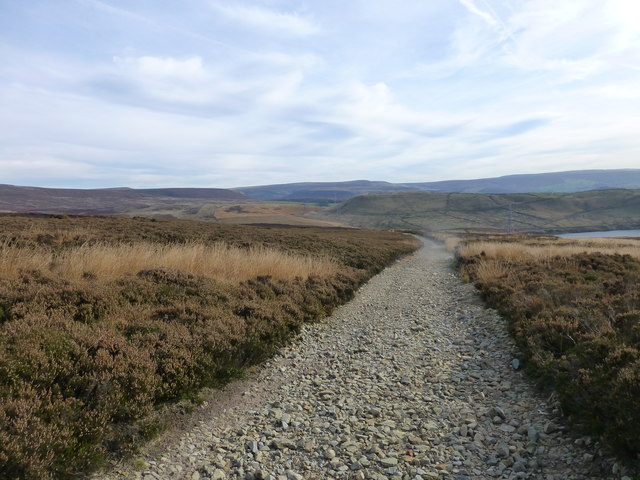
Near Harehill Clough is a picturesque valley located in the county of Cheshire, England. Situated in the northwestern part of the county, it is renowned for its natural beauty and tranquil surroundings. The valley is nestled between rolling hills, creating a stunning backdrop of lush greenery and a peaceful atmosphere.

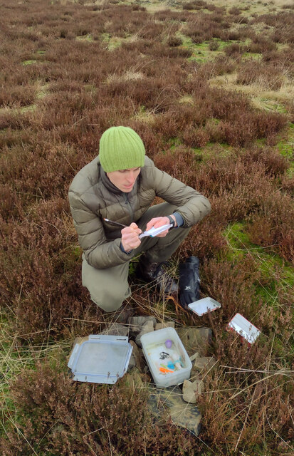
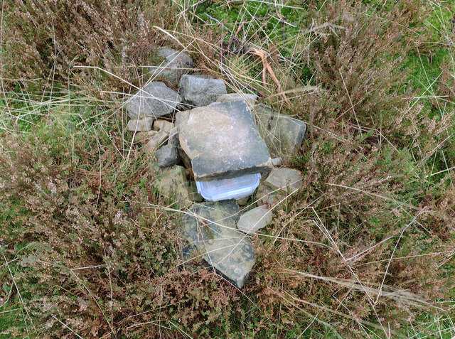
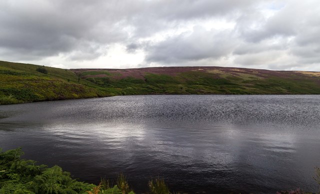
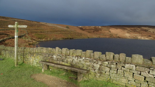
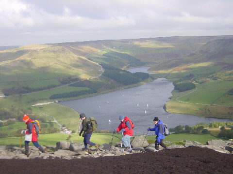
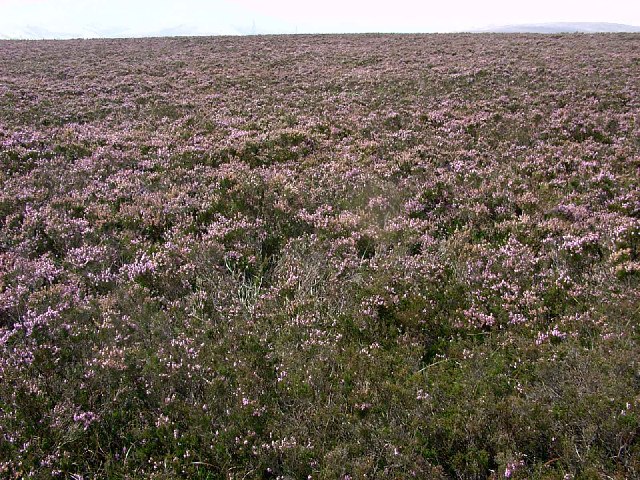
The area is characterized by its diverse wildlife and rich biodiversity. The valley is home to numerous species of plants, birds, and animals, making it a popular spot for nature enthusiasts and birdwatchers. The varied terrain and presence of a small stream running through the valley contribute to the unique ecosystem found here.

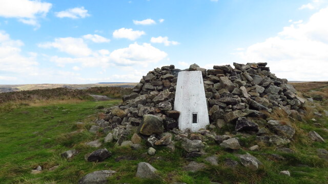
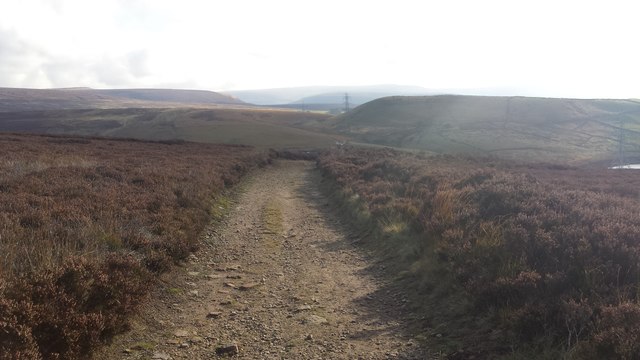
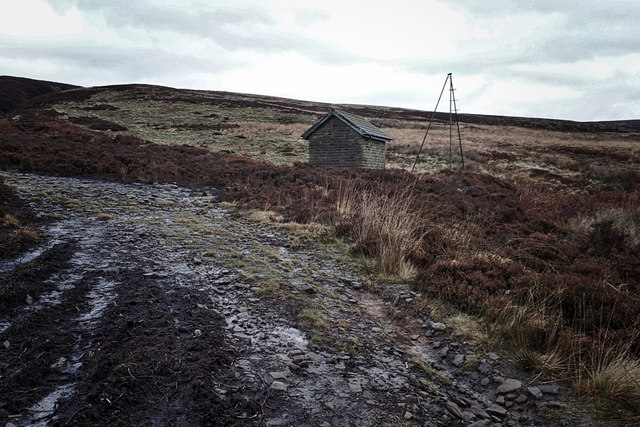
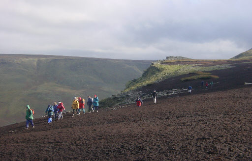
Near Harehill Clough is also known for its walking trails and hiking routes, attracting outdoor enthusiasts and visitors seeking a peaceful retreat. The trails wind through the valley, providing stunning views of the surrounding countryside and offering opportunities for exploration and relaxation.

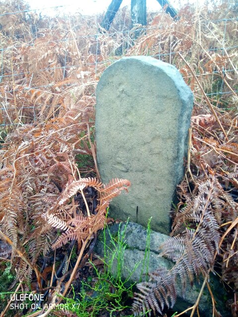
The area is steeped in history, with evidence of human habitation dating back to ancient times. Archaeological discoveries have unearthed artifacts and remnants from different periods, adding to the historical significance of the valley.

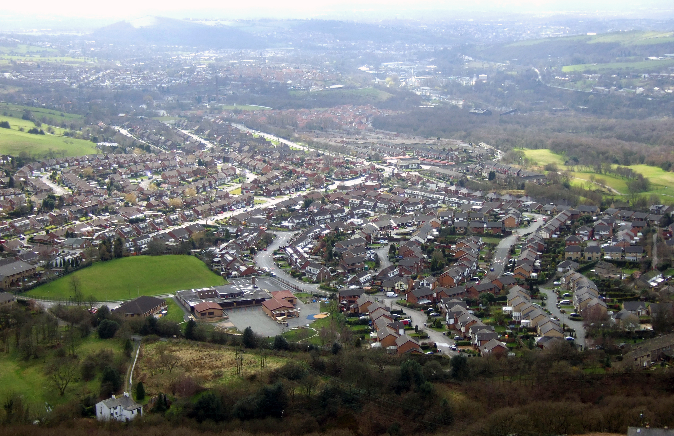
In addition to its natural beauty, Near Harehill Clough is conveniently located near several charming villages and towns, allowing visitors to easily access amenities and accommodations. The valley offers a serene escape from the hustle and bustle of city life, making it an ideal destination for those seeking a tranquil getaway or a place to reconnect with nature.

If you have any feedback on the listing, please let us know in the comments section below.

Near Harehill Clough Images

Images are sourced within 2km of 53.51067/-2.0045455 or Grid Reference SD9901. Thanks to Geograph Open Source API. All images are credited.

In Which Myriad? I've wanted to visit this spot for a while.  It's where the four Myriads SD, SE, SJ and SK meet.  Several people have obviously been here before as there's a geocache here.  We signed the visitor book in the box - the last person to have visited it before us today was on 31st. July 2021!  Pedantically, according to my GPS, the box position was about a metre too far north, but we left it where we found it!
In Which Myriad?
I've wanted to visit this spot for a while. It's where the four Myriads SD, SE, SJ and SK meet. Several people have obviously been here before as there's a geocache here. We signed the visitor book in the box - the last person to have visited it before us today was on 31st. July 2021! Pedantically, according to my GPS, the box position was about a metre too far north, but we left it where we found it!
SE from its South West Extremity The photo was taken just a couple of metres away from the SD, SE, SJ & SK intersection.  The meeting of the myriads had a geocache box in it and we signed the visitors' record book to prove we'd been there! According to my GPS, the box was a metre too far north on my 21 satellite fix, but of course, that doesn't really matter!  Luckily, the intersection was accessible as, just to the east of here, was a new and substantial wire fence with double barbed wire on its top which would have been impossible to climb over!  There was evidence of a former fence as its burnt wooden posts were still in situ - presumably from a moorland fire.
SE from its South West Extremity
The photo was taken just a couple of metres away from the SD, SE, SJ & SK intersection. The meeting of the myriads had a geocache box in it and we signed the visitors' record book to prove we'd been there! According to my GPS, the box was a metre too far north on my 21 satellite fix, but of course, that doesn't really matter! Luckily, the intersection was accessible as, just to the east of here, was a new and substantial wire fence with double barbed wire on its top which would have been impossible to climb over! There was evidence of a former fence as its burnt wooden posts were still in situ - presumably from a moorland fire.
Trig Point on Alphin
Cache on Land I've wanted to visit this spot for a while.  It's where the four Myriads SD, SE, SJ and SK meet.  Several people have obviously been here before as there's a geocache here.  We signed the visitor book in the box - the last person to have visited it before us today was on 31st. July 2021!  Pedantically, according to my GPS, the box position was about a metre too far north, but we left it where we found it!
Cache on Land
I've wanted to visit this spot for a while. It's where the four Myriads SD, SE, SJ and SK meet. Several people have obviously been here before as there's a geocache here. We signed the visitor book in the box - the last person to have visited it before us today was on 31st. July 2021! Pedantically, according to my GPS, the box position was about a metre too far north, but we left it where we found it!
Swineshaw Reservoirs Taken from the four Myriads SD, SE, SJ and SK intersection looking over to the south east into the rest of SK.
Swineshaw Reservoirs
Taken from the four Myriads SD, SE, SJ and SK intersection looking over to the south east into the rest of SK.
Moorland from the Myriad Intersection Taken just a metre into SD's extreme SE corner.  Not a particularly interesting feature, but an achievement to get here!!
Moorland from the Myriad Intersection
Taken just a metre into SD's extreme SE corner. Not a particularly interesting feature, but an achievement to get here!!
On the Oldham Way above Cowards, Greenfield
Grasscroft from lower end of path up Alphin
Old Boundary Marker on Slatepit Moor Boundary Marker against a wire fence beside Shire Clough on Slatepit Moor, near Carrbrook. On the former boundary of Staley and Tintwistle townships in Mottram parish in Cheshire, both being parishes from 1866. From 1894 Stalybridge parish in Cheshire and Mossley parish in Lancashire. From 1974 entirely in Tameside. Without an inscription its function and date is hard to decide.

Milestone Society National ID: CH_STAMOS01bm
Old Boundary Marker on Slatepit Moor
Boundary Marker against a wire fence beside Shire Clough on Slatepit Moor, near Carrbrook. On the former boundary of Staley and Tintwistle townships in Mottram parish in Cheshire, both being parishes from 1866. From 1894 Stalybridge parish in Cheshire and Mossley parish in Lancashire. From 1974 entirely in Tameside. Without an inscription its function and date is hard to decide. Milestone Society National ID: CH_STAMOS01bm
Higher Swineshaw Reservoir View looking across Higher Swineshaw Reservoir.
Higher Swineshaw Reservoir
View looking across Higher Swineshaw Reservoir.
Trail towards Swineshaw reservoirs It has also here just entered myriad SK from the west.
Trail towards Swineshaw reservoirs
It has also here just entered myriad SK from the west.
Looking towards Wicken Spring From a track near Turf Pits.
Looking towards Wicken Spring
From a track near Turf Pits.
The track over Slatepit Moor Lees Hill seen in middle distance with Lower Swineshaw Reservoir to the right
The track over Slatepit Moor
Lees Hill seen in middle distance with Lower Swineshaw Reservoir to the right
Building, Swineshaw Moor
Higher Swineshaw Reservoir above Stalybridge
Dovestones Reservoir from Alphin Pike Looking down on Dovestones Reservoir, Greenfield, from Slack Head Brow, Alphin Pike, east of Mossley. The nearby cairn on the summit of Alphin Pike is 469 metres above sea level. To the north and north-east the ground drops away steeply into Greenfield and Chew Valley.
Dovestones Reservoir from Alphin Pike
Looking down on Dovestones Reservoir, Greenfield, from Slack Head Brow, Alphin Pike, east of Mossley. The nearby cairn on the summit of Alphin Pike is 469 metres above sea level. To the north and north-east the ground drops away steeply into Greenfield and Chew Valley.
Wimberry Stones Wimberry Stones from Wimberry Moss, near Greenfield. The stones are known as "Indian's Head" because, when seen on the skyline from the valley below, they resemble the profile of a "red indian chief" when you turn your head to one side. See <a href="https://www.geograph.org.uk/photo/441976">SE0102 : Indian's Head above Greenfield</a>

In August 1949 a Dakota DC-3 crashed here at Wimberry Stones killing 21 of the 29 passengers & crew on board, including the pilot Capt. Frank Pinkerton, a wartime Lancaster pilot.
Wimberry Stones
Wimberry Stones from Wimberry Moss, near Greenfield. The stones are known as "Indian's Head" because, when seen on the skyline from the valley below, they resemble the profile of a "red indian chief" when you turn your head to one side. See SE0102 : Indian's Head above Greenfield In August 1949 a Dakota DC-3 crashed here at Wimberry Stones killing 21 of the 29 passengers & crew on board, including the pilot Capt. Frank Pinkerton, a wartime Lancaster pilot.
Heather What can I say...it's a very lucky place
Heather
What can I say...it's a very lucky place
Show me another place!

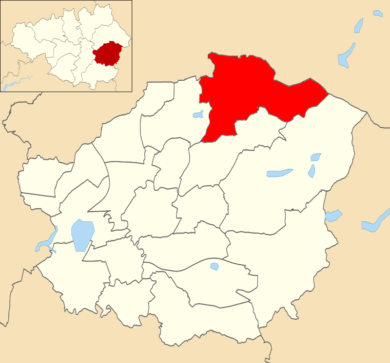
Near Harehill Clough is located at Grid Ref: SD9901 (Lat: 53.51067, Lng: -2.0045455)

Unitary Authority: Tameside

Police Authority: Greater Manchester

What 3 Words

///scorched.madder.item. Near Mossley, Manchester

Related Wikis

Buckton Castle

Buckton Castle was a medieval enclosure castle near Carrbrook in Stalybridge, Greater Manchester, England. It was surrounded by a 2.8-metre-wide (9 ft...

Heyheads

Heyheads is the easternmost area of Stalybridge, in Greater Manchester, England. The area includes the sixteenth century Grade II listed Nos 1, 2 and 3...

Harridge Pike

Harridge Pike is a hill situated within the boundaries of Stalybridge, Greater Manchester just outside the Peak District National Park. Its western flank...

Mossley Hollins High School

Mossley Hollins High School is a coeducational secondary school located in Mossley, in the borough of Tameside, Greater Manchester. The school's original...

Mossley (ward)

Mossley is an electoral ward of Tameside, England. It is represented in Westminster by Jonathan Reynolds Labour Co-operative MP for Stalybridge and Hyde...

Carrbrook

Carrbrook is a village east of Stalybridge, in Cheshire, Greater Manchester, England. The area still has many seventeenth and eighteenth-century buildings...

Higher Swineshaw Reservoir

For the reservoirs near Glossop, in Derbyshire, see Upper Swineshaw Reservoir and Swineshaw Reservoir (Derbyshire) Higher Swineshaw Reservoir is the...

Micklehurst railway station

Micklehurst Railway Station served the town of Mossley in Cheshire. It was built by the London and North Western Railway on its Micklehurst Line. The...

Nearby Amenities

Located within 500m of 53.51067,-2.0045455
Ford: yes
Seasonal: no
Lat/Long: 53.5079864/-2.0008
Access: permissive
Ford: yes
Motor Vehicle: no
Seasonal: no
Lat/Long: 53.5087859/-2.0029913
Ford: yes
Lat/Long: 53.5089303/-2.0036301
The data included in this document is from www.openstreetmap.org. The data is made available under ODbL.

Have you been to Near Harehill Clough?

Leave your review of Near Harehill Clough below (or comments, questions and feedback).