Tinkley Bottom

Valley in Wiltshire

England

Tinkley Bottom

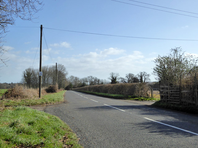
Junction near Farnham The road from Thickthorn Cross towards Shaftesbury meets a lane from Farnham.
Junction near Farnham Credit: Derek Harper

Tinkley Bottom is a picturesque valley located in the county of Wiltshire, England. Nestled between rolling hills and surrounded by luscious greenery, this idyllic spot offers a tranquil and serene environment.

The valley is situated approximately 3 miles southwest of the market town of Marlborough and covers a total area of around 5 square miles. It is known for its outstanding natural beauty, with its meadows, woodlands, and babbling brooks creating a haven for wildlife and nature enthusiasts alike.

One of the notable features of Tinkley Bottom is the River Og, which flows through the valley, adding to its charm and providing a source of water for the surrounding flora and fauna. The river is also a popular spot for fishing and canoeing.

In terms of human habitation, Tinkley Bottom is sparsely populated, with a scattering of small hamlets and farms dotting the landscape. The area is primarily agricultural, and many farmers in the valley focus on sheep and cattle rearing.

For those seeking outdoor activities, Tinkley Bottom offers numerous walking trails and cycling routes, allowing visitors to explore the stunning countryside at their own pace. The valley is also home to a variety of rare plant species, making it a haven for botanists and nature lovers.

Overall, Tinkley Bottom in Wiltshire is a hidden gem, offering a peaceful retreat away from the hustle and bustle of city life, and providing a sanctuary for both wildlife and humans alike.

If you have any feedback on the listing, please let us know in the comments section below.

Tinkley Bottom Images

Images are sourced within 2km of 50.957392/-2.0708955 or Grid Reference ST9517. Thanks to Geograph Open Source API. All images are credited.

Junction near Farnham The road from Thickthorn Cross towards Shaftesbury meets a lane from Farnham.
Junction near Farnham
The road from Thickthorn Cross towards Shaftesbury meets a lane from Farnham.
Road to Shaftesbury Common Drove approaching Farnham Woods.
Road to Shaftesbury
Common Drove approaching Farnham Woods.
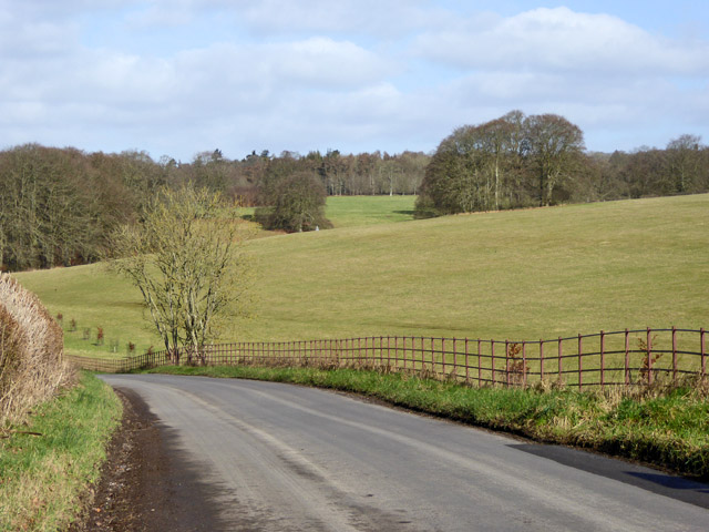
Road past Farnham Common Wood Common Drove follows the winding wood edge.
Road past Farnham Common Wood
Common Drove follows the winding wood edge.
Public access route past Farnham Farm The public route has been following the entrance road to the farm (right), but here continues left of centre as a smaller green lane.
Public access route past Farnham Farm
The public route has been following the entrance road to the farm (right), but here continues left of centre as a smaller green lane.
Folly and trees, Park View Point The folly is also shown at <a title="https://www.geograph.org.uk/search.php?i=211275871" href="https://www.geograph.org.uk/search.php?i=211275871">Link</a> ; Nigel Mykura has given a through explanation of it.  A pair of lambs are visiting it.
Folly and trees, Park View Point
The folly is also shown at Link ; Nigel Mykura has given a through explanation of it. A pair of lambs are visiting it.
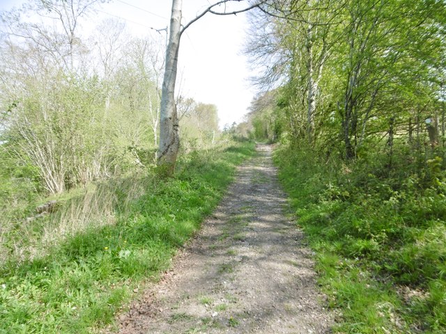
Clap Lane Spring leaves along a public access route through Clap Lane Coppice. The track meets the B3081 near Waterloo Farm.
Clap Lane
Spring leaves along a public access route through Clap Lane Coppice. The track meets the B3081 near Waterloo Farm.
Bugden Bottom A public access route meets the B3081. On the other side, between a pond and a sheep pasture, the Hardy Way makes a sharp V-turn across a county boundary, following each of two footpaths: (Wiltshire) TROY 11 (left) and  (Dorset) E52 30#1 (right). Both climb uphill across Rushmore Park.
Bugden Bottom
A public access route meets the B3081. On the other side, between a pond and a sheep pasture, the Hardy Way makes a sharp V-turn across a county boundary, following each of two footpaths: (Wiltshire) TROY 11 (left) and (Dorset) E52 30#1 (right). Both climb uphill across Rushmore Park.
Trees and field by Clap Lane Looking right from <a href="https://www.geograph.org.uk/photo/7772220">ST9417 : Clap Lane</a> through a belt of trees that forms the eastern edge of Clap Lane Coppice.
Trees and field by Clap Lane
Looking right from ST9417 : Clap Lane through a belt of trees that forms the eastern edge of Clap Lane Coppice.
Sheep at Bugden Bottom Viewed from the gate on the right of  <a href="https://www.geograph.org.uk/photo/7772274">ST9516 : Bugden Bottom</a>. Behind is a small wood on Minchington Down.
Sheep at Bugden Bottom
Viewed from the gate on the right of ST9516 : Bugden Bottom. Behind is a small wood on Minchington Down.
Parkland, Minchington Down A landscape of trees seen from footpath E52 20 following Ferney Way through the Rushmore estate.
Parkland, Minchington Down
A landscape of trees seen from footpath E52 20 following Ferney Way through the Rushmore estate.
Priory Cottages, Woodcutts This pair of cottages is listed as Old Manor House <span class="nowrap"><a title="https://historicengland.org.uk/listing/the-list/list-entry/1120125?section=official-list-entry" rel="nofollow ugc noopener" href="https://historicengland.org.uk/listing/the-list/list-entry/1120125?section=official-list-entry">Link</a><img style="margin-left:2px;" alt="External link" title="External link - shift click to open in new window" src="https://s1.geograph.org.uk/img/external.png" width="10" height="10"/></span> : "Detached house, late C18 or early C19, incorporating earlier material. Banded brick and flint incorporating monolithic, round-headed niches of unknown provenance." It is by Straight Lane. 200 metres down the lane is <a href="https://www.geograph.org.uk/photo/7772276">ST9717 : Woodcutts Manor</a>, which is given an earlier date.
Priory Cottages, Woodcutts
This pair of cottages is listed as Old Manor House LinkExternal link : "Detached house, late C18 or early C19, incorporating earlier material. Banded brick and flint incorporating monolithic, round-headed niches of unknown provenance." It is by Straight Lane. 200 metres down the lane is ST9717 : Woodcutts Manor, which is given an earlier date.
Sheep beneath oak, Woodcutts Common Here's a dilemma. The instructions on the gate I've just gone through are
 "SHEEP LAMBING
 IN THIS FIELD
STAY STRICTLY TO THE
RIGHT IS WAY
DO NOT APPROACH" [the last three words in red, underlined twice]
The right of way in question is footpath E52 20, and I can clearly see my target, a gate just left of centre 165 metres away, with what turns out to be an identical notice on it; it can be seen as a white speck to which the lowest left branch of the tree appears to be pointing.

It's only 8 am on a May morning, but it's a gloriously sunny day, and a herd of ewes and lambs has already booked the shade of the oak for the day. I'm in a hurry, having wasted much time looking for rights of way across the Rushmoor estate, of which this is part. The compromise is to keep a little to the left without going too near the ewe on the left, which appears to be standing guard and is looking at me with suspicion.
Sheep beneath oak, Woodcutts Common
Here's a dilemma. The instructions on the gate I've just gone through are "SHEEP LAMBING IN THIS FIELD STAY STRICTLY TO THE RIGHT IS WAY DO NOT APPROACH" [the last three words in red, underlined twice] The right of way in question is footpath E52 20, and I can clearly see my target, a gate just left of centre 165 metres away, with what turns out to be an identical notice on it; it can be seen as a white speck to which the lowest left branch of the tree appears to be pointing. It's only 8 am on a May morning, but it's a gloriously sunny day, and a herd of ewes and lambs has already booked the shade of the oak for the day. I'm in a hurry, having wasted much time looking for rights of way across the Rushmoor estate, of which this is part. The compromise is to keep a little to the left without going too near the ewe on the left, which appears to be standing guard and is looking at me with suspicion.
Parkland east of Oakley Lane Part of Rushmore Park.
Parkland east of Oakley Lane
Part of Rushmore Park.
B3081 looking east Heading towards Sixpenny Handley.
B3081 looking east
Heading towards Sixpenny Handley.
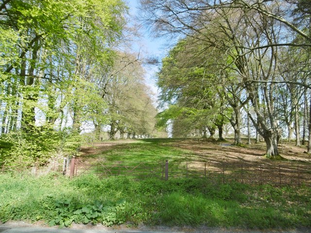
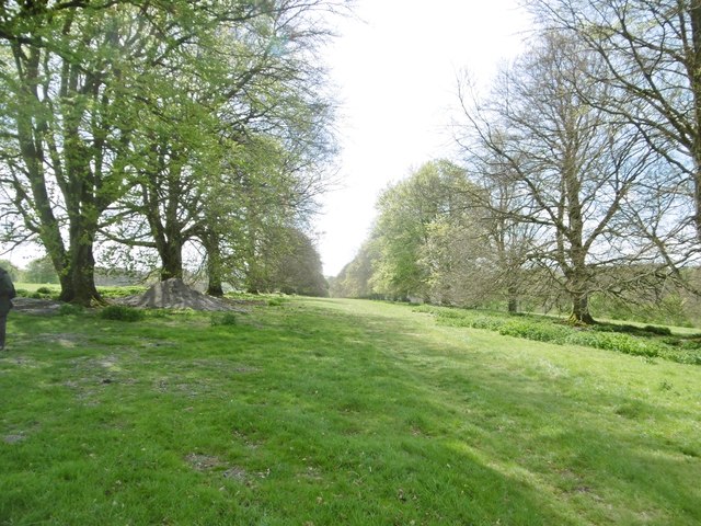
Rushmore Park, avenue The remains of a once fine avenue of beech trees, at the southern entrance to the estate.
Rushmore Park, avenue
The remains of a once fine avenue of beech trees, at the southern entrance to the estate.
Rushmore Park, timber Beech trunks, awaiting collection by the roadside.
Rushmore Park, timber
Beech trunks, awaiting collection by the roadside.
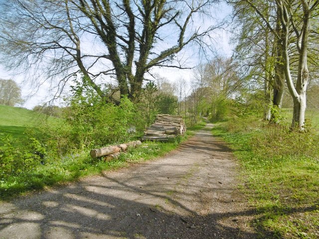
Rushmore Park, footpath Skirting woodland, towards Shermel Gate.
Rushmore Park, footpath
Skirting woodland, towards Shermel Gate.
Rushmore Park, avenue A once fine avenue of beech trees leading from South Lodge. Several have disappeared or are in poor condition.
Rushmore Park, avenue
A once fine avenue of beech trees leading from South Lodge. Several have disappeared or are in poor condition.
Show me another place!

Tinkley Bottom is located at Grid Ref: ST9517 (Lat: 50.957392, Lng: -2.0708955)

Unitary Authority: Wiltshire

Police Authority: Wiltshire

What 3 Words

///torches.bleaching.landed. Near Bower Chalke, Wiltshire

Related Wikis

South Lodge Camp

South Lodge Camp is an archaeological site of the Bronze Age, about 0.6 miles (1.0 km) south-east of the village of Tollard Royal, in Wiltshire, England...

King John's House, Tollard Royal

King John's House is a former manor house in the south Wiltshire village of Tollard Royal, England. Just south of the church, the building has at its core...

Tollard Royal

Tollard Royal is a village and civil parish on Cranborne Chase, Wiltshire, England. The parish is on Wiltshire's southern boundary with Dorset and the...

Sandroyd School

Sandroyd School is an independent co-educational preparatory school for day and boarding pupils aged 2 to 13 in the south of Wiltshire, England. The school...

Nearby Amenities

Located within 500m of 50.957392,-2.0708955
Material: wood
Power: pole
Source: bing
Lat/Long: 50.9538085/-2.0746488
Material: wood
Power: pole
Source: bing
Lat/Long: 50.9539031/-2.0750833
Material: wood
Power: pole
Source: bing
Lat/Long: 50.954192/-2.0742921
Material: wood
Power: pole
Source: bing
Lat/Long: 50.9542005/-2.0753998
Material: wood
Power: pole
Source: bing
Lat/Long: 50.9545435/-2.0756547
Material: wood
Power: pole
Source: bing
Lat/Long: 50.9547496/-2.0743457
Material: wood
Power: pole
Source: bing
Lat/Long: 50.9548915/-2.075947
Material: wood
Power: pole
Source: bing
Lat/Long: 50.9551416/-2.0735035
Material: wood
Power: pole
Source: bing
Lat/Long: 50.9555285/-2.0726372
Material: wood
Power: pole
Source: bing
Lat/Long: 50.9555758/-2.0750377
Uddens Coppice
Place: locality
Lat/Long: 50.9572457/-2.0678055
The data included in this document is from www.openstreetmap.org. The data is made available under ODbL.

Have you been to Tinkley Bottom?

Leave your review of Tinkley Bottom below (or comments, questions and feedback).