Ashcombe Bottom

Valley in Gloucestershire Cotswold

England

Ashcombe Bottom

The lane to Edgeworth
The lane to Edgeworth Credit: David Purchase

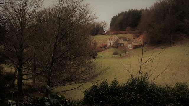
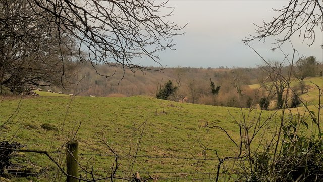
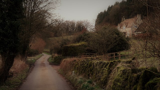
Ashcombe Bottom is a picturesque valley located in the county of Gloucestershire, England. Situated within the stunning Cotswolds region, this charming area is renowned for its natural beauty and tranquil atmosphere. Ashcombe Bottom is nestled between rolling hills and green meadows, providing visitors with breathtaking views of the surrounding countryside.

This idyllic valley is characterized by its meandering stream, which runs through the heart of the area, adding to its charm. The stream is lined with a variety of trees and wildflowers, creating a vibrant and colorful landscape throughout the seasons. The valley is also home to diverse wildlife, including birds, butterflies, and small mammals, making it a haven for nature enthusiasts and photographers.

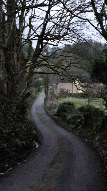
Ashcombe Bottom offers a range of recreational activities for those looking to immerse themselves in the great outdoors. The valley boasts numerous walking trails, allowing visitors to explore the area at their own pace. Hikers can enjoy the serene ambiance while taking in the breathtaking views and discovering hidden gems along the way.

For those seeking a peaceful retreat, Ashcombe Bottom offers a few secluded picnic spots, providing the perfect setting for a relaxing outdoor lunch. The valley's peaceful ambiance and scenic beauty make it an ideal destination for families, couples, or anyone looking to escape the hustle and bustle of everyday life.

Overall, Ashcombe Bottom is a captivating valley in Gloucestershire that offers a harmonious blend of natural beauty, tranquility, and recreational opportunities. Whether it's a leisurely stroll, a picnic, or simply enjoying the serenity of the surroundings, this hidden gem is sure to leave a lasting impression on all who visit.

If you have any feedback on the listing, please let us know in the comments section below.

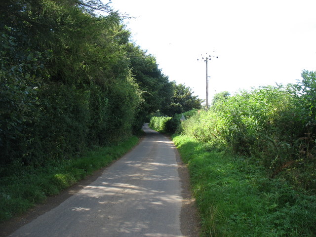
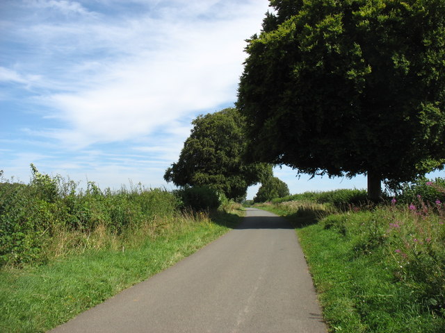
Ashcombe Bottom Images

Images are sourced within 2km of 51.767563/-2.0797266 or Grid Reference SO9407. Thanks to Geograph Open Source API. All images are credited.

The lane to Edgeworth
Crabtree Lane Heading for the Duntisbournes.
Crabtree Lane
Heading for the Duntisbournes.
Edgeworth, the valley from the top of School Lane School Lane connects the two clusters of Edgeworth through a steep combe.
Edgeworth, the valley from the top of School Lane
School Lane connects the two clusters of Edgeworth through a steep combe.
Pastures at Edgeworth Looking from School Lane to the far hillside of the upper Frome valley.
Pastures at Edgeworth
Looking from School Lane to the far hillside of the upper Frome valley.
School Lane, Edgeworth
School Lane, Edgeworth Looking north from close to the church and manor house end of the lane.
School Lane, Edgeworth
Looking north from close to the church and manor house end of the lane.
Edgeworth Manor The west front, facing the church, dates from the end of the nineteenth century.
Edgeworth Manor
The west front, facing the church, dates from the end of the nineteenth century.
St Mary's church, Edgeworth
St Mary, Edgeworth St Mary's has a Saxon and Norman nave and was drastically restored in 1869-72 with a rood screen added in 1885.
St Mary, Edgeworth
St Mary's has a Saxon and Norman nave and was drastically restored in 1869-72 with a rood screen added in 1885.
Rood screen and loft in St Mary's, Edgeworth Dating from 1885, the deeply cusped tracery echoes the stone chancel rere-arches of 1872.
Rood screen and loft in St Mary's, Edgeworth
Dating from 1885, the deeply cusped tracery echoes the stone chancel rere-arches of 1872.
Chancel at St Mary, Edgeworth The Victorian east window sits above a tiny Norman slit window with 1957 stained glass by the local artist Edward Payne.  All the chancel windows have rere-arches, as do the sedilia, piscina on the right.  A formidable Victorian performance, but what a pity that it extended to scraping the walls.
Chancel at St Mary, Edgeworth
The Victorian east window sits above a tiny Norman slit window with 1957 stained glass by the local artist Edward Payne. All the chancel windows have rere-arches, as do the sedilia, piscina on the right. A formidable Victorian performance, but what a pity that it extended to scraping the walls.
Cusping in St Mary's Two windows, an altar rail and a rood screen all decorated the same way.
Cusping in St Mary's
Two windows, an altar rail and a rood screen all decorated the same way.
Mediaeval stained glass in the chancel of St Mary's Edgeworth
Nave bench ends in St Mary's, Edgeworth From the restoration of 1869-72.  They are labelled with names of estate properties, allocating where the estate staff were to sit.  The elongated poppy heads are an individual touch.
Nave bench ends in St Mary's, Edgeworth
From the restoration of 1869-72. They are labelled with names of estate properties, allocating where the estate staff were to sit. The elongated poppy heads are an individual touch.
Pews in St Mary's, Edgeworth
The Garden at Miserden: Garden requisites defying gravity on the tearoom wall
The Garden at Miserden: Entrance to the walled garden
The Garden at Miserden: Mixed borders
Show me another place!

Ashcombe Bottom is located at Grid Ref: SO9407 (Lat: 51.767563, Lng: -2.0797266)

Administrative County: Gloucestershire

District: Cotswold

Police Authority: Gloucestershire

What 3 Words

///encodes.mime.dude. Near Chalford, Gloucestershire

Related Wikis

Edgeworth, Gloucestershire

Edgeworth is a small village and civil parish in the English county of Gloucestershire. It is located east of Stroud, west of Cirencester and south of...

Miserden War Memorial

Miserden War Memorial is a First World War memorial in the village of Miserden, near Stroud, in Gloucestershire, south-western England. The memorial, designed...

Miserden Castle

Miserden Castle was a castle near the village of Miserden in Gloucestershire, England. The castle is a large motte and bailey Norman castle, built before...

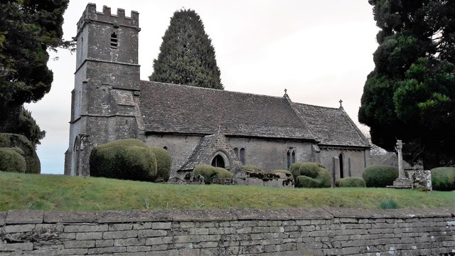
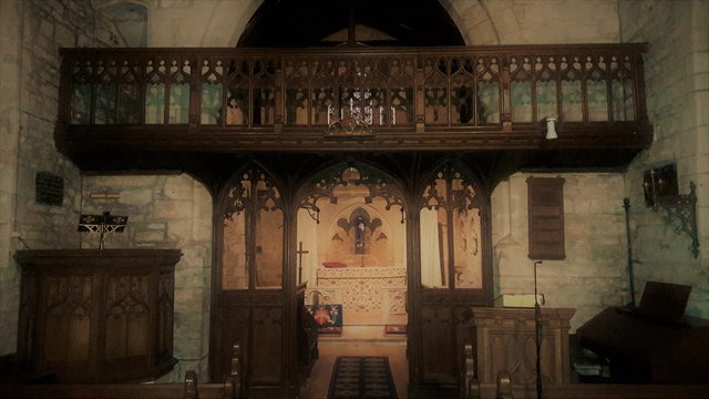
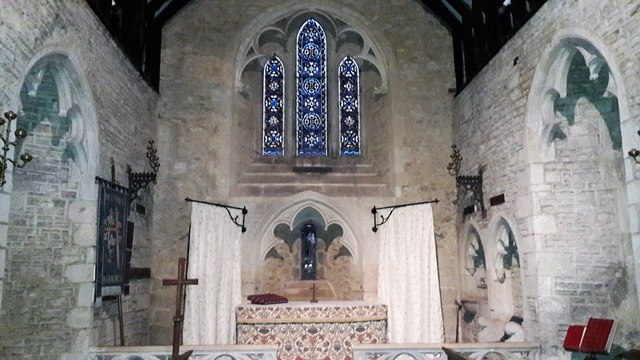
Church of St Mary, Edgeworth

The Anglican Church of St Mary at Edgeworth in the Cotswold District of Gloucestershire, England was built in 11th century. It is a grade I listed building...
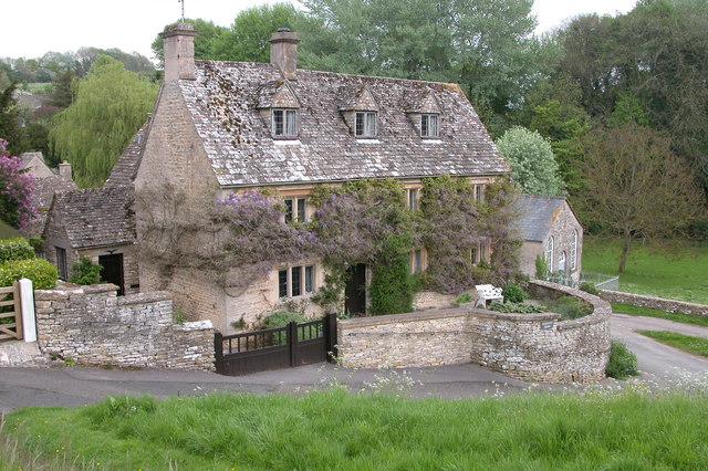
Edgeworth Manor

Edgeworth Manor is a Grade II* listed country house in Edgeworth, Gloucestershire, England. It was mentioned in the Domesday Book, when it was held by...

Miserden

Miserden is a village and civil parish in Stroud District, Gloucestershire, England, 4 miles north east of Stroud. The parish includes Whiteway Colony...

Duntisbourne Abbots

Duntisbourne Abbots is a village and civil parish located in the English county of Gloucestershire. Duntisbourne Abbots forms part of the Cotswold District...

Winstone

Winstone is a village and civil parish in the English county of Gloucestershire. The population taken at the 2011 census was 270.Winstone forms part of...

Nearby Amenities

Located within 500m of 51.767563,-2.0797266
Parson Hill
Natural: peak
Source: NPE
Lat/Long: 51.7690425/-2.074758
Power: pole
Lat/Long: 51.7711803/-2.0762378
Power: pole
Lat/Long: 51.7712417/-2.0775225
Power: pole
Lat/Long: 51.7713537/-2.0792901
Power: pole
Lat/Long: 51.7714227/-2.0804689
Natural: spring
Lat/Long: 51.7715811/-2.0822054
Power: pole
Lat/Long: 51.7674362/-2.0867185
Power: pole
Lat/Long: 51.7667155/-2.0865336
Natural: spring
Lat/Long: 51.7682062/-2.08488
The data included in this document is from www.openstreetmap.org. The data is made available under ODbL.

Have you been to Ashcombe Bottom?

Leave your review of Ashcombe Bottom below (or comments, questions and feedback).